In the heart of Bosnia and Herzegovina tucked between Vareš and Kraljeva Sutjeska, rises mountain Perun. It was one of the cult places in South Slavic countries dedicated to the supreme Slavic god of Perun. In Slavic mythology, he was the god of thunder and lightning.
This area is covered with dense coniferous forests and rich with iron ore. There are traces that prove, that since ancient times, this place was famous for its miners and smiths. But, after the last war in Bosnia and Herzegovina the mines were abandoned and just few smiths are left to preserve the traditional, medieval way of forging iron. In one of the abandoned mines beneath Perun mountain, an artificial lake was formed in the excavations of the former mining pits. The lake is called Nula (Zero) and it is about 500 m long, 300 m wide and 100m deep. Now, during the winter months the lake is often frozen, but in the summer many residents of Vareš come here for a refreshment during the hot summer days.
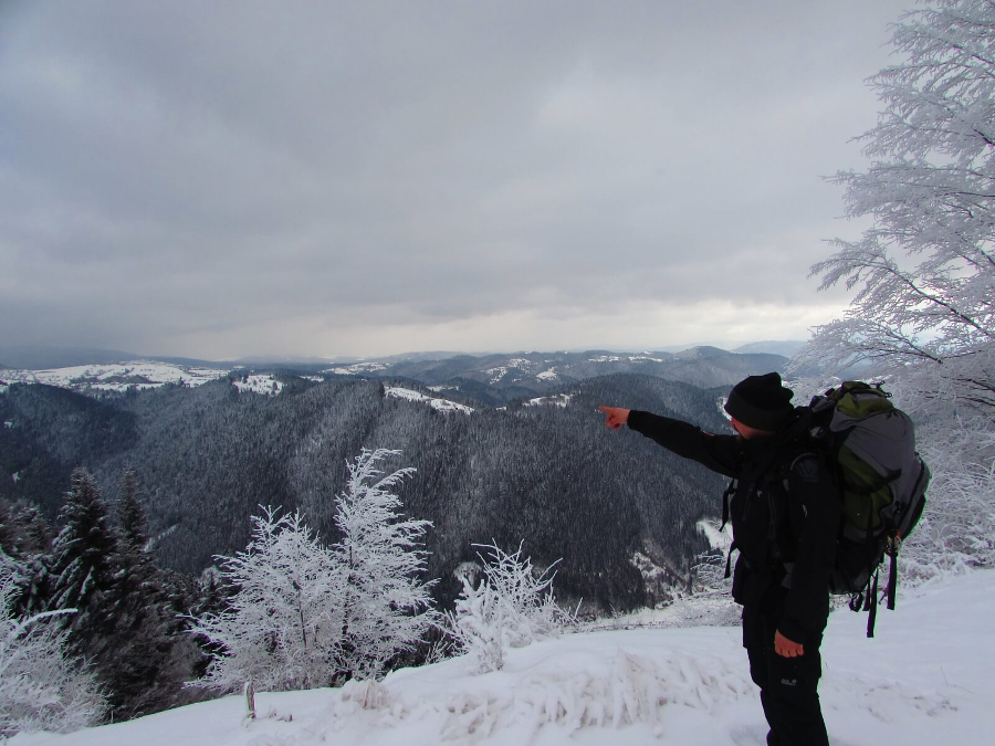
Recently, my friend and I went on a two-day adventure of exploring divine Perun mountain on snowshoes. From Vareš we made a round tour across Perun. Deep in the coniferous forest of Perun, away from civilization, there is a mountain hut called Javorje. Here you can enjoy in silence and smell of the fir and pine trees. The hut is opened during the weekends and during other days in arrangement with the host. From Vareš to the hut you can enjoy in approximately 2h and 30 min long walk through the forest. The path is uphill all the way to the hut, but for me a forest paths are my favourite. From the hut, you can hike to the two highest peaks of Perun- Karasovina (1472 m a.s.l.) and Površje (1454 m a.s.l.), that are also the highest peaks in Zenica-Doboj Canton. The hike to Karasovina is short and easy, appr. 1h of walking. It is covered with deciduous trees and there is no view, but you can take a rest and enjoy in the nature at picnic shelters that are placed at the peak. Don’t forget to put a stamp in your hiking pass and sign in the guest book! A stamp and the book are placed in the box that is hooked to a tree.
The trail from the hut to Površje peak goes through the forest and across big beautiful meadows. The view from the top is breathtaking! You can enjoy in 360 degrees view of marvellous mountains covered with snow – Vlašić, Vranica, Čvrsnica, Prenj, Bjelašnica, Jahorina, Romanija and Zvijezda.
Further, the trail goes through two small settlements- Poljice and Semizova Ponikva.The first settlement is situated beneath Površje peak and during the winter months mainly people don’t live here. Semizova Ponikva settlement is very close to Vareš and there is asphalt road that leads to it. On the final part of the trail there is beautiful panorama view of Vareš. Across, you will see Zvijezda mountain and beneath you Vareš situated in the valley of Stavnja river.
Perun mountain is not that high, but is truly a divine mountain, that has many stories and legends to tell and beauties to show to all visitors. Come and experience Vareš and Perun for yourself!
Short video of the beauties of Mt. Perun:
{youtube}GNebBKlhVjI{/youtube}
{source}
<script type="text/javascript" src="https://trail.viadinarica.com/en/tour/winter-hiking/winter-hike-from-vares-to-javorje-mountain-hut-and-karasovina-peak/21929585/tour2go"></script>
{/source}
{source}
<script type="text/javascript" src="https://trail.viadinarica.com/en/tour/snowshoes/snowshoeing-from-javorje-mountain-hut-to-vares/21901506/tour2go"></script>
{/source}
{source}
{/source}
{source}
{/source}
{source}
{/source}
{source}
{/source}
{source}
{/source}
{source}
{/source}
{source}
{/source}
{source}
{/source}
In the first part of my Via Dinarica trip report I told you about my expectations for this hike (none). Getting lost on the trail certainly wasn’t on my list.Day 2“Where am I? Who is up at this hour where the world doesn’t exist yet?”Ah ja, I’m at the Medjuprenje Mountain Hut, up on Prenj, on the Via Dinarica in Bosnia and Herzegovina. My name is Hendrik and that tiny backpack is mine. Yeah, systems booting, coffee required before we can get up and start hiking.Black gold is served steaming hot by Kenan’s friends & again I ponder about the weight & taste benefits of carrying real coffee to the mountains. Also the breakfast Kenan has for me is great: Joghurt & Müsli, where the yoghurt is dehydrated and stirred up by adding water. Good stuff, and after everything is eaten and packed up we leave the hut and move up into the fog.The trail is well marked and takes us through trees which are ready for spring, but yet hold back their green leafs. The higher we get the lower the vegetation becomes and the shorter the view. But Prenj, the mountain we’re on, is Kenan’s favourite and he knows it well. We follow markers and cairns, bushwack through the shrubbery and then take a “Shortcut”. I love shortcuts, especially in this weather.Ah no, not here. Lets go that way.Grey & white & greyCan you see where we are?Nope, don’t you have a compass?Ah yeah, true!Alright, this way.
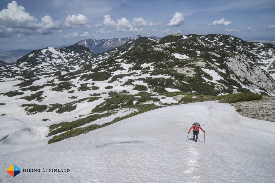
At one point we dropped down a bit in elevation and ended up ascending an 60°+ snow slope, without crampons or ice axes, in approach shoes. To say I was a bit freaked out would be putting it kindly, as underneath me it went down a couple of hundred meters and a slip would have ended in a coffin. But hey. Type 2 fun. Makes for a good story right now, doesn’t it?Kenan navigated us just great back to the track, and then it was smooth hiking over snow fields and talus. After a while Kenan knew exactly where we were and started again telling me the names of the summits that surrounded us as we walked down on a high plateau. Snow disappeared, the brown grass trail being pierced by purple crocuses and slowly turning to brown dirt to green meadows.We traverse the high plateau and the troubles of getting a bit lost earlier are forgotten. We’re set to meet Tim and the Terra Dinarica Team as well as some guests from the USA down in the valley, and are relieved to see that we’re the first to the meeting point.
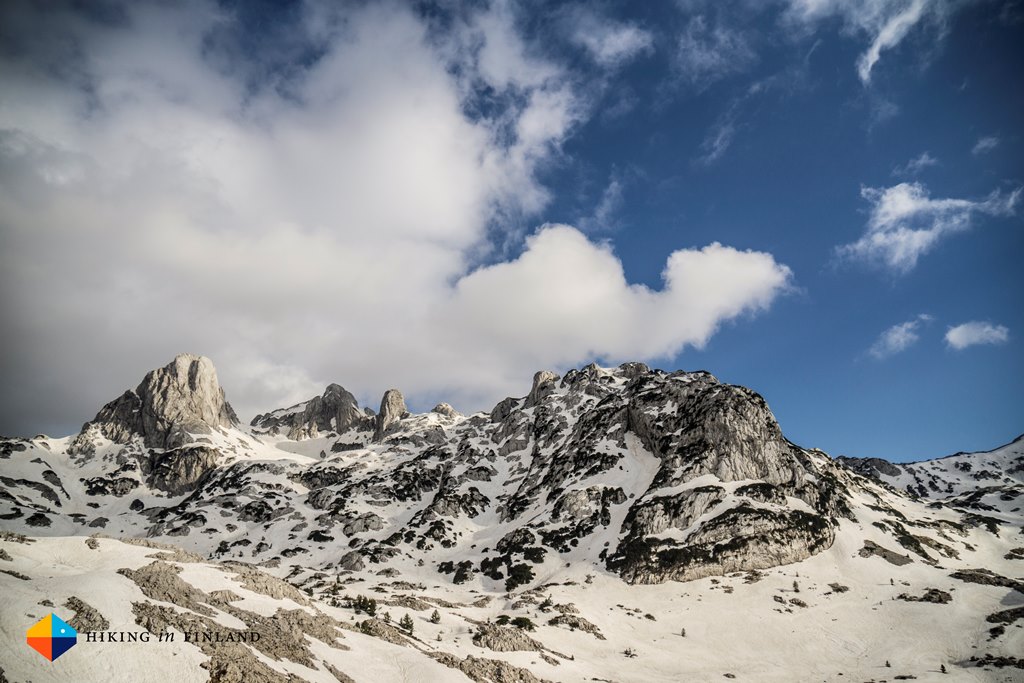
After walking mostly on snow the day before and this morning it is nice to have green grass and sunshine. We drop our packs, I get out of my shoes, and we walk around in the valley, towards the others who are just arriving. Food is shared, photos are snapped, and the beauty around us is celebrated by long, lonely stares, “Ahhh”s and “Ohhh”s and “Wow”s. And it is pretty, this valley. Otiš and Zelena Glava stand proudly at the end of the valley, a miniature Fitz Roy Range. We did plan to climb Otiš the next day, but seeing it is in full alpine conditions and our lack of alpine gear makes me decide against an ascent. I also wasn’t up for a 14 hour day, though it certainly would have made a great story & experience. So we will just hike comfortably across Prenj and arrive early at our destination the next day – a good decision as we’d see the tomorrow.After a lengthy late lunch we part with our friends and head back up the mountain, though our destination is not far. The Vrutak hut is less than 30 minutes up from the valley and luxurious hut by any standard. Clean at a prime location its nice to know we will sleep in such a nice hut tonight. I grab my tripod and head out to photograph the sunset and blue hour while Kenan prepares our dinner.With a big smile I come back in after the sun is gone and the first stars dot the sky. Kenan has prepared a delicious goulash, and I share a Finnish dessert with him to celebrate this adventurous day. We sit for a while and talk, but both of us are tired and soon turn in. Tomorrow would be “easy and relaxed”…Posted by Hendrik Morkel Sep 7th, 2015 Bosnia and HerzegovinaDay 3 – Next stage – Hiking to Boracko lake
{source}<script type="text/javascript" src="https://trail.viadinarica.com/en/tour/mountain-hike/via-dinarica-bh-w-06-prenj-mountain/17302956/tour2go"></script>{/source}
Is it the idea of connecting seven countries via humanities simplest activity, walking? Or something else? Reason enough for me to pack my backpack, book a flight to Sarajevo and investigate.“What are your expectations of this trip?” Tim asked me after he picked me up at the airport in Sarajevo. “Well”, I started, “I don’t have any. I never expect anything when I go on a research trip, and let the region show me what it has to offer. It’s only fair and more adventurous, too.” But Bosnia and Herzegovina has impressed me, very positively. It’s a beautiful country with warm, welcoming people, delicious food, and the views are quite decent, too. In the following series of trip reports I’ll walk you through the Bosnia & Herzegovina part of the Via Dinarica Trail, and will answer questions in the final post where I also will give more information on the trail.Sarajevo
“Coffee?” Sure. As an European Finn I seldom say no to coffee, and the coffee in Bosnia & Herzegovina is superb, especially when brewed in the traditional way. Besides, I was up since 4 am and already had three different flights so something to keep me awake in the sweltering heat of this bustling city was always welcome. We had good coffee and then a stroll through the old part of Sarajevo, which was gorgeous with small, narrow streets lined with stalls, open air Cafés, Restaurants where delicious smells wafted from the open windows, and lots of people. Mosques stood next to Churches, and the peaceful co-existence of the religions in this country is certainly something the world could learn.Later in the afternoon I meet the rest of the Terra Dinarica team, Olja, Stefan and Kenan, who would be my Guide over the next five days. We had a tasty dinner high above Sarajevo, before Kenan dropped me off at my Hostel for the night. “Pick up is at 5 am” he said with a smile, and so I turned in after a quick shower to get some sleep before the Alarm would wake me up yet again so early.Risovac to Diva GrabovicaThis 27,6 km section started at a ski slope a couple of hours drive south west of Sarajevo. Already on the way there we passed with the car scenery which would make any backpacker and climber very happy indeed, with a Mini El Cap and lush, green valleys which would make for fine hiking. Here at the Risovac ski centre Kenan and me shoulder our backpacks, said bye to Tim who’d meet us at the other side, and set off.We quickly reach the top of the ski slope and turned into the forest, where patches of snow still lined the trail. It didn’t take us long to be so high that the trail was under the snow, and I was pondering if my Arc’teryx Acrux² FL GTX shoes would be up to the task (They were, and great on the snow indeed). Where the trail skirts the mountain on the south/ west side, the snow was happily gone, but also walking on the snow was fine – it was still fairly compact with just a thin, mushy layer on top which gave good grip.The weather was great – so warm that I quickly shed layers and hiked in my T-Shirt. Kenan tells me about the mountain we traverse, the sights, where the Via Dinarica passes here and local lore. He’s also a good model and doesn’t protest when I let him walk several sections twice to get the right shot, but even with all the chatting and taking photos we make good speed and soon see the summit we’re aiming for today, the Great Vilinac Summit. The trail towards it sneaks through patches of low-growing shrubbery, and spring crocuses are piercing their white and violet heads already through the ground there where the snow has melted.The summit is snow-free and after signing the summit book we sit and have a drink. The view is fantastic and we’re lucky with the weather. But we arranged to have lunch at a mountain hut a bit further along the trail, and so we soon shoulder our light packs again and head onwards to the Tise Mountain Hut. It’s a bit off the trail and we descent for ten minutes, but already from a distance it looks like it is closed. As we stand in front of the locked doors we’re certain that we won’t be eating lunch here, a good thing we have some snacks with us and that the bench and table have a scenic view to enjoy. We go for a look to find the water spring nearby, but it is still buried under a meter of snow, and so we just continue.We follow the trailmarkers – a red circle with a white dot in the middle – for a while, until we’re back on the snow. While it allows us to make short-cuts it’s also a bit more strenuous to walk on it, and of course it also soaks your shoes and socks. But it’s warm & sunny, so not a problem, merely a slight inconvenience. We’re high up and descent and ascend just a little for several kilometres, until it is time for the big 1.600 m descent to the Diva Grabovica valley. The views which open up before us are breath-taking, but you have to stop to enjoy then, as the descent is steep on a trail which is often just a mere foot wide, if it’s not entirely covered under the snow.Ahead of us we also can see Prenj, the mountain range we will be traversing in the next two days. Soon enough we reach the tree line and lush green beech trees with fresh, young leaves make the walking in the warm weather more pleasant. From afar we already saw a rustic cabin – the former Kings Hunting Cabin – and we made a little detour to visit it. It was pretty from the outside, with wooden shingles on the face of the building, but the inside was mouldy, dark and not welcoming. Also the garbage which was left wasn’t a nice sight, and so we continued further down.We heard voices already further up the mountain, and as we happened on the 2nd hut – which was in much better shape – we meet Tim and friends of Kenan, who did the Evil’s Creek Route (scroll down to see their photos!), a trail which has some climbing along steel wires (a bit like like a Via Ferrata) and were now also on the way back down. We decided to go check out the Look out point and have a cup of coffee all together, and it was a nice place to rest and drink some good Bosnian coffee.On the way to the valley the trail soon became a gorgeous green tunnel which smelled so wonderful, it was unbelievable. Colourful flowers, buzzing insects, colourful butterflies and bubbling wells we found the further we descended the trail, and as we finally broke out of the dense green forest a magnificent panorama opened up before us. A colourful little meadow stood in full flowers, while the sun was hiding behind big, dramatic grey clouds, throwing a few rays on the mountains we just left behind. It was such a perfect place that I’d loved to have put my tarp up right there, but we still had a few hundred meters to descent and move onwards, so we left the meadow behind and hiked on.At the car we threw our packs into the car and drove towards the next Restaurant, where we enjoyed a dinner of lamb and a local beer before Tim brought us to Prenj. It was night as we arrived the start of the trail, and after a quick repack for the next two days we set off. I was completely destroyed as we started to hike, but pushed on. While I was planning to sleep in my bivy outside instead of the Medjuprenje Mountain Hut where we were headed, after I saw a few Scorpions on the trail and Kenan told me about the Black Widows Spiders which can be encountered here I decided that the hut it would be. It was close to 23 o’clock as we stumbled into the Medjuprenje Mountain Hut, where other friends of Kenan right away offered us a Rakija, and after a zip of this tasty fruit brandy I headed up to roll out my quilt and call it a night. To be continued.
Blog by Hendrik Morkel Jul 2nd, 2015 Bosnia and HerzegovinaDay 2 – Next stage – Hiking mountain Prenj
{source}<script type="text/javascript" src="https://trail.viadinarica.com/en/tour/mountain-hike/via-dinarica-bh-w-05-vrsnica-mountain-and-jablanica-city/17302945/tour2go"></script>{/source}