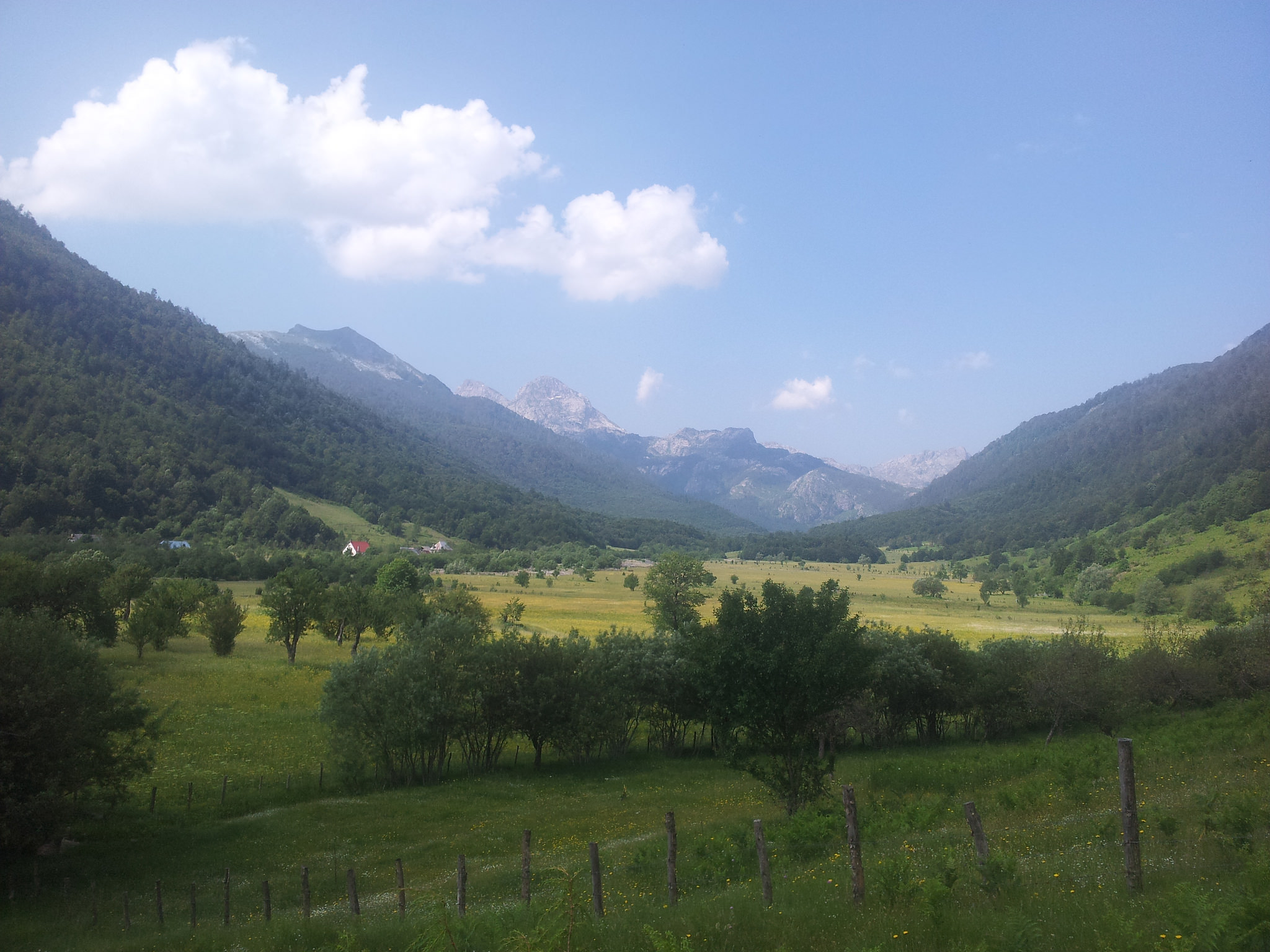
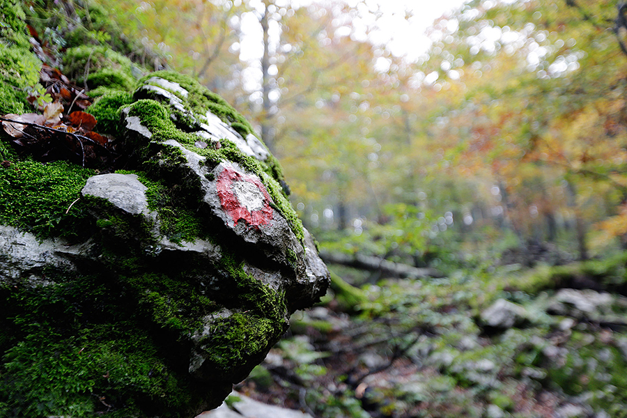
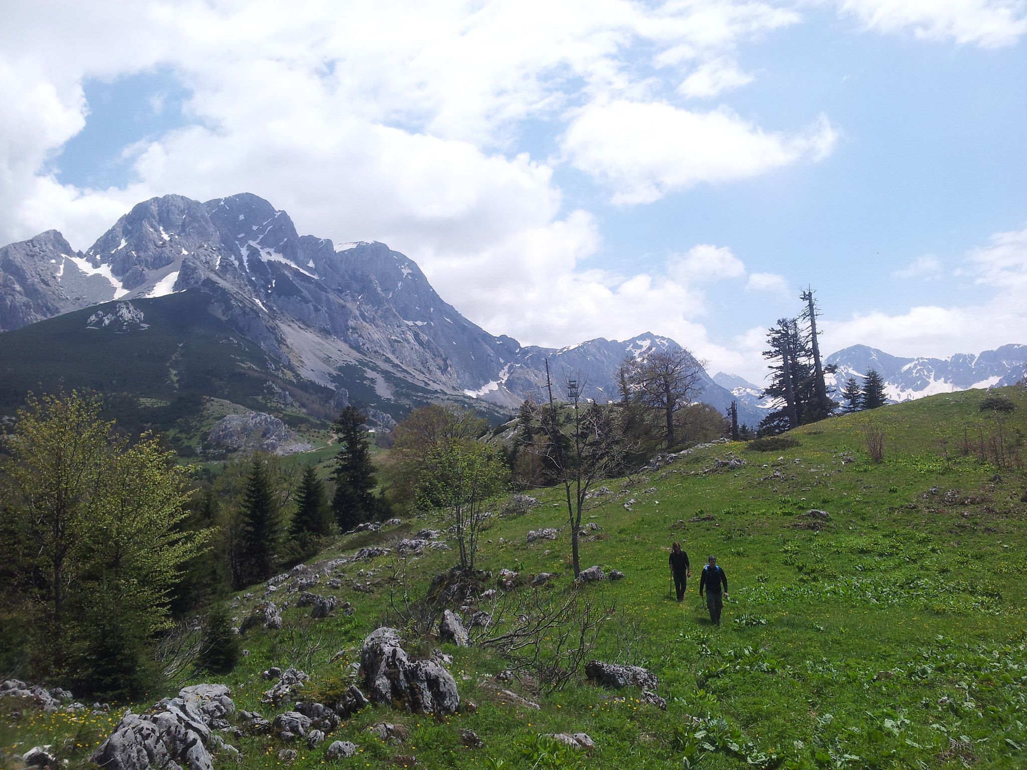
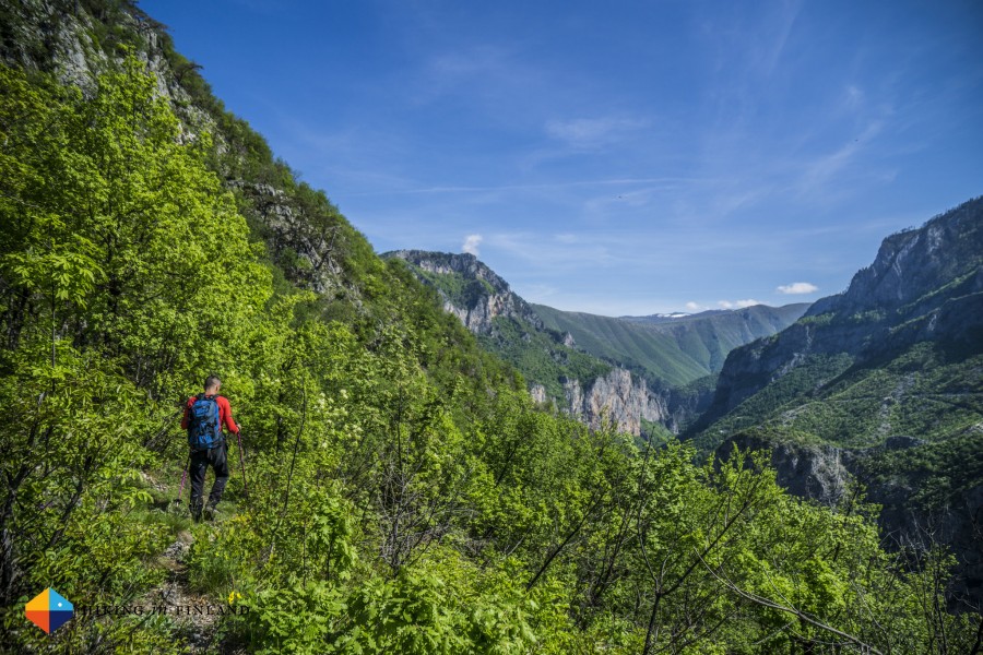
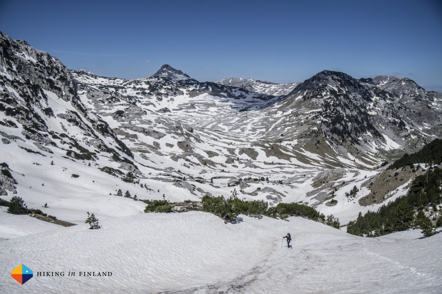
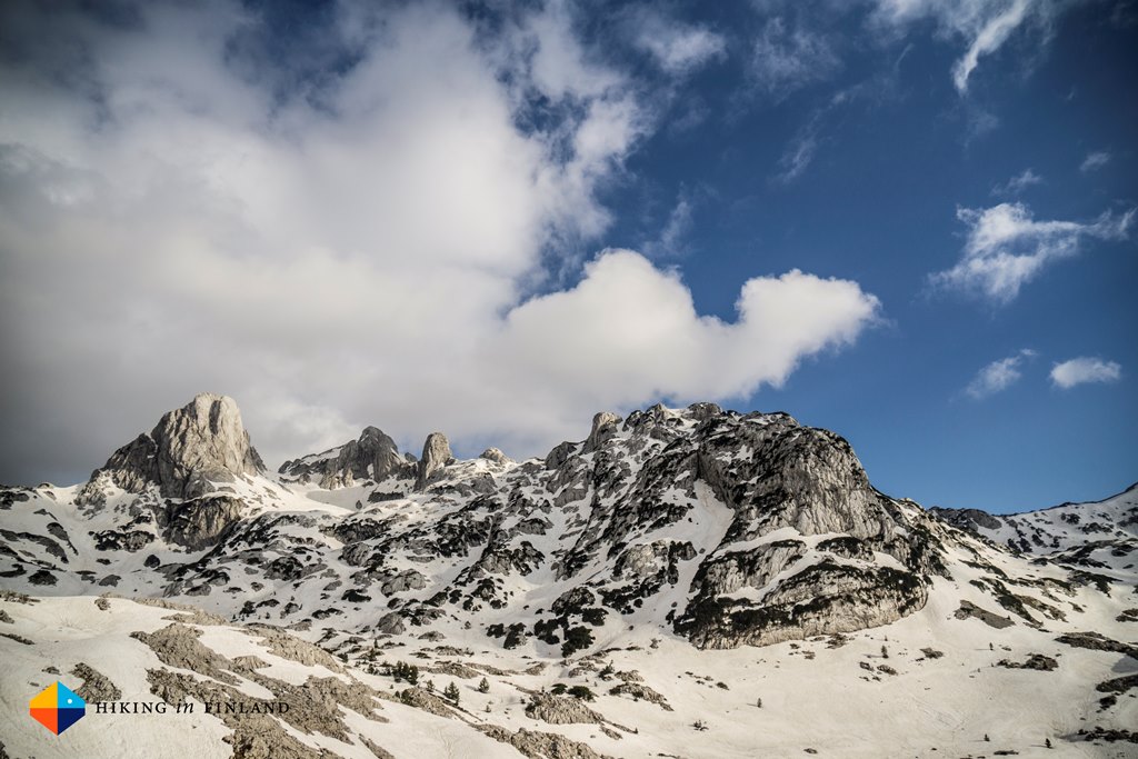
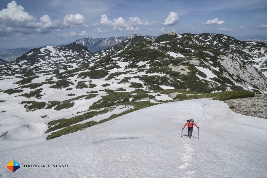
Traveling from Starigrad to Knin took me a day, but I got to see the beautiful old town of Ŝibenik. In Knin I checked in at a hotel at the outskirts of the town and close to the trail. Since it’s really warm out here I decided to leave the hotel early in the morning.After hiking for about an hour I crossed a dirt road, just at the moment an old truck came slowly driving uphill. In it were the bee keeper and his two friends, I learned. Since they were driving all the way to Brezovac, where I was heading too, I had to get in truck. No discussion.So as I sat on a plastic chair between bee hives enjoying the early morning views on the surrounding mountains, I was slowly driven up to Brezovac.BrezovacThere were no other hikers, so Brezovac mountain hut was closed (it’s only open by arrangement). There’s some nice, shaded camping-spots near the hut. But, don’t count on getting water from the cistern: it’s locked!As I wasn’t carrying enough water to hike the Dinara on this warm day, I tried my luck at some holiday houses close-by. No one was in and there was no outside access to water. As one house was being renovated an old barrel stood outside, from which I took water.The next cistern is at the other side of Dinara at Skloniŝte Martinova Košara – so hopefully the cistern at Brezovac will be unlocked for thru-hikers.To the topThe hike to the top of the Dinara is quite easy. The only hard part, is that’s its very exposed. I reached the top around 10.30 and since I heard thunder I hiked down at fast as possible.Skloniste Martinova KoŝaraThis from the outside nice looking shelter is kind of a mess inside; lot’s of flies and bugs and critter droppings. The good thing about this hut is the earlier mentioned cystern nearby. Since of the mess, the threatening thunder and the exposed surroundings I decided to hike to GlavašOn trail at a 1000 meter there’s a, again, surprise spring; fresh water coming straight from the mountain, yum yum! Just before Glavaš there’s the impressive ruins of a 15th century fort. I took a short break, since of the weather.As I arrived a Glavaš it started to rain. The door of the hut (container) was closed, so I pitched my tarp as quick as possible. Just as the thunderstorm started I lay under the tarp, a big storm it was including hail as big as M&M’s.Later, when it stopped raining, I discovered a second door in the hut. This one’s open and in it an pretty OK space containing bunk beds.KijevoThe next morning I hiked eight kilometers to the road and village of Kijevo. There was supposed to run some busses, but after waiting for 2.5 hours and no bus showing up, I decided to hitch back to Knin. From were I traveled by train to Split. The next two stages aren’t hiking trails, they’re biking trails over paved roads. So after buying a new pair of trail runners and other supplies I’m taking a bus from Split to Tomislavrad in BIH. After getting Bosnian cash and a sim card I’ll get back to trail at stage 27. From here, hopefully, no detours (except for resupplies) until Albania anymore.More pictures on Instagram. Support my adventures and buy me a refreshing soda pop.This blog has blog has been written on trail and on a mobile phone.
{source}<script type="text/javascript" src="https://trail.viadinarica.com/en/tour/mountain-hike/via-dinarica-hr-w-23-path-across-the-peak-of-dinara/16008868/tour2go"></script><p><a title="Europe’s largest outdoor platform" href="http://www.outdooractive.com/" target="_blank">part of outdooractive</a></p>{/source}{source}<script type="text/javascript" src="https://trail.viadinarica.com/en/hut/mountain-shelter-martinova-koara/16326222/hut2go"></script><p><a title="Europe’s largest outdoor platform" href="http://www.outdooractive.com/" target="_blank">part of outdooractive</a></p>{/source}{source}<script type="text/javascript" src="https://trail.viadinarica.com/en/hut/mountain-hut-glava/16326247/hut2go"></script><p><a title="Europe’s largest outdoor platform" href="http://www.outdooractive.com/" target="_blank">part of outdooractive</a></p>{/source}
On the second day of our trip, I visited Una National Park with National Geographic Explorers Lois and Shawn. The Via Dinarica Green Trail goes through the park, which is in Bosnia and Herzegovina near the Croatian border. I had been dying to visit this place for ages, having heard about the Una River’s beauty from many people since arriving in BiH. It surpassed my expectations on every level – in fact, you might have to see it to believe it.
With these photos, I’ll do the best I can to give you a glimpse!
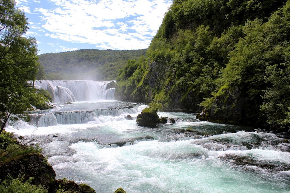
Legend has it that this river was named “Una” by Roman warriors who arrived on its banks and were healed of the grimness of war by the magnificent beauty of the river. The only way they could express the magic of the river was with the word “Una,” meaning “the one, the only.”The River is 212 km (132 miles) long and weaves a glorious course along the borders of Croatia and Bosnia and Herzegovina. Pictured above is Štrbački Buk, where many natural waterfalls are stacked one after the other, including the tallest cascade in the park at 24.5 meters.The many waterfalls on the Una River contribute to the water’s vibrant colors and clarity. Waterfalls naturally aerate the water by driving oxygen into it, which enlivens its colors and is extremely healthy for plant and animal life in and around the river. Hundreds of species of flora and fauna can be found in the park. Many are endemic- such as a certain aquatic salamander found in underwater caves- while some are endangered in the region, including the majestic and elusive Balkan Lynx.The Una River is clean, healthy, and strong, and so are its fish. Fishing, including fly-fishing, is very popular on the Una, and some of the most common varieties in these waters are graylings as well as Rainbow and California trout. Over 30 species of fish and many varieties of river crabs are part of the biodiversity of the Una River, whose many natural, cascade-fueled whirlpools are ideal habitats for large fish.
The Una River is famous in BiH for many other water sports, including kayaking, diving, and some seriously epic, whitewater rafting. The Una Regatta is an increasingly-popular event which includes organized water sports and camping in the park. It takes place annually, and will be held this year from July 28 to 31.A healthy environment creates natural wonders to rival our wildest dreams. This is as true for enormous and powerful waterfalls as it is for tiny, intricately beautiful plants that grow inch-high.The Martin Brod waterfalls are the other contenders for the most major and glorious cascade on the Una River. While Štrbački Buk boasts the tallest drop, Martin Brod is technically a larger collection of falls, which continue along the River for around 800 meters. I could have stayed at this viewpoint for hours (I’m the small figure on the right), enjoying the refreshing mist, therapeutic rumble of the water, and counting the rainbows in the sunny spray.Here, National Geographic Explorer Lois Parshley takes a picture of wildlife beside glistening ripples just downstream of the Martin Brod waterfalls. This photo shows the amazing clarity of the Una’s water.Unfortunately, there is some bad news: a dam might be built.The government of BiH- the same government that agreed to designate the Una National Park as protected land in 2008- may soon approve a project to build a hydroelectric dam on the Una River just upstream of the park itself. This is part of a larger scheme that proposes to erect up to 2,700 dams in the Balkans, threatening the prosperity of rivers all over the region.Damming would destroy the valuable and unique ecosystems as well as the natural diversity of the Una River and its surrounding wilderness. A dam would obliterate the park’s progress toward sustainable and responsible economic growth- growth that would, in the long-term, lead to larger profits and more jobs (especially locally) than would a dam.Tourism in the park is in its early stages of generating consistent and reliable incomes for local businesses. A dam would end this prospect, and only benefit the transnational, environmentally-irresponsible financial institutions, which have no interest in the long-term prosperity and wellbeing of BiH’s nature or people.Here is recent news about all this nonsense. Here is some information about a group that is trying to stop it. We met the director of the park, Amarildo Mulić (right), and park ranger Haris Hadzihajdarevic (left) for a coffee in Kulen Vakuf, a town situated in the center of the national park. Kulen Vakuf stands to benefit from positive economic development thanks to the park. There are plans to improve accommodation and tourism services in town and to create historical hiking and mountain biking tours to archeological sites in the surrounding mountains. The number of tourists visiting the park has grown significantly every year since its official opening in 2011, and demand for these sorts of offers is increasing. Amarildo mentioned that these initiatives would contribute more to economic development in the long term than would a dam.Haris (pictured above) and Amarildo are very passionate about protecting the nature of Una National Park and its great diversity of flora and fauna. Sadly, this newly-protected land is already under threat. The best way we can show our support for its safety is to visit, enjoy, spread the word and speak out against the dam project.I’m also very passionate about nature, as you can probably tell! At Backroad Balkans, I write about fun facts and stories I learn while exploring Balkans wilderness.
{source}{/source}
Leaving town is always hard. Especially when the forecast is rain.And rain there was. I hiked the shortest/fastest trail to Ŝugarska Duliba; about halfway there’s a crossing and two choices to get to the shelter. I guess the other one’s more scenic, but who cares when get soaked by the rain? I later found out that there’s a new shelter (5 person, solar panels and water) on the Dinarica – choice, it’s not on the maps yet.Šugarska dulibaAnother hiker just left Šugarska duliba (the wood stove was still burning), which helped drying my clothes and gear. This shelter is in an awful state, it’s a big mess, dirty, run down, taken over by Puh’s and other critters…At the beginning of the evening the weather changed and I decided to sleep outside, under my tarp – save from the Puh’s. There’s a cistern close-by and around the cistern there’s some good camping spots too.
Tetekovo duliba/Stap (daddy’s shelter)The next day it’s a short hike to the shelter (5 to 6 hours). Heading on is not an option, the next shelter is to far to hike to that same day and this area has been affected by the war – it’s not save to leave the trail. And; camping is only allowed next to the shelters in the national parks.The first half of the hike is really nice; some good views on the coast, hiking through shaded forest, etc. Then after the ruins of forest house Juliba a logging area starts. There’s signs, but some are easy to miss and there’s also a lot of ruined trail. So keep on checking if you’re still on it (or somewhat on it).After the logging area it’s time for a treat: great views on those beautiful Karst peaks! Tatekova koliba has been build on an amazing spot, surrounded by high peaks. This shelter is being taken care of, it’s small but clean.Closeby runs a little stream (use the one after the shelter, the first one’s being used as a toilet area). If the stream’s dry there’s a water pump a little down the trail. Again I slept outside, since of the Puh and also because of the warm temperature. There’s a donation box inside this shelter, don’t forget the leave some money for maintenance.StapThis morning I start my hike early, since I’m expecting it to be warm. Today there’s a lot change in scenery; the hike starts with views on the Karst mountains, then forest and then green hills full of flowers.Along the way there’s a few cisterns containing water next to ruined houses. Like all water from cisterns it needs purifying, but if you’re a thru-hiker you’re probably carrying a filter anyway. Next is a plain, it’s beautiful but exposed, so burning hot and flies everywhere.
At the chapel I take a break. There’s benches and shade and most important; a cistern. A little after here the climb up to Struge starts. It’s about 500 meter and got stunning views. The trail is nice and well maintained. There’s even two springs on the way to the top.StrugeStruge is a nice and busy shelter, this is were I met other hikers for the first time in days. Two day-hikers who fed me speck (bacon), bread onion. ‘Please eat. Don’t be ashamed you need it to hike to Macedonia’. This is also were I met Ivan and his friend. Two well informed hiker. Do you remember the dog? Well it’s common for him to walk along with hikers. He always returns to his boss. They also showed me pictures of the new hut between Baŝke Oŝterije and they tell me that the next hut has been torn down. They invite me for dinner; risotto with homemade speck and cheese. Yummy! Again in Struge there’s mice, Puh and other animals living in and around it. Water can be collected from a cistern which is a 20 minutes hike from the hut (or carry water uphill taken from the spring).Tulove gredeI start my hike early since I want to reach Tulove grede as early as possible. First is the ascent to Vaganski vrh., the highest peak in NP Paklenica.Although I hiked in the mist most of the morning, the views are stunning and I really enjoyed this part of the trail!Leaving NP PaklenicaShelter Vlaški Grad doesn’t exist anymore. There’s a cistern close-by and a little further down the trail there’s a spring – it only had a small trickle. Just before exiting NP Paklenica there’s a spring, fresh and delicious water coming straight from the mountain. This is also where a plain starts. From now on the hike is exposed and blazing hot! There’s almost no shade and no water sources.After the plain an endless road starts, it does have stunning views. Even though I tried to avoid it, I hiked this part of the trail in the full heat. This area has been heavily affected by the war, don’t go off trail.Tulove gredeAt Tulove grede there’s a little bit of shade. Here I decided to try to hitch back to civilization. There’s quite some tourists driving up here and there’s no suitable spot for bivouac (mines and very exposed to both weather and muggles). This road is only used by either hikers or tourists (most of being driven by in a 4×4 and on a photo-safari). Don’t count on an easy hitch here! After waiting for a long time, at a parking lot occupied by three cars, three Slovenian hikers gave me a ride to Starigrad. Way out of way… but I was very happy to get this ride.About stage 19, 20 & 21Stage 19 is in my opinion not a very pleasant stage to hike. Its very exposed and since of the mine situation its not safe to go offtrail. Therefore im skipping the remainder of this stage. If you’re planning on hiking this, make sure you got a good (better) strategy then I had. I’m also skipping stage 20 and 21. It will be hard to reach the start of stage 20 and after the climb to the summit its roadwalking. Stage 21 leads over paved roads and through rural areas – I guess finding a safe spot for bivouac will be difficult. So from Starigrad I will travel by public transport to Knin to hike Dinara, Croatias highest peak.More photos on Instagram. Support my adventures and buy me a refreshing soda pop.This blog has blog has been written on trail and on a mobile phone.
{source}<script type="text/javascript" src="https://trail.viadinarica.com/en/tour/mountain-hike/via-dinarica-hr-w-18-southern-velebit-iv-tulove-grede/15966982/tour2go"></script><p><a title="Europe’s largest outdoor platform" href="http://www.outdooractive.com/" target="_blank">part of outdooractive</a></p>{/source}{source}<script type="text/javascript" src="https://trail.viadinarica.com/en/tour/mountain-hike/via-dinarica-hr-w-17-nacionalni-park-paklenica/15966852/tour2go"></script><p><a title="Europe’s largest outdoor platform" href="http://www.outdooractive.com/" target="_blank">part of outdooractive</a></p>{/source} {source}<script type="text/javascript" src="https://trail.viadinarica.com/en/hut/mountain-shelter-ugarska-duliba/16325263/hut2go"></script><p><a title="Europe’s largest outdoor platform" href="http://www.outdooractive.com/" target="_blank">part of outdooractive</a></p>{source}<script type="text/javascript" src="https://trail.viadinarica.com/en/hut/mountain-shelter-tatekova-koliba-at-stap/16325350/hut2go"></script><p><a title="Europe’s largest outdoor platform" href="http://www.outdooractive.com/" target="_blank">part of outdooractive</a></p>{/source}
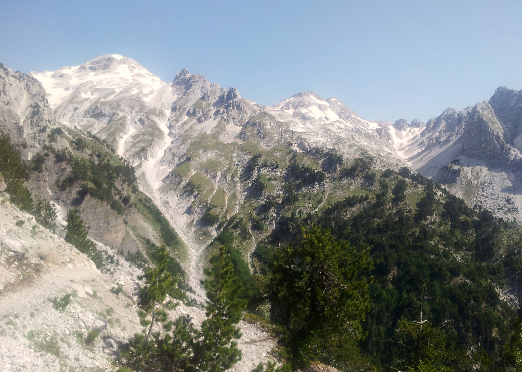
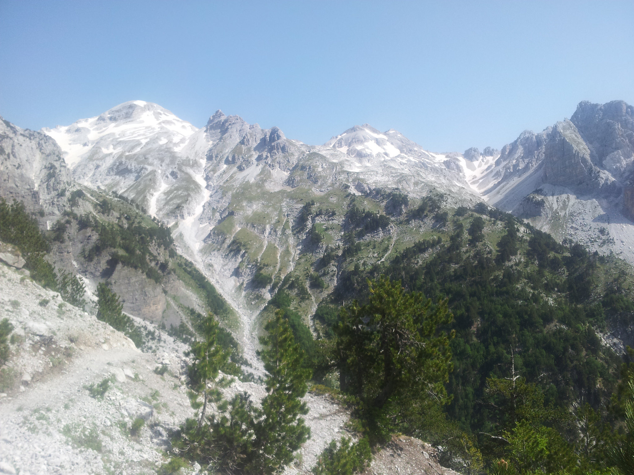
The Via Dinarica White Trail officially ends in Albania, in the highest part of the Dinaric mountains, but I decided to start there. Surrounded by pointy sharp peaks and deep, green valleys it had been challenging, but stunning. Although there are only three stages in Albania, it took me a week to get to the Montenegran mountains.
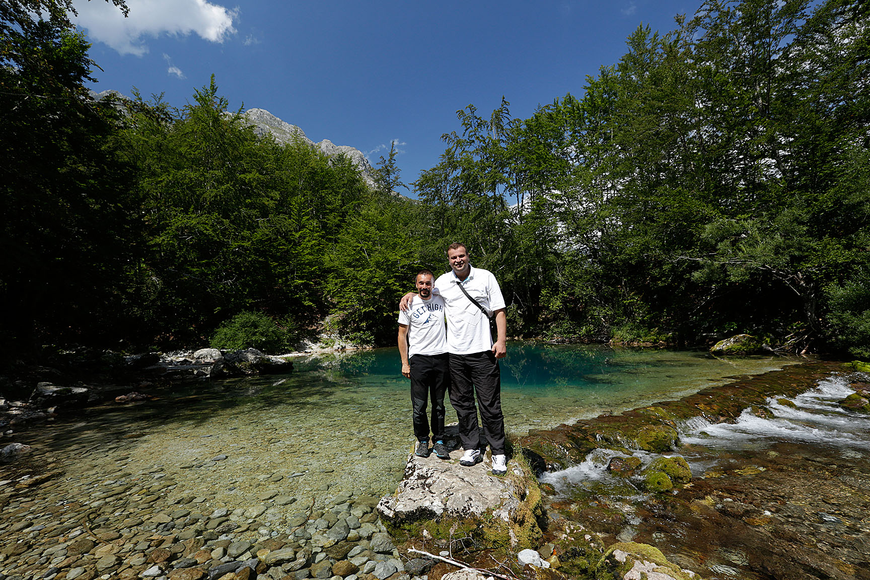
On the 17th of June, I started at the end of the asphalt road in the Valbona river valley. From there, a four wheel drive track leads you to some small villages with charming little bars where they serve local food and drinks. The route from Valbona to Theth is one of the most popular day hikes in Albania and is also part of the Peaks of the Balkan trail. Despite the though climb and the adventurous steep parts, many tourist give it a try. Halfway I stopped at “Somoni Kafe” and ended up talking all afternoon with the father and son who were running the place during the summer months. I felt no need to go on, so I put up my tent at their bivouac spot and sat down for another chat with the two men.
Cuku i Valbones, Albania
Only 5K..
Where to go, Valbona Valley NP
The next day I continued hiking up and down the steep mountain passes. Prokletije, the accursed mountains were actually covered with colorful flowers, herbs and all sorts of butterflies. After Thethi I met just a few other hikers, but most of the time I was all on my own. It’s great to feel the strength of the nature all around you, but it can be scary too. The dark clouds and strong wind forced me to stay in the valley. I couldn’t climb Maja Jezercë, Albania’s highest mountain, because of the weather conditions. On the other hand the unpredictable weather brought me into unplanned, unique situations like spending the night in a Alpine mountain hut whit a shepherd family.
Thethi NP
Mushroom of Concrete, typical Albanian bunkers from the cold war.
The people I met along the trail were friendly and very helpful. They offered me places to sleep and even left me with the keys of their house while they went out for a family diner. The Albanian language had been hard, impossible to understand, but it never really was a problem. I met an old lady who went up into the mountains with her sheep, every day. On the way down to her house she showed me her favorite view points and sang a beautiful song while we were holding each others hands. It’s these moments that don’t need words. And it’s these moments that mean the world to me.
Above Vermosh where I met the sweet shepherd lady, Drande.
Crossing the border to Montenegro from Vermosh was interesting. Via Dinarica has got GPS tracks you can download from their website. I did not expect a marked trail, but a path or something that looked like a hiking trail would have been nice. After several tries hiking, climbing, crawling through bushes, I gave up. Went back with the old shepherd lady and tried an alternative route the next day. It was hard to find, steep and completely overgrown, but I managed to reach the border. I’m still curious if it’s possible to follow the GPS track, but on the other hand I think that the trail to Rikavačko Jezero is an amazing hike with spectacular views. I recommend the other Via Dinarica hikers to follow this route, because it will bring you to the most beautiful lake I have seen in Montenegro, Rikavačko Jezero.
New route to Montenegro, the trail to Rikavačko Jezero
Rikavačko Jezero, Montenegro
Albania has been stunning, steep and wild. During the day, the weather was unpredictable, but every night I’ve seen falling stars and fire flies. Good coffee, home made raki, sweet people and loads of funny sheep along the way. I’m glad that I took my time, but really the Albanian Alps deserve more than just one week…
For more photos click here
{youtube}LwlmdGbo2tY{/youtube}
{youtube}PLRKMkWaaG3ql4KZaTlMFn_3HKzffmgAUc&v=UWDxXMTR_Ok{/youtube}
{source}
<script type="text/javascript" src="https://www.outdooractive.com/en/mountain-hike/albania/amazing-albanian-alps-via-dinarica-white-trail/19094515/tour2go"></script>
{/source}
{source}
{/source}
{source}
{/source}
{source}
{/source}
{source}
{/source}
{source}
{/source}
{source}
{/source}
{source}
{/source}
{source}
{/source}
{source}
{/source}
After the adventure with Drande the sweet shepherd lady from Vermosh, I gained an experience, but unfortunately I didn’t gain much knowledge about a route out of Albania. But I did notice, while looking out over the valley, that there might be another possibility. The valley kind of splits into two branches, of which I only examined one. I hoped if I would follow the river, I would find a path to Rikavačko Jezero, a lake that a local from the valley mentioned earlier. From there I would be able to venture further into Montenegro. It took a while (two hours) before I found the right turn to Rikavačko. While I almost gave up and walked back to Vermosh (for the third time), an arrow saying Vermosh caught my eye. ˝Yes, I know where I’m going˝, I wanted to yell at the tree. But hey, would this mean that it is possible to go the other way as well?? Haha! Yessss!!!!
The other branch of the Vermosh valley
My way to Montenegro
I couldn’t believe my eyes! After all the wilderness there finally was a clearly marked track! Adventurous and wild, overgrown and steep, but very pretty. Every step kind of felt like victory. I found my own way out of Vermosh. From the border it was a bit of improvising, slithering over the marshy, grown over hill, but with a great view on the lake. At the other side of the lake I ran into cows, horses and a panorama restaurant to be. From a distance the owner was mysteriously looking at me through his sunglasses. With a glass of red wine in one hand and a cigarette in the other, he was carefully watching his surroundings. No Engliski, but a friendly gesture to come over and sit down with him. With some words out of my Bosnian vocabulary and an online dictionary we managed to have a decent conversation. But in fact we didn’t need words to take in and enjoy the incredible place around us.
Rikavačko jezero
Simon joked about wanting to see my papers, since I just crossed the border. ˝Only if I get a stamp with a picture of the lake˝ I joked back. ˝This is Simon transit, slobodan!˝ He said. Together we drank some wine on that. Simon also had a happiness project. He was building his Eko Katun Rika i Tor. Tor meaning cattle and Rika referring to the lake; Rikavačko jezero. ˝The confrontation between lake and cattle˝ he filosophized. At this spot you experience the consequences of that confrontation. In other words: grilled meat served with cheese and yoghurt. Local habits and traditions are both visible and touchable. And edible. People tradition and nature. In nature.
Rika i Tor, Simons project
At this moment it is a pretty big job to put the restaurant, kitchen (grill-house) and five little cabins together. Although the design is done by a friend, Simon is both the foreman and the brain behind the project. A tough thing and Simon is not the most organized person. But hey, polako polako. That’s how I decided to take it easy as well, to give myself a rest day. Sunbathing, swimming and sleeping. Drinking coffee, writing and listening to music. Meanwhile Simon was rummaging around pulling out cigarettes like there was no tomorrow. ˝Work, swimming i vino. This is sam raj˝, he kept repeating. I think it meant my paradise. This place makes him happy and I understood why. Still I believed to see some sadness. An escape into a project, into paradise. Away from reality.
A day in Simons paradise
But why not? Enjoy wherever you can and don’t put too much time into systems and expectations. I would have loved to give him a hand, but I have my own project. My own escape into my own paradise. Through the Balkan by foot, day after day glued together by special meetings and incredibly beautiful places. Yes, the Via Dinarica is my paradise!
Visit my page for more stories, photos, news...:)
Translated by Sytske
{source}
{/source}
{source}
{/source}
{source}
{/source}
{source}
{/source}
{source}
{/source}
{source}
{/source}
{source}
{/source}
{source}
{/source}
{source}
{/source}
{source}
{/source}
After a relaxing day, a stay in a room with a view, some good seafood and buying resupplies in a well assorted store in Senj the bus brings me back to trail. Yeah, the trail beat me on the last section. But I know good things are waiting ahead! After a short road walk all trails lead to Oltari and hiking-paradise Velebit. A candy-red Lada Niva (I love those cars!), parked at a farm, brightens up my day. From now on things are getting better.OltariThe hike to Oltari is pleasant; green hills, flowers, farmland and (almost) no bushwhacking. Since it’s a weeks day the hiking hut in Oltari is closed, so I install myself on the terrace. It’s got all these luxuries; a toilet, a table and bench, water from a tab (that needs to be cleaned)… Then, after finishing dinner, a dad with two kids arrive. They’re staying at the hut this week, so I move from the terrace into a private dorm.ZavižanThe next morning the sun is shining, but I’m not feeling fit (I caught a cold thanks to the rain). I decide to hike to mountain hut Zavižan, there I’ll see if I feel fit enough to hike on. It’s still early when I arrive at Zavižan and although it’s a nice hut, it’s not a cozy place to hang around. So, after taking a break, I decide to keep on hiking – at a slow but steady pace.Premužić trailFrom Zavižan the Dinarica follows the scenic Premužić trail. This trail was build in the 1930’s, it leads along the mountains but there’s small ascends and descents. It makes an inaccessible and rugged part of Velebit easy to hike. This is like hiking a red carpet!Today is the first day I meet quite some other hikers; it’s a well known trail, easy to get to by car and yeah the stunning views… too bad I’m feeling ill. After a lunch break at Rossijevo Sklonište I decide to hike on to mountain hut Alan. This small shelter has recently been renovated, but there’s traces of Puh inside.There also a group of four French who are staying the night, I tell them about the Puh and to put away their food – I really hope they had a good night sleeping.AlanIn Alan there’s not many hikers staying, so I get a small, private room. After a good, long and deep sleep I feel better the next morning. Too bad, this morning it is nasty outside; wind, rain, fog… At nine I decide to leave, this area is close to the coast and I hope the winds will change weather – after Inger, a wise Swedish stugvärd (warden), once taught me. My hike starts foggy. Then it gets better.In the afternoon it’s clear blues skies and it’s getting hot! Halfway between Alan and Skorpovac there’s a spring (there ‘s only a trickle of water coming from it and I bet it’ll run dry later in summer).At Skorpovac, a small shelter with a well, I pause for a while and chat a bit (in German) with the warden. He tells me not to be scared of wolfs and bears, it’s the snakes to watch out for (true, I really don’t like snakes – meeting them makes me jump and act like a girl – ieieieieie).After leaving Skorpovac the warden’s dog joins me on my hike and while I’m not befriending him, he sticks with me. Yeah! Another Balkan experience!
Ravni DabarSince camping is only allowed close to the huts and shelters we hike on to Ravni Dabar. It’s a weeks day, so this hut isn’t open. After installing my tarp a dog somewhere in the valley starts barking. Then another. It’s pretty loud, impressive and annoying. It is also bothering my new friend – it is a relaxed dog but he’s getting nervous. Maybe it’s his presence in this valley? So we move to a shed that’s being used as a BBQ-area. I sleep on the table, my friend sleeps on an old cushion on the floor. I believe it caught (or scared) a Puh during the night.Baške OšterijeThat morning it’s an eight km hike to Baŝke Oŝterije from where the bus to the village of Karlobag runs. My friend has suddenly left me – I hope he found his way back to Skorpovac.I’m early and try to hitch to town, without any luck. At the hostel/restaurant the waitress tells me there’s no bus running, as do two elderly ladies who are out on a walk. Again I try to hitch. Again no luck. Then, lucky me, there’s the bus. The ride about a 1000 meter down to the coast is stunning. Karlobag is a tiny and relaxed village. I stayed at the decent and chearfull hostel Val. There’s a few small shops and with a bit of creativity I managed to buy resupplies for the next 100km.More photos on Instagram. Support my adventures and buy me a coffee, soda pop or a high calorie meal.This blog has blog has been written on trail and on a mobile phone.
{source}<script type="text/javascript" src="https://trail.viadinarica.com/en/tour/mountain-hike/via-dinarica-hr-w-10-northern-velebit-national-park-i-zavian/15957422/tour2go"></script><p><a title="Europe’s largest outdoor platform" href="http://www.outdooractive.com/" target="_blank">part of outdooractive</a></p>{/source}{source}<script type="text/javascript" src="https://trail.viadinarica.com/en/tour/mountain-hike/via-dinarica-hr-w-11-northern-velebit-national-park-ii-roanski-kukovi/15957577/tour2go"></script><p><a title="Europe’s largest outdoor platform" href="http://www.outdooractive.com/" target="_blank">part of outdooractive</a></p>{/source}{source}<script type="text/javascript" src="https://trail.viadinarica.com/en/tour/mountain-hike/via-dinarica-hr-w-12-from-alan-to-central-velebit/15957706/tour2go"></script><p><a title="Europe’s largest outdoor platform" href="http://www.outdooractive.com/" target="_blank">part of outdooractive</a></p>{/source}{source}<script type="text/javascript" src="https://trail.viadinarica.com/en/tour/mountain-hike/via-dinarica-hr-w-13-dabri-and-dabarski-kukovi/15957781/tour2go"></script><p><a title="Europe’s largest outdoor platform" href="http://www.outdooractive.com/" target="_blank">part of outdooractive</a></p>{/source}{source}<script type="text/javascript" src="https://trail.viadinarica.com/en/tour/mountain-hike/via-dinarica-hr-w-14-southern-velebit-i-route-to-ugarska-duliba/15966510/tour2go"></script><p><a title="Europe’s largest outdoor platform" href="http://www.outdooractive.com/" target="_blank">part of outdooractive</a></p>{/source}{source}<script type="text/javascript" src="https://trail.viadinarica.com/en/hut/mountain-lodge-zavian/14827887/hut2go"></script><p><a title="Europe’s largest outdoor platform" href="http://www.outdooractive.com/" target="_blank">part of outdooractive</a></p>{/source}{source}<script type="text/javascript" src="https://trail.viadinarica.com/en/hut/mountain-shelter-rossijevo-sklonite/16325849/hut2go"></script><p><a title="Europe’s largest outdoor platform" href="http://www.outdooractive.com/" target="_blank">part of outdooractive</a></p>{/source}{source}<script type="text/javascript" src="https://trail.viadinarica.com/en/hut/mountain-hut-alan/16325890/hut2go"></script><p><a title="Europe’s largest outdoor platform" href="http://www.outdooractive.com/" target="_blank">part of outdooractive</a></p>{/source}{source}<script type="text/javascript" src="https://trail.viadinarica.com/en/hut/mountain-shelter-skorpovac/16325041/hut2go"></script><p><a title="Europe’s largest outdoor platform" href="http://www.outdooractive.com/" target="_blank">part of outdooractive</a></p>{/source}
A few km’s after leaving Skloniste Miroslav Hirtz (stage 7) the fun started again. Fallen trees, an overgrown trail, searching for way markers – or all three combined. I bet there aren’t a lot of hikers using this trail! Hiking it solo, sliding over rocks, climbing over or under trees, head-high bushes, hidden rocks under the growth, checking the GPS – it slowed me down a lot.After hitting the road and seeing the run down mountain hut, kuća Stalak, (probably meaning that there isn’t a lot of hiking going on around here) an almost empty food bag and another 30km to hike I decided to hitch to the town of Senj and skip the remainder of stage 8 and stage 9.Hitching at this empty road took me an hour, and I was lucky the girls in first car driving by gave me a ride.More photos on Instagram. Support my adventures and buy me a coffee, soda pop or a high calorie meal.This blog has blog has been written on trail and on a mobile phone.
{source}<script type="text/javascript" src="https://trail.viadinarica.com/en/tour/mountain-hike/via-dinarica-hr-w-08-connecting-trail-kapela-velebit/15957274/tour2go"></script><p><a title="Europe’s largest outdoor platform" href="http://www.outdooractive.com/" target="_blank">part of outdooractive</a></p>{/source}{source}<script type="text/javascript" src="https://trail.viadinarica.com/en/tour/mountain-hike/via-dinarica-hr-w-09-senjsko-bilo/15957323/tour2go"></script><p><a title="Europe’s largest outdoor platform" href="http://www.outdooractive.com/" target="_blank">part of outdooractive</a></p>{/source}{source}<script type="text/javascript" src="https://trail.viadinarica.com/en/hut/mountain-shelter-miroslav-hirtz/16336282/hut2go"></script><p><a title="Europe’s largest outdoor platform" href="http://www.outdooractive.com/" target="_blank">part of outdooractive</a></p>{/source}
Rain. Two full days of rain after leaving Fuzine. Including thunder and lightning. Oh and hail too. A hiker I met in one of the dom’s told me this area is known for the bad weather. Seven days of rain is supposed to be quite common. Because of the rain (and the lack of people out here) I saw a lot of bear signs; paw prints, scratching on trees and scat.Bitorajska ShelterI stayed at the Bitorajska Shelter (a shelter with a wood stove and water collected from the roof into a water tank). It’s a little offtrail but it kept me warm and dry, which I needed after even getting my underwear soaking wet. I didn’t get a lot of sleep; there’s a pack of door-mice living in this shelter.I hiked the Dinara-route to Botorajska but it might also be possible to hike from the town of Vrata, close to Fužine, up to Bitorajka. This saves a lot of km’s. The trail seems at certain parts not to be used a lot. Again a lot of plants growing, fallen trees on the trail and again bushwhacking (old markings were sometimes visible). Not very well maintained, but doable, although I did a lot of sliding because of the very wet conditions and I choose to road-walk the last part to the town of Tuk. I did not meet a single person on a weekend’s day. Bitorajska does get a lot of visitors, according to the trailregister.TukAfter another very rainy day I stayed at Mountain Lodge Bijele Stijene in Tuk. There was a hikers meeting, so a lot people and free bean soup. They left in the afternoon and I had the hut to myself (if I promised to close the door after leaving the next morning). The shower and warmth were welcome after that very rainy day.Bijele StijeneStage 7 starts quite easy. First road-walking, then a forest road and then the trail. There’s this very nice shelter, Ratkovo sklonište, a little off-trail. It’s build against/in a cave and a must see. Especially since there’s water (again being collected from the roof). Then the trail gets slowly demanding; climbing over and under trees, scrambling, rock-climbing, chains and stairs. As a reward there’s stunning views on the white Karst rocks!Luckily for me today was a day without rain, which made hiking it (on trail runners and carrying a 40 liter backpack) way easier. Hiking this stage took a lot of time and energy. I decided to stay the night at Sklonište Miroslav Hirtz (also inhabited by door-mice), with a well close-by.More photos on Instagram. Support my adventures and buy me a cup of the strong Turkish coffee they’re serving here.This blog has blog has been written on trail and on a mobile phone.
{source}<script type="text/javascript" src="https://trail.viadinarica.com/en/tour/mountain-hike/via-dinarica-hr-w-06-strict-nature-reserve-bijele-i-samarske-stijene/15948691/tour2go"></script><p><a title="Europe’s largest outdoor platform" href="http://www.outdooractive.com/" target="_blank">part of outdooractive</a></p>{/source}{source}<script type="text/javascript" src="https://trail.viadinarica.com/en/tour/mountain-hike/via-dinarica-hr-w-07-along-kapela-hiking-trail-towards-the-adriatic-sea/15957187/tour2go"></script><p><a title="Europe’s largest outdoor platform" href="http://www.outdooractive.com/" target="_blank">part of outdooractive</a></p>{/source}{source}<script type="text/javascript" src="https://trail.viadinarica.com/en/hut/mountain-shelter-miroslav-hirtz/16336282/hut2go"></script><p><a title="Europe’s largest outdoor platform" href="http://www.outdooractive.com/" target="_blank">part of outdooractive</a></p>{/source}
Recently, I went on an amazing hike with my friend Eva, a fellow Via Dinarica enthusiast and a travel blogger from Amsterdam. We walked, climbed, and ambled our way out of Sarajevo and eventually made it to Vukov Konak, a charming guesthouse in the mountains near Vucja Luka village. Here are our different sides of the same story, and information about how you can complete the same hike – and have your own unique adventure.
Eva: Hiking from Sarajevo to Vukov Konak
A few weeks ago while I was still in Amsterdam, I saw a post on the Terra Dinarica Facebook page about a guesthouse named Vukov Konak. They were looking for volunteers to help them during the summer season. Of course my plan was (and still is) to hike the White Trail, but I couldn’t help clicking and scrolling down Vukov Konak’s page. When I came across a video that showed a little concert in their cosy wooden living room, I knew I had to go and find that place. If a video post on Facebook can touch me, who knows what can happen in real life.
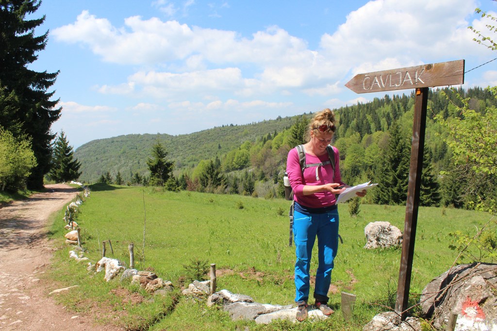
So I start searching “how to get to Vukov Konak” and found out that it was only a one-day-hike from Sarajevo. Terra Dinarica made it even easier with the tour “Hiking from Sarajevo to Vucja Luka” they created in Outdooractive. This tour is part of the Via Dinarica Green Trail which will be finished soon. I could download the GPS track and print the map with descriptions. Een kind kan de was doen, is wat we would say in The Netherlands. It means that the job can be done even by a child…When I told Maggie, a girl from the US who works for Terra Dinarica, about my plan to hike to Vukov Konak, she immediately decided to join me. Thrilled and excited we met at Vijećnica, the starting point in the middle of Sarajevo. Maggie printed out the description of the route and I brought my new GPS device. Besides spending the day in the mountains, for me it was also about getting used to use a GPS while hiking. I’m easily distracted by thoughts, conversations and of course by nature. Which is all right and I enjoy that, but I have to prepare myself for this summer. On the Via Dinarica it will be necessary to have some navigation skills and be focused. Although a GPS makes it a whole lot easier, it is quite some work to figure out how that thing works. With this hike I could check and test everything I’ve learned so far.Cheerfully chatting we started to climbed our way out of the city centre towards the yellow fortress. There we found the first trail markers that led us through the labyrinth of small streets and steep stairs. Although there were quite a lot of stray dogs, we safely reached the first viewing point where we could fill our water bottles. My GPS told us that we were still on the right track, our green line perfectly matched the purple line on the screen. Maggie called Vukov Konak to check if they were still open by the time that we would arrive. If we would keep on going like we did, it was doable to be there at 5PM. Confident and optimistic we continued.The description said that during the next part of the trail we had to make sure that we would stay on the paths, because of the sport shooting area we were about to cross. While walking on that path we heard several shots, but weren’t aware of the fact that bullets don’t care about hiking trails or hikers. When the shots became louder and a man started to wave at us, we realised that sport shooters also don’t care about trails or hikers. The man told us that this area is forbidden for hikers during the weekend and we had to make a detour along the road if we didn’t want to risk our lives…A bit bummed out we turned around and headed back to the road. Suddenly a car stopped right in front of us, for a second I thought of asking for a ride to our next exit into the forest. But we didn’t. A girl with dyed red hair got out of the car and started to ask us some questions. I still don’t speak or understand Bosnian, so I let Maggie do the talking. The red haired girl explained that she was drunk… and wanted us to take a picture of her and her boyfriend with the amazing city view. That was the good thing about the detour, the spectacular views and crazy passer-by’s.In Čavljak we stopped for a coffee at the mountain lodge where some men were playing cards, smoking and drinking beer. When they noticed the FiveFinger shoes I was wearing, their card play suddenly didn’t seem that important anymore. They invited us to stay for a drink, but we explained that we were on our way to Vukov Konak, which was still quite a long way to go. Like all the other people we would meet along the way they started to warn us that it was really really far. Most people even said it was irresponsible to go all the way up there with just the two of us.At that time we were still optimistic that we could make it, we did most of the climbing and had already done one third of the tour. How hard could it be? We had all day and it was only 20 kilometers after all.The road took us to a forest, finally we could leave the asphalt and feel the earth under our feet. This was absolutely the most lovely scenery I’d seen so far. Indescribable green grass, wide views and cute wooden huts. Although there were several refreshment stops, it wasn’t crowded or spoiled by people. In fact, because of these little bars there was a special vibe, all kinds of people who were enjoying the atmosphere just as much as we did. Before we knew it, we sat down for another break. This time we did accept an invitation of two beer-drinking men and got ourselves a rakija before we went on.Unfortunately we then discovered that we were not quite as far as we thought we were, which meant that we still had halfway to go. My legs didn’t agree with the rakija pauza and started to complain. At the same time, the sun disappeared behind dark grey clouds and all of the sudden there were no trail markers anymore. On the GPS we could see that we were off the purple line, but we couldn’t find a path that led us back. Add the worries of all the people we met during the day and the dense, eerie forest that lied in front of us… I seriously started to doubt if it was wise to go on. Maybe we had been a bit naive and a bit too slow after all. I didn’t want to get lost in that dark forest full of animals I was still afraid of.Going back to the last trail marker we had seen didn’t make sense, because the description told us that we had to leave that dirt road and walk on the northern side of the Crepoljsko Mountain towards the forest, which we did. The only option, beside going back to Sarajevo, was to walk a few meters in each direction to see where we would meet the purple line on the GPS screen. Luckily there turned out to be a very small path through the grass after all. But at this spot, a signpost would have been kind of welcome.Once we finally got back on track we stepped up our pace a little, but still not in such a hurry. Maggie was the most positive. Maybe because she likes forests, but they give me the creeps. I prefer mountain landscapes with wide views. But I have to admit that it was a kind of special feeling to be all alone, or just the two of us, in that huge wild piece of nature. Our conversation turned to more serious subjects, maybe heavy but not creepy at all. It was a completely different atmosphere, which led to completely different emotions and feelings than the lovely green landscape only a few hours ago had. I love to be on my own, but during this hike, the fact that we made it together added something that couldn’t be experienced by being all alone.All of the sudden the high trees made room for a great view over the hills and mountains before we took the last turn towards our destination. The threatening clouds slowly disappeared and the moment we arrived at the guesthouse, the sun started to shine. At 5PM exactly we walked onto the terrace of this beautiful place surrounded by nature, right into the arms of the warm and friendly Vukov Konak crew.Maggie had to go back to Sarajevo, but I decided to stay for the BBQ and ended up spending the night. It was a special evening with an eclectic group of people. Guests, volunteers, owners. Finns, Germans, Hungarians, an American girl, the Bosnian host and a guy from Slovenia who was there to pick up his new Finnish girlfriend. Rakija and a Finnish sausages. Bosnian coffee with Lakka (I believe it was). Stories and a campfire, music and more beer. And of course the very amusing goat with a name I forgot.
Maggie: Sarajevo to Vukov Konak on Foot
At 9 AM, I set out from my house in downtown Sarajevo toward Vijećnica (Town Hall) to meet Eva, who will hike the entire Via Dinarica White Trail this summer.Our mission was to hike to Vukov Konak, a mountain guesthouse near the village of Vucja Luka, about 20 kilometers (12.4 miles) away from Sarajevo. We were testing ourselves by relying on nothing but the guidance of the information we got on Outdoor Active, “Europe’s largest outdoor platform for trails, tracks, tours and outdoor route planning.” Via Dinarica has its own Outdoor Active platform under the “Maps and Trail” tab above, where you can find each stage of the trail and all offshoots and points of interest along the way.We had printed the materials for the Vucja Luka tour, which is part of the Via Dinarica Green Trail. These included a detailed map, turn-by-turn directions, and statistics such as the total ascent (1,096 meters) and descent (429 meters) and the estimated time to get there, which was 7 hours. Eva also had a GPS device, to practice using it in preparation for her Via Dinarica journey.
It was a hot and sunny day, and we were both sweating after the climb to Zuta Tabija (Yellow Fort) 20 minutes in, but were excited and energetic and had no desire to take a break. The climb out of Sarajevo, up many narrow, rocky staircases occasionally flanked by growling stray dogs, was probably the most grueling and steep part of the journey, but somehow we barely noticed at the time. We were psyched up for a long day.This was good, because along the way, all the weekend hikers and picnickers we passed told us that Vucja Luka was too far away, and seemed to think we were crazy to try to walk there. Our explanations – especially the part about the Via Dinarica and Eva’s plan to hike from Albania to Slovenia alone this summer – were met with looks of astonishment. Honestly, I think a few people simply didn’t believe us.Our steadfast resolve helped us push past more than just stray dogs and naysayers. A couple of kilometers before Barice, we started hearing gunshots coming from the hills we were headed for. The Outdoor Active information told us that this was a sportshooting area, but that if we stuck to the trail we would be fine. But in Bosnia, rules can change without everyone being notified. We semi-confidently continued along the path, gunshots getting louder, when we saw a man up ahead waving at us. We stopped and I shouted “can we go?” and he yelled back “its up to you!” We walked a few more paces and saw shooting targets behind a hill on the left – we were literally about to walk into the line of fire! The man ducked and ran to us, laughing, and explained that this was now a forbidden zone on weekends, and that we’d have to stick to the asphalt road to go around the area. This added a couple kilometers to our trip, but on the plus side we got additional amazing views of Sarajevo.
An hour or two later, we took a break at Mountain House Cavljak, a waypoint along this hike and a great place to have a drink, sit in the sun and enjoy a nice breeze and a view.Shortly after that, the track left the main road, veering right onto a gravel path through alpine farmland. This part was more charming and beautiful than I could have possibly imagined; I felt as though I had strayed into a fairytale or one of the fantasy novels I used to read when I was a child… perhaps Narnia, or the Wind in the Willows. The vision was enforced when, walking along a wooded part of the trail, we passed two men attaching logs to a pair of two big, chestnut-colored horses. Their equipment and dress in the remote setting made it seem like we had wandered centuries back in time.We continued on in this reverie, enchanted by our surroundings and feeling at ease as the path had leveled off somewhat, most of the ascent having been completed in the morning. Dreamy, we ended up overestimating how far we had gotten, and when we passed by a particularly pleasant-looking mountain hut, we wandered in and ended up having a lengthy rakija break with two old Bosnian men, who, like many others, couldn’t believe we were planning to go to Vucja Luka on foot that afternoon.Back on the trail, our tired legs feeling a bit wobbly from the rakija, we realized we were by no means as far as we had thought. Still, we didn’t want to give up. As we hastened across empty fields scattered with wandering cows here and there, the wind picked up and the clouds became heavy and dark, threatening rain. We were panicked as we struggled to find the trail markers that would lead us through the thick pine forest that was the next segment of the trail. Finally we did and entered the forest, but our immediate relief didn’t last long as the trees created an eerie, mystical atmosphere. The woods were spooky, their density creating silence and deepening the darkness of the gathering clouds.The Sun emerged from behind the clouds just as we emerged from the woods, as if the weather had been purposefully playing with our minds. From there it was only one kilometer to Vukov Konak. We reached it with a mixture of relief and pride.Vukov Konak is a guesthouse that exudes such good vibes that some guests end up staying quite a while, and the resulting sense of community and chillness that pervades the area is a perfect welcome after a long day of hiking. It is a wooden cottage, built traditionally with a low-hanging roof, rustic stone floor and homey touches that couldn’t be more authentic. The ground floor has a charmingly cluttered bar and a dining room with hand-hewn wooden tables and benches; bedrooms are on the upper floor. Outside is a large barbeque with a picnic table, where a group of people was having beers when we arrived. Some nettle soup, uštipci and a šljivovica (plum rakija) later, the soreness in my legs was the last thing on my mind and the tribulations of the day seemed like a walk in the park.There’s something so satisfying about leaving your house in downtown Sarajevo on foot, climbing out of the city through the hills that shape Sarajevo valley, and hiking for hours through mountain pastures and pine forests all the way to a remote house where a warm meal and good company is waiting for you as the sun begins to set.Surreal might be a better word to describe it.
{source}<script type="text/javascript" src="https://trail.viadinarica.com/en/tour/hiking-trail/hiking-from-sarajevo-to-vucja-luka/17519981/tour2go"></script><p><a title="Europe’s largest outdoor platform" href="http://www.outdooractive.com/" target="_blank">part of outdooractive</a></p>{/source}{source}<script type="text/javascript" src="https://trail.viadinarica.com/en/hut/mountain-lodge-demal-bijedi-avljak/15887009/hut2go"></script><p><a title="Europe’s largest outdoor platform" href="http://www.outdooractive.com/" target="_blank">part of outdooractive</a></p>{/source}
The first few km’s hiking from Izvor Kupe are nice, then I hit another paved forest road. The thing goes on and on and on. Endless asphalt. Endless turns. Endless forest. In the heat of the day. There is zero traffic, so I listen to some upbeat music on my phone. Then this road hits a bigger road. Again endless asphalt, topped with cars. Oh what joy is hiking out here.At the convenient store in Crni Lug I buy myself an ice cream, soda pop and a bag of crisps. Bread has sold out at the end of the day. I then continue hiking to the entrance of Risjnak NP. The hotel is closed due to renovation, the restaurant is open (including WiFi, yeah!). Since camping (or bivouac and hitting bears, see sign on entrance ticket) isn’t allowed, I stayed at a sobre (room) just down the road.Running up to Schlosserov domI’m in a shower, wearing my cloths and backpack. It’s raining, cats and dogs, and frogs and the whole arch of Noah…The hike up the mountain to the hut is a nice one, I did not see of lot of though. At the dom they’re only serving beansoup, only beansoup sounds delicious to me!
It doesn’t stop raining, so after waiting for a while I hit the trail again. That evening I arrive soaking wet at dom Lepenica – a little off-trail. This hut is only open in the weekends, but I guess it’s ok if I use the garden. It’s got pick-nick tables, a stream running next to it and a campfire area (don’t use the wood that’s laying in the garden, that’s meant for heating and cooking).Bushwhacking, againA few km’s after leaving the dom and back on the Dinarica, it’s obvious this trail doesn’t get used a lot. At a some points it’s pretty OK hiking, at other points I’m up to my chest in the bushes, the nasty, stinging ones. At again another point I’m even up to my head in the bushes, yeah that was fun!After passing over the A6 highway I was done with the bushwhacking. I found an old unused road and hiked to Fužine.
FužineIn the small town of Fužine the lady of the tourist office helped me find a place to stay – a nice and quite hostel (a group of Buddhists were heaving a silence retreat). The convenient store is, again, well stocked for buying resupply on the go and there’s even free WiFi in the town centre. Tomorrow I’m taking a zero. My photo camera is broken and I’m taking a bus to Rijeka to buy a new one.More photos on Instagram. This blog has blog has been written on trail and on a mobile phone.
{source}<script type="text/javascript" src="https://trail.viadinarica.com/en/tour/mountain-hike/via-dinarica-hr-w-04-gornje-jelenje-fuine/15948472/tour2go"></script><p><a title="Europe’s largest outdoor platform" href="http://www.outdooractive.com/" target="_blank">part of outdooractive</a></p>{/source}{source}<script type="text/javascript" src="https://trail.viadinarica.com/en/tour/mountain-hike/via-dinarica-hr-w-05-fuine-mrkopalj/15948550/tour2go"></script><p><a title="Europe’s largest outdoor platform" href="http://www.outdooractive.com/" target="_blank">part of outdooractive</a></p>{/source}
These parts of the Via Dinarica are not yet ready for hikers – in my opinion…Leaving Prezid was a pleasant hike, through rural Croatia; small villages with beautiful fields and gardens full of flowers and vegetables. Shortly after Goraci the trail needs maintenance; a lot of trees were blown. After searching and trying for a while I returned to the road, skipped Ćabar and hiked over the paved road to Tršće. After I bought snacks and a soda at the convenient store I hiked back to the trail. Soon it lead through forestry area. Paths were missing, new ones were created… It was kind of a messy hike. I spent the night at this amazing church in the middle of the woods.The next morning a trail was nowhere to be found. I ended up bushwacking for 2 km, at the end I was up to my chest in plants and weeds…The next part of the trail leading to Izvor Kupe was easy to be missed; again severely overgrown (see photo above, do you spot the marker?). I took a paved road to the entrance of Risjnak NP. Here there was a note hanging, telling that this trail is closed and people are advised to take the paved road.Izvor Kupe, the spring of the river Kupe, reminded me of little Crater Lake along the PCT with it’s clear blue water. A few km’s after leaving Izvor Kupe, again paved roads all the way to the other part of Risjnak NP (part of stage 5). After this hike my legs are burning from the sun, the scratching of the bushes and hiking on the paved roads. Ouch! Out of a 28km hike, 2 were bushwhacking, 4 were hiking trails and 24 were paved roadsMore photos on Instagram. This blog has been written on trail by Claire Leenen.
{source}<script type="text/javascript" src="https://trail.viadinarica.com/en/tour/mountain-hike/via-dinarica-hr-w-02-tre-sveta-gora-izvor-kupe-crni-lug/15948208/tour2go"></script><p><a title="Europe’s largest outdoor platform" href="http://www.outdooractive.com/" target="_blank">part of outdooractive</a></p>{/source}{source}<script type="text/javascript" src="https://trail.viadinarica.com/en/tour/mountain-hike/via-dinarica-hr-w-03-nacionalni-park-risnjak/15948304/tour2go"></script><p><a title="Europe’s largest outdoor platform" href="http://www.outdooractive.com/" target="_blank">part of outdooractive</a></p>{/source}
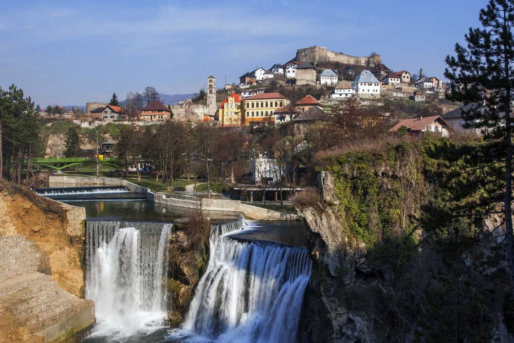
Last weekend, Terra Dinarica traveled with the National Geographic Explorer team to visit a few locations on the Via Dinarica Green Trail. On our first day, we took a coffee break in Jajce and hiked through the Šipovo Eco Zone.JajceJajce is one of the only cities in the world with a waterfall in the town center – and a particularly impressive one at that. Jajce’s falls are 21 meters high and mark the confluence of the Pliva and Vrbas rivers, and the Green Trail will take you there.
Jajce was a political capital and preeminent city in medieval times. As Ottoman armies moved westward during the 15th and 16th centuries, Jajce found itself at the frontier of opposing armies, and this fortress atop the city withstood much fighting. The region of central Bosnia fell to Ottoman invaders in 1528.
Hundreds of years old, these 20 traditional watermills are set on the Large and Small Pliva Lakes five kilometers from Jajce. They were used for grinding wheat and corn for centuries, and today stand as impressive and beautiful antiques – though rumor has it that a few may again be in use.Šipovo Eco Zone
Sipovo is a quiet town, but its surroundings are renowned for their beautiful rural tourism. Our guide, Mira Jovic, showed us around the Šipovo Eco Zone, which the Via Dinarica Green Trail passes through. Further down the path pictured above is the source of the Janj River.
The Janj River is simply enchanting, and is a defining feature of the Šipovo Eco Zone. Like many of Bosnia and Herzegovina’s rivers, it is exceptionally clear and clean. The green you see here underwater are clover-like plants that grow on the riverbed.
On a hot day such as this one, standing in the cool, misty breeze let off by the Janj waterfalls is so refreshing. Swimming, however, is not highly recommended – the water is a constant 7 degrees at all times of the year.
In this picture, National Geographic Explorers Lois Parshley and Sean McDermott cross one of the many small bridges that create paths through the watery wonderland of the Šipovo Eco Zone. This one led to a small bungalow and picnic table on a grassy “island” on the Janj.
We continued through the Šipovo Eco Zone and hiked to the source of the Pliva River, which rumbles out from under the mountains and emerges with surprising breadth and force through a rocky gateway. This river is famous for its world-class fly-fishing, and was used in the World Cup Fly Fishing Championship in 2015.
Only about a kilometer down the river from the source is the new Tourist Complex ‘Pliva’, complete with an amazing riverside restaurant and a long row of stand-alone bungalows (pictured above). These bungalows are both modern and cozy, located right on the river’s edge in a prime fly-fishing zone – and only cost about 15 Euros a night.For a late lunch/early dinner, we continued on to a different restaurant and lodge:
We finished the day at Pliva Lodging Radoja, where the owner Pedja met us with an incredibly warm welcome and some truly exceptional rakija, a unique blend of herbs and honey that he calls “Plivovica.” He and his wife offered us a feast fit for kings.
A story by Maggie – see more on her website, Backroad Balkans.
{source}{/source}
Sutjeska National Park may be the Yosemite of the Balkans, but the route from Donje Bare through Kovačev Panj could just as easily be compared to a temperate rainforest. This path takes you through vibrantly green forested meadows of aromatic wild spring onions (srijemuš), babbling brooks hidden by lush overgrowth, leaves as big as car tires and wildflowers that grow neck high.I was recently part of a trail maintenance expedition along the Kovačev Panj route. This was a joined effort between Terra Dinarica and Green Visions, two organizations that cooperated with the Sutjeska National Park authority to clear and mark this trail, which is one of the least used along the Via Dinarica in Bosnia and Herzegovina due to its geographical remoteness as well as the fact that, before we updated its markings, it was easy to lose one’s way in the dense forest of beech, oak and black pine trees. In fact, a group of tourists from Israel had recently done so – they began from the already well-marked portion of the trail that begins at the base on the main road of Sutjeska NP, and forged on past where the markings had left off. They got so lost that they had to be rescued, but our action put a stop to all of that.It was exhilarating to work together as we did – it’s a great feeling to meet down-to-earth people who are passionate about a cause. Working together is an important theme of the Via Dinarica, which is fundamentally an initiative to build connectedness and mutual understanding between people and communities within and outside the region. In fact it can’t help but do exactly this, because it is by nature a combined effort that relies on everyone involved, from the owners of guesthouses to the hikers themselves, from international supporters to all levels of governments in the region: the Via Dinarica belongs to no one while at the same time belonging equally to everyone who cares about it. And the more people who take ownership of it, the more sustainable and resilient it will be.On this route in particular, teamwork was crucial because there was quite a lot of work to be done. Though not technically very long at 5.35 km, it takes around 3 hours to climb through the forest. The lower end had recently been re-marked on Earth Day by Terra Dinarica and volunteers from the Faculties of Forestry at Sarajevo and East Sarajevo Universities and from the U.S. Embassy in Sarajevo.
Our expedition started at the upper end, 1,490 meters above sea level at Donje Bare Lake, one of the many alpine lakes on Zelengora Mountain. At first the trail leads past a hunting lodge, which sits across from the destroyed stone remnants of a villa that was Tito’s base for his own excursions to hunt wild boar and deer in the area. It them ambles East across open hills before turning Northeast, naturally following a gully down into a beech forest. Here, we began our work painting the red and white trail markings.This trail has a certain peaceful, mysterious ambiance. The trees emanate a peculiar calmness as if they had been whispering secrets to each other in the breeze, and were surprised by our arrival, having never seen so many two-legged creatures together at once. So few people have visited in recent history that both flora and fauna had begun to encroach upon the trail – we encountered many trees that had grown or fallen over the path, and even passed a mound of fresh bear droppings on the trail itself, a sure sign of disuse, since the somewhat shy local brown bears tend to stay away from areas where their powerful noses pick up human scent.
After a couple kilometers from Donje Bare, the trail opens onto a clear hillside that gazes over Sutjeska Valley. Across the way are the park’s main mountains (in addition to Zelengora): Mt. Maglić, which rises to 2,386 meters, and Volujak at 2,336 meters. One enters this clearing gradually as the wall of trees begins to thin, so these monumental massifs first appear as distant shadows looming like sleeping giants behind the pine needles. One eventually emerges onto a hillside with a view worth celebrating. It depicts an ancient and powerful face of Bosnia and Herzegovina, the site of an unimaginable wealth of human and natural history. Enormous Illyrian Black Pines grow tall and wide here, observing their kingdom. They have withstood invasions and conflicts over time, including the WWII Battle of Sutjeska in 1943, but their sturdy, high-altitude nature means that many of them are over 200 years old.
It is said that hiking makes you happier, and I truly believe this. It was also exciting to make this unique trail accessible, and I’m so grateful to be part of this project. Now, just go experience it for yourself!Posted by Maggie Cormack on her blog, Backroad Balkans.
{source}{/source}
A few weeks ago while I was still in Amsterdam, I saw a post on the Terra Dinarica Facebook page about a guesthouse named Vukov Konak. They were looking for volunteers to help them during the summer season. Of course my plan was (and still is) to hike the White Trail, but I couldn’t help clicking and scrolling down Vukov Konaks page. When I came across a video that showed a little concert in their cosy wooden living room, I knew I had to go and find that place. If a video post on Facebook can touch me, who knows what can happen in real life.So I start searching “how to get to Vukov Konak” and found out that it was only a one-day-hike from Sarajevo. Terra Dinarica made it even easier with the tour “Hiking from Sarajevo to Vucja Luka” they created in Outdooractive. This tour is part of the Via Dinarica Green Trail which will be finished soon. I could download the GPS track and print the map with descriptions. Een kind kan de was doen, is wat we would say in The Netherlands. It means that the job can be done even by a child…When I told Maggie, a girl from the US who works for Terra Dinarica, about my plan to hike to Vukov Konak, she immediately decided to join me. Thrilled and excited we met at Vijećnica, the starting point in middle of Sarajevo. Maggie printed out the description of the route and I brought my new GPS device. Besides spending the day in the mountains, for me it was also about getting used to use a GPS while hiking. I’m easily distracted by thoughts, conversations and of course by nature. Which is all right and I enjoy that, but I have to prepare myself for this summer. On the Via Dinarica it will be necessary to have some navigation skills and be focussed. Although a GPS makes it a whole lot easier, it is quiet some work to figure out how that thing works. With this hike I could check and test everything I’ve learned so far.Cheerful chatting we started to climbed our way out of the city centre towards the yellow fortress. There we found the first trail markers that led us through the labyrinth of small streets and steep stairs. Although there were quiet a lot of stray dogs, we safely reached the first viewing point where we could fill our water bottles. My GPS told us that we were still on the right track, our green line perfectly matched the purple line on the screen. Maggie called Vukov Konak to check if they were still open by the time that we would arrive. If we would keep on going like we did, it should doable to be there at 5PM. Confident and optimistic we continued.
The description said that during the next part of the trail we had to make sure that we would stay on the paths, because of the sport shooting area we were about to cross. While walking on that path we heard several shots, but weren’t aware of the fact that bullets don’t care about hiking trails or hikers. When the shots became louder and a man started to wave at us, we realised that sport shooters also don’t care about trails or hikers. The man told us that this area is forbidden for hikers during the weekend and we had to make a detour along the road if we didn’t want to risk our lives…
A bit bummed out we turned around and headed back to the road. Suddenly a car stopped right in front of us, for a second I thought of asking for a ride to our next exit into the forest. But we didn’t. A girl with dyed red hair got out of the car and started to ask us some questions. I still don’t speak or understand Bosnian, so I let Maggie do the talking. The red haired girl explained that she was drunk… and wanted us to take a picture of her and her boyfriend with the amazing city view. That was the good thing about the detour, the spectacular views and crazy passer-by’s.
In Čavljak we stopped for a coffee at the mountain lodge where some man were playing cards, smoking and drinking beer. When they noticed the FiveFinger shoes I was wearing, their card play suddenly didn’t seem that important anymore. They invited us to stay for a drink, but we explained that we were on our way to Vukov Konak which was still quite a long way to go. Like all the other people we would meet along the way they started to warn us that it was really really far. Most people even said it was irresponsible to go all the way up there with just the two of us.At that time we were still optimistic that we could make it, we did most of the climbing and had already done one third of the tour. How hard could it be? We had all day and it was only 20 kilometres after all.
The road took us to a forest, finally we could leave the asphalt and feel the earth under our feet. This was absolutely the most lovely scenery I’ve seen so far. Indescribable green grass, wide views and cute wooden huts. Although there were several refreshment stops, it wasn’t crowded or spoiled by people. In fact, because of these little bars there was a special vibe, all kinds of people who were enjoying just as much as we did. Before we knew it, we sat down for another break. This time we did accept an invitation of two beer drinking men and got ourselves a rakija before we went on.Unfortunately we discovered that we were not quite as far as we thought we were, which meant that we still had halfway to go. My legs didn’t agree on the rakija pauza and started to complain. At the same time, the sun disappeared behind dark grey clouds and all of the sudden there were no trail markers anymore. On the GPS we could see that we were off the purple line, but we couldn’t find a path that led us back. Add the worries of all the people we met during the day ánd dense, eerie forest that lied in front of us… I seriously started to doubt if it was wise to go on. Maybe we had been a bit naive and a bit too slow after all. I didn’t want to get lost in that dark forest full of animals I was still a bit afraid of.Going back to the last trail marker we had seen didn’t make sense, because the description told us that we had to leave that dirt road and walk on the northern side of the Crepoljsko mountain towards the forest, which we did. The only option, beside going back to Sarajevo, was to walk a few metres in each direction to see where we would meet the purple line on the GPS screen. Luckily there turned out to be a very small path through the grass after all. But at this spot, a signpost would have been kind of welcome.
Once we finally got back on track we stepped up our pace a little, but still not in hurry though. Maggie was at this point a bit more positive than I was. Maybe because she likes the forests which is giving me the creeps. I prefer mountain landscapes with wide views. But I have to admit that it was a kind of special feeling to be all alone, or just with the two of us, in that huge wild piece of nature. Our conversation turned to more serious subjects, maybe heavy but not creepy at all. It was a completely different atmosphere which led to completely different emotions and feelings than the lovely green landscape only a few hours ago did. I love to be on my own, but during this hike, the fact that we were together and did it together, added something what couldn’t be experienced by being all alone. And I’m very grateful for that. Although it was just a day-hike and I’ve done much more demanding tours, this hike, this day, this adventure thought me how important it is to believe in yourself.All of the sudden the high trees made room for a great view over the hills and mountains before we took the last turn towards our destination. The threatening sky slowly disappeared and the moment we arrived at the guesthouse, the sun started to shine. At 5PM exactly we walked onto the terrace of this beautiful place surrounded by nature, right in the arm of the warm and friendly Vukov Konak crew.
Maggie had to go back to Sarajevo, but I decided to stay for the BBQ and ended up spending the night. It was a special evening with an eclectic group of people. Guests, volunteers, owners. Finns, Germans, Hungarians, an American girl, the Bosnian host and a guy from Slovenia who was there to pick up his new Finnish girlfriend. Rakija and a Finnish sausages. Bosnian coffee with Lakka (I believe it was). Stories and a campfire, music and more beer. And of course the very amusing goat with a name I forgot.If you’re planning to hike this trail as well, (and you don’t want to get lost where we did) you can download the GPS track, maps and descriptions here on the Via Dinarica website.This blog-post was originally published on EVAdinarica Project website.
{source}<script type="text/javascript" src="https://trail.viadinarica.com/en/tour/hiking-trail/hiking-from-sarajevo-to-vukov-konak/18265085/tour2go"></script><p><a title="Europe’s largest outdoor platform" href="http://www.outdooractive.com/" target="_blank">part of outdooractive</a></p>{/source}
The trail from Postojna to Mašun is like a forest highway, but with little cars. It’s a fast and OK hike. I caught quite some rain, but there were some abandoned (or emty) houses along the road. Some had patios, which I used to hide from the rain.
I got to Boardinghouse Mašun around dinner time. They’re widely known for the food they serve. Yes, the food was really good. I, however, skipped the dishes containing bear… Since it was a weekend’s day Mašun was fully booked. I asked if I could camp in the front garden and they then showed me the summer bar (a tiny shed), in which I could sleep. The next morning I heard a heavy sound, as I was walking towards Snežnik mountain. Then I saw something brown and fluffy running. It moved fast away from me and it moved like a dog (and not like a pig). Oh yeah! A bear! Lucky me!
The climb to the top of Snežnik isn’t very demanding, it’s a pleasant walk and not many hikers take the Dinarca-route. Parts of the of trail are a bit overgrown (or need maintainance).
On top there’s this very, very nice hut. It’s open in the weekends and on Sunday until four in the afternoon. Hikers can stay for the night and they serve (good!) food and drinks. If the weather is good, it’s possible to overlook the whole of Slovenia. Because it’s an easy walk up, it’s a popular hike among Slovenians (and Italians). Both in summer and in winter.
On Snežnik I met Iztok, he’s a regular visitor and loves to explore the mountain. We went to search for a geocache to put my travel-bug (Reise(ver) in. Iztok was happy to help, since this was a new discovery on the mountain. Mission accomplished: TB86F83E is on it’s way!Through Iztok I got invited to have supper with the staf of the hut. Katia (and the other lady’s name I forgot, shame on me) are really good cooks and so friendly. They did not let me pay and sent me on the way with a home-brewed pear-schnapps and good luck charm. Thank you!I left the Dinarica and took a shortcut to Babno Polje through the forest. Since there’s serious forestry going on, it’s not a very inspiring hike. But, it shaved off quite a few kilometers from, an also uninspiring, hike over a main road.That evening I camped next to an English couple who were out on tour with their old school Land rover for a few weeks. They invited me for tea and a beer, to which I off course could not say ‘no’. After entering Croatia I got myself Croatian money from the ATM and bought some snacks from one of the small, but well stocked grocery stores in Prezid.More photos on Instagram. Support my adventures and buy me a coffee, soda pop or a high calorie meal.This blog has been written on trail.
{source}<script type="text/javascript" src="https://trail.viadinarica.com/en/tour/long-distance-hiking/slovenija-postojna-via-snenik-to-prezid/17236133/tour2go"></script><p><a title="Europe’s largest outdoor platform" href="http://www.outdooractive.com/" target="_blank">part of outdooractive</a></p>{/source}{source}<script type="text/javascript" src="https://trail.viadinarica.com/en/tour/mountain-hike/via-dinarica-hr-w-01-prezid-abar-tre/15085364/tour2go"></script><p><a title="Europe’s largest outdoor platform" href="http://www.outdooractive.com/" target="_blank">part of outdooractive</a></p>{/source}
Two weeks ago I got an invitation to go to Sutjeska national park. I knew a part of the White trail was being marked again, but had no idea how that would be done. In the car on the way to Tjentište it turned out no one really knew what the idea was other than helping out with marking the trail. In the parkinglot of hotel Mladost a whole group of people gathered. No one knew exactly what they were supposed to do, but they were all very excited. And patiently waiting for instructions. We were guests in Sutjeska National Park. Before I wrote a blog about goings in Sarajevo. Now, more than a week later I realise that my goings are continually influenced by the way things are going here. The things I do and the things I want to do are dependent on other people, on transportation, the weather and money but also on the internet, websites, providers and WordPress. Today a sense of helplessness came over me, a feeling of not being in control and feeling like not being able to move forward. Funny enough that feeling can change in a heartbeat when I see the charm of setbacks and the fun of the unexpected.
Sutjeska is waiting…
Being flexible, letting go and not overthinking things, “Polako polako” is what I hear all day. I’m not sure if that is meant especially for me, because I’m not very polako, or if this is something people just say. Take it easy, just wait and see, no worries, it will be okay. No rush and no stress. I’m having some difficulty getting used to this taking it easy and just wait and see, but I think it can be quite good for me. Now and then a little confronting because I feel quite self conscious and uncomfortable while waiting and seeing what will happen. Of course there is a downside to all this waiting. A lot of time passes and not much is accomplished. That can be frustrating for those who are trying their best to get things going. As an outsider it is a funny process to watch, but then again, it’s not my things that need to get going.
The new signposts to Suha
Quite suddenly we were separated into three groups because we needed to get up the mountain in jeeps. Marking trails is done from high to low, which is quite logical when you think of all the paint, tools and marking materials that are needed. Together with Maggie and Džana we were in the back seat giggling and laughing like teenagers. This is a phenomena that seems to happen automatically when men start to behave very manly (which is driving a jeep up a steep mountain or handling tools), girls start to behave girly. Haha, it was a bumpy ride full of laughter.
Girls and cars
When we arrived at the top we had another interesting parkinglot scene. Gathering people went a bit faster, since we were spread over three jeeps. The challenge was in gathering and taking inventory of all the materials. We realised that we had more stuff than people to carry them. So what to do? There were people, tools and paint, but how does this come together in marking a trail? Fortunately Lorenc took charge and organized that all the men carried tools and equipment and all the women a can of paint. Clearly everyone had his or her own part to play in this mission.
Almost ready…
But what was this mission? In a long column we descended to the Donje Bare lake which the White trail passes. The men were in the front hacking, clipping and chopping, making the way clear for the women who were marking. Bringing up the rear was the clean-up crew to make sure no one was left behind. Lorenc was running around giving orders and helping out here and there. All in all a quite simple system. The only disadvantage for the impatient ones among us was having to wait on the slow.
We’re working on it!
I think it took me a whole day to realise that there actually was no one who had a complete overview or ultimate responsibility. Everyone was doing his or her task and meddled where necessary in other people’s doings, but the big picture wasn’t clear to anyone. For me this results in a situation that I have no control over. A situation that I think can be much more efficient. But would that make it better? Or more fun? The best solution for me is just to surrender to whatever is happening and enjoy actually being there.
Team red&white Gradually I began to see the logic behind the trailmarks, how they are placed and how they should be interpreted. I have hiked an amazingly beautiful and wild part of the White trail and I’m very happy that I get to do that again. My fear for bears and wolves has decreased, not because “it’s not that bad and you never run into them anyway” but because they are literally hiding left and right of the trails. Fresh bear poop in the middle of the path proves that they are close, but run away whenever they see, hear or smell people. To me this is comforting. As long as these creatures have nothing to fear from me, I don’t have to be afraid of them. I felt very honoured to be passing through this piece of wild nature. The forest allowed us to be there with all our disorganised good intentions, but also made clear that nature is, and hopefully will stay in charge there.
{youtube}fQdgYnxhySI{/youtube}
Visit my page for more stories, photos, news...:)
Translated by Liesbeth
{source}
{/source}
{source}
{/source}
{source}
{/source}
{source}
{/source}
{source}
{/source}
{source}
{/source}
{source}
{/source}
{source}
{/source}
{source}
{/source}
{source}
{/source}
The last 1.5 days I hiked from the Italian/Slovenian border to Predjama Castle – where the White Trail according to www.viadinarica.com starts. I mostly hiked along the Nanos plateau, which has stunning views! Too bad it has been raining a lot and when the rain stopped, mist set in. So, I actually hiked in the clouds most of the time. Yesterday, after lunch in a nice restaurant called Gostilna Tratnik in Col, I couldn’t find a side trail I wanted to take. I changed plans and ended up hiking all the way to Predjama Castle and arriving there just before night fell. I earned myself a AAA-bivouac with a view, though.PostojnaI got to the town of Postojna early. And after buying resupplies in one of the many well-stocked grocery stores, insect repellent (six tick bites is a bit too much) and a stay in the really nice and comfortable youth hostel I’m ready for stage 1: Croatia here I come! More photos on Instagram.Support my adventures and buy me a coffee, soda pop or a high calorie meal.This blog has been written on trail and on a mobile phone.
{source}<script type="text/javascript" src="https://trail.viadinarica.com/en/tour/long-distance-hiking/slovenija-postojna-via-snenik-to-prezid/17236133/tour2go"></script><p><a title="Europe’s largest outdoor platform" href="http://www.outdooractive.com/" target="_blank">part of outdooractive</a></p>{/source}
To this day the Balkans and especially Bosnia Herzegovina is unknown territory for many outdoor people. It remains a blind spot within Europe and the outdoor community. It is still associated with war and poverty instead of the beautiful, wild and untamed nature and mountains. I cannot deny the scars of the past are still well visible in some areas. You will surely see houses in ruins, abandoned villages and warning signs for landmines, but the Balkans nowadays are anything but a bleak and unsafe place to be. I have always experienced exactly the opposite. This summer I am going to the Balkans to hike a new and promising long distance route: The Via Dinarica White Trail. This unfinished route crosses the worlds largest karst mountain range, unknown to many people, Dinaric Alps. The trail currently is 1260 kilometres long and crosses the highest peaks of the five Balkan countries. After a short overlap with the Via Alpina near the Predjama castle, the trail continues through Slovenia, Croatia, Bosnia and Herzegovina, Montenegro and Albania. The trail is a connecting passage through nature that knows no borders. Connecting Naturally. Country, nature, culture and tradition connected with and through each other. The Via Dinarica will be a platform for sustainable tourism and will stimulate the local economic growth. To me the Via Dinarica is more than just a trail, a connection or a platform. Via Dinarica has inspired me to act on my passion for the Balkans and the mountains. Not just undertaking this hike from east to west, I want to bring attention to the Balkans and the Via Dinarica. To inspire other hikers, nature lovers, outdoor enthusiasts, adventurers and pioneers and put the Balkans with the Via Dinarica on the map in all of Europe. Because the route is yet unfinished, my adventurous plan has become more of a project. At first I started searching the internet for information on the Dinaric Alps, the Via Dinarica project and experiences form other hikers. Next I tried to make an overview of all the stages and went looking for maps. This turned out to be a little more complicated than expected. There seems to be no clarity on the stages. Every hiker seems to hike his or her own Via Dinarica route. No one has hiked the entire trail yet and/or documented it. On the Via Dinarica website the blogs contain little concrete or detailed information on the trail. Their Outdooractive logged hikes seem to be circular walks or day trips to summits that could be party merged. And while looking for hiking maps of Bosnia Herzegovina you only find military maps with a 1:50000 scale, dating from 1996. My journey of a lifetime seemed to turn into a mission impossible. The most obvious solution would be to hike “a” Via Dinarica instead of the one and only. I could than share my information on preparation and route to lure impatient hikers to the Balkans. To me the experience, the journey, is more important than the achievement itself. The less obvious route would be to fly to Sarajevo where the Via Dinarica team is working on their ever growing project. If I really want to contribute it might be worth while to discover everything that’s happening behind the scenes. That’s why I accepted their invitation and I am getting on a plane tomorrow!
Visit my page for more stories, photos, news :)
Translated by Liesbeth
{source}
<script type="text/javascript" src="https://trail.viadinarica.com/en/tour/long-distance-hiking/via-dinarica-white-trail/17291189/tour2go"></script>
{/source}
{source}
{/source}
{source}
{/source}
{source}
{/source}
{source}
{/source}
{source}
{/source}
{source}
{/source}
{source}
{/source}
{source}
{/source}
{source}
{/source}
The Via Dinarica connects seven countries, and on my final day on the trail I will hike into Montenegro and climb Maglić, the highest peak of Bosnia & Herzegovina.Day 5Early mornings were the norm on the Via Dinarica for me, and this final day was not different. At six in the morning I was up and soon I was sitting with my friends Olja, Kenan and Tim at the breakfast table. It might be hard to imagine, but the breakfast at the Restaurant & Pension Umoljani Bjelašnica was even better than the dinner the previous evening: Local cheeses and honey, tasty warm bread, ham and marmalades – and all of it locally made. Add in a great coffee and you have the energy for a long day.Before we would be climbing up Maglić we had a two hour car ride in front of us. I tried to nap as much as possible, but the stupendously beautiful scenery made that difficult. We drove through deep canyons next to raging rivers on narrow roads, and all of it looked just so gorgeous that one could have spent a fine day exploring little paths off the road. The views got wider & wider and after one and half hours we passed the first signs for the Sutjeska National Park, the oldest National Park in Bosnia and Herzegovina and home to a large waterfall and a primeval forest. We drove up into the park, parked the car, packed up – crampons, harness, helmet and ice axe come along – and started to hike.
The trail takes us through the forest, and soon we hike again on snow. Kenan leads the way and here and there we see the trail markers on rocks & trees, and while the ground is covered in snow it is warm and the trees have already the first green leafs. After about an hour Kenan remarks that we must be in Montenegro now, and in front of us towers Maglić.The views are superb and we can see far into Montenegro, while we walk again over short stretches of grass & past crocuses. It does not take long and we’re again on snow, but now it’s the steep kind. We put the harnesses on, take the ice axe in hand and start off. While Kenan and Olja wear mountaineering boots I have my Arc’teryx Acrux² FL GTX Approach Shoes on, and while the crampons in my pack would fit on them I decide to go on without. The shoes have shown me on this trip that they are great on snow, so I decide I rather be fast & nimble without crampons.After the first snow field we continue on a steep path which is secured a bit with a Via Ferrata cable in places, but the going is easy so the cable is largely ignored by us. Then we arrive at a 70° chute which is covered in snow, and here I decide it would be smart to rope up. Olja and Kenan agree, and a few minutes later I cross the chute first. After that it is again a mix of dry, steep paths and snow fields up to the summit ridge, where we arrive around three hours after we left the car.From here it is an easy stroll to the summit of Maglić & some 20 minutes later we stand at the post and high five each other.We put on insulation layers, get food & drinks out and take in the view while enjoying the fine weather. The warm sun makes it comfortable to sit up on the summit and we spend quite a while up there to photograph, sign the summit register and eat. I then pack up and steal away in front of Kenan and Olja to shoot a few wide angle shots of the two on the summit.The two catch up with me, we rope up again for the descent and then it’s down, down, down. Descending snow slopes in approach shoes is possible but it is more comfortable in mountaineering boots I can now tell you. A mere 3 meters before the end of the snow slope I slip and manage to self-arrest, but the damage is done: Kenan smiles at me and lets me know that “I told you approach shoes are no good”.After that we cross the chute again and then are going back to the car as fast as we can. We’re all hungry and thirsty – the sun has been shining the whole day again. On the way back to Sarajevo we stop at a nice road side restaurant where we eat a tasty dinner before we need to continue to Sarajevo, where we arrive late in the evening And so another fine day on the Via Dinarica went by.Posted by Hendrik Morkel Nov 2nd, 2015 Bosnia and Herzegovina
{source}<script type="text/javascript" src="https://trail.viadinarica.com/en/tour/hiking-trail/via-dinarica-bh-w-12-donje-bare-via-suha-and-prijevor-to-trnovako-lake/17303012/tour2go"></script>{/source}
30°C Sunshine, 3.000 m of ascent and 30 km of ridge walking – a good day on the Via Dinarica!
Day 4After a leisurely day of hiking on snow it was time for some serious distance and ascent today. The day started at six o’clock because we hoped to avoid the 30°C heat during midday and be already in the shade of the forest up on the ridge by then.We crossed the bridge over the Rakitnica river, which has created here one of the deepest canyons in Europe, and encountered kids on their way to the school bus and who looked at us with a smile on the face – why would someone hike here at such an early time they likely were thinking. We pass a few houses and soon are on a narrow trail which weaves through the forest, with the river always in earshot. We cross another wobbly bridge over a turquoise river, fill up our bottles at a spring and cross a meadow with a lonely hut on it before we start our ascent up to the ridge. The thermometer is already at 30°C and the sun shines from a cloudless sky on us – it’s gonna be a hot day.
We follow the steep and overgrown trail up to the ridge, and on the other side it is two shoes wide and drops several hundred meters down to the river. The view is gorgeous – we see the complete ridge which we will be hiking today in front of us. The trail slowly weaves through the shrubbery towards the Dubocani village, and at some point we reach a forest road above Dubocani. It is lush and green down there in the village, the red roofs being a stark contrast to the green meadows. Behind it is the next hill we need to climb. We follow the forest road and colourful lizards run into the undergrowth as they hear us approach, so fast that it is difficult to snap a good photo of them.Over a soft trail of old leafs we climb the hill, refill our bottles once more at a spring next to a Shepard who tells us that his two sisters are living in Helsinki (!) and then climb further up. By the time we reach the top and start of the ridge my water bottles are empty again, and refilling them at a cistern full of death insects and dirt is somehow sub-optimal without a filter.After a break we start our second ridge walk of the day – mostly in the hot sun, occasionally in the shade of the forest. It is so hot that I seriously question why I decided to wear the Rab Calibre Pants which were great for the snowy and coolish weather on Prenj the previous days but are way too hot for this kind of hiking. But I don’t want to hike in my boxer shorts, and so we continue, kilometer after kilometer, hour after hour, always with the turquoise Rakitnica river to our right down in the canyon.We pass a bombed down village from the war where nowadays only Shepards life with their sheep, then climb another 400 m hill and still have many kilometers to go. I am so thirsty but don’t want to drink the “dirty” water from the cistern, but after a few hours in the heat I can’t take the thirst anymore and drink the litre in one go. We bushwhack up an hill with a 200 m drop to our right, and then finally come onto the path which will take us to Lukomir, the most remote mountain village in Bosnia and Herzegovina. I somehow am refreshed by the thought of soon being able to drink some clean water and wash my face in a cool fountain.The trail contours the mountain and after a bend we can see the minaret of the Mosque of Lukomir up ahead, and the sound of a cool stream is echoing from the hills. We walk through the old, traditional village and head for the fountain, where I gulp down a litre of cold water in one go. After that Kenan and I sit down in the Café and I enjoy a tasty coffee, while we wait for our ride to the nearby Restaurant & Pension Umoljani Bjelašnica. The trail to the B&B would have been short and easy Kenan tells me, but after a 30 km day with over 3.000 m of ascent and plenty of heat I am so knackered that I am happy to drive in the car there. As we arrive late in the evening we are welcomed by the owner who cooks us a tasty dinner – all ingredients are locally sourced. Full and happy I stumble to my soft bed, put my alarm on for another 6 o’clock alpine start, and fall soundly asleep.The defining memory of the day is not the heat, the sun, the fine hiking, the cold fountain in Lukomir, the old huts and tasty Bosnian coffee or even the utterly delicious food in the evening, no, it is the smell of Herzegovina that I was breathing in and out during the early morning. The dry, sweet and warm smell is a mix of the earth, flowers, water and trees of the region and is so beautiful, that it alone would be a reason for me to hike that section again.Posted by Hendrik Morkel Oct 20th, 2015 Bosnia and Herzegovina, Dinaric Alps, Via DinaricaDay 5 – Next stage – Hiking Sutjeska National Park
{source}<script type="text/javascript" src="https://trail.viadinarica.com/en/tour/hiking-trail/via-dinarica-bh-w-08-neretva-and-rakitnica-canyon-to-lukomir-village/17302968/tour2go"></script>{/source}
After getting lost on the Via Dinarica the previous day, today we had a superb blue-bird day with wide views, wall-to-wall sunshine and nice snowy trails.Day 3We spend the night in the wonderful Vrutak hut, and having decided the day before that we won’t climb Otiš because of the wintery conditions we could sleep in and take it easy. The Vrutak Hut really was great, a cozy hut with plenty of space for six or more mountaineers or hikers. You’ll need to get a key to sleep in it, but outside there would have been plenty of good spots for a UltaMid or similar.After we packed up our light packs it was time to go on. We climbed the snoy slopes till the pass and then took a left. The sun was shining warm and nice on us, but the cold wind meant we wore our hardshells to stay warm.But the views today?They were superb. We took it easy and were in no rush, because we skipped the seven to eight hour climbing adventure we could walk in peace and enjoy the views.We had a relaxed lunch at the nice Jezerce Mountain Hut, which like all the other mountain huts had been build by hand, from materials which horse and human had carried up the mountain.After a few more hours of walking underneath beautiful mountain tops and on snow we reached greeen meadows which were full of flowers.But the snow remained a companion – funnily enough the forests were free of snow but the trails still covered in half a meter of snow here and there.After some bushwacking through the forest – the trail was over-grown – we reached a nice grassy trail through pretty meadows. It was still early afternoon as we reached the forest road, where we met Edin, a friend of my Guide Kenan, who gave us a lift to the Vila Sunce where we would spend the night. We had a wee stop at an Café at the shore of the Boračko jezero Lake and then had a look at the Rakitnica river, which would be ideal for packrafting. Alas, I didn’t bring my packraft – maybe the next time!To be continued.Posted by Hendrik Morkel Oct 15th, 2015 Bosnia and Herzegovina, Dinaric Alps, Via DinaricaDay 4 – Next stage – Hiking Rakitnica canyon
{source}<script type="text/javascript" src="https://trail.viadinarica.com/en/tour/mountain-hike/via-dinarica-bh-w-06-prenj-mountain/17302956/tour2go"></script>{/source}
In the first part of my Via Dinarica trip report I told you about my expectations for this hike (none). Getting lost on the trail certainly wasn’t on my list.Day 2“Where am I? Who is up at this hour where the world doesn’t exist yet?”Ah ja, I’m at the Medjuprenje Mountain Hut, up on Prenj, on the Via Dinarica in Bosnia and Herzegovina. My name is Hendrik and that tiny backpack is mine. Yeah, systems booting, coffee required before we can get up and start hiking.Black gold is served steaming hot by Kenan’s friends & again I ponder about the weight & taste benefits of carrying real coffee to the mountains. Also the breakfast Kenan has for me is great: Joghurt & Müsli, where the yoghurt is dehydrated and stirred up by adding water. Good stuff, and after everything is eaten and packed up we leave the hut and move up into the fog.The trail is well marked and takes us through trees which are ready for spring, but yet hold back their green leafs. The higher we get the lower the vegetation becomes and the shorter the view. But Prenj, the mountain we’re on, is Kenan’s favourite and he knows it well. We follow markers and cairns, bushwack through the shrubbery and then take a “Shortcut”. I love shortcuts, especially in this weather.Ah no, not here. Lets go that way.Grey & white & greyCan you see where we are?Nope, don’t you have a compass?Ah yeah, true!Alright, this way.
At one point we dropped down a bit in elevation and ended up ascending an 60°+ snow slope, without crampons or ice axes, in approach shoes. To say I was a bit freaked out would be putting it kindly, as underneath me it went down a couple of hundred meters and a slip would have ended in a coffin. But hey. Type 2 fun. Makes for a good story right now, doesn’t it?Kenan navigated us just great back to the track, and then it was smooth hiking over snow fields and talus. After a while Kenan knew exactly where we were and started again telling me the names of the summits that surrounded us as we walked down on a high plateau. Snow disappeared, the brown grass trail being pierced by purple crocuses and slowly turning to brown dirt to green meadows.We traverse the high plateau and the troubles of getting a bit lost earlier are forgotten. We’re set to meet Tim and the Terra Dinarica Team as well as some guests from the USA down in the valley, and are relieved to see that we’re the first to the meeting point.
After walking mostly on snow the day before and this morning it is nice to have green grass and sunshine. We drop our packs, I get out of my shoes, and we walk around in the valley, towards the others who are just arriving. Food is shared, photos are snapped, and the beauty around us is celebrated by long, lonely stares, “Ahhh”s and “Ohhh”s and “Wow”s. And it is pretty, this valley. Otiš and Zelena Glava stand proudly at the end of the valley, a miniature Fitz Roy Range. We did plan to climb Otiš the next day, but seeing it is in full alpine conditions and our lack of alpine gear makes me decide against an ascent. I also wasn’t up for a 14 hour day, though it certainly would have made a great story & experience. So we will just hike comfortably across Prenj and arrive early at our destination the next day – a good decision as we’d see the tomorrow.After a lengthy late lunch we part with our friends and head back up the mountain, though our destination is not far. The Vrutak hut is less than 30 minutes up from the valley and luxurious hut by any standard. Clean at a prime location its nice to know we will sleep in such a nice hut tonight. I grab my tripod and head out to photograph the sunset and blue hour while Kenan prepares our dinner.With a big smile I come back in after the sun is gone and the first stars dot the sky. Kenan has prepared a delicious goulash, and I share a Finnish dessert with him to celebrate this adventurous day. We sit for a while and talk, but both of us are tired and soon turn in. Tomorrow would be “easy and relaxed”…Posted by Hendrik Morkel Sep 7th, 2015 Bosnia and HerzegovinaDay 3 – Next stage – Hiking to Boracko lake
{source}<script type="text/javascript" src="https://trail.viadinarica.com/en/tour/mountain-hike/via-dinarica-bh-w-06-prenj-mountain/17302956/tour2go"></script>{/source}
Is it the idea of connecting seven countries via humanities simplest activity, walking? Or something else? Reason enough for me to pack my backpack, book a flight to Sarajevo and investigate.“What are your expectations of this trip?” Tim asked me after he picked me up at the airport in Sarajevo. “Well”, I started, “I don’t have any. I never expect anything when I go on a research trip, and let the region show me what it has to offer. It’s only fair and more adventurous, too.” But Bosnia and Herzegovina has impressed me, very positively. It’s a beautiful country with warm, welcoming people, delicious food, and the views are quite decent, too. In the following series of trip reports I’ll walk you through the Bosnia & Herzegovina part of the Via Dinarica Trail, and will answer questions in the final post where I also will give more information on the trail.Sarajevo
“Coffee?” Sure. As an European Finn I seldom say no to coffee, and the coffee in Bosnia & Herzegovina is superb, especially when brewed in the traditional way. Besides, I was up since 4 am and already had three different flights so something to keep me awake in the sweltering heat of this bustling city was always welcome. We had good coffee and then a stroll through the old part of Sarajevo, which was gorgeous with small, narrow streets lined with stalls, open air Cafés, Restaurants where delicious smells wafted from the open windows, and lots of people. Mosques stood next to Churches, and the peaceful co-existence of the religions in this country is certainly something the world could learn.Later in the afternoon I meet the rest of the Terra Dinarica team, Olja, Stefan and Kenan, who would be my Guide over the next five days. We had a tasty dinner high above Sarajevo, before Kenan dropped me off at my Hostel for the night. “Pick up is at 5 am” he said with a smile, and so I turned in after a quick shower to get some sleep before the Alarm would wake me up yet again so early.Risovac to Diva GrabovicaThis 27,6 km section started at a ski slope a couple of hours drive south west of Sarajevo. Already on the way there we passed with the car scenery which would make any backpacker and climber very happy indeed, with a Mini El Cap and lush, green valleys which would make for fine hiking. Here at the Risovac ski centre Kenan and me shoulder our backpacks, said bye to Tim who’d meet us at the other side, and set off.We quickly reach the top of the ski slope and turned into the forest, where patches of snow still lined the trail. It didn’t take us long to be so high that the trail was under the snow, and I was pondering if my Arc’teryx Acrux² FL GTX shoes would be up to the task (They were, and great on the snow indeed). Where the trail skirts the mountain on the south/ west side, the snow was happily gone, but also walking on the snow was fine – it was still fairly compact with just a thin, mushy layer on top which gave good grip.The weather was great – so warm that I quickly shed layers and hiked in my T-Shirt. Kenan tells me about the mountain we traverse, the sights, where the Via Dinarica passes here and local lore. He’s also a good model and doesn’t protest when I let him walk several sections twice to get the right shot, but even with all the chatting and taking photos we make good speed and soon see the summit we’re aiming for today, the Great Vilinac Summit. The trail towards it sneaks through patches of low-growing shrubbery, and spring crocuses are piercing their white and violet heads already through the ground there where the snow has melted.The summit is snow-free and after signing the summit book we sit and have a drink. The view is fantastic and we’re lucky with the weather. But we arranged to have lunch at a mountain hut a bit further along the trail, and so we soon shoulder our light packs again and head onwards to the Tise Mountain Hut. It’s a bit off the trail and we descent for ten minutes, but already from a distance it looks like it is closed. As we stand in front of the locked doors we’re certain that we won’t be eating lunch here, a good thing we have some snacks with us and that the bench and table have a scenic view to enjoy. We go for a look to find the water spring nearby, but it is still buried under a meter of snow, and so we just continue.We follow the trailmarkers – a red circle with a white dot in the middle – for a while, until we’re back on the snow. While it allows us to make short-cuts it’s also a bit more strenuous to walk on it, and of course it also soaks your shoes and socks. But it’s warm & sunny, so not a problem, merely a slight inconvenience. We’re high up and descent and ascend just a little for several kilometres, until it is time for the big 1.600 m descent to the Diva Grabovica valley. The views which open up before us are breath-taking, but you have to stop to enjoy then, as the descent is steep on a trail which is often just a mere foot wide, if it’s not entirely covered under the snow.Ahead of us we also can see Prenj, the mountain range we will be traversing in the next two days. Soon enough we reach the tree line and lush green beech trees with fresh, young leaves make the walking in the warm weather more pleasant. From afar we already saw a rustic cabin – the former Kings Hunting Cabin – and we made a little detour to visit it. It was pretty from the outside, with wooden shingles on the face of the building, but the inside was mouldy, dark and not welcoming. Also the garbage which was left wasn’t a nice sight, and so we continued further down.We heard voices already further up the mountain, and as we happened on the 2nd hut – which was in much better shape – we meet Tim and friends of Kenan, who did the Evil’s Creek Route (scroll down to see their photos!), a trail which has some climbing along steel wires (a bit like like a Via Ferrata) and were now also on the way back down. We decided to go check out the Look out point and have a cup of coffee all together, and it was a nice place to rest and drink some good Bosnian coffee.On the way to the valley the trail soon became a gorgeous green tunnel which smelled so wonderful, it was unbelievable. Colourful flowers, buzzing insects, colourful butterflies and bubbling wells we found the further we descended the trail, and as we finally broke out of the dense green forest a magnificent panorama opened up before us. A colourful little meadow stood in full flowers, while the sun was hiding behind big, dramatic grey clouds, throwing a few rays on the mountains we just left behind. It was such a perfect place that I’d loved to have put my tarp up right there, but we still had a few hundred meters to descent and move onwards, so we left the meadow behind and hiked on.At the car we threw our packs into the car and drove towards the next Restaurant, where we enjoyed a dinner of lamb and a local beer before Tim brought us to Prenj. It was night as we arrived the start of the trail, and after a quick repack for the next two days we set off. I was completely destroyed as we started to hike, but pushed on. While I was planning to sleep in my bivy outside instead of the Medjuprenje Mountain Hut where we were headed, after I saw a few Scorpions on the trail and Kenan told me about the Black Widows Spiders which can be encountered here I decided that the hut it would be. It was close to 23 o’clock as we stumbled into the Medjuprenje Mountain Hut, where other friends of Kenan right away offered us a Rakija, and after a zip of this tasty fruit brandy I headed up to roll out my quilt and call it a night. To be continued.
Blog by Hendrik Morkel Jul 2nd, 2015 Bosnia and HerzegovinaDay 2 – Next stage – Hiking mountain Prenj
{source}<script type="text/javascript" src="https://trail.viadinarica.com/en/tour/mountain-hike/via-dinarica-bh-w-05-vrsnica-mountain-and-jablanica-city/17302945/tour2go"></script>{/source}
Sir iz mijeha / Sack cheese This type of strong cheese is made from sheep or cow milk. It is matured in sacks made of sheep skin. This ingenious invention has apparently been around since Illyrian times when Dubrovnik merchants would eagerly awaited the shepherds with their delicious cheese and meats stored and preserved in these animal sacks. The cheese is one of the stronger ones produced in Herzegovina. Due to its production method sir iz mijeha cannot be produced industrially – a good thing for those looking for pure, organic, traditionally made dairy products. The best type of this cheese comes from the Podvelezje and Nevesinje area of eastern Herzegovina. Sir Škripavac / Škripavac cheese The cheese, which is made of raw sheep or cow milk, can be consumed immediately after the maturation period, which takes between ten days and two months depending on the humidity and wind. There is no other way to produce this cheese but manually, a practice passed down through generations. Škripavac cheese, or squeaking cheese, is a specialty of southern Herzegovina. The cheese quite literally squeaks because of its unique texture. This sought after delicacy can be bought directly from producers but is most easily found at the open air markets in Trebinje’s main square.
Livanjski sir / Livno cheese The day after the Berlin Congress in 1878, when Bosnia and Herzegovina became part of the Austro-Hungarian Monarchy, the small town of Livno began to attract the attention of the Czar. Franz Joseph decided to open a school and an agricultural station in Livno and in the year 1900 asked French agriculturist Cyprian Jaillet to manage them. At this time Livno was already producing excellent cheeses, including roquefort, trappist, and liptauer. But the vegetation, coupled with the endemic sheep species, challenged Jaillet to experiment with a few combinations. Inspired by the Swiss dairy traditions, Jaillet had soon made his own Swiss cheese in Livno – and simply called it Livanjski sir or Livno Cheese. The precise recipe that was created at the turn of the 20th century is still used today. It is a mix of unpasteurized sheep and cow milk with an 80/20 ratio. It has a distinct smell and texture. It best goes with dry meats and cheese platters with local wines and/or rakija. Pršut / Prosciutto This type of ham can be found in most places in Herzegovina. However, this cured meat tends to be best along the Trebižat watershed – an emerald karst tributary of the Neretva River. It is beleived that this is due to the winds, the bora and sirocco, which meet and collide only in this area. The meat is smoke dried with hornbeam and beech trees which grow in the higher altitudes in the nearby mountains. Pigs in this area are free grazing; they eat potatoes from Vodice, pomegranates and figs from Pocitelj, and wheat, rye, barley and corn ground in the mills of Capljina. The herbs used to season the ham, along with salt, pepper and garlic, are the same medicinal plants used in the production Herzegovina’s superb honey assortments. Med / Honey Herzegovina honey is among the best known in the Balkans, particularly for its aromatic and organic properties. The combination of unpolluted soil where the bees are situated, the rich array of herbaceous plants, and a mild and sunny Mediterranean climte, results in The consequence in the bees feeding on and pollenating approximately 3700 various types of flower-grass plants. For this reason Herzegovina’s honey has such a strong aroma like the Meadow Honey (Livadski med), Heather Honey (Med od vrijeska) from the Livno region and Sage Honey from the Trebinje area. Nar-Šipak / Pomegranate Pomegranate is one of the most characteristic symbols of Herzegovina. Wild pomegranate can be found almost everywhere- from wild countryside to city centres. Pomegranates are used in a variety of ways, notably as pomegranate juice and jams. Fresh squeezed pomegranate juice has become so popular that you can literally find juice stands on street corners in Herzegovina’s larger towns. One pomegranate delivers 40% of an adult’s daily vitamin C requirement. Late summer and early autumn are the best time for pomegranates.
Grah Poljak / Pole beans Grass pea (Lathyrus sativus L.), falls under the category of a historically significant crop in the Trebinje region. Due to its ability to grow under adverse climatic and soil conditions, its long-term storage capability and, above all, its abundant nutrients (primarily proteins), it has been one of the essential food items for centuries, and consequently, was awarded the honorary title “Meat of the Poor”. For almost a half century only a small handful of farmers continued to grow this endemic pea, which is found only in this part of the world. Due to the persistent efforts invested in rediscovering this lost treasure, the grass pea has made a comeback to both the fields and the dinner tables in the Trebinje area, highlighting the slow food menu of Herzegovina.
Raštika / Collard
In Herzegovina, winter is not winter if there is no collard greens and smoked meat. It is a tradition that has remained largely unchanged for centuries, where the cultivation of a special type of cabbage with leaves has been a staple for centuries. Collard greens are fairly widespread in the urban green markets. The plant is very adaptable to all conditions of soil and climate and often grows spontaneously. It is harvested in the coldest months. For this reason farmers in traditionally poor Herzegovina have always considered it a precious food in the fighting hunger and why they have carefully guarded the seeds to ensure its cultivation for future generations.
{source}
{/source}
{source}
{/source}
{source}
{/source}
{source}
{/source}
{source}
{/source}
{source}
{/source}
{source}
{/source}
{source}
{/source}
{source}
{/source}
{source}
{/source}
The Via Dinarica White Trail finds its way through the mountains of the Dinaric Alps. It crosses the highest peaks of every country and Maja Jezercë in Albania is the last in row.
I walk the other way around and started in Valbona. Maja Jezercë would be my first peak to climb. It’s a quite demanding one, especially the south-east approach. This time of the year there is still a lot of snow and the weather is kind of unpredictable. Will I be able to do it? That question has been on my mind for days now. Is it wise to do it? Alone, on Vibram FiveFingers, with a very heavy backpack in the first week of hiking..
Jep, only 5K
Many people advised me to skip Jezercë. It would be too hard to find my way and the conditions are not good. It would be dangerous if I would try it on my own. Are they really right, or just afraid? Ok, I promised myself not to do steep snow-slopes and decided to find another route around Jezercë. By doing that, I could add useful information for other Via Dinarica hikers who are not really into climbing all the peaks. The most obvious alternative would be to follow the Peaks of the Balkan trail from Thethi to Vuthaj (Vusanje). That one goes straight into the valley after the Peja pass, but it seemed a bit of an too easy option. After a closer look on the map, there turned out to be a way in between. A partially marked trail that goes up to the lakes, Buni i Jezercës, north of Maja Jezercë. Perfect. A little extra climbing, lakes and a spectacular view. I had a plan!
Up there is Maja Jezercë
During the first day on the trail, I bumped into group of Greek hikers from Thessaloniki who were about to have lunch in a cuet little wooden bar in Pragami. They invited me in and ordered a salad for me. Although it didn’t feel like I deserved that, because I just started hiking one hour ago, I couldn’t refuse. They insisted on sharing the table with them which was a very cheerful start of the day.
Lunch at Rrogami!
Their plan was to climb Maja Jezercë the next day. “Why don’t you come with us?” Uhhhh… “I don’t have the right gear.” “We have that” “But I can’t do it on my FiveFingers.” “Alexandra! Do you have a exyra pair of shoes?” How could I possibly end up in this situation. I finally made up my mind NOT to go to the peak, then these people came along. I have to confess that it was a relief that there were no proper shoes for me. Although I try to be flexible, I had a hard time to switch. Somehow I didn’t want to climb Maja Jezercë anymore. It was not about concurring a mountain, but about the experience of being there. And I had a great plan B.
Taking it easy! Wow wow wow this is the Thethi National Park!
On the third day, (yes, I took my time) Maja Jezercë finally appeared. Hmm, it doesn’t look that difficult. One more look on the map, but I made up my mind. It’s not worth the risk. I ignored the grey trail on my GPS that turned right towards the peak and went on to the Peja pass. A breathtaking view on the Thethi valley and an impressive karst landscape on the other side. Wow! The first day I met a few “Peaks of the Balkan” hikers, mostly between Valbona and Thethi. But here I was all alone. Just me and the mountains. And clouds.. Although it was still morning, it started to get darker and the clouds seem to rise up from all directions towards me. “If the clouds are coming in, you have to go down.” is what a guide I met earlier told me. Hmm, I didn’t want to go down. I wanted to see the lakes, so politely I asked the sun to come back.
Albanian bunker in the valley to Montenegro after the Peja pass
Well, if it’s just clouds, it will be OK. As long as there is no thunder storm. I slowly continued, trying to ignore the strong wind and fact that it was getting colder. “I’m in the mountains, it can’t be sunny all the time…” I thought. A little bit of rain won’t hurt me. But I still had to go up another 600 meters, right into these dark clouds. On moments like this I do wish that there would be someone else to discuss what to do. It would be easier. But I had to make a decision. I didn’t want to let myself blown of a mountain, but I also didn’t want to let my fears control the situation.
What to do next?
I waited and looked at the sky. Took another break, filled my bottle with water. Hesitated and waited a bit more. At the junction I gave it a go and took the path that traversed along the mountain, parallel to the Peaks of the Balkans trail, but a bit higher. I could easily go back. Suddenly a strong wind came around the corner and almost knocked me off my feet. “OK, that’s it, this doesn’t feel good.” I was too insecure. Maybe it would have been a piece of cake, but I was afraid. I could still see the other trail below me, so I scrambled down the grassy stony hill until I was back in the valley. No Maja Jezercë, no Buni i Jezercës for me. Today. For a minute (or actually an hour) I thought of camping in the valley and wait what the weather would be like the next day. Arhgg, it’s so hard to make a choice. I felt so stupid, skipping the highest part. On the other hand, it would be even more stupid to continue going up while the weather was getting worse every minute.
Walking through the valley, leaving Jezercë behind…
I tried to let go of it all and went down. A long way down, Vuthaj was much further than I expected. My feet were tired and my moral was down. It felt like I lost the battle, however I actually won by not letting my pride get in the way. I tried to tell myself that, but I couldn’t feel it yet. Vuthaj was still another 2,5 hour and I wasn’t sure if I could camp there. On my GPS a saw an Alpine hut named Zastan which was again a bit up, but much closer. This time I didn’t need much time to decide and started to walk up on the 4 wheel drive track.
Alpine hut Zastan
FiveFingers in the disappeared lake, Liqeni i Gjeshtarës
Once I saw the hut in the middle of an open space between high beautiful steep mountains, I could feel the smile on my face coming back. Optimistic with renewed energy I crossed the field and knocked on the door. Two women and a little boy were surprised to see a hiker. They looked at me if as I must be crazy or lost, but started to laugh as soon as they saw my shoes. “Are you alone?” “Yes.” “No friends?” “Not here.” “Not coming? ” “No, not today.” “Why?” “Well, because. ..” “Ok, you come in.” The minute I entered the door, heavy rain covered the valley with a thick grey curtain. Showers, thunders and lightning went on for the rest of the afternoon, evening and night. Impressive how strong nature can be. And impressive how excellent my timing was. They gave me a room, one they didn’t use. I found out that a Alpine hut isn’t the same as a Mountaineering hut. Here this family lives during the summer months with their sheep and cows. It was a very minimalistic, old windy building. I had to sleep on the flour, the window was broken and it was dirty, but it was perfect. I was still in the middle of the mountains and suddenly a guest in a rural shepherds household.
I love sheeeep!
“Come here for coffee.” The lady said, next minute I sat in their warm cozy living/bedroom sipping a cup of Turkish coffee. We talked about their life and mine. About why I’m alone “No good, must be together”. I tried to explain that it is a choice, it makes my adventure the way it is and I love it. Maybe people here don’t understand me, but they give me a friendly, warm welcome. And a cup of coffee :). They invite me in, let me stay and share their stories with me. Meeting people, sitting down with them is exactly what it is about for me. This is worth so much more than climbing a peak of a high mountain. This is what gets me high ;-).
Visit my page for more stories, photos, news...:)
{source}
<script type="text/javascript" src="https://trail.viadinarica.com/en/tour/hiking-trail/via-dinarica-prokletije-bjeshket-e-nemuna-via-maja-jezerce-to-theth/17303206/tour2go"></script>
{/source}
{source}
{/source}
{source}
{/source}
{source}
{/source}
{source}
{/source}
{source}
{/source}
{source}
{/source}
{source}
{/source}
{source}
{/source}
{source}
{/source}
Hendrik Morkel is Scandinavia’s most popular hiking blogger. His blog, www.hikinginfinland.com, is one of the go-to sites for Finnish, Swedish, Danish and Norwegian hikers looking for the best info on the coolest places to experience hiking, skiing, climbing and pack-rafting adventures in Europe. He started out his blogging journey promoting the little-known areas of Finland. With his popularity and passion spreading, so too did his blog. He recently visited the Via Dinarica’s White Trail in Bosnia and Herzegovina…and this is what he had to say about the world’s best new trail:PrenjWhich mountains did you visit on the Via Dinarica White Trail in Bosnia and Herzegovina?On day one we hiked to the Great Vilinac Summit and down to Diva Grabovica valley which was a very beautiful hike. We slept in Medjuprenje Mountain Hut and hiked the following day on Prenj, and while the weather in the morning and afternoon was rainy and misty it was a good day, especially as it cleared up in the afternoon. The third day was a leisurely hiked across Prenj with lunch at the Jezerce Mountain Hut and onwards to Boracko lake. On the fourth day we hiked the Rakitnica canyon ridge which was impresisve with great views and lots of beautiful flora and fauna. The last day we summited Maglic in the Sutjeska National Park.Which trail segment was your favorite?I did like all my days in the mountains in BiH, though if I had to choose on views alone then it would likely be Prenj with its high plateaus, lush green valleys and beautiful summits.What is your view on Via Dinarica BiH’s potential to become a popular destinations for adventurous and extreme tourism?I certainly think so. Because BiH is right now still off the beaten track and some parts of the Via Dinarica Trail are not yet marked it will be an adventure to set out to hike on it. Also the possibilities along the trail – from (pack-) rafting and Mountain Biking over Via Ferratas to climbing & mountaineering – there’s plenty of activities that will be very inspiring for many people. However, development should happen with the environment and the people living there in mind so that it does not get overrun, which brings a whole lot of problems with it (rubbish, erosion, noise, no more wilderness).Is it possible to compare Bosnia and Herzegovina with some well known mountain destinations like Switzerland or Austria?I found the Dinaric Alps had much in common with the Tatra Mountains of Poland and Slovakia: Small, big mountains with great views and varied trails, friendly local people with unique traditions and delicious foods. The Via Dinarica was far less crowded, though, and was missing some of the Mountain Huts and superb trails which can be found in the Tatras.What would you suggest as a priority to our tourism professionals and governments when it comes to the development potential of the resources you’ve seen here?As said before, I’d try to create a true wild experience on the Via Dinarica which allows backpackers and adventurers to experience the beauty of the region as it is right now. Good trails that are clearly marked minimize erosion and stress on the environment, waste bins and compost toilets at smart locations allow people to carry their waste out and not drop it on the mountains, and wells and springs every 10 to 20 km would certainly be good on the hot days of a Balkan summer. I also would make sure that hikers have the possibility to hike at least once a day through a village where they could e.g. drink some good Bosnian coffee and eat local delicacies, or stay the night.So my suggestions would be:– Well-built trails, e.g. in areas with erosion risk that there’s good water drainage off the trail and sturdy trails, finish the trail markings– Support/ encourage local entrepreneuers along the trail. Food (Cafés) and accomodation are important, possibilities like rafting, mountain biking and climbing great for rest days/ if you want to spend more time in one area– Detailed maps!– Entry fees to all National Parks (should be low like 2 to 5 KM/ day) so that the trails + infrastructure can be built and maintainedDo you think Via Dinarica can dramatically influence sustainable mountain and tourism development?If done right, yes. Ensuring that there’s proper rubbish disposal possibilities at the beginning/end of each section (or in the middle when passing a village) keep the trail clean, rest areas with dry toilets allow people to heed nature’s call without leaving little brown mountains and toilet paper flying around, and support to local entrepreneurs. While the hiking and camping is inherently sustainable, there should be sustainable possibilities to get to and away from the trail in a sustainable manner, e.g. bus transportation.Many backpackers & adventurers would support local cultures by favoring businesses which conserve cultural heritage and traditional values and buy local goods from small businesses if there’s the possibility.How many countries have you visited while professionally doing the “mountain-trips”?I have hiked and climbed in Slovenia, Poland, Italy, Switzerland, Austria, Sweden, Åland, Germany, Norway, United Kingdom, Ireland, Northern Ireland, France, Luxembourg, Belgium, Russia and Turkey.What would you say to Via Dinarica enthusiasts and the people involved in developing the concept?Clear maps of the White trail, preferably available online for free or that you can buy them as paper maps. This is essential for any backpacker and mountaineer to do planning at home and navigating on the trail. If there’s maps outdoor enthusiasts will come =)Getting a website online with all the essential information, much like thehttp://www.walkni.com/iat/ website.Interview by Stefan Pejovic
{source}{/source}
It is a kind of local truism in Bosnia-Herzegovina [see note] that “mountaineers are the most positive people.” This is no banal statement in a society that has been struggling to rebuild itself economically and socially for nearly two decades, and where many people understandably feel fatalistic and resigned. In a country of 3.8 million, there are thousands of mountaineers of all ages and social groups—at least 10,500 of them are registered members of the nearly 200 local mountaineering clubs, and many more hikers and rock climbers have no formal affiliation to clubs. The mountaineering ethos of positivity here represents a political and cultural statement that carries the torch of past traditions otherwise compromised by war and economic transition.Through the story of Bosnian mountaineering, an alternative mini-history of Bosnia emerges—one that illuminates a group of people who, together, have been quietly resisting the dehumanizing effects of nationalist politics since the end of the war in 1995. Their narrative of hope also brings to light many of the everyday problems Bosnians are facing today, and points to new initiatives, which are responding to some of those issues.The Past: Mountaineering in the age of Brotherhood and UnityWhen most people think of Bosnia-Herzegovina, they immediately think of war, but there is much more to Bosnia than tragedy and conflict. It’s also an increasingly popular tourist destination. The country’s striking natural beauty has drawn travelers to the area for over a hundred years. Bosnia’s terrain is nearly 84 percent hilly or mountainous, and 60 percent is above an altitude of 2,296 FASL. Its copious fresh waters are some of the cleanest in Europe. And it has a mix of continental, alpine, and Mediterranean climates that supports an abundance of biodiversity, endemic species, and picturesque, almost magical landscapes.
As far back as the late 19th century, when the Austro-Hungarian Empire took control of the territory from the Ottomans, Western European travelers, enthusiastic about Bosnia’s pristine natural beauty and fascinated by the country’s “Eastern” aspects, began to document their trips. Today, the Sarajevo Historical Archives abounds with late 19th- and early 20th-century German- and French-language travel guides to Bosnia, which feature the mountains and highland communities.With Western European influence, from the late 19th century to the period between the first and second World Wars, the tradition of mountaineering as a sport in Bosnia began to take shape, mainly through the formation of local sports clubs. When Bosnia became a part of socialist Yugoslavia during the aftermath of World War II, mountaineering became further entrenched as an important local tradition. Sports, including hiking, were promoted and many activities were subsidized by the state.In that period, a mountaineering association was created in each of the state’s republics, including Bosnia-Herzegovina. The associations served as organizing bodies for local mountaineering clubs, which were typically financially sponsored by Yugoslavia’s worker-owned companies. For example, in Sarajevo, the capital of Bosnia-Herzegovina, the mountaineering club “Energoinvest” bears the name of its sponsor—an energy company founded in 1951. Many of Bosnia’s mountaineering clubs today still bear the names they adopted when they were formed during the socialist period.Braco Babić, 62, lives in Sarajevo and has been mountaineering since he was a child. He has fond memories of the mountaineering excursions that shaped his youth as a scout, and turned him into a lifelong mountaineer, mountain guide, naturalist, and citizen historian who has fastidiously documented Bosnia’s mountains and mountaineering culture in dozens of books, reports, and diaries.“Before the war [in socialist Yugoslavia], we had a whole mountaineering movement with a great number of members, and an affluent society in the material and financial sense,’’ he says. “People were employed and they worked in factories, firms, and offices. Workers, clerks, school kids, and university students spent their weekends and holidays in the mountains. In those days, mountaineering was a popular form of recreation and socializing in nature.’’Another mountaineer, Branislav Popović, 51, lives in East Sarajevo, which lies in Republika Srpska (RS). He remembers the pre-war period as a time when people, including mountaineers, didn’t pay attention to the ethnicity of their co-citizens. “Before the war, [ethnicity] absolutely was not something people looked at. We all mountaineered together.’’“Brotherhood and unity,” was the popular slogan of socialist Yugoslavia, and this ethos penetrated the educational system, the workforce, and common life—including mountaineering clubs. As Popović suggests, it was considered backwards to assess one’s co-citizens through the lens of ethnicity or religion. Bosnia-Herzegovina was the most diverse of all the former Yugoslav republics. There, as elsewhere in Yugoslavia, all citizens—whether Serb, Muslim/Bosniak, Croat, or other—were first and foremost Yugoslavs.The rise of ethnic nationalism and subsequent civil wars in Yugoslavia in the 1990s changed this. In Bosnia-Herzegovina, the consequences and the violence were the most severe, due in part to the pre-existing social diversity of the country and the intermixing of people both geographically and by marriage. Since the 1995 Dayton Accords, a peace agreement that led to the partitioning of the territory along ethnic lines, Bosnia-Herzegovina has been composed of two autonomous entities: the Federation and the Republika Srpska, plus an additional Brčko District.The Present: Mountaineering as a SubcultureWhile Dayton brought peace, it has led to nearly two decades of political deadlock that has impeded post-war social and economic recovery. And politics in contemporary Bosnia has not shed its ethno-nationalist elements, often exploiting citizens’ emotions about the war. In general, people have far fewer opportunities than before the war to meaningfully interact with co-citizens of other ethnicities.Mountaineers, however, are a notable exception to this predicament. According to Babić, “mountaineers were the first people who came together after the war. Since many of the battles were fought in the mountains, mountaineers who fought on all sides immediately cooperated with one another to exchange information about the location of landmines in the mountains.’’In contrast to the single mountaineering association that existed in the socialist period, there are now three mountaineering associations in Bosnia-Herzegovina, reflecting the geopolitical realities of the country. Although there are ongoing debates within and between the associations about policies and the potential formation of a single association, relations both between the associations and between the club members are generally positive, and members regularly engage with one another in various ways.Popović says, “Mountaineers—in the mountains and in everyday life—defy [the political situation] by socializing and cooperating together. The group I mountaineer with is mixed and I am proud of that!”Luka Mandić, 32, is a member of a mountaineering club, which falls under the jurisdiction of the Mountaineering Association Herceg-Bosna, largely defined by its Croatian character. He lives in Mostar—a city often described as bitterly ethnically divided. His experience mountaineering portrays another picture. “I personally mountaineer with members of mountaineering clubs which are not Croatian, and so do others. There aren’t any problems [between us]. We don’t talk about politics, because everyone has a cemented opinion and it doesn’t make sense to engage in debate,’’ he says.It is not simply that mountaineers hike and climb together on the weekends. The nature of their activities means that they sleep in the same mountain huts, share meals, drinks, and coffee, deliver first aid to one another, plan routes and maps together, and guide one another. Sometimes they travel together to climb mountains in foreign countries. In the process, they become acquainted as human beings. This is true for both women and men, as women represent a significant and highly active portion of the mountaineering population.Although mountaineering thrives in Bosnia today, the tradition has also suffered in the post-war period. Babić says,“The consequences of war are still felt in mountaineering. Many mountaineering lodges, huts, and shelters are still ruined. Some of those buildings were destroyed despite the fact that they were far away from the front lines. Many hiking trails are [still] mined. Demining them is third on the list of [demining] priorities, and it will be a long time until they are all removed. It is necessary to once again again reconstruct [mountain] buildings from the ashes. It would be difficult even for much richer countries to deal with this [level of damage].”In addition to physical damages, the economy is grim. Unemployment is estimated to stand at around 40 percent, not including those working in the grey economy. Babić adds, “From the social aspect, it is difficult to re-establish the mountaineering movement here to the state is was before the war. Now [at least] half a million people are registered at the unemployment bureau, people are without work, they don’t have money [for basic living expenses], let alone for recreation in the mountains. Before the war, mountain lodges and huts were so full on the weekends, that you had to call in advance to reserve a space. Nowadays, you are lucky if you run into a couple people there.’’
Bosnia’s mountaineering clubs regularly offer group excursions within the country at a price of somewhere between five and ten euros per day trip. Included in this amount is transportation in a van or bus and an experienced guide. To this sum, one has to add the cost of food for the day and basic gear such as boots, a backpack, and a waterproof jacket, which are essential for rough terrain. While this may be relatively cheap in comparison with prices elsewhere in Europe, it is not an insignificant amount for someone earning Bosnia’s average salary of approximately 400 euros per month—still less for those collecting the mere 175 euros that constitute an average monthly pension from the state.In a population wounded on many levels, access to nature and sport may have more than one positive consequence. Mountaineers often describe hiking as necessary for their mental and emotional health. Mladen Lukić, 36, was president of Javorina Mountaineering Club, based in Pale (a part of the Republika Srpska) for 12 years. He says, “I feel closer to God when I walk up. The height and the peace of the mountain environment helps me to bring my thoughts together and better understand the world we live in. The mountain heals me somehow.”But those unable to mountaineer because of economic circumstances are not only excluded from those benefits—they are also excluded from the social advantages of this activity. Lukić adds, “The relationship between people in mountaineering clubs is a little bit brighter than that of politics, mainly thanks to a few people who, beside their life as mountaineers, were great human beings who gave their love to any person in the mountains who decided to share in mountaineering with them, without prejudice in terms of religion, nationality [ethnicity], profession, way of thinking, dressing, walking, [etc.]…The Future: Mountaineering in an Age of Climate Change and Natural Resource ExploitationThe fact that a significant portion of the population does not have disposable income is a hindrance to the growth of mountaineering as a social movement, and prevents locals from enjoying their own country’s greatest asset—the beautiful nature with which they are surrounded.Yet, alongside most citizens’ gloomy financial reality, the sustainable and outdoor tourism sectors in Bosnia are growing and some see their continued advancement as integral to the realization of a more viable economy in the country. Already, some mountaineers have found employment leading hiking trips and outdoors excursions for locals, tourists, and diaspora. In 2013, a group of Bosnian mountaineers launched an initiative called Via Dinarica, which aims to connect, promote, and develop the local communities, small businesses, and trails of the Dinaric Alps—the regional mountain range of which the Bosnian mountains are part. According to their website, it is modeled on the Via Alpina in the European Union, and “promotes [mountaineering and] tourism for the purpose of economic development of the region, while preserving the environment and respecting the sociocultural diversity and authenticity of local communities.”Via Dinarica’s vision of sustainability comes at a time when Bosnia-Herzegovina’s precious natural resources are increasingly under threat as a result of climate change and natural resource exploitation, particularly due to an increase in hydroelectric dams, illegal logging, shady privatization deals, and poorly planned development. A combination of factors led to the country being in a state of emergency several times last year due to flash flooding and landslides, with erosion caused by reckless logging having contributed to the problem.However, given all the other problems in Bosnia, many locals view sustainability as a low priority—even if it may be in their best interest to protect resources for the future. Luka Mandić says, “environmental protection is a marginal theme [here] and people don’t give it serious attention. This is no surprise, because the state doesn’t care about people, let alone about the environment.’’
This attitude is most visible in the early spring, when the sight of Bosnia’s gushing, sparkling rivers is marred by innumerable plastic bags tangled in bare trees and bushes along the river banks. Most mountaineers are nature lovers, and, at least in theory, adhere to a “leave no trace” policy. Even so, the mountaineering movement has only minimally responded to the environmental threats which pose a risk to the mountains, the way of life so precious to them, and the future of their country.“Mountaineering and the ecological movement have never been in a close relationship,’’ Popović laments. “That’s a mistake of [the previous] and [the current] system. It is even more pronounced now, because little has been done to protect the environment. Mountaineers are a great minority in [environmental protection] although most of them care for nature. We [mountaineers] go to nature in order to admire it, and careless excursionists destroy it. Although nature protection laws exist, they are poorly implemented. But this is just our reality.’’However, things may be slowly changing. Emina Šunje, 27, is a dedicated mountaineer and conservation biologist from Sarajevo.“The question of ecology and nature preservation has been present in the past few years,’’ she says. “I know a lot of mountaineers from both entities who, without any interest in earning money, have gone into ‘battle’ with the state to preserve certain areas, preventing the building of hydro-electric power plants, quarries, and so on. Many of them are active in public debates which affect nature preservation… [M]ountaineers and other activists in the Republika Srpska and Federation have, in the past two years, managed to stop the building of hydroelectric power plants at Sutjeska and the Ljuta Canyon.’’Babić is also optimistic. “[In August], Vranica Mountaineering Club led a [volunteer] action to clean Prokoško Lake on Mount Vranica. People were amazed at what the divers pulled to the surface of the water. Three trucks were needed to drag it all away to the garbage dump!’’
For years, the existence of three separate mountaineering associations have impeded joint efforts to apply for certain types of funding and to participate in international activities as a united group. However, this may be changing. Babić confirms that there have been ongoing talks about reinstating a single, common mountaineering association. According to him, it seems likely that this may be accomplished by the middle of the year, pending results of negotiations.To date, mountaineers have overcome problems such landmines and poor political relations, and their culture has preserved a humanistic tradition that the war nearly destroyed. Although mountaineers need not be overly idealized, the history of mountaineering in Bosnia-Herzegovina, plus the energy and perspective of younger mountaineers like Emina Šunje and those active in Via Dinarica, provides reason to believe that they could also come to play an increasingly important role in the environmental and sustainability movements.
{source}{/source}
One of our tasks as part of the Via Dinarica team is to bring to you – outdoor enthusiasts from near and far – a wide range of news from the hundreds of mountains, valleys, rivers, forests, towns and villages across the Dinaric Alps. For the most part, it’s an easy job to do. There isn’t a corner of the Via Dinarica that isn’t story worthy.
I recently participated in the Balkan Forum (thebalkanforum.org) in Thessalonika, Greece. Dozens of activists, academics, and advisers gathered to confront the challenges and opportunities we, as a region, have at our feet. The themes we discussed, whether education, labor markets, or energy, all had a common denominator – GREEN. The potentials for green development in this region are truly limitless. But as we speak of green employment and environmental protection – and the very real opportunities to make the western Balkans an eco-oasis – reality is that some of this pristine wilderness is at risk.As the Via Dinarica team moves deeper into the development phase of connecting all the dots along the trail, we too discover and rediscover the endless pockets of the adventurer’s playland that Dinaric Alps are. At the moment, we are identifying potential B&B homestead locations in the mountain villages along the trail as well as mountain lodges that will receive upgrades to better serve the increasing number of hikers to the region.One such place is Dubocani, an idyllic village tucked into a small, sunny valley on the ridge of the Rakitnica Canyon on Bjelasnica Mountain’s southern end. This area lacks any type of accommodation and is considered one of the gaps along the trail that we are tasked to fill. But the village is mainly elderly folk who have neither the interest nor the strength to invest their time and energy into new endeavors. It’s a dilemma we face along the entire Via Dinarica – depopulation in the rural mountain areas. And one that, long term, we aim to reverse – at the very least seasonally. We know that part of the charm of the ‘world’s best new trail’ is also the people and the medieval villages that tastefully blend into the mountain landscapes. The Via Dinarica is certainly the light at the end of the tunnel in providing many of them with sustainable livelihoods.
Then there’s the natural aspect. As I traversed up southern Bjelasnica towards Dubocani, I recalled one of my first trips through the Rakitnica Canyon and the glorious hike from Dubocani to Konjic. The trail was canopied by old growth trees for a good 3 hours. It was almost impossible to see the sky from the thick mix of conifers and black pines. That was a little more than 15 years ago. Today, unfortunately, is a different story.The hiking trail is now a logging road. Finding a healthy, old growth tree there is like finding a needle in a haystack. Southern Bjelasnica, earmarked since the Dayton Peace Accords as part of a wider national park, is almost completely devastated. Loggers have reached the ridge just before Dubocani. It sort of looks like the google earth border between Haiti and the Dominican Republic. Lush green on one side of the border and a tree-barren land on the other. This is a dilemma we can no longer afford to ignore.So whilst our job is to promote the Via Dinarica, we also have the moral duty to promote environmental stewardship. It’s why we consistently repeat that the Via Dinarica is more than just a trail.The Via Dinarica is hope. And it is a viable alternative.It is hope that we can support the traditional lifestyles of the highlanders and the spectacular nature that is their home by opening up this little known region to the outdoor enthusiast world. It is an alternative to the crude destruction of the environment we see across the natural resource rich Western Balkans. We have a chance to preserve what much of Europe lost long ago. We hold the key to Europe’s last bastion of old growth forests; potable, crystal clear waterways; and a highland culture second to none on the old continent.So when you’re hiking in Valbona, Albania or rafting on the Nereteva River in Bosnia and Herzegovina know that you’re not just hiking or rafting. You’re making a difference. One step at a time.
{source}<script type="text/javascript" src="https://trail.viadinarica.com/en/tour/hiking-trail/via-dinarica-bh-w-08-neretva-and-rakitnica-canyon-to-lukomir-village/17302968/tour2go"></script>{/source}
Krvavac (bos. "krv" - blood) is the second highest peak of Mt. Bjelašnica, towering 2062 meters above sea level. In order to reach Krvavac, one is confronted with many obstacles - from dragons and bears to the deep gorges and steep slopes which characterize this vast and wild part of Bjelašnica. The journey starts in small settlement of Umoljani. "Hello householder, how can I reach the dragon?" a friend of mine asked a local villager while he was collecting hay. "How do you mean dragon?" the villager replied. "Well, you know, the one from the rock above the village," my friend explained through his cars open window. "It's not a dragon," snapped the villager, continuing to collect his hay. "Then what is it?" my friend asked with disparage. "Well, a lizard," said the villager, not even looking at my friend. "Oh, yeah, and what's the difference between a dragon and your 'lizard', please?" he nervously replied. "What do you mean ‘what's the difference?’” While skillfully handling the hayfork, he suddenly turned to my friend and shouted, "dragons fly, lizards crawl, my poor friend!" He continued collecting his hay, leaving my friend's jaws open down to the floor. This was how we began our hike to Krvavac, arguing with a local over the definition of the villages mythical icon. The village is a 40 minute drive away from Sarajevo. The road leads you past Maršal Hotel on Mt. Bjelašnica, passing by Bijele Vode, the mountain lodge owned and operated by the Mountaineering Club Željezničar, and carrying on through Šabići village on Mt. Bjelašnica before heading uphill at the head of the Rakitnica Canyon, one of Europe’s least explored gems.
The story about the "dragon" (or is it a lizard?) and Umoljani is well-known amongst the locals: a monster came from the Rakitnica Canyon terrorizing the local people. They managed to escape, the legend goes, and ran to a nearby hill, praying to the skies for protection. The dragon was then petrified in the rock forever. Legend aside, one can honestly see a dragon figure in the rock. Rural legends do no harm for tourism either. Judging by the increasing number of B&B's and restaurants opening in Umoljani over the past few years, it is obvious that visitors are coming. In this small place, you can find one of the oldest mosques in Bosnia, which is under state protection. Even though nobody knows when exactly it was built, many guess that it dates from the XV century. Except for the mosque, this mountain village also hides a beautiful stećci (medieval tombstones) necropolis. Umoljani is a true witness to history and a guardian of highland traditions, perched in high and isolated place, which is also a starting point for a hike and climb up to Krvavac Peak. Above Umoljani is the Gradina summer pasture - our next stop and crossroad: on the left one can go to Studen Potok, a fascinating place which looks just like the Windows wallpaper. It even caught the eye of NatGEO who published a short story and a photo of this place. To the right one can go towards Crveni Klanac (Red Gorge), Dugo Polje (Long Field) and Krvavac, or even further on towards Lukomir, a magical village on the ridge above the Rakitnica Canyon. On Gradina, we were accompanied by two dogs - a small goofy one, who like to put his nose where it doesn't belong and a huge tornjak shepherd dog, who was our guardian to and from the peak.
From Gradina, we continue towards Crveni Klanac, the natural pass through the mountains, which is "red" during spring and summer because of the specific color of the soil and rocks. We pass the gorge quickly - some on tour skis, some on their feet - and continued towards Dugo Polje, the genuine desert of Mt. Bjelašnica, planted in between massive rocky mountain massifs. Dugo Polje is really a “calm before the storm” as Bjelašnica's high and menacing peaks are waiting above.
We took a rest on Dugo Polje and prepared ourselves for the next climb, which leads to Greda. While we climb, I suddenly spot a bunch of scattered feathers and our little goofy dog wallowing on that place. That dog even got a name on the way up - Geronimo, and by wallowing in the poor eaten birds' remains, he wanted to show us he is a great hunting dog. Well, Geronimo might be a good hunter on mountaineers' food remains, but he couldn't trick us by pretending to be someone else.
We took a short brake just before Greda and enjoyed a sight on an abyss, showing itself right in front of us only few steps away. We go to the left, climbing Greda and making our way through the snow for the older members of our small group, who decided to join us despite being 60+ years old. They said it's better to do this hike than to read black chronicle or feed already fat Sarajevo pigeons. After successfully climbing Greda, we reach the final ascent. The snow is 2 meters deep, the juniper is well covered beneath us, but the snow's crust is surprisingly solid, not letting us slip through it. We suddenly see an unknown yellow ball in the sky. It breaks through the clouds and gives a post-apocalypse impression, the way the sun would shine after a nuclear war from an 80’s film. That small yellow ball burned my face and scorched my lips after walking for several hours. Despite the cold, I felt like I had just come out of an oven. You can't see or feel it burning you, but be rest assured that it is.
A bear's tracks are visible below the peak. It is unusual to see them here and at this time of year. A friend said he hadn't seen them just a few days before, so the traces are definitely fresh. Judging by the traces' size, our beloved "teddy bear" is a huge brown bear. We laugh and joke about it but are all secretly hoping we won't meet him today. It crossed my mind that perhaps Krvavac was named for the blood spilled by those who encountered that huge guardian of the mountain. It gave me the creeps. But I shook that thought off, rubbing snow against my face to come to my senses and continued walking towards the peak. At 2000 meters a man can think of many stupid and silly things due to the lack of oxygen.
Krvavac. It was extremely windy and cold on the peak. But when you crouch behind a drift, it’s comfy enough to even take off your jacket. I was sorry that weather was so bad - dark and gloomy - but it was glamourous anyway. We could not enjoy the beautiful views that Krvavac offers when the sun is shining but the cold united our little group. We had a quick coffee and brunch and then decided to go back to Umoljani - the place where it all started. I mustn't forget to mention that this great hike was organized by the Mountain Club Željezničar team from Sarajevo. For more information about them please visit www.pdzeljeznicar.ba. The tour Umoljani - Gradina - Crveni Klanac - Dugo Polje - Greda - Krvavac is around four hours long in winter conditions. It is also located on the White Trail of the Via Dinarica. It is recommended for more experienced hikers and mountaineers in good condition because of the high ascents. It’s better to not even ponder to wander Bjelašnica's outback without experienced mountain guides!
After a night on an airplane, a transfer and another flight I arrived at Sarajevo airport mid morning. As forecasted it was a rainy day with low clouds so I did not see any mountains. Somewhat disappointed and tired from travelling I tried to figure out my next move, but before I could worry about where to go next I saw a girl with a sign reading: “ Eva Smeele Via Dinarica.” Smiling I went over and introduced myself. I stepped right into their most busy time ever. In two days’ time the Via Dinarica Networking Conference would start and there were still a lot of preparations going on. Everyone apologized for not being able to properly show me around and assured me “things didn’t usually go this way.” Fortunately there was still time for a nice pot of Bosnian coffee and within an hour I was having lunch with the leaders of the Via Dinarica project. I thought to myself: “If this is maximal stress, count me in!” As a western European, what probably impressed me most about my travels through the Balkans, is their hospitality. I’m not the only one telling or writing about this. Hospitality, food and war are mentioned in the same sentence by every Balkans tourist. I personally would like to add breathtakingly beautiful nature and a sense of time slowing down. Hospitality is more than just inviting someone in for coffee. I think hospitality is more about making someone feel welcome, hence the term “welcoming someone with open arms.” Despite the bustle around the offices I felt welcome and at ease. Slowly sipping my coffee I took everything in and surrendered to this new environment I surprisingly ended up in. The big day! The White trail is online and at Hotel Sarajevo all involved parties are coming together to talk about the progress and future of the Via Dinarica. That the Via Dinarica is more than a trail through some of Europe’s most remote mountain ranges became even more clear at this conference. More than 120 passionate mountaineers and outdoor enthusiasts are fully committed to make the Via Dinarica into something extraordinary. A brand that will not only put the Dinaric Alps on the map, but also supplies a future for the region, the national parks, the communities and the local businesses connected through Via Dinarica. Connecting naturally.
Inspired by the overwhelming Via Dinarica Vibe and the contagious Balkan Spirit I immersed myself in it for a few days. I was staying with a young couple and their eight-year-old daughter living in Sarajevo. They took me in and let me be part of their lives for a couple of days. That’s how I ended up at the local mountaineering club gathering and had a couple of beers and rakijas. It somehow felt very familiar. I was surrounded by people with the same passion and the same outdoor outfits. On the other hand our worlds couldn’t be further apart. Of course, in the Netherlands there are no mountains and in the Netherlands everything is very well organized and managed. But that is not what makes me feel so alienated. For me it is the people making the difference. The people that made me feel understood despite of the language barrier. It’s the people that move me.
Mountains, nature, culture, history, tradition, hospitality, the food and the people, together they make sure that the time you spend in the Balkans feels like another dimension. Together they have an indescribable appeal that makes me go back, year after year…
Visit my page for more stories, photos, news..:)
Translated by Liesbeth
{source}
{/source}
{source}
{/source}
{source}
{/source}
{source}
{/source}
{source}
{/source}
{source}
{/source}
{source}
{/source}
{source}
{/source}
{source}
{/source}
{source}
{/source}
Drežnica is a small place, but a place rich in history - a witness to the demise of various empires, conquerors, hajduks, and all others who dared to set foot in this areas. Drežnica escorted them all to the history books whilst staying proud, wildly beautiful and unavailable to those seeking to win her by force.
The Drezga herb (crummock - Sium sisarum) thrives in water-abundant lands for its growth, and Drežnica, our little Herzegovinan emerald, got its name from this herb. It is located along the Drežanka River, whose canyon - one of the deepest canyons in Europe - cutsthrough the mountains of Čvrsnica and Čabulja, some 20 km north of Mostar, and 100 km south of Sarajevo. The Drežanka is a clear, ice-cold and clean mountain river, which flows into the Neretva river upstream from Mostar, just below the slopes of the Prenj mountain. It brings life and much needed modest incomes to local fish breeders.
Dreznica is not only rich in natural heritage but has a fascinating history. After the Ottomans conquered Bosnia, the people of Drežnica were granted a special status, becoming privileged citizens of the Empire because of their skills in catching and training hawks for hunting for the emperors in Istanbul. Since then, the surname Sokolović (bos. soko - hawk) is very common among the people of Drežnica. They were even exempt from paying taxes, forced upon all citizens of the Ottoman Empire, perhaps partially because of their hawks taming skills and most certainly due to their tough, self reliant temperament which, above all, demands freedom and independence from anyone or anything – a trail most likely inherited from the rocky mountains that have carved out the raw beauty of Drežnica.
It's unique geographical position and isolation allowed for the centuries-old preservation of authentic traditions and customs of different ethnic groups living in this area making it a vital asset to Europe's cultural heritage. The people of Drežnica are dedicated in preserving this heritage, led by community leader Ramiz Alić. The community have managed to withstand the economic pressure to not abandon this village, partially because of Mr Alić's vision and efforts towards the sustainable development of the area by creating an eco center in Drežnica. The future eco-center will be located on the bank of the Neretva River , just beside a stećci necropolis and a centuries-old remains of a basilica-style church. Eco tourism represent a sustainable alternative to the reckless destruction of Bosnia-Herzegovinia's natural and culture heritage.
Today Drežnica is home to around 2200 inhabitants, with 618 households.. Some of these households offer accommodation to local and international visitors, which are genuinely, delighted with this place. One of the most interesting spots are the nomad houses above Drežnica, where local herders keep their sheep over the summer grazing period. A handful of these primitive shacks are preserved in their authentic form and are available for a rustic, medieval mountain accommodation experience. Details about these accommodations can be found on the Via Dinarica website, as Drežnica is one of the most important arteries of the Via Dinarica White Trail. This small place bridges rather than divides Čvrsnica, Čabulja and Prenj mountains, as well as the Drežanjka and Neretva Rivers. Seeing and feeling that connection will change you. It is soulfood at its finest. We'll be visiting Drežnica again soon to inform you on other places of interest such as Drežnica waterfall, local rock climbing sites, nomad houses, the medieval stećci tombstones, and whatever other secrets this valley will uncover for us. Stay tuned for more updates!
desno{source}
{/source}
{source}
{/source}
{source}
{/source}
{source}
{/source}
{source}
{/source}
{source}
{/source}
{source}
{/source}
{source}
{/source}
{source}
{/source}
{source}
{/source}
I was helping a Swiss TV crew do a documentary on Bosnia some years back. I can’t recall exactly when but I do know it was summer. They asked me to take them to Lukomir, the highest and most isolated permanent settlement in Bosnia and Herzegovina and a highlight of the Via Dinarica’s highland cultural heritage. It’s as close as one gets to a medieval village in this part of the world.It was early morning and a weekday, so there were no tourists milling about. Most of the younger people from the village were going about their daily morning chores of milking the cows or taking the sheep out to pasture. I greeted a handful of the village elders as we wandered through their highland homesteads. We made a loop and upon our return I found a village elder, Dedo Duran (rahmetli), sitting on a rocky outcrop in front of a stone barn. He seemed lost in thought. I sat down a few meters to his left in silence.
The TV crew seemed confused. The producer politely asked me what I was doing. I wasn’t exactly sure… until I was. My answer was “I’m keeping him company.” I told them that more elders would soon appear and that they too would just come and sit. Dedo Duran rolled a ‘shkija’ cigarette. The tobacco comes from Herzegovina in what looks like a blue shoe box. He licked the shkija, stuck it to his lip and let it hang until he was ready to light up. The producer seemed puzzled, doubtful even, of my answer. Within a few minutes a few elderly men strolled over, lifted their pants at the knees and sat down on comfy spot on the rock. Within ten minutes there were six of us there, minus the TV crew, sitting in silence.
I think the producer thought I had staged all this for him. I assured him I hadn’t. He asked one of the gentlemen who had come over and sat near Dedo why he had done that. Without hesitation he explained ‘It’s ok to be alone in ones thoughts. But we should never leave each other alone. There are enough hard things about life here, we don’t need to make loneliness one of them. We depend on each other. So I sit next to Dedo Duran just like he would come and sit next to me. We don’t always need to speak but it’s important for everyone to know that they are never alone.’The other men gazed at the producer in quiet compliance. Dedo Duran lit the cigarette he had just rolled and stuck on his bottom lip. This village elder, a highland shepherd, had just laid out, in the most simplistic of terms, the nature of our existence as social beings.The producer, ecstatic about the elderly man’s profound answer, turned to me, still puzzled, and asked “But how did you know to do that?” At that moment I realized that this was the first time that I was one of ‘them.’ I was always warmly welcomed there. I felt accepted. There was most certainly a reassuring mutual trust among us. But I wasn’t one of them. Not until that summer morning.
So my respect and admiration for ‘them’ transformed into a sense of belonging. And what I was grateful to belong to was not a state or a nationality, but rather the circle of ancient knowledge, often unspoken, that indigenous people possess about the value and essentials of our social fabric. This is where the idea and principles of Via Dinarica were born. It is not, however, only about stunning, untouched wilderness. It is the highland customs and lifestyles that set the Via Dinarica apart from other trails in Europe, making it one of the last true portals to old-world Europe.It’s sometimes true that white westerners have the habit of romanticizing or demonizing ‘old world’ traditions and ways of life. We tend to view indigenous peoples as poor folks who, of course, need our help to be like us. But for me the highlanders of the Western Balkans are a precious, and indeed rare, window into our not-so-distant past. I have learned a tremendous amount from the simplicity and wisdom of mountain peoples, whether they be in Lukomir or Lamay.
In developing the Via Dinarica I have discovered a small glimpse of the magic, warmth, and ruggedness of the people of the Dinaric Alps. It is not a pathetic illusion of a fairy tale world. Their lifestyles are difficult and, sadly, dying. They too grapple with problems of the world, old and new. But there is a fierce self-reliance that inspires us as much as the dramatic and pristine nature that is their home.
Many of us wrestle with the challenge on how to protect and preserve this precious heritage – both natural and cultural. There is certainly no single or simple answer. But along the Dinaric Alps that stretch from northern Albania all the way to Slovenia are dozens of remote, traditional villages that have lived in sync with some of the most spectacular mountain scenery in all of Europe for many centuries. So it seems logical to try and connect the dots as, forgive the cliche, there is strength in numbers. That is why so many are embracing the vision of the Via Dinarica.It’s more than just a trail.
{source}<script type="text/javascript" src="https://trail.viadinarica.com/en/tour/hiking-trail/via-dinarica-bh-w-08-neretva-and-rakitnica-canyon-to-lukomir-village/17302968/tour2go"></script>{/source}{source}<script type="text/javascript" src="https://trail.viadinarica.com/en/tour/mountain-hike/via-dinarica-bh-w-09-lukomir-via-visoica-mountain-to-ljuta/17302987/tour2go"></script>{/source}
The first leg of Mountain Guide Station Zagreb (SPVZ) involvement in the „Walking the Via Dinarica“ is over and it was a great success! It was a success for our partners from UNDP Croatia in organising and supporting the walk and a success for Croatian mountain guides in presenting some of the country’s best and most beautiful nature on offer to potential outdoor visitors.As a focal point for the field component of the project, the SPVZ deployed four of our top guides in the field with four more being involved in the research, planning and supporting of the „Walk“ before, during and after the event. We also need to mention colleagues from the Makarska, Split, Šibenik, Zadar, Lika and Rijeka Mountain Guide Stations. They are all part of a 12 association strong network, with some 900 leadership specialists of various classifications, of the Croatian Mountaineering Association (Hrvatski planinarski savez) and Mountain Guide Service (Vodička služba).Established in 1961, the Service has evolved from a group of alpine and skiing experts offering support and guiding service to CMA members into a well organised, recognised and internationally standardised voluntary specialist network active in the field through the stations.Mountain guides as specialists are a cohesive factor between many mountaineering disciplines including trekking, hiking, sports climbing, alpinism and tour skiing. But guides are also at the forefront of other service orientated disciplines. Search and Rescue is adamant for guide training, solid knowledge of rules and regulations in sports and tourism, nature protection, hospitality and mountain paths and lodges are a must have for anyone providing guiding services as well as constant improvement of personal skills and knowledge within the sport.The Via Dinarica provides an awesome platform for three major possibilities in the foreseeable future. From a formal standpoint, connecting over something like the Dinaric arc is not just natural but also a simple fact of neighbourly life in the region. The sun, the wind, the snow and the rocks care little of man-made borders and have their own rules that obligate and engage anyone that visits the mountains. Protecting those using the highest possible standards is not only a possibility for joint actions in the region but a necessity.People still do live and try to prosper in these mountains. Since “no man is an island”, some sort of communication channel and a fora for the resolution of the vital needs for those living the Dinaric Alps is very important. Gathering all those that mean well and try to sustainably prosper and give back to the mountains with targeted, nature friendly regional development is the second of the Via Dinarica possibilities.The third is definitely the improvement of the existing mountaineering networks, being that formal and informal cooperation between specialist such as climbers, guides and rescuers or „mountain hardware“ improvement and standardisation. Mountain huts and lodges need repair and energy and eco-friendly technologies installed, paths need signalisation, providers of local goods and services need access to markets and sales, regulation and regionally standardised education needs to be put in place while the entire package must be properly advertised and brought to the doorsteps of those potential visitors and connoisseurs of nature and its products.The Croatian leg of the Via Dinarica is envisaged to cover the green, white and the blue line and current plans still need thinking and tweaking here and there. It is quite clear Croatia is the gateway to the Dinaric Alps for visitors, not only due to geography but also due to tradition (CMA was established in 1874 and is the oldest mountaineering association in the region, 9th in the world), level of advancement in the field of mountaineering and recent EU accession experiences in nature protection and alignment with standards and best practices.The SPVZ and its network of partners, friends and colleagues are ready to start on the long path. As mountaineers we are well used to long trails. We stand ready to further develop the Via Dinarica as a concept and as a reality and offer assistance and partnership to all those in the region who share this fantastic dream and the values behind it.Dorijan Klasnić,Head of the Mountain Guide Service of the Croatian Mountaineering AssociationSPVZ member
{source}{/source}
The first lap of Walking the Via Dinarica has been completed. In just under two months we ascended on 23 mountain summits, visited more than 30 mountain lakes, rafted rivers, mountain biked in national parks, and negotiated canyon walls in 6 countries. We also managed to climb couple of routes and even participated in mountain running race in Slovenia.We overnighted in 10 mountain shelters and 15 lodges. On our mountain journey from Albania to Slovenia, we found the most interesting and challenging spots on Via Dinarica’s main white trail, while also tackling some of the Blue line along the Croatian coast.The most remarkable experience of Walking the Via Dinarica, however, has been about meeting a plethora of good and honorable people who live in, along, and around the Dinaric Alps and are, naturally, connected to them.As team leader, I wish to thank all our partners and friends who helped us to successfully accomplish this part of the project.In geographical order :)A big, warm and genuine thanks to…Braco Babic experience and knowledge was invaluable in nailing down the details of the Via Dinarica journey. Thanks for sharing Braco.«Oxfam Italia» and «Vis» in Albania who helped us with useful information and hosted our team in Vermosh, Albania. Their guide Tonino Pllumaj assisted us in Vermosh and Gusinje.Catherine Bohne i Alfred Selimaj (http://www.journeytovalbona.com) who introduced us to the beautiful valley of Valbona and traditional life there. They selflessly shared all they know about this corner of Bjeshket e Nemuna.Klaydi Lishi, without who it would be difficult to find our way in Tethe. Klaydi is largely responsible for us feeling like home and why we discovered the most significant sights of Theth.The Director of National Park «Prokletije», Enes Dreskovic, who was our host on the Montenegrin side of Accursed Mountains. He dedicated all of his time, from morning to late evening, to squeeze us in our tight schedule. It would be near impossible to navigate all of the corners of this spectacular range which Enes presented to us with unhidden enthusiasm.Viktor Subotic of UNDP Montenegro who secured mountain guidance for us and coordinated our journey through Montenegro.Duško Raketić, who was more than our guide. He was our host, advisor and partner who helped us to see and record the most beautiful parts of Komovi, Bjelasica and Durmitor and to meet many honourable people within the Montenegrin section of the Via Dinarica.Brane Babović, who is truly a symbol of Montenegrin hospitality. Brane became our friend, quite literally overnight. He welcomed us as if we were his closest relatives and shared with us all what he had even though we were just two complete strangers in the night. Furthermore, his good spirit followed us all the way to Bjelasica as we carried his blessings to his cousins and friends on other sides of the mountains.The staff of katun “Vranjak” for the unforgettable break in unforgettable surroundings …and for the best cheese JThe Dakic family and Savo Obradovic from Zabljak, for hosting us and taking care of arranging for us a glimpse of the traditions and customs of the people from Durmitor.Savo and Milenka from Grabač.Mirjana Radović and tourist village household «Radović» from Tjenitšte (http://radovicsutjeska.freshcreator.com/), which was our base for Maglic and Zelengora ascents. Mirjana also helped us with useful information and advice on movement in National park “Sutjeska”.Mountaineering Club “Zeljeznicar” from Sarajevo, who hosted us before and after Treskavica tour.Nersid Masleša from Lukomira, whose restaurant we indecently occupied for our filming needs J.Kasim Džajić, «Neretva rafting» team and staff of «Plaža Džajića buk», who waited for us, made sure that we didn’t freeze and sent a new raft …just for us J. The gastronomic offer and service that followed our adventure has marked this team as probable the best tourist offer on Via Dinarica.Dragan Stojanović from Konjic by whose merit we reached Prenj on time.Father Stjepanu Petru Krasiću for his time and patience he had for us.The young ladies from the folklore group “Croat Unity” from Rama and to the staff of Etno-village “Remici” at Mejnik.Ismet i Žuti, owners of «No man’s land» at Prokosko lake for warm mattresses and cosy ambient they arranged for us.Besim Muminović (MC «Koprivnica) i Armin Gazić (Scorpio) for their hospitality and unforgettable sport climbing experience at caves near Bugojno.Stana and Zoran-Soko Kovljenic form Nuglasica for warm welcomes, patience and friendship, and especially for contributing to the development of mountaineering on Dinara and Sator mountains.Dorijan Klasnic, head of Mountain Guide Service of Croatian Mountaineering Association, for his excellent organization and support to Via Dinarica idea in Croatia.Croatian Mountain Rescue Service and its Head Vinko Prizmic for useful information and topographic maps we used for planning and negotiating mountain trails of Via Dinarica in Croatia.Mountain guide stations from Split, Sibenik, Zadar, Lika, Zagreb and Rijeka and particularly to our guides Vinci, Viktor, Marjan, Gojko, Ivan, Davor and Bozo.Mountaineering clubs “Extreme” from Makarska, “Mosor” from Split and “Promina” from Drnis for their hospitality.Maja Grozdanic for organization and coordination of all tours, activities, meetings and visits and for her great company above all.Marija Jurčević of UNDP Croatia for support, organization and development of Via Dinarica idea…and for all the laughsValentina and Ana Marija for friendship and contacts with Via Dinarica community.Alan Caplar for generously sharing his great knowledge of Croatian mountains with us, for his support and contribution to development of Via Dinarica idea and for guidance and great company.To directors and rangers of Nature Park “Biokovo” for arranging such a cosy and warm atmosphere on such a rainy and cold day on Biokovo.Zlatko Marasović, director of National Park “Paklenica” for his hospitality and support.Ivan Crnković-Pavenka, the administrator of bear sanctuary in Kutarevo for his patience and lectures we are always going to remember.The Popovic family from Crni Lug for which we are still not sure if they are real or we dreamed about them.Sandi Nobergoj and Mountaineering Club “Podnanos, and to Stojan and Joze from Podnanos for their hospitality, support and useful information, as well as for letting us attend the “Gorski Tek na Nanos” and taking care for us.Slavko and Janja Škoberne, caretakers of Koča na Snežniku for a warm welcome, patience and useful information.Jernej Jež for his support, guiding and knowledge sharing, as well as for Sneznik summit which was fantastic ending of our Walking the Via Dinarica journey.I think we can all say with confidence that…honey, this is the beginning of a beautiful thing.Thanks. Hvala. Falimenderit.
{source}{/source}
We’re gonna stir things up a bit for the final days of ‘Le Tour de Bosnie et Herzégovine’ and throw California travel blogger The Blonde Gypsy (TBG) into the mix. TBG joined us just in time for the spectacular rescue on Cvrsnica and was with Elma and Kenan all the way to Via Dinarica’s beautiful blue trail in Dalmatia, Croatia. Mind you, this adventurous lass had never delved into the depths of mountain travel…until now. She hiked up – and down -Cvrsnica Mountain, journeyed through Blidinje Nature Park and the Rebel’s Republic, discovered the source of the Vrbas River, climbed Vranica’s Mountains highest peak, rock-climbed with Bosnia’s best free climber, dined with former refugees trying to carve a new life out of eco-tourism, mountain biked and whitewater rafted in Una National Park, before heading north of the border into Croatia’s Plitvice National Park.
But before you get your hearts set on the sunny Adriatic (coming on Thursday), be sure to endulge in The Blonde Gypsy’s Via Dinarica Bosnia blogs (live link photo above)…she’s living proof that the Via Dinarica has a little something for everyone, even if you aren’t quite aware of it yet.Although this is last blog on Kenan and Elma’s home turf, we will be revisiting all of the countries of the Via Dinarica in this series and bringing you more amazing photos, details from the trails, videos, timelapses, and Kenan’s report card on who makes the best rakija on Via Dinarica. The team conquered 7 peaks of Bosnia and Herzegovina’s major mountains, visited two national parks, a nature park, went canyoning, biking, climbing, and rafting, and learned that even though this leg of the trip was home – there are always new people and places to be discovered.Zbogom Bosna, enter Croatia.{gallery}galerija4{/gallery}
{source}{/source}
When Kenan, Elma and Benjo left their Prokletian giant they headed towards Komovi, the missing link between the larger than life peaks of the Prokletije and Biogradska and Durmitor NP’s. On google maps mostly bike trails will appear in Andrijevici municipality to the northwest of Prokletije National Park. This often overlooked swath of mother nature not only has some excellent hiking but is more off the beaten track than some of the isolated peaks of the Prokletije. Not only do they connect Montenegro’s most precious protected areas…but, as they team would find out, this section of the trip would follow them all the way to the border with Bosnia and Herzegovina.
After a long day in the Prokletije the team arrived in the middle of nowhere and in the dark. The eventually found the village of Konjuhe and entered a hole-in-the-wall cafe. When they entered the cafe the handful of beer drinking, chain smoking men went silent. They stared. A few guarded inquiries as to who they were and what they were doing there followed. The owner, Branislav Babovic, seemed surprised when Kenan said ‘we’re from Sarajevo and we’re hear to help promote the hiking areas in Montenegro.’ That was the initial ice-breaker. Kenan continued that they were looking for a place to spend the night. The cafe owner offered them the incomplete concrete floor above the establishment. After a quick peek, Elma declined. They would pitch a tent in the garden.They sat down and had beers. And then a few more. Then the lights went out. What does one do when the lights go out? Nothing much. So they drank some more and joined the card game. Brane and Kenan hit it off. After several hours he refused to let them sleep in the garden. Instead he brought them to his family home where they slept in comfortable beds and had a hardy breakfast the next morning. The ice caps had turned to global warming. It was like they were long lost cousins. Before they left he made sure they knew where to go and who to look for before as they met up with their Montenegro Explorer guide Dusko Raketic. A new journey would begin but it would all be connected naturally by this unexpected encounter.
One connection led to another and this little known corner of northern Montenegro had become more like a family reunion rather than a discovery trek. Although the hike to Carine, guided by the friendly and competent law student/mountain guide Dusko, was more tame than the intimidating peak of the Prokletije, the team found it no less charming. The highlands were a welcome change, with more forest and greenery than they had previously experienced. It was still a hardy hike and a first for both Kenan and Elma in this pocket of Montenegro. Dusko would be their worthy guide all the way to Durmitor. More adventure talk to come.
{source}<script type="text/javascript" src="https://trail.viadinarica.com/en/tour/hiking-trail/via-dinarica-montenegro-komovi-to-vermosh/17303184/tour2go"></script>{/source}
Although there are apparently ways of ‘unofficially’ meandering across the border without any consequences, the team decided to play it straight and cross into Montenegro at Vermosh – legally. We had stayed in Albanian longer than expected. There were too many enticing mountains and moments not to. But the show had to go on. Enter magical Montenengro.Many of the seemingly impassible jagged peaks of the Albanian Prokletije’s appeared ever-so-slightly more approachable from the Montenegro side. With the help and know-how of Enes Dreskovic, the Prokletije National Park director based out of Plav, Kenan, Elma and Benjamin would soon find out if their hunch was correct.This larger than life figure, towering over the entire team like the mountains in the backdrop, was the best host we could hope for. We had ‘lost’ a few days exploring northern Albania a bit more than we had planned and keeping pace with our already tight schedule would be no easy task. Enes to the rescue. Once team leader Kenan explained the vision and the situation, the 2 meter plus Prokletian giant took charge. Instead of the previously planned trekathon through Prokletije National Park, the following two days would be a whirlwind jeep tour of the Accursed Mountains.I think everyone was secretly thinking that nothing could compare to what the team just witnessed in Albania. The raw wilderness and challenging hiking of the Albanian Alps would be hard to beat. Montenegro would not disappoint, however.After getting the low-down on the Montenegro side approaches to Zla Kolata and Maja Jezerce, two of the Prokletije’s highest and most challenging peaks, Enes took on the task to show what Plav and Gusinje had to offer. In sharp contrast to the rough roads (or complete lack of them) on the Albanian end of things, the roads and infrastructure – even dirt tracks – were in good working order.
The low valleys in and around Plav and Gusinje are chock full of exciting sites and sounds. There are a plethora of natural water sources that come in many forms. Alipasina Izvor in Gusinje is a classic and the easiest to find, just follow ones nose to the aroma of fresh grilled trout. Navigating a bit further into Plav’s wilderness frontier with Albania is Oko Skakavice. And high up in the border region between Kosova and Albania is Hridsko Jezero. All of these water wells are created by the limestone formations that make up almost the entire bulk of the Via Dinarica. The harsh karst topography of the high mountains makes for a plush and water rich lowland region. For this very reason, Plav and Gusinje have it all – top notch high Dinaric hikes, superb light adventure or leisurely outdoor activities in the lowlands with campsites, biking and walking trails, and more natural monuments than I can count on my hands and feet.
That’s not to say that there aren’t some missing links in Montenegro’s Prokletije. Enes is the sole employee of the park and although he is a Goliath of a man, covering that much ground is nearly impossible. During breakfast on the second day of the tour Enes got a call from a local villager – the sounds of chainsaws had woken him. Enes literally dropped his fork on his plate and abandoned his warm first meal of the day to investigate. Kenan joined in the odyssey.Enes admitted that on occasion he would turn a blind eye on a villager cutting small quantities of wood to heat their homes for the long and harsh winters. But that wasn’t the heart of the problem. It was the forestry service and their powerful lobby. Enes claims that it is both legal (yet irrational) and illegal logging from the forestry industry that is the biggest threat to the park. And he didn’t hold his tongue at his discontent. Kenan and Enes stumbled across the freshly cut remains of a large beech tree but found no culprit was in site. They carried on.As they moved on through the forested lowlands Enes spotted something suspicious. Kenan admittedly didn’t notice a thing. A large camper van in the distance seemed out of place to Enes and the jeep parked perpendicular to it looked familiar to him. As they approached the camper van Enes’ suspicions were confirmed. A large trailer, fully loaded with fresh wood, was hiding behind it. The culprit? The son of a forestry inspector. The startled son first tried his hand at flattery. He was going nowhere quick with that strategy, though. His second go would be ‘sanitary cuts.’ That just pissed Enes off. The wood was clearly healthy with no signs of disease or drying out. The third and final attempt was to be whiny and pathetic. This didn’t fly with Enes either. He gladly wrote up a hefty fine and scolded the inspector’s son. Enes claims guilt and shame work almost as good as hitting them where it hurts – in the wallet. Protecting the lands of the Via Dinarica will be no easy task, but with champions like Enes Dreskovic at the helm of Prokletije National Park we left optimistic.
{source}<script type="text/javascript" src="https://trail.viadinarica.com/en/tour/hiking-trail/via-dinarica-prokletije-bjeshket-e-nemuna-via-maja-jezerce-to-theth/17303206/tour2go"></script>{/source}