When Kenan, Elma and Benjo left their Prokletian giant they headed towards Komovi, the missing link between the larger than life peaks of the Prokletije and Biogradska and Durmitor NP’s. On google maps mostly bike trails will appear in Andrijevici municipality to the northwest of Prokletije National Park. This often overlooked swath of mother nature not only has some excellent hiking but is more off the beaten track than some of the isolated peaks of the Prokletije. Not only do they connect Montenegro’s most precious protected areas…but, as they team would find out, this section of the trip would follow them all the way to the border with Bosnia and Herzegovina.
After a long day in the Prokletije the team arrived in the middle of nowhere and in the dark. The eventually found the village of Konjuhe and entered a hole-in-the-wall cafe. When they entered the cafe the handful of beer drinking, chain smoking men went silent. They stared. A few guarded inquiries as to who they were and what they were doing there followed. The owner, Branislav Babovic, seemed surprised when Kenan said ‘we’re from Sarajevo and we’re hear to help promote the hiking areas in Montenegro.’ That was the initial ice-breaker. Kenan continued that they were looking for a place to spend the night. The cafe owner offered them the incomplete concrete floor above the establishment. After a quick peek, Elma declined. They would pitch a tent in the garden.They sat down and had beers. And then a few more. Then the lights went out. What does one do when the lights go out? Nothing much. So they drank some more and joined the card game. Brane and Kenan hit it off. After several hours he refused to let them sleep in the garden. Instead he brought them to his family home where they slept in comfortable beds and had a hardy breakfast the next morning. The ice caps had turned to global warming. It was like they were long lost cousins. Before they left he made sure they knew where to go and who to look for before as they met up with their Montenegro Explorer guide Dusko Raketic. A new journey would begin but it would all be connected naturally by this unexpected encounter.
One connection led to another and this little known corner of northern Montenegro had become more like a family reunion rather than a discovery trek. Although the hike to Carine, guided by the friendly and competent law student/mountain guide Dusko, was more tame than the intimidating peak of the Prokletije, the team found it no less charming. The highlands were a welcome change, with more forest and greenery than they had previously experienced. It was still a hardy hike and a first for both Kenan and Elma in this pocket of Montenegro. Dusko would be their worthy guide all the way to Durmitor. More adventure talk to come.
{source}<script type="text/javascript" src="https://trail.viadinarica.com/en/tour/hiking-trail/via-dinarica-montenegro-komovi-to-vermosh/17303184/tour2go"></script>{/source}
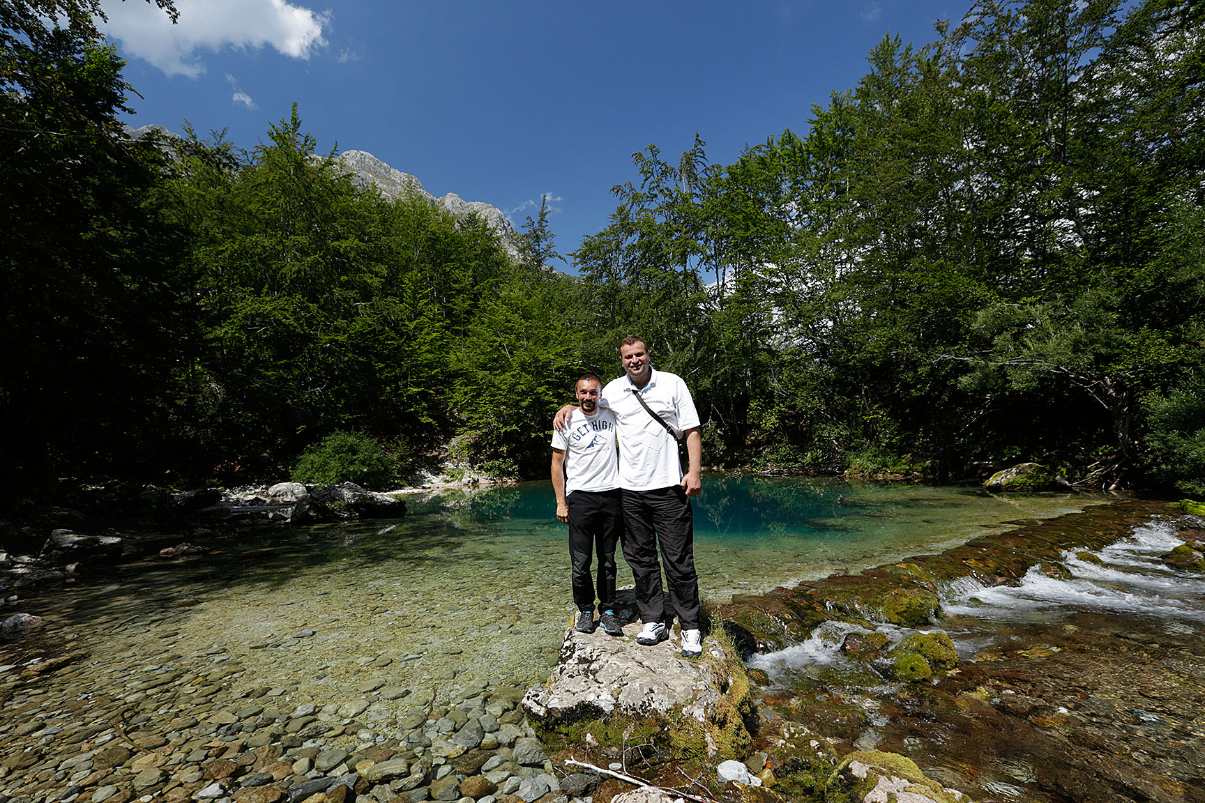
Although there are apparently ways of ‘unofficially’ meandering across the border without any consequences, the team decided to play it straight and cross into Montenegro at Vermosh – legally. We had stayed in Albanian longer than expected. There were too many enticing mountains and moments not to. But the show had to go on. Enter magical Montenengro.Many of the seemingly impassible jagged peaks of the Albanian Prokletije’s appeared ever-so-slightly more approachable from the Montenegro side. With the help and know-how of Enes Dreskovic, the Prokletije National Park director based out of Plav, Kenan, Elma and Benjamin would soon find out if their hunch was correct.This larger than life figure, towering over the entire team like the mountains in the backdrop, was the best host we could hope for. We had ‘lost’ a few days exploring northern Albania a bit more than we had planned and keeping pace with our already tight schedule would be no easy task. Enes to the rescue. Once team leader Kenan explained the vision and the situation, the 2 meter plus Prokletian giant took charge. Instead of the previously planned trekathon through Prokletije National Park, the following two days would be a whirlwind jeep tour of the Accursed Mountains.I think everyone was secretly thinking that nothing could compare to what the team just witnessed in Albania. The raw wilderness and challenging hiking of the Albanian Alps would be hard to beat. Montenegro would not disappoint, however.After getting the low-down on the Montenegro side approaches to Zla Kolata and Maja Jezerce, two of the Prokletije’s highest and most challenging peaks, Enes took on the task to show what Plav and Gusinje had to offer. In sharp contrast to the rough roads (or complete lack of them) on the Albanian end of things, the roads and infrastructure – even dirt tracks – were in good working order.
The low valleys in and around Plav and Gusinje are chock full of exciting sites and sounds. There are a plethora of natural water sources that come in many forms. Alipasina Izvor in Gusinje is a classic and the easiest to find, just follow ones nose to the aroma of fresh grilled trout. Navigating a bit further into Plav’s wilderness frontier with Albania is Oko Skakavice. And high up in the border region between Kosova and Albania is Hridsko Jezero. All of these water wells are created by the limestone formations that make up almost the entire bulk of the Via Dinarica. The harsh karst topography of the high mountains makes for a plush and water rich lowland region. For this very reason, Plav and Gusinje have it all – top notch high Dinaric hikes, superb light adventure or leisurely outdoor activities in the lowlands with campsites, biking and walking trails, and more natural monuments than I can count on my hands and feet.
That’s not to say that there aren’t some missing links in Montenegro’s Prokletije. Enes is the sole employee of the park and although he is a Goliath of a man, covering that much ground is nearly impossible. During breakfast on the second day of the tour Enes got a call from a local villager – the sounds of chainsaws had woken him. Enes literally dropped his fork on his plate and abandoned his warm first meal of the day to investigate. Kenan joined in the odyssey.Enes admitted that on occasion he would turn a blind eye on a villager cutting small quantities of wood to heat their homes for the long and harsh winters. But that wasn’t the heart of the problem. It was the forestry service and their powerful lobby. Enes claims that it is both legal (yet irrational) and illegal logging from the forestry industry that is the biggest threat to the park. And he didn’t hold his tongue at his discontent. Kenan and Enes stumbled across the freshly cut remains of a large beech tree but found no culprit was in site. They carried on.As they moved on through the forested lowlands Enes spotted something suspicious. Kenan admittedly didn’t notice a thing. A large camper van in the distance seemed out of place to Enes and the jeep parked perpendicular to it looked familiar to him. As they approached the camper van Enes’ suspicions were confirmed. A large trailer, fully loaded with fresh wood, was hiding behind it. The culprit? The son of a forestry inspector. The startled son first tried his hand at flattery. He was going nowhere quick with that strategy, though. His second go would be ‘sanitary cuts.’ That just pissed Enes off. The wood was clearly healthy with no signs of disease or drying out. The third and final attempt was to be whiny and pathetic. This didn’t fly with Enes either. He gladly wrote up a hefty fine and scolded the inspector’s son. Enes claims guilt and shame work almost as good as hitting them where it hurts – in the wallet. Protecting the lands of the Via Dinarica will be no easy task, but with champions like Enes Dreskovic at the helm of Prokletije National Park we left optimistic.
{source}<script type="text/javascript" src="https://trail.viadinarica.com/en/tour/hiking-trail/via-dinarica-prokletije-bjeshket-e-nemuna-via-maja-jezerce-to-theth/17303206/tour2go"></script>{/source}
Some 600 years ago, one Selim Pretash from Vuthaj (now in Montenegro) decided to settle permanently in Valbona. Before this, the narrow valley had been visited only in summer, for grazing cows, sheep and goats. Selim, one imagines, built a house, had himself some sons, who in turn built themselves some houses, and thus the Selimaj were born. On old maps, for example the one on the wall in Tirana’s archeology museum, you’ll see this name, “Selimaj” and not Valbona.Can you, dear guest, imagine what this was like? Quite easily, in fact. While tourism has been growing astonishingly (to us at least) in the valley since 2005, not much has changed in the mountains.Recently, in my self-appointed role as general cartographer for the valley, I made the hike from Valbona, up the Çerem valley to the (not very imaginatively named) eponymous village of Çerem, and struck off west from there to pass behind (or in front of, if you’re Montenegrin) Kollata – the precipitous mountain forming a large part of the northern boundary of Valbona, heading for Qafa e Borit (the pass of snows), from whence I and my young sidekick (chaperone and amanuensis, both) passed into Mali i Zi (Montenegro) and on to Qafa e Persllopit (thus re-entering modern Albania), intending to camp (which we in fact did) in order to be in position to spend the next day charting the route over the peaks of Kollata e Keqe (Bad Kollata – the highest peak in Montenegro, ho hum) and Kollata (proper – higher, but not the highest in Albania!) – which we did not – chart that is, waking up as we did at 3h30, to horrible rain, increasingly frequent lightening, and crippling winds – so we high-tailed it off the mountain top in the dark (well, dark except for the blinding white of the lightening every minute or so), and amazingly didn’t succumb to hypothermia, a plunging death, electrocution, or anything worse than a torn ankle (me). Amazing really. But the real point of that (very long establishing) sentence is to say that should you, like me, chose to spend a day or two wandering in the mountains around Valbona (on, need-I-say, the Via Dinarica route), you will probably experience more or less what old Selim Pretash did in his time. Except that, if the Marubi photographs are to be believed (and I’m sure they are), people were much more fabulously dressed back then. More lashings of thick, unfancied fur.Which is to say?Mountains are probably more-or-less mountains, and not that much needs to be said about them (although I could, and oh, how!) but what is remarkable in Valbona is how this ancient way of living-with-things-as-they-actually-are survives. Mir and I exhaust ourselves stalking up the Çerem path, gaining 500m and 5 km in a little more than 2 hours. Çerem is inhabited between May and October each year, is not electrified and boasts two cafes – one is a small shack wrapped in plastic sheeting and offers Turkish coffee cooked over something like a bunson burner, and the other is Sajmir’s more luxurious shack, with outdoor seating. Both have been built out of whatever could be found or made by hand, a chain saw being the most sophisticated tool. Our friend Berti has opened a guesthouse, and some relative has put up a sign saying “Hotel Gecaj.” From here we head West.
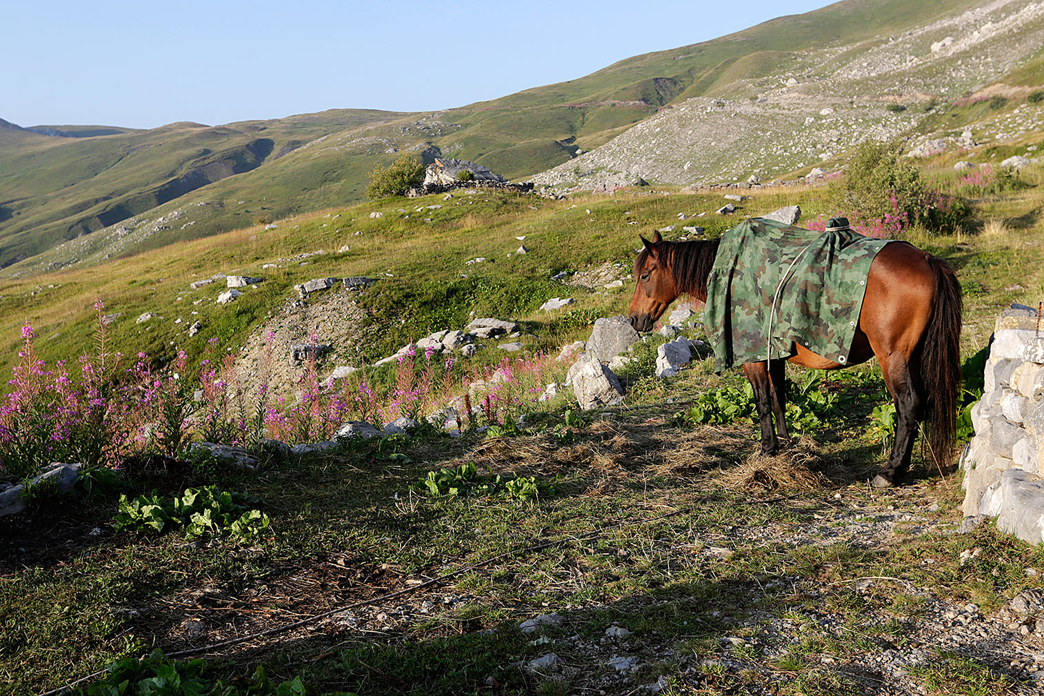
While we’re doing our best to mark trails and put in signs, this is a strange endeavor; a bit like stapling a ball gown onto some fabulous and self-sufficient savage. The paths are there. They’re the Rruga Malore, the ancient ‘Mountain Roads.” The path we set off on is probably one of the ones used by Selim Pretash those 600 years ago, and hasn’t changed much. If you have any sort of old map, and are decent with a compass, you can find your way. Of course, you’ll be helped by the various other travelers you meet. After 3 hours or so, climbing endlessly through silent beech forest, the air is torn by human shouts. A string of horses appears, each horse tripled in size by the mattresses, pots and pans and lumber attached to it. Some cheerful men shout to encourage the horses, to pass the time, to make their mark on the silence? And even though we’re hardly gear-heads, we’re lightly embarrassed to trade nods with the stately ladies, in black pumps and tailored jackets, who are pacing behind the horses. Families coming down for the winter from the Bjeshket, the summer grazing meadows.
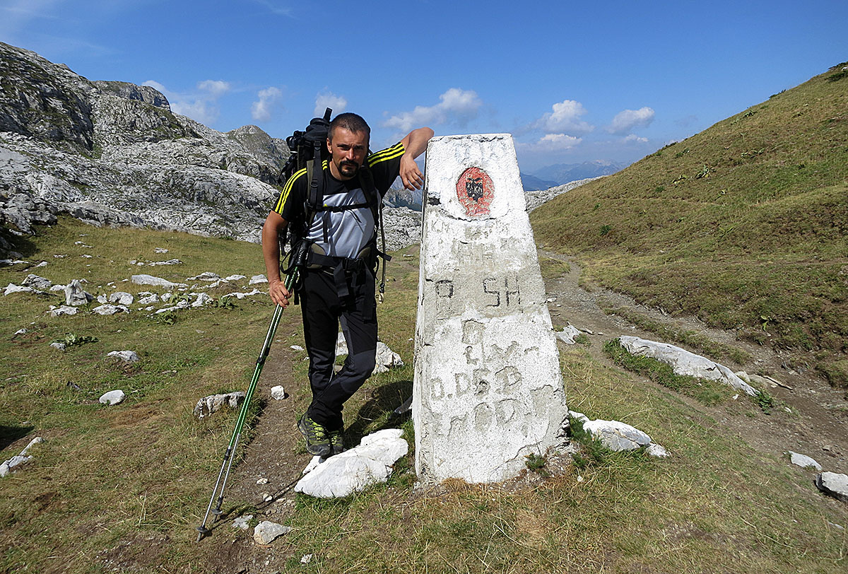
An hour or two on and we emerge into a large set of meadows. Smoke is curling out of the cluster of shacks that makes up the Stanet e Derzhanës. Families on their front porches wave to us as we stagger doggedly on. The nearest electricity is a 3 hour walk away in either direction (being generous). What are they doing up here? Grazing the cows sheep and goats that will give them milk and cheese all year. What else should they be doing? Nothing. Living. Having the children that before the days of amortized investments were the best retirement plan.Now we’re climbing through rock-seeded fields. The winds have started, and the weird echoing of any sound. Another hour and we reach one last stan, perched just before the cement border marker at Qafa e Borit. Some sort of basic shrine seems to be rising on the horizon, a square of staked logs and plastic sheeting. A few meters higher, and a stan is revealed, a woman stands alone outside the door. All the mountains around are chiming to the bell-tones of her frantic Shari dog’s baying. He lashes himself silly, throwing himself against the chain holding him to the irregular fence. “Come and have a coffee?” she invites us. No, we’re late. The day is short and the road is long. “Tomorrow,” I tell her, “we may pass this way again.” If we manage to circumnavigate the peaks (which as it turns out we don’t). She’ll be gone, she says. Down to Bajram Curri for the winter.
And after this? Hours, still. Stones, wind, grass, peaks and paths. In Mali i Zi, just as we’re thinking we should sit and check the map, we meet another group of shepherds. Butter yellow and fat cows everywhere and sheep. Some horses, with enormous plastic barrels stained purple with blueberries lashed to their sides. They are returning to Vuthaj this night. It will rain tonight, they tell us, and all night. They correct our path, offer us blueberries, and wave us on. Gjithe te Mirat we call to each other as we grow smaller: All Good for You!
{source}{/source}
First of all, anyone can walk to Theth. From Valbona, I mean. Or from Theth to Valbona as well, of course.The walk from Theth to Valbona started out getting itself written about back when just getting to either place, in the first place, was a feat, and the idea of walking from one to another was just icing on the off-the-track cake. The fact is, and I hope I’m not disappointing you, it’s not a terribly challenging hike. Six hours at the most, and in the last two summers a couple of enterprising fellows have even hewn (hewn more than built) cafes along the way. Okay, they’re beautiful and quaint, and made of ax-cut trees lashed together, but you can get coffee, beer, and even a good meal. Nowadays, you don’t need to walk more than an hour or two, before you can stop for “refreshments.” This is not to say that it’s not worth doing – not at all – but it isn’t a death-defying route, and it does NOT take several days. “Can we do it in one day?” sweet tourists, bristling with equipment and emergency gear ask me. “Will we survive?” their subtext. Yes you will.Let me deal with this quickly: From Valbona, you can drive (or be driven) to the end of the cars’ road. From there, it’s 3.5km on the stony river bed to the beginning of the path, found in the last cluster of houses comprising the village of Gjelaj. From Gjelaj, you have a 2-3 hour climb of 800 meters, through a bit of forest, some meadows, a bunch of hairpins (switchbacks?) to the foot of the rock face that’s the steepest part of the wall of mountains cutting you off from Theth. At the rock face you make a left turn and nip along the base of the rock to the pass, and then skip over about three steps of scary steep stuff to take up the gentle forest path that goes down to Theth on the other side. It’s a nice walk. There are some very pretty meadows between the pass and Theth. That’s about it. It makes a perfectly credible adventure for a family, or for people who are not used to hiking much.
Of course, that’s in summer, when the track has mostly been beaten clear by the two or three hundred other people who’ve done it before you. According to one funny American girl (not me) it’s also lined with passed-out Southern or City Albanians in varying states of dehydration, they having been led to believe by the Shkoder (dis-)Information Center that anyone in dancing shoes can walk in the mountains, without the cumbrance of things like water. In early spring or winter, with the pass choked in snow, it’s another matter. Then the sensible approach to the pass is buried in several meters of snow, and it’s a sheer claw up to the pass, with the danger of avalanches ever present. But that’s probably not what you’re thinking of?None of this is to say that there aren’t still romantic ways of getting from Theth to Valbona (and vice-versa). Two years ago Alfred and some cousins set off to prove the alternative southern and northern routes. I was in a snit when they left, so missed the southern test. From Valbona, you can walk south through one of two passes (Ndroqes from Dragobi or Zhaborre from Rrogam) either of which end you up in the Mysterious Lost Village of Curraj i Eperm. From there it’s a day or two walk (depending) to Nderlyse, the southern part of Theth. I have done most of the Ndroqes path, and I can attest that it’s mostly irritating and annoying. Lots of forest, and the path overgrown in most places. A long, Winnie-ther-Pooh style bump down from the pass to just above Curraj. Also, it’s apparently hard to find, as a French mountain guide just returned unsuccessfully after 3 days looking for it. Not sure about this. I found it, and I have no sense of direction and get lost coming out of bathrooms. Still. The Zhaborre pass is beautiful, but kind of going in the wrong direction, if you want to end up in Theth. I mean, you get yourself to Rrogam and then, instead of taking the 6 hours route, head off 9 hours in the wrong direction, to end up in a village a two day walk away from Theth. Still. It’s nice! And for people wanting a “will we survive?” adventure, this is definitely the way to go!Better possibly is the northern route. I’d recovered from my snit in time for this one, and dashed across the Valbona Pass (in 3.5 hours! So it can be done, although admittedly, I was showing off at the time) to meet Alfred and the cousins in Theth. From Theth you head north to Qafa e Pejës. This is all nice walking through pine scrub and classic high-mountain stuff. From Qafa e Pejës you are strolling north and then east through the roof of the world. Huge mountains seem to be folded out of children’s modeling clay, with all the weird cake slices and massive slabs of rock pierced by holes you’d expect. There’s no one up there except one odd group of shepherds with about 300 sheep, ‘living’ in an old army hut. Not normal stan living, as there’s no family, no women or children, and absolutely no comfort. The men very sweetly made us coffee, and sat with us, perched on various packing crates and tins, next to their mattresses in the mist of flies inside their bare barracks. From there you head east along the “Towers of the Dragons” towards the Jezerces Lakes. We slept in a cave, the Cave of the Old Malesori Woman, where we unearthed about 100 old bullet casings when we tried to level the ground to make our beds. She was tough, that old woman. The mountains echoed weirdly with the barking of the shepherds’ enormous hounds. In the morning we headed off due south, climbing over various rock faces and snow patches, to follow some very basic cairns and red paint slashes to the peak of Jezerces, the highest mountain at 2691m (give or take) wholly within Albania. From there we did a bold (read blind) descent from the (horrible) scree of Jezerces to some identical (take your pick for route) rolling mountain meadows, onto a precipitous switchback which lead in turn to an oterg – Albanian for a sort of avalanche-prone vertical river of stones, which we stumbled down for seemingly hours during which it got dark and then hours (?) through scrubby beech forest to reach Kukaj, from where we staggered exhausted and blind back down the dirt road to Valbona. Absolutely do-able with a guide. Insane without one.That said, you could leave off the peak of Jezerces, and carry on to the Lakes. Camp there and then find your way on the reasonable path through Mali i Zi (Montenegro) back to the passes by Maja e Rosit, and walk down sensibly to Kukaj. Of course, this can all be reversed.If you’re not super confident with map and compass (or map and GPS) you still might want a guide, but either of these ways, I humbly submit, is more in keeping with the do-or-die spirit in which people seem to face the 6 hour walk to Theth.
{source}<script type="text/javascript" src="https://trail.viadinarica.com/en/tour/hiking-trail/via-dinarica-albania-bjeshket-e-nemuna-tethe-to-valbona/17303220/tour2go"></script>{/source}
Rough. Raw. Invigorating. Maja Jezerce is the Prokletije’s and, in fact, the entire Via Dinarica’s highest peak. It is not one to be reckoned with. The mountain is bare with limited vegetation. The approach north of Theth from Vermosh is a long and challenging one that required sleeping under the stars. Being that it was Keno and Elma’s first camping experience of the journey, they picked a green patch in the midst of the moon-like landscape to call home for the night. The following day they would summit to their highest altitude of the entire trip at 2,694 m (8,839 ft).
Maja Jezerce rears her head above the Valbona and Shala Valleys. Being only 5 clicks from Montenegro many choose to Gusinje access to the peak. From the Albanian side, Theth is the most common launch spot to stand atop of the Accursed Mountain range.Elma celebrated with one of her trademark peak headstands.
{source}<script type="text/javascript" src="https://trail.viadinarica.com/en/tour/hiking-trail/via-dinarica-prokletije-bjeshket-e-nemuna-via-maja-jezerce-to-theth/17303206/tour2go"></script><p><a title="Europe’s largest outdoor platform" href="http://www.outdooractive.com/" target="_blank">part of outdooractive</a></p>{/source}
After a rainy day on the trail to Theth from Valbona the warm summer weather returned the following day. Well, for the most part it did. It was slightly overcast but still short sleeve weather. This day was set aside to discover a little more about the heart and soul of this remote Catholic community that had cast itself far into the mountains east of Shkodra to escape the invading Ottomans.
Kenan and Elma found the place quite well organized. Most houses offered accommodation. It was, and is, easy to find good food and a local with a story to tell (or two). The traditional stone houses are adorned with perfectly carved wood shingle roofs. The local Kula, an Ottoman term for fort, is used by the local men when they need to be alone to calm down a bit. In all seriousness, it’s basically a rage reducing technique that seems to have a chill-out effect on those who send themselves here for a moment of self-reflection. Everything about the place seems rustic and romantic. It’s no wonder it’s one of northern Albania’s must-see spots.
There are no shortage of musicians either. And I’m not talking about your ordinary musicians. The ones Elma ran across played a leaf and another twiddling on a traditional lahuta.
{source}<script type="text/javascript" src="https://trail.viadinarica.com/en/tour/hiking-trail/via-dinarica-prokletije-bjeshket-e-nemuna-via-maja-jezerce-to-theth/17303206/tour2go"></script><p><a title="Europe’s largest outdoor platform" href="http://www.outdooractive.com/" target="_blank">part of outdooractive</a></p>{/source}
The first day of real hiking took Elma and Kenan from the Valbona Valley at 800 m. to Kollata e Keqe, or in Montenegro known as Zla Kolata, at 2,582 meters. It was remarkable commencement of their journey. Zla Kolata naturally connects the Albanian and Montenegrin borders at the Qafa Borit pass at 1,850 meters. Zla Kolata (8,314ft) is officially Montenegro’s highest peak, with most hikers approaching it from the easier accessible from Montenegro. The Albanian side from Valbona is a much more demanding trek.
Kenan and Elma both, along with a shepherd and his sheep, weaved over and back to each side on more than one occasion. As Catherine had indicated, a good bit of the trail is marked or easily visible on the Albanian side (Montenegro’s approach is very well marked and on maps). She also warned of the stretches with not much to go by other than experience, a keen sense of direction, and good map reading skills. The Via Dinarica team lived up to the task.
This hike is a challenging and long one, needing a good 10 hours + from start to finish. It’s ascent leads to many rewards, from buckets of organic blueberry’s to some of the astounding views of the Prokletije range.
Mission accomplished. They put the first mammoth tour under their belts. So many more would follow.
{source}{/source}
We all ordered omelette’s with cheese and varying versions of espresso’s in a petrol station restaurant on the Drina River just before Sutjeska National Park. It had started. The prep work that we knew would need two months was cut to 2 weeks. Our budget was slashed by pretty much the same amount. But we had made our first step towards the unruly mountains of northern Albania. Trekking the entire Via Dinarica would finally move from an idea to reality in a few short days.After the somewhat hairy road from Brod to Scepan Polje on the Bosnian side we entered Montenegro near the town of Pluzine. The border crossing is where the Tara River, which has carved Europe’s deepest canyon, and the Piva River create the mighty Drina. These scintillating blue waters flow north and eventually find their way to the Black Sea, losing most of their blue somewhere near the Danube.The long 12 hour drive spun us through the highlands of Durmitor National Park and south to Skadar Lake, southeast Europe’s largest RAMSAR site. We crossed the border from Montenegro into Albania at Hani Hoti. I spoke my pigeon Albanian to the border guard. She loved it. We passed with a warm smile from a lady who had spent most of her life under the strong grip of Enver Hoxha’s isolated communist regime. Albania has come a long way. The new road from Hani Hoti to Shkodra was a warm welcome for our kidneys. Just a few years ago this road more resembled Brazzaville than Europe.After a short break in Shkodra to pick the brains of Oxfam Italia, and a good espresso to match, we headed towards the new highway to Kukes. I hadn’t been to Kukes since the NATO bombing in 1999 where I worked as an aid worker for Save the Children. It was a poor and exceptionally closed place. We asked for directions north to Valbona in Kukes, twice. Both times we got friendly instructions in English on which way to go. Kukes was still poor but no longer as closed as it was.We were delighted to find the road towards Bajram Curri, the far north’s main ‘city’, to be paved. Our excitement didn’t last for long. After a few clicks the road went rather schizophrenic. One patch would require kidney massages for us and new shocks for the jeep whilst another bit would be a narrow yet newly paved winding countryside road. It went back and forth like for the next 2 hours. By dusk we caught our first glance of the flickering lights of Bajrum Curri below the intimidating peaks of the Cursed Mountains, as they are called in the local language. As an aid worker in ’99 we were forbidden to come here. It was too unruly and dangerous, with carjacking being the rule rather than the exception. We cruised through the town without incident and made our way, through the pitch darkness of night, towards the Valbona Valley National Park.Another schizophrenic stretch of road and within an hour we had located our sleeping cubby, Hotel Rilindja (meaning rebirth in Albania). Coming from Sarajevo I think we all expected the greeting from our hosts to be a bit warmer. Alfred Selimaj, the owner, was a bit guarded. So too was the waiter. We scarfed down the fresh carrot salad with raisins and fresh trout from their fish farm. The next morning we caught our first glimpse of the peaks that guarded this exceptionally remote valley. We were awe-struck. After a chat explaining the who’s, what’s, when’s, where’s, and why’s to our hosts Catherine and Alfred (and some strong coffee), we got the warm greeting we were waiting for…and the best was yet to come.Hotel Rilindja was named so by the Selimaj family as a symbol of the rebirth of this poverty stricken valley. Both geography and politics kept these traditional mountain communities closed from the rest of the world for many centuries. The Selimaj family, and in particular the eldest son Alfred, was keen to open it up. Eco-tourism would represent the rebirth of Valbona. He was the first to open shop in the 30 kilometer long valley. There are now 600 beds available in Valbona alone.
We studied maps. Asked a million questions. Got a million answers. Catherine Bohne, an American gone local, was more than keen to share her extensive knowledge and passion about Valbona. I must admit that her energy was rather contagious. We fell in love with Valbona at first site. Catherine and Alfred decided to use our orientation day to show us a small stan (summer shepherds hut) that they were working with. It didn’t take us long to figure out that these two remarkable individuals were on a mission and that they really knew their shit. From wildlife, politics, tourism publications, visitor demographics, maps, trail descriptions, local community involvement….they simply had their finger on the pulse of this community. It was music to our ears and an immediate confirmation that we were on the right track.We met Salum, a more-than-enthusiastic 13 year old shepherd boy, at the trailhead so he could lead us to his stan. After a ten minute walk (or rather slow jog trying to keep up with the excited teenager) we reached their summer settlement. To our surprise it was a full house. The family had come to enjoy their summer holidays from Tirana. Salums uncle had a PhD in Forestry, his aunt taught at university. His first cousin spoke better English than me. So here we were, high on an Albanian hillside in the middle of nowhere with no electricity or running water, talking forestry ecology in English and Italian.
Grandma, in fine Balkan fashion, didn’t hesitate to start rolling the dough to prepare us lunch. Elma, our seasoned photographer, bonded with grandma straight away. They spoke in hand and eye language as grandma made lunch and Elma captured her skills on film. After eating too much of the delicious burek me djath and fresh peppers stuffed with homemade cheese we skipped back down the mountain just before the skies opened up.
We ended the day at Alfred’s home and their family guesthouse. We entered to find Alfred’s aunt and uncle sitting in the large dining room area. We soon discovered they now live in Sarajevo and spoke our local lingo. I think it was the fifth language we used in Valbona that day. Although we had come to see the accommodation the conversation with Alfred quickly drifted to the high peaks above us. I could see that Kenan was drooling to start the hike the following morning. As Elma darted around the village taking many of the photos in the gallery on this post, Kenan sussed out which approaches would be best to conquer these rugged and raw cliffs.We set our alarm clocks for a 5am wake up call. The very first of many steps would be taken tomorrow morning. One of a million.
{source}{/source}
When team leader Kenan Muftic was asked to calculate how many steps did he think they’d make on their pioneer journey up and over the Dinaric Alps, he paused for a few minutes. We weren’t expecting him to do the the math right then and there. But he did. He raised his head from thought and answered, ‘Well over a million.’ Add in Elma’s strides and all the partners and hikers that will join them along the way we soon realized that this was a multi-million project. Steps that is.And that, ironically, is exactly what this idea was intended to be.Taking steps forward. We just didn’t expect it to be in the millions. The Via Dinarica concept is right in step with how we see the future of this region. It is this vision that we would like to move forward with, one that finds that precious balance between economy and ecology, modernization and tradition, protection and promotion.We know it’s a challenge of a lifetime…and, in fact, it may just take that long to tick off our long wishlist. But, one step at a time, the Via Dinarica is emerging as a solution to poverty, isolation, reconciliation, sustainability and harmony for the local communities that have called this home for many, at times tumultuous, centuries.The solution comes in the form of a lot of hard work but just as much fun. And that’s exactly what we intend to do, work and play hard. There will be many hundreds of kilometers of superb hiking trails. Low in the valleys the wet suits come out for whitewater rafting in, for example, Europe’s deepest river canyon – the Tara River in Montenegro and Bosnia & Herzegovina. Bike trails have already been blazed and are well-marked on many parts of the trail(s). There are campgrounds and B&B’s dotting the entire length of the Via Dinarica, playing host to families looking for soft adventure or hard-core adrenaline junkies looking for a new playground.The Via Dinarica is an open concept. It is owned by everyone along the trail, including you. It aims to provide a wide range of activities and highlight the uniqueness of each mountain community and the quality services provided for tourists to enjoy.The Via Dinarica ‘connects naturally.’ By taking a million steps forward we aim to share the rich history and stunning nature of this little known part of Europe with the rest of the world.
{source}<script type="text/javascript" src="https://trail.viadinarica.com/en/tour/long-distance-hiking/via-dinarica-white-trail/17291189/tour2go"></script>{/source}
When team leader Kenan Muftic was asked to calculate how many steps did he think they’d make on their pioneer journey up and over the Dinaric Alps, he paused for a few minutes. We weren’t expecting him to do the the math right then and there. But he did. He raised his head from thought and answered, ‘Well over a million.’ Add in Elma’s strides and all the partners and hikers that will join them along the way we soon realized that this was a multi-million project. Steps that is.And that, ironically, is exactly what this idea was intended to be.Taking steps forward. We just didn’t expect it to be in the millions. The Via Dinarica concept is right in step with how we see the future of this region. It is this vision that we would like to move forward with, one that finds that precious balance between economy and ecology, modernization and tradition, protection and promotion.
We know it’s a challenge of a lifetime…and, in fact, it may just take that long to tick off our long wishlist. But, one step at a time, the Via Dinarica is emerging as a solution to poverty, isolation, reconciliation, sustainability and harmony for the local communities that have called this home for many, at times tumultuous, centuries.The solution comes in the form of a lot of hard work but just as much fun. And that’s exactly what we intend to do, work and play hard. There will be many hundreds of kilometers of superb hiking trails. Low in the valleys the wet suits come out for whitewater rafting in, for example, Europe’s deepest river canyon – the Tara River in Montenegro and Bosnia & Herzegovina. Bike trails have already been blazed and are well-marked on many parts of the trail(s). There are campgrounds and B&B’s dotting the entire length of the Via Dinarica, playing host to families looking for soft adventure or hard-core adrenaline junkies looking for a new playground.The Via Dinarica is an open concept. It is owned by everyone along the trail, including you. It aims to provide a wide range of activities and highlight the uniqueness of each mountain community and the quality services provided for tourists to enjoy.The Via Dinarica ‘connects naturally.’ By taking a million steps forward we aim to share the rich history and stunning nature of this little known part of Europe with the rest of the world.
{source}<script type="text/javascript" src="https://trail.viadinarica.com/en/tour/long-distance-hiking/via-dinarica-white-trail/17291189/tour2go"></script>{/source}
Even though Valbona, blessed with Mother’s Natures finest as well as the Catherine & Alfred duo, had so much more to offer – the show had to go on. Kenan and Elma packed up and headed towards the top of the Valbona Valley. Their destination? Theth National Park.
This 7-8 hour medium-level hike took a bit more time than planned due to rain and great cloud movement for Elma to capture with her superb eye. She took a time lapse of the clouds rolling in on them that required over 400 photos for a 30 second clip. They did arrive as wet rags but they came with a story to tell.
{source}<script type="text/javascript" src="https://trail.viadinarica.com/en/tour/hiking-trail/via-dinarica-albania-bjeshket-e-nemuna-tethe-to-valbona/17303220/tour2go"></script><p><a title="Europe’s largest outdoor platform" href="http://www.outdooractive.com/" target="_blank">part of outdooractive</a></p>{/source}