Velika Kapa – Prenj
Source: Zehrudin Isaković, Planine Bosne i Hercegovine – 50 izabranih uspona
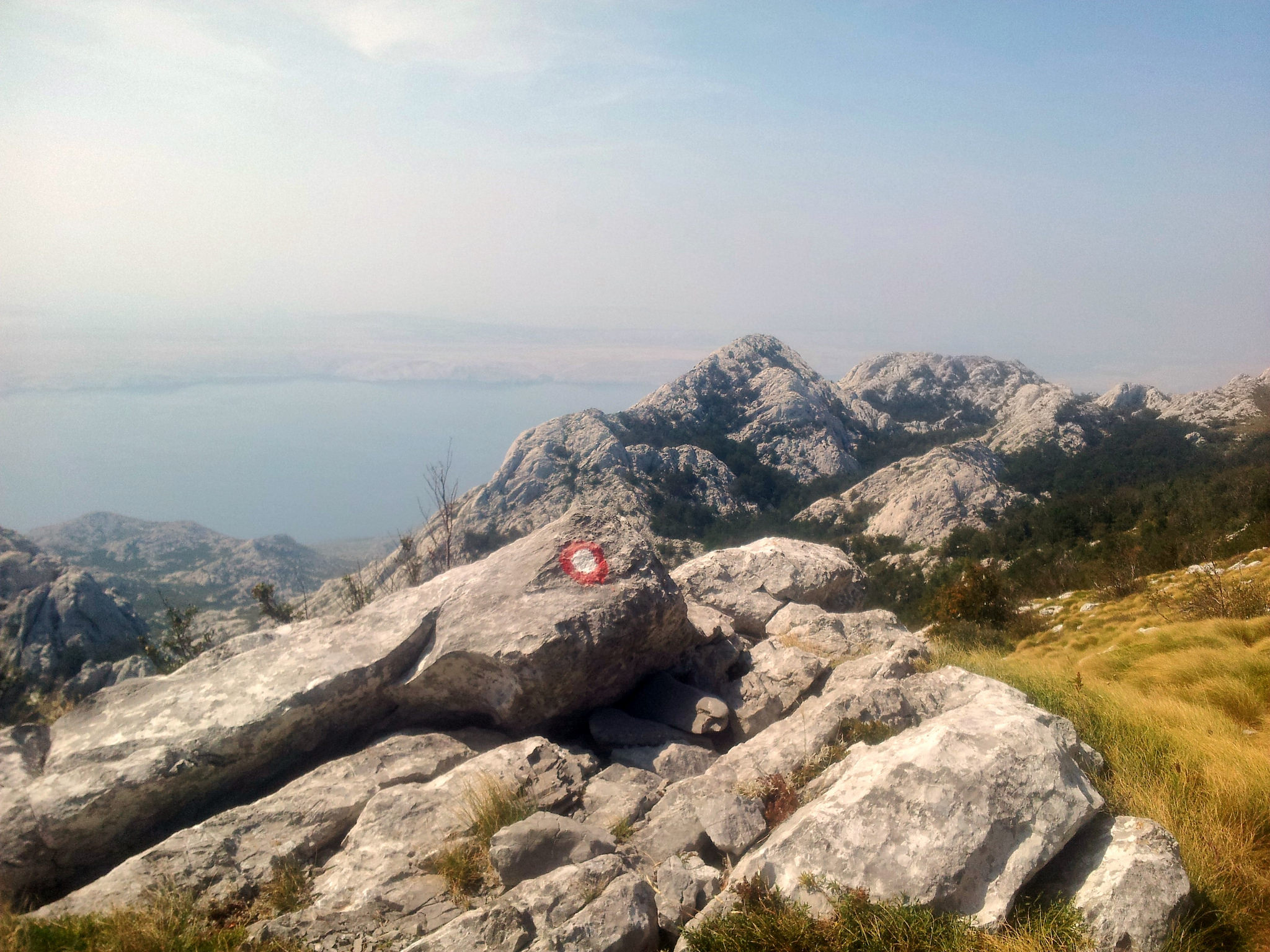
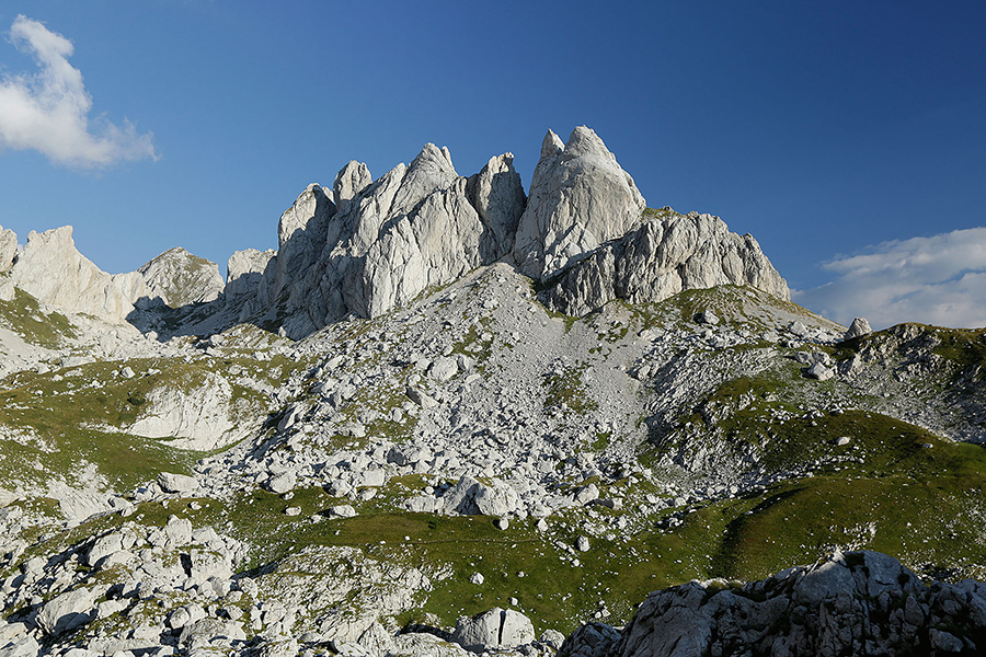
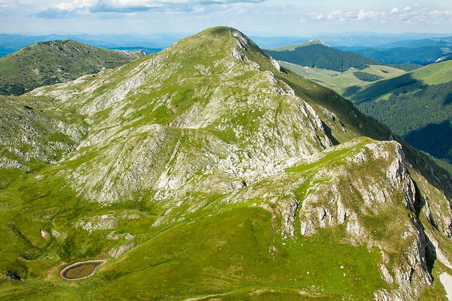
Because of its unforgettable viewpoint, Velika Kapa is one of the more prominent peaks of Prenj. Standing on the summit of Velika Kapa, you feel like a falcon soaring freely high above the valleys and other elevations of this mountain.
Velika Kapa rises above 2,000 metres, making it a notable and dominant peak by this criterion as well. The summit itself is the culmination of the Konjic Bjelašnica ridge. Its northern and eastern sides are rocky and very steep, while the other sides of the peak are grassy and gently undulating.
The approach to Velika Kapa from Rapti, and the time spent on the summit itself, will make you happy.
The approach is very pleasant, along grassy slopes and through forest vegetation of varying heights.
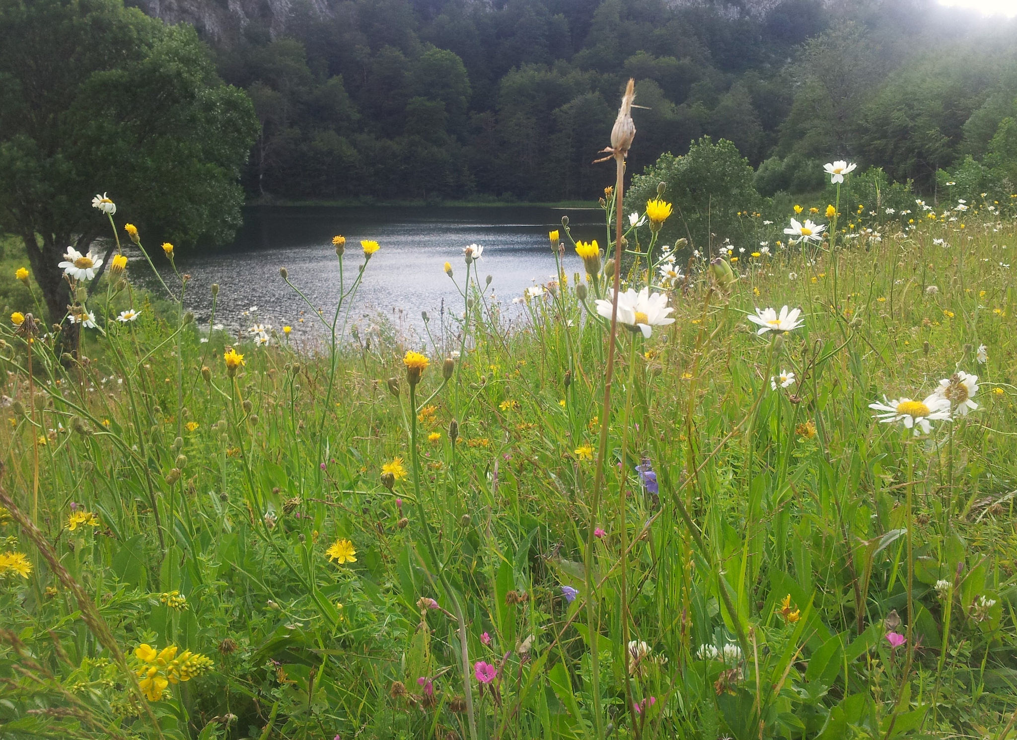
On the way to Velika Kapa, you will pass through carpets of flowers, accompanied by the buzzing of bees and an abundance of cheerful colours that will lift your spirits.
Apart from reaching the summit itself, the most joyful moment is reaching the pass to the left of Borova Glava. Here, you will be fascinated by the open view of Prenj’s vibrant panorama. Almost the entire array of high peaks of this mountain seems to dance right in front of you, just for your eyes.
It can be said that after this, the approach to the summit feels like passing through a ceremonial guard of honour, like a VIP path of happiness and adrenaline.
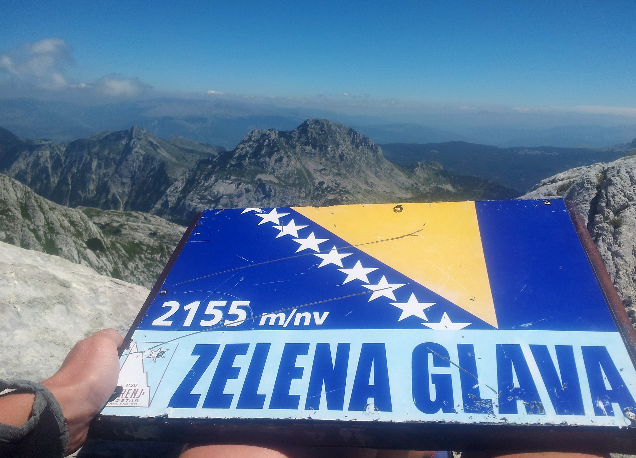
At the summit, above all, you are fascinated by the breathtaking view into the depths of Konjička Bijela. The views of Osobac, Otiš and Zelena Glava from Velika Kapa look impressive, especially in winter, when they seem like some Alpine peaks rising above 3,000 metres.
It is especially beautiful on days when valley fog covers the valleys around Prenj. At such times, the landscape before you looks like a sea dotted with numerous beautiful islands, whose shores plunge sharply into the sea of fog.
Recommended Approach
From Konjic, we take the paved road towards Boračko Lake. At the very exit of the suburban area, we turn right onto another paved road towards the Bijela Valley, where several small hamlets are scattered along the valley. At the end of the paved road, we continue along a poor-quality gravel road for the next 17 kilometres to the Rapti location. Along the way, there is a sign indicating the turn-off to the left towards Rapti, while the road continues further into the Tisovica Valley, which can only be reached by a 4x4 off-road vehicle.
DESCRIPTION
We begin our journey at the Rapti mountain facility (PD Borašnica), from where our destination for the day is already visible. We follow the marked trail along a wide gravel road for several hundred metres, before soon turning right into the forest, through which we continue for approximately twenty minutes. Emerging onto open meadows is accompanied by gradually opening views, extensive habitats of mountain flora, and pleasant hiking without any difficult obstacles along the way.
For the next 45 minutes, the hike is very enjoyable, occasionally passing through areas of dwarf pine, with the intense scents of Herzegovinian (Mediterranean) plants.
The emergence onto the main ridge (one hour from the start) of Prenj's Bjelašnica (a long ridge culminating in the Velika Kapa summit) is accompanied by spectacular views of the Prenj massif, especially Cetina, while to the right of it, directly across the Neretva River, Čvrsnica stretches out before you as if in the palm of your hand.
For the next hour and a half, the route continues along a broad ridge (oriented northwest–southeast), following a marked trail to the summit of Velika Kapa (2004 m). Hiking along this ridge is one of the greatest pleasures you can experience in the mountains. Moving gently along the trail, on the right, across the Tisovica Valley, the view extends towards the giants of Prenj (from left): Otiš, Zelena Glava, Vjetrena Brda, Erać, Lupoglav; Kerać; Veliki Prenj, Cetina...
Depending on the season, we will have Alpine winter views, or a spring landscape streaked with snow, or, alternatively, warm autumn colours, whose beauty will carry us all the way to the summit.
And as for the view from the summit of Velika Kapa towards the Konjička Bijela Valley (1,500 metres deep), it is an understatement to say that it is breathtaking. The depth inspires respect. Directly across the valley is Osobac – an isolated peak, along whose northwestern ridge runs one of the longest via ferratas in the Balkans – as much as 1,300 metres in length and with a vertical elevation gain of 700 metres. From the summit, Sivadije can also be clearly seen – another very interesting part of Prenj, whose diversity and unique relief leave no one indifferent.
We can return by the same route, which is also the easiest option.
It is possible to continue along one of the routes towards the interior of Prenj.
One hour from the summit, we can reach the Vrutak bivouac (to obtain the key, contact PD Borašnica from Konjic), which is potentially an excellent starting point for numerous ascents.
From the summit to the mountain hut (open-type) at Jezerce takes one hour and 45 minutes.
From the Rapti mountain hut to the pass of Prenj's Bjelašnica
1 hour
From the pass to the summit
1,5 - 2 hours
Total
2,5 - 3 hours
Return to Rapti
2 hours
Total
4,5 - 5 hours
Starting Elevation
1400 m
Summit Elevation
2004 m
Elevation Gain
604 m
Source: Zehrudin Isaković, Planine Bosne i Hercegovine – 50 izabranih uspona.
The origin of the name Osobac suggests that this is a distinctive peak.
And indeed, it is: isolated in its geographical position, separated from the surrounding peaks, slender from every side, and extraordinary in its beauty.
It is hard to say from which direction Osobac looks the most beautiful.
The view from Jezerce, especially when the peak is reflected on the surface of the lake, is certainly one of the most beautiful. In the foreground stands the Osobac Ridge (an alpine climbing route), along which a challenging and highly scenic via ferrata has been built. It is particularly beautiful on winter evenings, when smoke rises from the mountain hut and you can watch the red glow of the setting sun spread across the peak. It is as if some powerful force had placed it there—just for us, so that we could enjoy the view and admire it.
Osobac is equally impressive when viewed from the summit of Velika Kapa. It stands watch, proud and vigilant, over the Bijela Valley. From this side too, its slender form and the sense of dominance it radiates are truly captivating.
If, by some stroke of luck, you climb Zubci in winter from the direction of Crno Polje, you will see a massive, striking peak on your left. Yes, you guessed it—that is Osobac. A limestone giant supporting the blue of the sky, proudly carrying all the icy ornaments with which winter has adorned it.
ACCESS ROUTES:
1. Crno polje - Osobac (2024 m)
ACCESS:
From Konjic, follow the paved road towards Boračko Lake. At the village of Borci, turn right (signposted) onto the gravel road towards Rujište. At the first junction, turn left; at the second, turn right (the turn-off is marked with Via Dinarica signs), from where the road becomes rougher. The total distance from Borci to Crno Polje is 10 km.
DESCRIPTION
The trail initially descends slightly, then follows a marked path through pleasant meadows, gradually tending to the left towards the magnificent Sivadija Ridge, which accompanies us throughout the day. As we move farther along, the view gradually opens up. On the right, we can already catch sight of our destination—the mighty Prenj peak of Osobac, which from this side still does not reveal its true character.
After about half an hour, we enter the forest, where we continue through the shade for the next 45 minutes. Along the way, we come across the Kamenac spring, located on a prominent meadow, in the rock on the left side. The spring is marked. During dry summers, however, it may be unusable, so it is safer to carry enough water for the entire day.
Soon, the trail joins the path leading from Bijele Vode towards Jezerce. From here, our destination reveals itself in all its grandeur. This is also when the adrenaline starts to kick in. Just below Osobac, we turn right onto a marked trail (freshly marked in 2019) that leads all the way to the Osobac–Mali Osobac saddle. From there, we ascend a steep grassy slope to the summit.
The final section can be slippery and unpleasant in rainy weather, so caution is required. Nevertheless, the last fifty metres of the ascent offer a true high-mountain experience. The trail passes beside an impressive rocky opening, while the view opens up over the entire Prenj massif and the surrounding mountains.
We can return to Crno Polje along the same route, although other options are also possible.
Starting elevation
1,350 m
Summit elevation
2,024 m
Elevation gain
674 m
Time: Crno Polje → Osobac summit
3–3.5 hours
Time: Return
3 hours
Total time
6–6.5 hours
Difficulty
3–4
2. Konjička Bijela – Skok – Osobac
ACCESS
From Konjic, follow the paved road towards Boračko Lake. At the very edge of the suburban area, turn right onto another paved road leading into the Bijela Valley, passing several small hamlets along the way. At the end of the paved road, you can continue for another two kilometres along a gravel road to Rakov Laz, where the hiking route begins. (The gravel road continues towards Rapte and into the Tisovica Valley itself, which can only be reached by a 4x4 off-road vehicle.)
DESCRIPTION
The trail leads through coniferous forest, whose refreshing shade will accompany us for the next two hours of ascent. The first half hour is not strenuous and serves as a warm-up for the steep section that awaits us. For the following hour and a half, we climb through the forest along a series of switchbacks. Initially, we pass through tall beech forest, which gradually gives way to mountain pine as we gain elevation. Soon, a view opens up towards Velika Kapa, an isolated Prenj peak, from whose summit we can look steeply down into the Bijela Valley, as well as across the rest of Prenj.
Further on, the trail traverses four potential avalanche paths. Therefore, maximum caution is required here during the winter and spring months.
Once we successfully cross this section, we arrive beneath the northern side of Osobac. Here, it is possible to turn left and continue the ascent to the summit of Osobac via two different routes. (More information can be found in the description of the ascent to Osobac.)
During the summer months, a gentle breeze awaits us at Skok, providing a pleasant refreshment. In other seasons, this windy spot serves as our first reminder that ascents of the Prenj peaks are a serious undertaking, requiring a certain level of experience and solid mountaineering equipment.
Skok is also a trail junction. Turning right leads towards Jezerce, while we turn left to approach Osobac from the southeast. We follow a faintly marked but logical trail, heading straight through a south-facing gully. After about half an hour, we reach the trail leading to Osobac from Crno Polje. We gradually gain elevation, getting closer and closer to the steep and slippery upper slopes, so particular care and caution are required, especially when the ground is wet.
Just before the summit, if we look carefully, we will spot a large rocky opening on our left, a popular feature for photography.
Continuing along the ridge, we reach the summit in about ten minutes. The feeling is indescribable. The pride of having climbed such a distinctive Prenj peak, combined with the effort of the ascent and the alpine surroundings, leaves us perfectly happy and satisfied.
If the weather permits, you can deservedly have lunch and lie down for a while, allowing everything to settle and fall into place. When you open your eyes, don't worry—you haven't gone to another world. You are still on Planet Prenj, which has treated you to one of its most beautiful gems.
Starting elevation
600 m
Summit elevation
2,024 m
Elevation gain
1,424 m
Time: Bijela → Skok
2 h 30 min – 3 h
Time: Skok → Osobac
1 h 30 min
Time: Return
3 h
Total time
7 – 7.5 h
Difficulty
4
More than a drink, real kafa is a ritual Few misconceptions are as widely spread as the one about Turkish coffee. If you order this thick, dark beverage with its bewitching aroma in Turkey, you’re bound to be horribly disappointed. You won’t be served a džezva (a hand-engraved copper or tin coffee pot), a šećerluk (a proper sugar bowl), or a fildžan, (a small, handle-less traditional coffee cup). Instead, they serve coffee in a mug or worse yet, in a teacup. Offering coffee in a cup with a handle to a die-hard Bosnian coffee drinker is the equivalent of serving tea in a soup bowl to a proper English lady. For the coffee of your dreams, you’ll have to come to Bosnia and Herzegovina. This is the real thing. So, from this point on, this bewitching, heavenly drink will be referred to as Bosnian coffee.Truth be told, even in a country where coffee is a national pastime, there are fewer and fewer places to have coffee prepared in the traditional way. Bosnian coffee is often replaced with flavored instant coffee, espresso, or filtered coffee – all of which, by local standards, diametrically oppose the theory of good coffee because they don’t have the granules. The rule here: the thicker the better. Offering coffee in a cup with a handle to a die-hard Bosnian coffee drinker is the equivalent of serving tea in a soup bowl to a proper English lady.Good Bosnian coffee has its own lore and method for preparation, of course. To yield the proper results, whole coffee beans should be bought raw. The beans should be freshly roasted in a wood-burning stove. It’s not a general practice to store ground coffee, either. One grinds them just before brewing and only in the amount needed for that particular serving. In some places old traditions are still respected. Coffee grounds are roasted in a shish, a simple metal cylinder at the end of a long skewer. Unfortunately, this practice is almost extinct. What a shame … the aroma is singular. Coffee roasted in this way should not be put in an electric grinder. There is no scientific proof to back the theory, but it is common knowledge that these gadgets over-grind the coffee. Every self-respectable household or café priding itself in offering proper bosanska kafa, has to have a handheld manual version. Properly grinding the beans is an art form. Leaning the tool on your lap if seated – or on your hip if standing – you hold the grinder firmly with one hand. Then turn the handle with the other. This may seem rather menial, but churning until the beans are finely ground will leave even the fittest wondering what these beans are made of. Coffee is brewed in a džezva, which is first warmed up a bit. The not-just-yet-boiled pot of water on the other ring is removed just before the boiling point. A fildžan of this hot water is set aside and the rest is poured into the ground-coffee-bean-filled džezva. It is stirred and placed back onto the stovetop. The coffee should boil until a rich layer of foam reaches the very top of the džezva. Removing it from the heat, pour the water from the fildžan over it and set it aside for a moment until the grinds settle on the bottom. It is then served in a fildžan. Traditional coffee drinking entails sucking one’s coffee through a sugar cube. Not a whole one, but a chunk of a cube that is first dipped in the coffee to soften it up before sinking your teeth into the now-brown and melting cube. Nowadays, this ritual is mostly practiced at home. There are, though, a few kafanas around town clinging to this noble art. Old habits die hard in Bosnia and Herzegovina.An invitation for a coffee rarely means the necessity of a shot of caffeine to stay awake or make it through the workday. Coffee here is an invitation for conversation. This implies time. And making time for friends and family is something that is valued here above most other things.Author: Tim Clancy for Don't Miss Magazine
desno{source}
{/source}
{source}
{/source}
{source}
{/source}
{source}
{/source}
{source}
{/source}
{source}
{/source}
{source}
{/source}
{source}
{/source}
{source}
{/source}
{source}
{/source}
Author Margherita
Are you wondering about the best food in Croatia and Herzegovina? Welcome to the last instalment of our Via Dinarica adventures, where we tell you all about what we ate during our week-long adventure in southern Croatia and Herzegovina. To learn more about the Via Dinarica and this section of the Balkans, read our posts about Sipan Island and things to do in Herzegovina!
Did you know that Herzegovina is the only place in the world with 'wine' in it? I had never thought about it before, until our guide Marko pointed it out, as we were walking towards an ancient winery during our time exploring the Herzegovinian section of the Via Dinarica. Marko explained that the word Herzegovina comes from Herceg, meaning duke - referring to the duchy of Stjepan Vukčić Kosača, a medieval lord who ruled over present-day Herzegovina - and vina, meaning wine.
Culinary Traditions in Herzegovina and Croatia
I am not sure whether it is true, or if Marko was just pulling my leg, but Herzegovina's wine making tradition does indeed stretch back millennia, since Illyrian times. The fertile karstic soil, combined with a hot and dry climate has encouraged the cultivation of vineyards and orchards. The region is also perfect for apiculture, and anywhere you look while driving around the region you'll find beehives stacked on the roadside or hand-painted signs advertising 'MED', honey.The tradition of growing healing herbs is also widespread all across the Balkans - from Jezersko in Slovenia to Albania. Herbs are used to make beauty products and treat a variety of ailments, or they are turned into tea and syrups or used to flavour food. Animals grazing on the hills eat wild herbs, which lends their meat a delicate, herby flavour.
Along the Croatian coast, you'll find seafood and Italian-inspired dishes on most restaurant menus, paying homage to the territory and centuries of trading with the neighbours across the Adriatic. Fresh vegetables, delicious olive oil and homemade wine complete the picture - anywhere you'll go, you're likely to enjoy amazing meals.Every village, every family in Croatia as well as Bosnia and Herzegovina has their own recipes and culinary traditions - be it a syrup, a special kind of preserved vegetables, flavoured rakjia, homemade cheese or whatever else.
Eating on the Via Dinarica
The Via Dinarica trails, three 2000-km long hiking trails stretching across the Dinaric Alps, were established in 2010 to bring sustainable tourism development to an area that still sees few visitors. The trails link family-run establishments like farmhouses, local restaurants and small producers, creating a network of places offering local experiences – and food is likely to be one of the highlights of your experience, as it was for us!
Here we've collected the best food in Croatia and Herzegovina among what we ate along the Via Dinarica - including some local tipples!
Best Food in Croatia and Herzegovina
1) ĆevapiAll along the Dinaric Alps, from Slovenia to Albania, you can't go wrong with a plate of Ćevapi, sausage-shaped meatballs cooked on hot coals. They are usually made with minced beef, pork or lamb, or a mixture, depending on the region. You can enjoy cevapi on a plate with a side-dish of chips or rice, or in a bread roll, with some extra soft cheese if you like. A similar specialty is pljeskavica, a burger-like beef patty that can also be enjoyed in a sandwich or on a plate.2) BurekEvery bakery (or 'Pekarna') in Croatia and Herzegovina will serve burek, a local specialty made of baked fillo pastry stuffed with either meat, cheese or potatoes. Borek is a popular breakfast food, but it can really be enjoyed at any time of the day - it's especially delicious when freshly-baked.
3) SačA common method to cook meat in Croatia and Herzegovina is 'under the bell', a cast-iron dome known locally as sač. Most restaurants will advertise 'under the bell' dishes - meat (goat, lamb, beef, veal, whatever) is laid on top of potatoes and cooked under the sač for hours, until it stews to braised deliciousness and the potatoes are cooked in the meat juices. Served with a simple tomato and cucumber salad, it makes a wonderful lunch or dinner. Just don't forget to book it in advance, as it takes several hours to cook.
4) CheeseWe ate two kinds of cheese in Bosnia and Croatia - the most peculiar was sir iz mijeha, with a chalky and crumbly texture and a pungent flavour that comes from being aged in a sheep's stomach. We also enjoyed skripavac, a smooth medium-hard cheese that is usually preserved in olive oil.The association Udruzenje Selo u Srcu (meaning 'Heart of my Village') near Trebinje organises tasting events showcasing Herzegovinian products, including cheese made by Miro, a local cheese maker and founder of the association.
5) PršutA product that will be often served to you when visiting a Herzegovinian or Croatian family is pršut, homemade cured ham. The word pršut has a similar pronunciation to prosciutto, Italian for cured ham. We tried pršut twice during our journey along the Via Dinarica - once on Sipan Island near Dubrovnik, during our visit with olive oil maker Miho Bender, and the other time at the house of a man called Risto in Tuli. Risto also took us to the room where all his hams are hung to air dry, and where in saw the largest ham of my life!
5) Black RisottoThe closer you'll get to the coast, the more Italian influence the food will have. Walk down the streets of Zadar or Dubrovnik, read the restaurant menus, and you'll feel just like in Italy - it's all about the pizza and pasta.The signature dish of the Dalmatian coast is black risotto, flavoured with squid ink and often served with calamari, mussels or other seafood. It's a popular Venetian dish that somehow found its way across the Adriatic. We had black risotto several times during our trips to Croatia, so this time we decided to try something a little different - black pasta with buzara sauce, made with tomatoes and spices, from Restaurant Magellan in Dubrovnik.6) SeafoodSeafood is the protagonist of most restaurant kitchens along the Adriatic coast - you'll be offered seafood pasta, seafood risotto, or just simple, grilled seafood platters - sometimes divided in 'first', 'second' and even 'third' class in terms of quality. Seafood is usually excellent, but prices can be steep in Croatia - and given that they're often quoted by the kilo, it's hard to figure out how much you'll actually be spending.For excellent seafood at much cheaper prices, head to Neum, Bosnia and Herzegovina's only coastal town. This platter for two, plus wine and side dish, cost us only 40 euro! There are many things to do in Neum, and the town can generally be seen as a cheaper alternative to the pricey Croatian coast.
7) Wild BoarDuring our stay on Sipan Island we were surprised to see wild boar on restaurant menus. Locals explained that boars roam the island and sometimes fall victim to hunters, ending up in stews and casseroles. You'll find tasty wild boar stews in restaurants throughout the island - and it's delicious! We sampled wild boar braised in red wine at Konoba Trisestre in Suđurađ, served with tasty dumplings to soak up the sauce.8) AjvarAjvar is another specialty you'll find all across the Balkans. It's a relish made with puréed vegetables (usually carrots, aubergine, peppers and garlic) blended with olive oil and often served as an accompaniment to grilled meat. Every family has their own ajvar recipe and - of course - everyone will tell you that theirs is the best! If you see farmer stalls while driving around, don't miss trying their ajvar. The one we bought at this stall in Ljubinje was the best we've ever had!
9) Wine and RakijaConsidering you're in a country that has 'wine' in its name, you can't possibly leave Herzegovina without trying some local wine, right? The main varieties of wine produced in Herzegovina are Blatina and Vranac, dry red wines typical of the Balkan region, and Žilavka, a fruity white wine similar to Riesling.
The winery of Tvrdos Monastery near Trebinje is one of the longest-running in the region, having produced wine since the 15th century, and one of the best places for wine tasting in its stone-walled cellar with barrel ceilings. Another option in Trebinje is Vukoje Winery, established in Austro-Hungarian times and especially renown for its tasty Žilavka.If you visit a local home, you'll surely be offered rakija, a grape spirit similar to Italian grappa. Rakija seems to be popular as an aperitif, to accompany a meal, and as an after-dinner tipple... really, any time is rakija time! If you're not a fan of spirits, try rakija flavoured with herbs or honey. We had the BEST rakija of our lives from Baba Olga, a lady that sells honey and rakija from a roadside stall just outside Ljubinje. Just don't ask her for the recipe - naturally, it's secret!
The project “Sustainable tourist development – From Herzegovina trails to Dubrovnik Elaphiti islands” is financed by the European Union under the IPA CBC Programme Croatia – Bosnia and Herzegovina 2007 – 2013.
{source}
{/source}
{source}
{/source}
{source}
{/source}
{source}
{/source}
{source}
{/source}
{source}
{/source}
{source}
{/source}
{source}
{/source}
{source}
{/source}
{source}
{/source}
At the end of the month I like to look back on what I’ve done and where I’ve been. On how I felt and what was on my mind. It turned out that my Instagram pictures actually give a pretty good impression. So, I decided to put them together in a blog post. Her is September.
Slovenia
This is the view from Javornik mountain, they build a lookout tower on top so you can actually see something. I love the forest, but when I hike up to a peak, I want a view! This one I like.
View from Javornik
I wanted to share a photo of Predjamski Grad, the end of my Via Alpina trek, but halfway a long boring macadam road down, I found a real nice hiking path to Sv. Lovrenc Gora, where I planned to camp. So, here’s the view from this sweet peak. And here is the start of the next part of my journey: the Via Dinarica Green Trail. Green Trail? Yes! For Slovenia I created a route that’s basically a combination of local (mountain) hiking trails, trailrun tracks, thematic hiking routes and a bit of my own previous hikes here. I’m super excited. Even though I skipped Predjama where I more or less ended last year, it feels like I’m “back”. Back in the Dinarides and back on “a” Via Dinarica.
Sveti Lovrenc Gora
Confession: hills make me happy too, especially running down the green grassy ones.This is Slovenia, there’s a church on e-ve-ry hill And what’s also funny, people RUN up mostly before breakfast or after dinner, ring the church bell and run down. Really. It doesn’t matter that there’s a girl camping next to the church, that bell has to be ringed… Dobro jutro!
5K up
This is a lake. Cerkniško jezero. And I’m camping on the bottom. Beautiful!
Although I know that it takes at least four rainy days for the water to rise to a certain level and then at least four more days for the water to fill this enormous lake… I kind of couldn’t get the flood stream visions out if my mind.
The next day when I walked across the lake, I found traces of a bear. Yes, there are bears around here. Lots of them.
In the village on other side, a man showed me photos of two sheep that were killed last night. “This town is dangerous at night. Many bears.” I’m usually not afraid of bears, I believe that they won’t bother people, but I noticed that some people try to scare me.
Why?! If it’s not for the realistic fears, it’s the fantasy-flood-stream-fears that rub me from my sleep.
So please, let’s stop scaring each other! Stop the stupid (well meant) warnings that are just a product of your own fears rather than useful advice. And please stop comparing me with a sheep. Really.
Cerkniško jezero
I’m back in Loška Dolina, the green heart under mount Snežnik. It’s a relatively unknown region, but last year it kind of stole my heart. Some say it’s less developed, that they’re behind. I think they have just the right pace. It’s a region where people used to work on the land. Men in the forest, women in the garden. This changed over the years, big city jobs pay better, but still you can feel and see that people live differently. More relaxed. Old grannies are watering the flowers while the old men sitting together with a cup of something. They wave and smile with a heartwarming twinkle in their eyes.
Of course I’m generalising ánd romanticising, but hey, this is what I feel. And hey, look at this photo… Need to say more?
Vrhnika pri Ložu
My view for the next few days, hiking through Loški Potok and Kočevje.
Croatia
Next country, Croatia. I can’t believe it. I have to say it out loud. “I walked from Amsterdam all the way to Croatia.” And repeat it. “I walked from Amsterdam all the way to Croatia.” It feels amazing.
Little less amazing was the lady with the plastic gloves at the border checkpoint. For over an hour she’s been busy taking e-ve-ry item out of my backpack, asking me what it was. “Polenta, bouillon, oatmeal with cocos, paracetamol, E-reader, emergency blanket, solar charger, …” Welcome in Croatia
Another border
All of the sudden the summer stopped. Apparently it has been very hot and dry when I was in the Alps. Now it’s cold and wet. Just like last time when I was in Gorski Kotar. “You should come during the summer,” yes I know and I certainly will. Because it is beautiful here. And pretty wild. A bit rough though. I’m impressed by those forests, they’re endless. Again the trees starting to turn orange. And red and yellow. I’m all alone. I mean, no other hikers. It’s kind of magical. The clouds, the trees. So quiet.
Gorski Kotar
My home for tonight: Planinarska Kuća Javorovo Kosa, 1000 m
Planinarsko društvo: Višnjevica Ravna Gora
For now, the Via Dinarica Green Trail in Croatia has a few road sections. They suggest to take a bike, but I have no clue how to organise that ánd I have to admit that I don’t mind a few paved parts. You see a different side of the region. I mean the forest is great and the views from the mountains are brilliant, but walking through the villages in the valleys gives you a different perspective. In every possible way.
Karolinaroad from Ravna Gora to Vrbovsko
Look I got a real follower! Hiking five days with Elise through Croatia.
It’s a very very autumny day on a trail full of mushrooms. I like
“We’re almost there… No really, it can’t be far…” First hiking day together was a long and interesting one. According to my GPS we were almost there, according to the signpost it was still 3.45 hour! How on earth can 5K take almost 4 hours?! “I think we can do it in two.” I was wrong. Hiking turned into climbing. Although that’s the sport that brought us together, scrambling up slippery rocks at the end of the day is slightly different than rocking plastic in the gym. #justonemorestep
Hiking Kle
Sunny selfie series ️️ Klek, MalaKapel & Plitvice lakes – Via Dinarica Green Trail through Croatia
A perfect start of the the day: waiting for the sun to dry your tent while making coffee when your hiking buddy slowly wakes up (and takes a beautiful photo).
Sabljaci jezero
Some places are just undescribable beautiful. And undescribable popular. Everybody knows about the Plitvice lakes and everybody goes there. That was a reason for me not to go, plus that I’ve been there before. Until I realized that Elise, my hiking buddy who flew all the way from Amsterdam to Zagreb to join me for less than a week, had to see this place. We hiked 75 kilometers on the Via Dinarica Green Trail, saw mountains, forests, fields, rocks, rivers and even a lake, but no waterfalls… Since we were only 40km away from Plitvice National Park, we decided to put up our thumbs and got ourselves a ride. I’m so happy we did!
“Aren’t your feet getting wet?” Uhmm, yes they do. But they also get dry… Very fast. And no, I don’t have cold feet. It’s funny, my feet are often the warmest part of my body. In the evening when cooking a meal, I’m often wearing my downjacket, buff, gloves while my feet are still naked. Also, instead of wearing socks during cold nights, I have to open my sleeping bag at the bottom so I can put my feet outside. Strange, but true. Walking barefoot or barefootstyle makes you use every single muscle in your feet, which means they get strong, but also warm.
FiveFingers under water
Bosnia and Herzegovina
A rainy, but colourful start in Bosnia and Herzegovina. This is Bihać, from here I’m gonna find my way through BiH towards Sarajevo. It’s the last part of my journey, perhaps the most challenging one. For some stretches I found hiking trails, but in order to reach the beautiful spots, I have to hike along roads. This is no fun with the dogs and crazy cardrivers. I don’t know how I’m gonna do it, but I’m sure I’ll find my way.
Bihać umbrella lane
Wherever I come, first thing I get are a pair of slippers/pantoffels. Impossible to get cold feet over here
Papuča
Aren’t these flowers a bit late? Or early…
Štrbački Buk, people who stare at stuff
“Up and down, hiking in BiH, it’s a rollercoaster of impressions and emotions, I can hardly keep up with them. But when the ride is over, you want to stay for the next round.” I wrote that about a year ago and it is still true. I’m happy to scroll through my photos and see so many nice places I want to share, I can hardly choose. But I would like to show not only the shiny Instagrammable moments, I use Instagram to show my journey in stills. The whole journey.
And to be completely honest, I kind of have a hard time. The last week has been difficult in order to find my way. I sort of know where I want to go, but the problem is that I want to go on foot. That’s not a common thing to do, I know, but here it often seems impossible. Sometimes there’s only a big road and I can tell you, these are no fun. Smelly, noisy and boring, but most of all dangerous for hikers. My biggest fear are the dogs. And they know that, I know, but really, they’re super scary when they’re hanging around in groups, next to the road. I’m tired off being afraid. It’s only been one week and that’s not enough to give up. I believe it will get better, in a way I get used to it, I just need some time to adjust. AND I need to spend just as much time hiking in nature!
Roadhike
And when you think you had enough of it, of all of it, you find a place like this… The evening sun is my favourite, evening sun and a nice, quiet river is even better
Una river, Ripač
{source}
{/source}
{source}
{/source}
{source}
{/source}
{source}
{/source}
{source}
{/source}
{source}
{/source}
{source}
{/source}
{source}
{/source}
{source}
{/source}
{source}
{/source}
At the end of the month I like to look back on what I’ve done and where I’ve been. On how I felt and what was on my mind. It turned out that my Instagram pictures actually give a pretty good impression. So, I decided to put them together in a blog post. Here’s November where I stayed two weeks in Sarajevo before I took my bike for a ride to the Croatian coast. An exciting month full of social stuff, warm showers, blue skies and new opportunities. Scroll down to find out more!
Hiking in Bosnia and Herzegovina
Pretty busy for a peak without view. Humanitarian Tour to Crni Vrh on Igman.˝Wild soul, warm heart˝ The Wild One & me hiking on Trebević
˝A walk in the woods˝, the abandoned Olympic bobsled track
One of the things I love about Sarajevo is that it’s surrounded by mountains. This is Trebević and that beauty in the back is Jahorina, isn’t it wonderful? And seriously, this is only a 3-4 hour hike from city centre. As a Dutchie I’m used to dríve twice as much before I could even get a glimpse of some peaks. So yeah, for me this is really special. And I love it 🙂Sarajevo, A Concrete Gem Amidst Mighty Mountains
Biking in Bosnia and Herzegovina
Up up up to Bjelašnica. I’m back on the road again… By bike! After a 7 month hike I’m reunited with my old love. She’s gonna take me to Buna, Neum, the Croatian coast and hopefully back to Zagreb. No idea how long it’s going to take, no idea what the weather will be like, but we’re gonna give it a try 🙂After a pretty late start in Sarajevo, I biked up up up until I found a nice place to camp. Oeff, I forgot how tough biking on a fully loaded bike is. And oeff, there are some muscles that I didn’t use for a long long time! During the night the temperature dropped below zero, but believe it or not, the morning sun is warm. I think I even got sunburned today! This is a view on Bjelašnica on the right and Visočica in front. One of my favorite mountains ánd favorite roads through the Bosnian mountains. Happy to be back!Might be a brand new road, it’s a pain in the ass. Or legs. So much steeper than it seems. When you stop it’s difficult to get yourself rolling again. If you don’t stop, you don’t get to see the views behind… Bikers issues. This is my second day on the bike and I kind of realize that on a bicycle you really have to push through sometimes. It’s a completely different sport. I actually have to go much deeper than when I’m hiking. It’s interesting, it’s painful, but most of all it’s super, super beautiful. All of it.And that snowy mountain is Treskavica. It’s one thing to cross all those mountains on foot, you get to feel and experience them. That’s what I did last year when I hiked the Via Dinarica White Trail. By bicycle on the other hand, you get to see them. You see how they are connected, how they form the landscape, but also how each mountain has its own character. It’s own shape with it’s own specific features. This is perhaps why I like to go back to places, why I like explore both by bike and on foot. It’s like a puzzle that slowly starts to show an image. I need time to see that and I love the process of this image that is growing, getting its shape. While growing, shaping and forming they nestle themselves in me. Those mountains. I’d like to get to know them, because the more time you spend with them, the more I realize I don’t know them at all.Hello Herzegovina! Such a good idea to make a detour on the south. Although it can get windy, it’s much much warmer. It feels like spring!˝Servis Bicikla˝ It’s funny, this bicycle sign reminds of home. It’s a universal sign, I know, but still it feels Dutch. #fietsen And my bike is alright, one flat tire, but no need for a service yet.
Biking the Via Dinarica Blue Trail in Croatia
Hello blue sky! After taking this photo I rolled down into the Cetina canyon, gorgeous, but terribly cold. Couldn’t believe the difference with just a few minutes before. Later, while my tent turned into an iglo, I scrolled down all the blue sky photos I took. Oeff, nature is strong. And oeff, I’m so thankful to experience it all.Brrrreautiful BivakBiking Via Dinarica Blue Trail, Omiš. Ok, I have to admit that I want to walk up that white rocky mountain there, pitch my tent far away from the road and enjoy this powerful feeling of sleeping alone in the wild. Instead I take a super long lunchbreak at the pier, stare at my bike and give my feverish body what it needs. Warmth and rest. Not so bad neither.
Looking back, thinking feeling writingIn the middle of a thought…Split, Croatia. This is where I decided that it was enough for now. A perfect moment to stop. For now.It’s a way of living. I choose to do so. I live on the road. I choose the Dinarides to do so. ~~~~~ I’m on my way. There’s no conclusion, I’m rather in the middle of a thought. “What is your message?” a friend asked. “I don’t know.” There are loads of things I want to say, stories I want to tell, thoughts I want to share, places I want to show. But a message? It would be good if I had one. One clear message. “That’s okay, then you are the one that opens doors.” I think he’s right. I open doors. ~~~~~ One week ago I opened a new door. One for myself. Or actually I closed one, which made it possible to open new doors. I decided to give up my house in Amsterdam, stopped the rent and CHOOSE to keep on doing what I’ve been doing for the past 18 months. ~~~~~ Trekking around, Exploring the Balkans, hiking the Dinarides and sharing my stories with the virtual world. ~~~~~ It’s a way of living. I choose to do so. I live on the road. I choose the Dinarides to do so. ~~~~~ Photo credits to Kristel without Instagram.Jeheej! I’m nominated for the Dutch Hiking Blog Award!~~~~~˝Last year Eva hiked many kilometers through the Dinaric Alps, on Vibram FiveFingers shoes. After that she went back to Amsterdam. Once she was there, she decided to continue with a new Adventure: walking back to the Balkans; ˝From Amsterdam to Sarajevo˝, again on FiveFinger shoes. While she’s hiking, she keeps a blog EVAdinarica Project where she shares her experiences in an open and honest way. Not only the beautiful side of the story, but also the difficult emotions and the things she struggles with. Especially that is what’s so special about her blog: it is honest and real.˝~~~~~No need to say that I’m so so honored…~~~~~Ok, so usually I don’t ask, but… sharing is caring. And voting too. So, if you like reading my stories and if you would like to support me keep on writing and hiking, please vote via the link in bio 🙂~~~~~Thanks a million!~~~~~Liefs,Eva~~~~~
ViaDinarica{source}
{/source}
{source}
{/source}
{source}
{/source}
{source}
{/source}
{source}
{/source}
{source}
{/source}
{source}
{/source}
{source}
{/source}
{source}
{/source}
{source}
{/source}
At the end of the month I like to look back on what I’ve done and where I’ve been. On how I felt and what was on my mind. It turned out that my Instagram pictures actually give a pretty good impression. So, I decided to put them together in a blog post. Here’s October.
Bosnia and Herzegovina
Kulen Vakuf view from castle Ostrovica
I treated myself to a backpackless hike, oh what a pleasure. The village down there is Kulen Vakuf. During the Ottoman empire there were two castles on each side of this little town. Now there are two ruins. Nevertheless worth a visit, even if only for the view.
Early morning on the trail, hiking from Kulen Vakuf to Vrtoče.
I spend the night in a hunters lodge full of hunters who had to get up at 5.30. Luckily they made coffee for me as well ánd assured me that if I stayed on the road, there was no way anyone would shoot me. Maybe it sounds stupid when you look at the road on this picture, but in Kulen Vakuf I was told that it’s dangerous to get up here (all by myself), that there are bears, wolves, boars and…. hunters. I listened to those people, appreciate their concerns, but went my own way. And look how beautiful it is up here. I’m so glad I went and I’m so glad I met those hunters, because they gave me the other side of the story. Because of them I had a totally fearless, super pleasant hike.
Bosnian coffee?
This is what happens if they think you’re from the US: Bosnian coffee, American size…
This is the view from Šibovi, a small village somewhere between Podrašnica (Zelenkovac) and Jajce: Another colourful day in the forest.
Bosanska kafa
And here we have the real Bosnian coffee, I like
Veliko Plivsko jezero
Last few days I’ve seen many fishermen and I’m kind getting it, I think. Perhaps it’s not just about catching fish… I mean when you think it, a fisherman is often alone at the most beautiful, quiet places. They bring all they need and then spend a few hours or days there. Catching fish. Or not. Sounds good to me!
Bears on the road…
New old pants, new old shoes & some shit on the road. I prepared myself for the last part of my journey, for the winter. Therefore I picked up some warm clothes, a warm sleeping bag, my bearbell and a pair of shoes. New old shoes. And guess what happened… The temperature is going up! Good weather, non stop. The snow on Vlašić is probably melting, nevertheless, I’m prepared! No “bears” on the road for me. Just a some shit
Čuperovica
From Jajce I followed a small road up through some small villages. Through the forest, through more villages, more forest until I found a good place to camp. The next day I wanted to hike from Čuperovica to Smet, a supposed to be beautiful hikingtrail. Only I had to reach the trailhead… My GPS had no clue, there were no signposts and the people I met offered me a ride back to town. “No thanks, I’m going to the mountains. (Da, sama!!)” After one more hour through the forest, I reached an open field with a trail that lead me to this viewpoint. Oh yes, I’m back. Back in the mountains and look, that’s where I came from. Happy and proud that I found my way.
Smetovi mountain, this supposed to be beautiful hikingtrail IS super beautiful!
On my way up to Vlašić. This is really an amazing mountain. It’s sweet, it’s grassy, but there are cliffs and rocks as well. The city down there is Travnik, it should be worth visiting, but Vlašić changed my mind. I want mountains. I choose mountains. This is where I feel happy. So, I’m gonna cross this beauty and try to find my way to Sarajevo through the mountains instead of going all the way down.
Vlašić mountain, I like
More Vlašić
There is this typical mist or smog which covers the valleys. I’m not sure if it’s actually pollution or a mountain-thing. Or a combination. It is beautiful from above, but I remember Sarajevo during the winter and that’s no fun for sure. Luckily there is a solution: go up into the mountains
Lisac mountain, Good night
For real
Tvrtkovac peak
Today I’m not alone, I got a guide (long story) to bring me to Tvrtkovac, a peak close to Pepelari where I camped. After this peak I had to do it on my own. Do another six hours on a sort of marked trail. Despite the very detailed (Bosnian) description of the route, I managed to loose the track within half an hour. Stupid thing is that I know exactly where I took a wrong turn, but I was too stubborn to go back. As a result, I scrambled down the mountain, arrived in a village which I was supposed to pass by from above and hiked 20 kilometers on macadam roads… BUT I made it to Ponijeri and I had a great day
Perun planina
Meet Perun. I named this cute dog after the mountain we hiked. For one day Perun joined me, or actually followed me. First I thought he (or she) would go back at a certain point, but he didn’t. I went up, he went up. I walked through the snow, he did. I ate pita, he did. When I stopped to put on warmer clothes, I saw him shaking. He’s still young and I wasn’t sure if he could find the way back. I didn’t know what to do, so I kept on going. I crossed Perun mountain, he did. When we arrived in Vareš, I realized that I couldn’t take him with me for the rest of my trip. I went to a gas station to warm up and think of what to do. Perun was not allowed to come in. Poor, cold Perun. I asked the guy who worked there what to do. He just laughed. He tried to chase Perun away. Perun kept on coming back. He locked Perun in the bathroom, Perun waited. Ow and now comes the terrible part. The terrible part is that I left Perun in the cold. I left this cute little dog in the bathroom. Honestly when I think of it, I feel so cruel. It hurts. I know I wasn’t able to take care of him, but I also know that I didn’t do everything I could to help him. Maybe he walked back. Maybe the guy from the gas station took him home… The next day I went back to the gas station, I had to check if Perun was still there. I had to ask the guy what happened after I left. Bad luck. The gas station was closed. Perun was gone. The end. I’m sorry. I’m so so sorry.
Roman bridge on Orlja river
fter rain & snow comes sunshine. Oh yes. With a friend from Vareš I explored Zvijezda. My goal was to find a way to Olovo, his goal was to find this old Roman bridge. We both succeeded ánd had a great time!
Happy to find a džezva in an open mountain hut
Not so happy to see this…
It’s one of the many many many garbage dumps I came across. I simply don’t understand, especially because almost everyone I met praises selfgrown food. “No pesticides” or “alles natur“. Also, a lot of people go into the forest to pick mushrooms, rosehips, berries and so on. They make fantastic food, they make amazing food! How come that leaving or dumping garbage is not considered as a threat for their food? And how come that people are always blaming the “fucked up country” for all the mess instead of start picking up trash? I simply don’t understand. Perhaps I’m from a different world. Actually the more I think of it, the more I realise that I’m exactly the same. As in, I complain but don’t take any responsibility. I don’t pick up trash neither. I don’t dump garbage, but I dump a photo and passively wait… Hoping that awareness will show up eventually.
This is how I like the night laku noć
An obelisk surrounded by trees. Just one. In the middle of the forest.
So I forgot where exactly this beautiful peace of art was, sorry don’t remember the name of the village, but it is somewhere between Olovo and Bijambare… Also, I’m not sure how old this obelisk is. Is it from the Roman Empire or after. Oh dear, did you know that I actually studied history of art?!! Wait… Bakići? Yes! Anyways, there’s real nice, well marked hiking trail going up, definitely worth a little detour. (a Google search tells me that it’s probably from the 14th century), check this page if you want to find out more.
Crepoljsko, really really really almost there!
Made it!
{source}
{/source}
{source}
{/source}
{source}
{/source}
{source}
{/source}
{source}
{/source}
{source}
{/source}
{source}
{/source}
{source}
{/source}
{source}
{/source}
{source}
{/source}
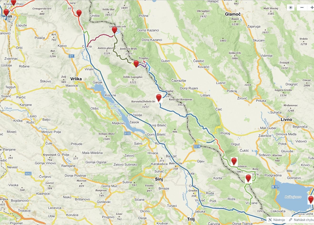
Via Dinarica climbs over Dinara, highest peak of Croatia, and then descends to the valley of Cetina and later joins with pilgrim route of Our Lady of Sinj till Bosnia and Herecegovina (I heard there will be some changes to route and will lead via mountains next year). Since we first saw this on the map we started to flirt with the idea of alternative hike via mountains. We really like hiking up in the hills and staying at high elevation if possible. And there are really beautiful mountains on the borders. So we started researching options and found trail, also called Put Oluje (relates to military operation from 1995 - Operation Storm). I don't like idea of war related naming, so we prefer to call this just Troglav and Kamešnica hike. There is not much information about this, but it appears on OSM maps and there is an organized hike every year by a mountaineering club Dinaridi. Thanks to them there are beautiful huts on the trail, open for anyone, most of them with water cisterns (very important!). Still, I was bit concerned about this hike. It is crossing state borders, there are still suspected mine areas and it is quite remote so not many people go there. For me, it was definitely an adventure.
In Knin we resupplied for 7 days as there is no option to get any food.
Blue line - official Via Dinarica going via valley Colorful line, red points - alternative we hiked via mountains
Dinara
We climbed from Knin to Brezovac much faster than expected so after lunch break at the hut we decided to continue to Dinara and sleep at Martinova košara. The hut was not very appealing to me, but it had great water source so we decided to pitch a tent outside. Just after we started cooking dinner, lovely dog (husky) came to visit us. He and his master invited us to their kuča and vrt (house and garden). He has lovely house not far from the trail and comes to Martinova košara for water as it is much better than water at his place. Young guy, in his early 20s, repaired old family property and now uses as weekend house. It was very welcome alternative for sleeping in a tent and we tasted from his dinner - delicious.
Brezovac was full. We got there beer, radler, mineral water and invitation for dinner.
Yummy strawberries everywhere
Climb to Dinara
At the top of Dinara
Almost at Martinova košara
Nor me neither Katka like the interior of the hut
Luks, lovely puppy which tried to help us with cooking/eating dinner
Evening at Nikola's place
Thank you very much for your hospitality
Source of Cetina
Descend down to Glavaš and Cetina was easy, although we struggled a bit on the section Glavaš Cetina. Easy terrain, but no visible trail nor markings and very very hot. We looked forward to Cetina source and it didn't disappoint us. Magical place, where water springs from underground in form of 100 vertical shaft or maybe more? There are still places waiting to be explored and this fascinates me here in Balkan. We gave up the idea of swimming in this place, the water was freezing cold. Besides, I would be scared to death to swim in such deep place, which is actually a cave. As all the trees have been cut here (to have better view of this natural gem), we walked a little bit along the river to find cool place for relax. It was busy with local people enjoying lovely weather and cooling drinks in the water. After I practiced my Croatian with two men, they were impressed with our hike (Slovak people do not go often here, Czech people much more), we received a tasty piece of freshly grilled pršut from them.We planned to hike to hut Rupe in the late afternoon, developing storm has forced us pack earlier. Climb is quite ok, but as the storm gets closer, we rather hide at the door of one of the ruined housed. Hiking amongst lightning is not my favourite. Rupe hut was a lovely place to sleep in, with some rain water and beautiful view, especially when sun came out after the storm.
Glavaš, old fortress on descend from Dinara
Kilogram of bacon, just enough for 3 people for 7 days
Magic Cetina source
Rupe, lovely hut, enjoying the view after storm
Pume
First time on this trip when we have to put on wet clothes plus strong wind, time for jackets. Due to strong wind we decide to hike more or less directly to another hut, Pume. We will leave Troglav for tomorrow, Kubo is very sad about skipping ridge walk from Jankovo Brdo to Troglav, so we at least hike Velika Duvjakuša instead of road. Pume hut is hut De Luxe. Water, gas, electricity, nice sitting with views - even of the sea. We decide to stay here although it is still early, but in such wind there is no point to continue. And it would be sin to skip this lovely hut.
Leaving Rupe in strong wind
Marin Bunar, the only natural water source, tasted like herbal tea
Hike to Velika Divjakusa. Ridge from Jankovo Brdo to Troglav in background
Memorial on Velika Divjakusa
Hut De Luxe
Relaxing at the hut. It had even very good cell reception
For Slovak and Czech speakers - Ne hladiti piče
Troglav
Next day we start by hiking Troglav. From the hut/road it is very short climb. Surprisingly, there is a wind shadow just on the top thanks to the steep slopes from the BiH side. Then we have choice - hike the road or trail. Problem - mine area. As we need to stick to the road or trail,I prefer the road, as it is more easy to follow. I don't have good experience with trails. I was bit nervous about this, and it felt very strange to be in place where not so long ago people were putting landmines. I felt disappointed and angry, why are people so bad and stupid? We rather decided to skip ascend to Maglaj as there was no visible trail and I was afraid to go there just following gps. We were in landmine area. Sv. Jakov hut was closed, but there was water and nice sheltered benches, ideal for night. After the sunset the wind changed its direction and we were not sheltered anymore.We planned early start as tomorrow would be very long day.
Troglav
Pano from Troglav
Descending from Troglav
Difficult decision, road or trail?
Military barrack at beginning of mine field
Opasnost, mine. Strange feeling
Mine area, trail is cleared. Safe trail corridor was marked, but I was still happy with our decision to hike the road
Our camping spot at Sv. Jakov
Mračna pećina, Kurtagić dolac, Bunarić
Hiking already at 6 am, our record, we knew it will be long day and wanted to avoid heat. First crossing the plain with sheep and then up the hill to the border with BiH. A lot of markings, some very old, some new, but trail almost no visible at all. Relying on GPS, but when GPS differed from markings, we had to pay very close attention to finding them. Three pairs of eyes were very helpful, but still we experienced few situations when we lost them and had to backtrack a lot. Everything in burning heat. Our first stop - Mračna pećina, accessible cave with excellent water. Very good spot for lunch break, escape from heat with cold water. Then we continued, again losing and finding markings till we crossed the road just under pass Vaganj and started climb to Kurtagić dolac. We passed by not very nice well with water, but didn't refil (mistake). At the top we found ruins of old hut and after another half an hour we reached new hut Edo Retelj in picturesque area of Kurtagić dolac. But there was no water in the tank. We tried to explore area with spring shown on map, but it was nothing just a hole with a lot of green plants. I believe there is some water there, few meters under, one just needs to dig. It was almost 6 pm, so we had to decide quickly. Continue via ridge to Bunarić (bunar means water well/spring) where should be some water. Almost 3 hours of hiking, but it was the best hike. Sun was slowly going down, beautiful trail, views and little bit of tension - will there be water? What do we do if there is nothing? We had cca 1 litre of water for all of us. Timing was right, we reached the hut just when it got dark. And there was water, at 1600 meters above sea level. Lovely small bunar with perfect cold water. Best drink ever. We hiked almost 15 hours, it was much longer as we expected (we didn't even dare to think we would go to Bunarić). So we enjoyed evening and slept in next day till 9 am as we had very short day ahead of us. We basically slept just under Kamešnica.
Long plain to cross, Kamešnica in the background. We had no idea we will sleep under that hill the same day
Mračna pećina, accessible cave, great place for relax in hot weather
Cool tasty water from the cave. Full of calcium?
Nothing resembling trail, thanks for the markings
Vaganj pass, road leads to local border crossing point
Markings
Wonderful Kurtagić dolac, but without water. We have to hike another 2,5 hours
One of the best hikes, ridge walk to Bunarić, Kamešnica
Descent before ascent to Bunarić. Kamešnica in the the last sun
So happy to find water
Bunar that saved us. Thank you!
Kamešnica
Deserved relax at the hut in the morning before we hike the last section of these mountains. Kamešnica and Konj, with views of large valley in BiH and Buško jezero. We dream of swimming there. Descending towards Croatian side and our last hut before we leave (now officially) Croatia. Sv. Mihovil is a recently built hut with water reservoir. Short day, but there is no point to continue.
Bunarić hut, morning relax
Hiking ridge towards Konj, Buško jezero on the right
Looking back at our ridge, BiH on the right, Croatia on the left
Sv Mihovil hut, our last hut in Croatia
Kamensko, Buško jezero
Fast descend from the hut to Voštane, famous for making pršut. We hope to buy some there, but the factory had no shop. Soon we rejoined Via Dinarica on the pilgrim route of Our Lady of Sinj and hiked to Kamensko. First real food after Knin, tasty food at the bar. We opted to hike via major border crossing Kamensko, it was fun to be walking there among cars. In BiH trail leads through more civilized areas so you can expect some shops, restaurants. Buško jezero was great for swimming. We checked Monastery of St Elijah (accommodation was too expensive for us, but had free wifi available outdoors). Wild camping at the other side was also good option for us. This was place were Tomáš, Katka's boyfriend, picked us up by car and next day we headed to family reunion in Zadar, Croatia. We spent there almost week (finally holiday at sea) and then returned back to Buško jezero to hit the trail again.
Back on Via Dinarica. Too much sun on exposed road
Some shade, thank you windmill
Dreams come true. Yesterday just a dream, today reality. Swimming in Buško jezero
Popular place for local people.
Sun setting behind Konj. Yesterday we were standing up there
Meeting with Tomáš. We enjoy having car and eating out. Heading to sea for a week break from trail.
Recovering at sea. Healthy mud from Nin to heal our bodies
Written by Lenka Syrovatkova
{source}
{/source}
{source}
{/source}
{source}
{/source}
{source}
{/source}
{source}
{/source}
{source}
{/source}
{source}
{/source}
{source}
{/source}
{source}
{/source}
{source}
{/source}
Backpacking Through Breathtakingly Brilliant Beauty
Get away from Familiar… With our Via Dinarica Trail Itinerary
The further we get from Familiar, the happier we become. Julia and I travel because we crave the personal growth that comes from discovering places and cultures that are new to us. Backpacking on the Via Dinarica Trail allowed us to do exactly that. From playfully hurdling language barriers via. impromptu games of charades, to navigating grocery stores and shops filled with unfamiliar foods, to absorbing spontaneous mountainside cheesemaking lessons (and drinking sessions), we found Balkan culture in Bosnia-Herzegovina and Montenegro to be an outpouring of warmth, hospitality and kindness.
In large, that is why we wanted to share our Via Dinarica Trail itinerary.
The geography of these countries is also breathtaking. After trekking to guesthouses that served fresh, homegrown, farm-to-table organic meals*, to homes of complete strangers who generously allowed us to camp in their back yards, and meeting a dog who adopted us, we were already talking about when we’d be back to hike more of this spectacular trail.
Mt. Maglic
What We Did – Our Via Dinarica Trail Itinerary
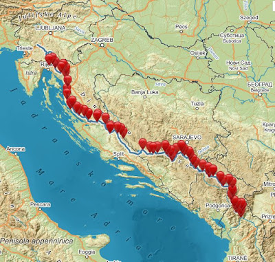
Broadly speaking, this was the route of our Via Dinarica Trail itinerary, the one you’ll read more about below.
This was our route
More specifically, we backpakced a 10-day section of this magnificent trail. Our Via Dinarica Trail itinerary took us through 138 km (86 miles) of the Dinaric Alps, totalling an elevation gain of about 8,000 meters (26,200 feet). We started in Bosnia-Herzegovina at Sutjeska National Park and ended in Montenegro just shy of Biogradska Gora National Park. A few of our days were quite flat, but most had steep ascents yet moderate descents. The breathtaking terrain ranged from dense pine forests to flower carpeted mountain pastures to alpine zones dotted with emerald lakes to forest-ponds teeming with fish.
Guide-Free
We didn’t hire a guide, as we love the thrill of navigating trails on our own, even if it means getting into some minor pickles. Given the fact that the trail is occasionally difficult to follow, we did indeed get into a few tough spots, but with both our GPS and paper maps, we ended up just fine. If you follow our Via Dinarica Trail itinerary, you’ll certainly be able to avoid some of the mistakes we made.
Go Now – But Read This First
In a sentence, we highly recommend this stretch of the Via Dinarica Trail. This wellspring of cultural experiences as well as sheer natural beauty is still largely undiscovered by mainstream tourists, so go as soon as you can. But before setting out on your own, make sure to also read 12 Things to Consider Before Hiking the Via Dinarica Trail, as there are a number of planning and logistical details you’ll definitely need to think about to ensure you have a safe and enjoyable trek.
In the meantime, here is our Via Dinarica Trail itinerary.
Day 1: Suha to Prijevor Huts on Mt. Maglić (in Sutjeska National Park) – 5 km (sleeping elevation: 1692 m) (Via Dinarica Trail Stage 37)
Sutjeska National Park Via Dinarica Trail Itinerary
Valley up to Prijevor Huts in Sutjeska National Park
We started trekking in Sutjeska National Park via the Suha entrance. We spent the majority of the day picking our way up the left side of this valley, and we didn’t have to worry about protecting ourselves from the sun, as the old growth forest provided us with ample shade. Had we not been in the cool shade of the trees, the steepness of this section of trail would have been significantly more challenging than it already was.
In the blink of an eye, the trees ended, and towering before us at 2386 meters (7828 feet) was Mt. Maglić, Bosnia-Herzegovina’s highest peak. Standing at it’s base, I was acutely aware of how small I am in relation to our beautiful world and universe. Simultaneously however, I was peaceful, calm and completely clear in my mind. The medicinal power of mountains is miraculous.
Prijevor Huts
This Via Dinarica Trail itinerary would NOT be complete without mentioning the Prijevor Huts. By early afternoon, we arrived at the Prijevor Huts. Each hut sleeps 6 people, has a toilet, running water and best of all, a wood burning stove. For me, there are few things more enjoyable than slowly drifting off to sleep in a cozy mountain top cabin while being gently warmed by a wood burning stove. And that night, that’s exactly what we experienced!
Cheesemaking on the VDT
The next morning, Randovan gave us a cheese making lesson. We met Randovan the previous afternoon and learned that he is a herder who seasonally lives and pastures his flocks near the huts in his katun (a summer cottage in the mountains used by shepherds in the Balkans).
During the lesson he milked his 8 cows, boiled the milk (letting us taste the hot milk at the various stages along the way) and then showed us how to make about half a dozen different kinds of cheeses. All the while, he fed us fresh soft chunks of freshly finished cheese, and he gave me shots of plum brandy, loza.
Although I wasn’t particularly keen to take shots at 9:30AM, I didn’t want to be rude, so I did my best to refuse as politely as possible, but I must admit, by the time we started hiking about an hour later, I was a little bit buzzed and and most certainly full with cheese. Radovan’s hospitality was second to none.
Day 2: Prijevor Huts to Mratinje -13 km (sleeping elevation: 1200 m) (Via Dinarica Trail Stage 37)
The next day we hiked down to the road, and we found some locals selling fresh picked mountain blueberries! For a little more than US$1, we snacked on a couple of pints! If you do use this Via Dinarica Trail itinerary, try your best to get some blueberries too!
Reservoir Near Martinje
To make a LONG story short, we had to take a bus to Martinje where we hiked along this aqua marine beauty of a reservoir. To find out why we were not able to cross the border from Bosnia-Herzegovina into Montenegro through the mountains, check out 12 Things to Consider Before Hiking the Via Dinarica Trail.
Entry to Martinje
Naturally, the town Martinje is near the Mratinje dam. It’s a quaint farming town nestled in this mountain valley.
Incredible Hospitality
Sleeping in a Strangers Driveway
Although we planned to camp by a mountain lake this night, we ended up camping in this person’s yard! On our way to the lake, one of the local men communicated to us that the lake was too far off to reach before dark. We didn’t want to risk losing the trail (some sections were not well marked), so we asked the man where we might be able to spend the night. In an instant, he gestured to this driveway, so we set up camp. Then a moment after we had finished, he left! A few minutes later other people arrived at the house, and we realized that the man must have told us we could sleep in his neighbor’s yard! We found this hilarious in retrospect, but a little awkward at the time. Oh well.
Day 3: Mratinje to Farm House – 12 km (sleeping elevation: 1250 m) (Via Dinarica Trail Stage 38)
Mratinje Dam
Hiking out of Mratinje, we had to cross the Mratinje Dam through the Piva Canyon. If you’re scared of heights, close your eyes on this part, as you’ll be 220 metres (720 ft) above the river! But if you’re not, you’re in for a scenic treat.
Scrambling up Piva Canyon
Getting from the base of the dam, up to the Piva Plateau, we had to complete a MASSIVE climb. Much of the time we scrambled up rock slides and extremely overgrown sections of trail. Make sure you have GPS capabilities for this section. We go into detail about this and more in 12 Things to Consider Before Hiking the Via Dinarica Trail.
Getting Lost (We Didn’t Have this Via Dinarica Trail Itinerary Yet!)
Super lost in Piva Canyon
And when we say ‘massive’, we really mean it. From the dam to the plateau, we would have climbed 650 meters (2,100 feet) in 1.6 km (1 mile), if we hadn’t gotten terribly lost. But, we did get terribly lost, and we ran out of water. Our GPS was a savior in this situation, and this Via Dinarica Trail itinerary would not be complete without the recommendation to BRING A GPS device, or two. We weren’t quite yet at point of needing to use our paper maps and compass, but we were pretty darn lost. So again, we really recommend you have GPS capabilities for at least this section of the trail and better yet, for the entire thing.
Arriving at the Farmhouse in the Nick of Time
More Hospitality
By this point, we were quite dehydrated, and there were dark clouds quickly moving towards us, but we made it to this farmhouse just before it started to rain. This home is listed on the VDT website as a place to get water, but what was not on our Via Dinarica Trail itinerary was the elderly couple living here who were kind enough to let us camp in their yard. Thankfully we were able to rehydrate and set up camp before the storm. While we were setting up our tent, they even brought us hot coffees and a beer! Trail magic like this is always the best.
4: Farm House to Guest House Nedajno – 18 km (sleeping elevation: 1400 m) (Via Dinarica Trail Stage 39)
The Piva Plateau – Heading into Nedajno
The Piva Plateau is STUNNING! Its rolling hills are dotted with fresh green farms and fade into distant mountains, forming a seemingly endless carpet of pastoral beauty.
Guesthouse Nedajno
Arriving at Guest House Nedajno
Guesthouse Nedajno* was one of our favorite stops along the trail. This family owned and operated guest house has a capacity of ~15 guests, so it’s a small and intimate place as well as a great one for getting a real taste of Montenegrin culture. It’s also very affordable. For one person’s meals (which were massive, we probably could have shared) and accommodations we paid just under €20 (US$23).
Organic food at Guest House Nedajno
Guest house Nedajno serves scrumptious organic food. From meat dishes, to cheeses, to vegetable ones too, they can accommodate just about any dietary needs.
An Organic Feast
Guest House Nedajno’s home cooking
And again, their portions are MASSIVE. This plate of Ćevapi, a type of skinless minced meat sausage, potatoes, homemade cheese and lamb soup (not pictured) was for one person. By the end of our meal here we were not only stuffed, but infinitely satisfied.
Guest House Nedajno’s Organic Garden
To top the sheer deliciousness and size of the meal was the fact that everything they serve is organic and sourced from either their own backyard or from within 1.5 km (1 mile) of their guesthouse. We only spent one night here, but we wish we had planned to spend a few more.
Day 5: Guest House Nedajno to Planinarski Dom Mountain Hut (Škrčko Jezero – Durmitor National Park) – 13 km (sleeping elevation: 1800 m) (Via Dinarica Trail Stage 39)
Sušica canyon
Although we descended quite a bit while trekking to the bottom of Sušica canyon, the entire hike down was via a mountain road, so it was quite gentle on our knees.
Durmitor National Park
At the bottom, we reached the entrance to Durmitor National Park. The entry fee was €3/person, so it was a good thing we had some money with us.
Nearing Škrčko Jezero
Within Durmitor, we headed to Škrčko Jezero (lake). The climb up to the lake was pretty grueling, but it switch backed enough to keep us from having to take too many breaks. Indeed, slow but steady pacing worked perfectly for us here.
Durmitor National Park Via Dinarica Trail Itinerary
As we continued to gain elevation, the scenery became increasingly breathtaking. Little did we know at this point that the next day we’d be going nearly straight up the wall you can see on the left.
Škrčko Jezero
And then finally, we made it! Refreshing, cool and crystal clear, Škrčko Jezero is quite possibly one of the most beautiful alpine lakes I’ve ever seen. We went for a swim, lounged in the sun, and savored the accomplishment of hiking all the way up there.
Mountain Hut Planinarski Dom
Planinarski Dom Mountain Hut
To our surprise and delight, Planinarski Dom Mountain Hut had room for us to stay that night! We had planned to camp out, but we wanted to get an early start for a big climb we had the next morning, so we decided to sleep in the hut and thus save the time of breaking camp in the morning.
Day 6: Planinarski Dom Mountain Hut (Škrčko Jezero – Durmitor National Park) to Žabljak – 13 km (sleeping elevation: 1300 m) (Via Dinarica Trail Stage 39)
Škrčko Jezero in the Morning
As planned, we got up early, passed by Škrčko for one final goodbye, and then we started to climb, straight up.
Massive Planinica
Ascending Mt. Planinica
While Julia looks quite happy at this resting spot, I must admit that we were both pushed nearly to our limit on this ascent up Mt. Planinica. We climbed 610 meters (2,000 feet) in 1.4 km (0.9 mile). This was by far the most challenging stretch of trail on our trek. Later on, we found out there are more gentle routes up Mt. Planinica, and we discuss those in 12 Things to Consider Before Hiking the Via Dinarica Trail.
Into Zabljak
Heading Into Žabljak
However, the hardcore climb up Mt. Planinica was well worth the views at the top. They. Were. Stunning! And the weather could not have been more perfect. Off in the distance, we could see Žabljak, the town in which we’d take a zero day (a rest day), so with a bit of extra pep in our step, we made the 7 mile descent into town. This one was markedly harder on our knees though, and by the time we arrived, we were ready for an extended rest. If you decide to use this Via Dinarica Trail itinerary when you head out to the VDT, consider skipping this massive climb if you’re not into a ass-kicking workout. However, in retrospect, I’m glad we did it, and I’d definitely take this route again.
Day 7: Zero Day in Žabljak – 0 km (sleeping elevation: 1300 m)
Black Lake in Žabljak
On our zero day in Žabljak, we slept in late, ate lots of good food and took a gentle stroll around Black Lake. Flitting around without our packs was luxurious, and the lake was gorgeous! I sure love hiking, but zero days are fantastic too.
Day 8: Žabljak to Zminica Jezero – 14 km (sleeping elevation: 1300 m) (Via Dinarica Trail Stage 40)
A Dog Adopted Us
After a zero day in Žabljak, we were resupplied and nicely rested, so we hiked onward. On our way, this dog started following us. We didn’t think much of it, as there were a good number of other farm dogs we’d seen along the trail.
Picking Berries on the Via Dinarica Trail
While we only took one picture of these wild mountain strawberries, we could have taken dozens more. The section we hiked on the Via Dinarica Trail was thickly lined with strawberries, blueberries, blackberries and raspberries. No wonder this is Grizzly country.
Zminičko Jezero
After a relatively effortless 16km (10 miles) on flat terrain, we arrived at Zminičko Jezero. The picture above is indeed of the lake, but it was taken the next morning. The night we arrived, we were quite abruptly greeted by an intense thunder and lightning storm. Think ‘discotech’ to understand how much lightning we experienced. Frankly, it was terrifying, but there was nothing we could do other than stay low in our tent and hope for the best. Clearly and thankfully, we made it out unscathed, albeit a little wet.
Day 9: Zminičko Jezero to Guesthouse Zabojsko Jezero – 18 km (sleeping elevation: 1500 m) (Via Dinarica Trail Stage 40)
Open fields on the Via Dinarica TrailAfter our restless night in the thunder and lightning storm, we were glad to experience blue skies again.
Guesthouse Zabojsko JezeroWe were surprised to arrive at Guesthouse Zabojsko Jezero*, as we hadn’t noticed it on the maps when we had been researching our route, and actually stayed in one of the rooms near their restaurant. Thus, we’ve included it in our Via Dinarica Trail itinerary! We were planning to camp this night, but since we did not sleep much the night before, and since we were still a bit shell shocked from all the thunder and lightning, we opted for this cute little A-frame instead. For €10/person we not only got to sleep in the little cabin, but we also got another organic, locally sourced and homemade meal. We were on cloud 9!
A Frog Hatch on the Via Dinarica Trail
We felt thrilled both to be a guesthouse and to see this tremendous frog hatch! There were tens if not a few hundred thousand newly born teeny-tiny frogs hopping just about anywhere we looked. We had to delicately pick our way back to the guesthouse to avoid squashing any of them.
Day 10: Guesthouse Zabojsko Jezero to Mojkovac – 32 km (sleeping elevation: 1000 m) (Via Dinarica Trail Stage 40)
Big Blue Sky on the Via Dinarica Trail
After we left Guesthouse Zabojsko Jezero, we encountered a lot of wide open fields. We felt thankful for our GPS capabilities on this stretch of trail. This was because many of the trail markers had been painted on rocks, and many of those rocks were hidden in the tall grass.
Endless Fields on the Via Dinarica Trail
This stretch of trail was stunningly beautiful, but it would have been nearly impossible to follow without GPS. We highly recommend you bring GPS when hiking on the VDT. For specifics on this as well as other planning and logistics you ought to consider before hitting the trail, make sure you read 12 Things to Consider Before Hiking the Via Dinarica Trail. As an aside, can you see our friend hiding in the picture?
Via Dinarica Trail Via Dinarica Trail Itinerary
If you couldn’t see it in the last photo, our canine friend was still following us! In fact, she followed us for 3 days and nearly 50 km (30 miles)! Although she got a few bulls to charge us, we grew to love her and even considered taking her back to Hong Kong with us. When we eventually had to say goodbye to her, it was tear jerkingly tough.
A View before Mojkovac
Wanting More
As we reached the final few miles of our journey we realized the Via Dinarica Trail is unrelentingly beautiful. Unrelentingly. Although we thought hiking nearly 100 miles of of the VDT would satisfy our desire to explore it, our hike only served to intensify it. We are certainly planning to hike more, if not all, of this spectacular trail, and we highly recommend it to anyone who loves the great outdoors.
So there ya have it, our Via Dinarica Trail itinerary has come to an end! However, don’t attempt it without proper planning. If you’d like to learn what we learned, and potentially avoid making some of the mistakes we made, definitely check out 12 Things to Consider Before Hiking the Via Dinarica Trail.
Source https://www.forsomethingmore.com/via-dinarica-trail-itinerary/
{source}<script type="text/javascript" src="https://trail.viadinarica.com/en/tour/long-distance-hiking/via-dinarica-white-trail/17291189/tour2go"></script>
{/source}
{source}
{/source}
{source}
{/source}
{source}
{/source}
{source}
{/source}
{source}
{/source}
{source}
{/source}
{source}
{/source}
{source}
{/source}
{source}
{/source}
On Top of the World in Sutjeska National Park
This past summer we hiked a 10-day section of the Via Dinarica Trail (VDT), so we decide to write this Via Dinarica Trail Guide! Our route on the VDT took us through 138 km (86 miles) of the Dinaric Alps, totalling an elevation gain of about 8,000 meters (26,200 feet). We started in Bosnia-Herzegovina at Sutjeska National Park and ended in Montenegro just shy of Biogradska Gora National Park. A few of our days were quite flat, but most had steep ascents yet moderate descents. The breathtaking terrain ranged from dense pine forests to flower carpeted mountain pastures to alpine zones dotted with emerald lakes to forest-ponds teeming with fish. If you want more details about our route, read Our Via Dinarica Trail Itinerary.
And, while we had an absolutely fantastic time, we definitely learned some things along the way! We’ll share those with you down below in our Via Dinarica Trail Guide, so that if you decide to set out on this incredible route, you’ll have a smooth and satisfactory experience.
But first, a bit of background on the Via Dinarica Trail and the Balkans.
Hiking in the Balkans?
A mere 20 years ago it would have been quite impossible to safely hike in the Balkans. Yugoslavia was in the midst of a bloody war, and as its republics were at war with one another, it would have been unlikely if not downright dangerous to try and cross from one into another.
Fast forward 20 years however, and now the Via Dinarica Trail (VDT), a nearly 1,200 mile route following the spine of the Dinaric Alps actually weaves its way through many of those previously warring republics. The trail starts in Slovenia and goes through Croatia, Serbia, Bosnia and Herzegovina, Montenegro, Kosovo, and terminates in Albania.
The trail covers terrain ranging from limestone karst fields, to flower carpeted alpine pastures, to steep and rugged river canyons to dense pine forests to alpine zones dotted with emerald lakes to forest-ponds teeming with fish. It’s spectacular, and it’s largely undiscovered by mainstream tourists, so we recommend you go now.
1. Pack Right but Pack Light: Our Gear List
I’ve thru-hiked the entire 2,200 mile Appalachian Trail, I’ve thru-hike nearly the entire 273 mile Long Trail, I’ve backpacked in countless other places across the United States, and I’ve also done a good bit of backpacking in Asia as well as Europe. In my 20+ years of experience, I’ve discovered 2 things about packing. (1) Light packs make happy hikers and (2) people tend to pack their fears.
If you can leave some of your fears at home and trust in my experience, the list below details exactly what you need to safely and comfortably hike a section or even the entire Via Dinarica Trail. This Via Dinarica Trail Guide is quite comprehensive.
This is all the stuff my wife and I used this past summer, and we know it’ll be sufficient for you too.
Via Dinarica Trail GuideJulia and My Timetested Gear
Linked below are the exact items we used and/or recommend.
Clothes Gear List
The bottom line is you need one pair of clothes to hike in, and one to sleep in. I know this might sound nasty, but anything you wear while hiking is going to get sweaty and dirty right away, and therefore extra clothing will just be unnecessary pack weight.
Hiking Shoes: Julia’s, Seth’s
Low Cut Wool Socks (2 pairs per person): Unisex option
Zip Off Pants, non-cotton (1 pair per person): Female option, Male option
Quick Dry T-Shirt, non-cotton (2 per person): Female option, Male option
Quick Dry Underwear (2 pairs per person): Female option, Male option
Raincoat (1 per person): Female option, Male option
Rain Pants (1 pair per person): Female option, Male option
Long underwear top, non-cotton (2 tops per person): Female option, Male option.
Long underwear bottom, non-cotton (2 bottoms per person): Female option, Male option
Down Parka (1 per person): Female option, Male option
Wool Hat, mid-weight (1 per person): Unisex option
Light Gloves, smartphone friendly (1 pair person): Unisex option
Waterproof Mitten Shells (1 pair per person): Unisex option
Hats for sun, with neck flaps (1 per person): Unisex option
Hiking Gear List
A Via Dinarica Trail guide wouldn’t be complete without a gear list. So read on
Via Dinarica Trail GuideHiking and Sleeping at Elevation Means You Need the Right Gear
To the extent that you can afford, but the lightest weight gear you can. Again, light packs make happy hikers! For some of these items, such as the hiking backpacks, sleeping bags and pads, the most important thing to consider when buying them is comfort and fit. For those items below, we’ve linked to the things that fit us best, but make sure to try a bunch of different options before settling on a pack, sleeping bag and pad. Also, these are our affiliate links, but we fully endorse all of these products, otherwise, we wouldn’t have included them here!
Hiking backpack (one per person): Julia’s, Seth’s
Sleeping bag (one per person): Julia’s, Seth’s
Sleeping pad (one per person): Unisex option
Hiking poles (one pair per person): Unisex option
Stove (one per party)
Fuel bottle (one per party)
Cooking Pot Set (one per party)
Cooking utensils (one set per party)
Sponge
Water purifier (one per party)
Back up water purification method (one per party)
1L Wide mouth water bottle (2 per person)
3L Water storage container (one per party)
Matches/lighter
Spices
Biodegradable Soap
Spoon/Fork/Knife (one set per person)
First Aid Kit
Parachute Cord 50’ (one bunch per party)
Trowel (one per party)
Toilet Paper
Toothbrush
Headlight (one per person)
Camera
Knife
Compass
Tent (one per party)
Packtowl (one per party)
Pack cover (one per person)
Inflatable Pillow (optional, one per person)
Nylon stuff sack(s) to make bear bags
Emergency whistle
2. Get Cross Border Permits
***Quite possibly the most important section of this entire Via Dinarica Trail guide is right here.*** We almost learned this lesson the hard way. To make a LONG and boring story short, you most likely need cross border permits to cross any international border on the Via Dinarica Trail. Let me explain.
Via Dinarica Trail Cross Border Permits Via Dinarica Trail GuideGet Cross Border Permits
Follow along by looking at the above map. Originally, we planned to follow the string of yellow stars up to the huts on Mt. Maglic, cross from Bosnia Herzegovina into Montenegro via the Via Dinarica Trail, and then continue hiking south.
However, on the morning we were scheduled to start our hike, we discovered we should have applied for cross border permits (we should have done this weeks before) in order to legally cross into Montenegro from Bosnia Herzegovina. Although some locals said we didn’t need such permits, we didn’t want to take the chance of being fined and/or thrown in jail for making the crossing illegally.
So, what we ended up doing is: On day 1 we started at the road and hiked up to the huts. We slept up in the huts, and they were beautiful! Check out Where to go Trekking in Bosnia and Montenegro for more about that. On day 2 we hiked from the huts back down to the road. Then, we took a bus north to Foca and then south to the formal border crossing. At the border, we got entry stamps in our passports, and then we rode the bus a little further. We got off the bus, and we actually hiked back up the trail in the opposite direction. Even though hiking in the opposite direction meant on day 3 we would have to retrace our steps, we didn’t want to miss this beautiful stretch of trail.
So, I’m now thinking that I didn’t make this long story short, but the moral is: make the choice to get the permits, or not, based on your own personal risk tolerance. This company, Zublo, can help you with the process.
3. Have GPS Maps and Paper Maps
A Typical Trail Marking Trail Marking Via Dinarica Trail GuideA Typical Trail Marking
Almost as important as cross border permits are GPS and paper maps. While the Via Dinarica Trail is gorgeous, it’s often times VERY difficult to find the trail markings. On the stretches of trail that go through national parks, the trail is well marked by a red circle filled with white.
Via Dinarica Trail Hard to Follow Trail Via Dinarica Trail Guide
Beautiful but Hard to Follow the Trail Here
However, outside of the national parks, the trail is often NOT well marked. Further, much of the trail goes through tall grassy pastures. In those sections, the trail markings (which are often painted on rocks) are completely obscured by the tall grass.
Via Dinarica Trail Website Via Dinarica Trail Guide
Via Dinarica Trail Website for GPX Files
I highly recommend you download the GPX files of the stretches of trail you’re planning to hike, upload them into Google Maps, and then drop pins every few hundred meters along the trail. You can find the GPX files on the VDT website. This process is tedious, but it saved our butts, countless times. For more info on how exactly to do this, check out this video about Plotting Courses Using Google Maps.
Although there are paper maps for the national parks through which the trail runs, as of July 2017, I couldn’t find any paper maps that specifically cover the Via Dinarica Trail. So, I made my own by screenshotting and the printing the topo maps that you can find on the VDT website.
4. Consider Guesthouse/Hut Hopping
Via Dinarica Trail Planinarski Dom Mountain Hut Via Dinarica Trail GuidePlaninarski Dom Mountain Hut
If you plan your trip carefully, it’s possible that you won’t actually have to spend too many nights sleeping in a tent. I like camping out, so I’m not too concerned about this, but if you do want to hut hop, again, you can look at the maps on the VDT website, and you’ll be able to find a guesthouse/hut about every 10-20 miles (16-32km).
5. Bring Along a Small Stash of Cash
Via Dinarica Trail Bring a Small Stash of Cash Via Dinarica Trail GuideBring a Small Stash of Cash
It never hurts to have a little cash with you, but make sure you have the proper currency for the country you’re in. Bosnia Herzegovina uses the Bosnian Convertible Mark (BAM). Montenegro uses the Euro (EUR). The national parks we entered had a 3 Euro fee. There were also a few spots along the trail where we encountered some small country shops, and it was nice to be able to buy a little snack. There was even a point in a town where we needed to catch a taxi. You never know what unexpected expenses may pop up, but one thing you can be certain of is that there are no ATMs way up in the mountains. We think if you bring the equivalent of US$50-100 in the local currency you will have more than enough money.
6. Download Some Translation Apps
Via Dinarica Trail Google Translate was a Lifesaver Via Dinarica Trail GuideGoogle Translate was a Lifesaver
A Via Dinarica Trail Guide in 2017 wouldn’t be complete without some technology tips. For us, the experience of hurtling a language barrier usually falls into one of two categories: (1) comical and playful or (2) nightmare. We’ve found, the more planning we do up front, the more often we’re in the first category. Again, find out the local languages and plan accordingly. Google translate works offline for some languages, but not for others. Fortunately, we were able to use it for both Bosnian in Bosnia Herzegovina and Croatian in Montenegro.
7. Bring Thank You Cards (or Lightweight Thank You Gifts)
Via Dinarica Trail So Much Hospitality Via Dinarica Trail GuideSo Much Hospitality
Along the trail we were show an overwhelming amount of hospitality. We were taken into people’s homes when it was raining, we were given coffee and beer, we were allowed to camp in people’s backyards, and we were even given a mountainside cheesemaking lesson (if you want to read all about it, check out Where to go Trekking in Bosnia and Montenegro), yet all we had to offer were words of thanks and some dried meat we had in our packs.
Via Dinarica Trail Mountainside Cheesemaking Lesson Via Dinarica Trail Guide
Mountainside Cheesemaking Lesson
Certainly, none of the kind people along the trail were expecting anything, but a simple thank you card would have been perfect. Next time we set out, we might even bring some lightweight gifts such as herbal tea and spices to give as small thank you gifts.
8. In a Pinch, Wave a Bus
Via Dinarica Trail Wave to Flag Down a Bus Via Dinarica Trail GuideWave to Flag Down a Bus
Up in the mountains of Montenegro, things are pretty informal. While hitchhiking isn’t particularly common, and thus we struggled to thumb rides, we were quite successful at waving down busses. And while hitchhike isn’t hiking, this Via Dinarica Trail Guide wouldn’t be complete without this piece of advice. Basically, we were able to stop a coach bus, and hop on (for free) until the next stop. Keep in mind, up in the mountains there aren’t many formal looking bus stops, so we just waved when one was coming by, and voila!
9. A Little Difficult for Vegetarians
Via Dinarica Trail A Typical Meal of Meat and Potatoes Via Dinarica Trail GuideA Typical Meal of Meat and Potatoes
While there were a few places where we had some small salads, the majority of the food we encountered along the trail was quite literally, meat and potatoes. If you’re a vegetarian, be prepared to eat a lot of bread and cheese, which is actually not too bad of a charge.
Via Dinarica Trail Kaymak Cheese Via Dinarica Trail Guide
Kaymak Cheese
The bread and cheese in both Bosnia Herzegovina and Montenegro were incredible. If you have a chance to sample some Kaymak, this creamy cross between butter and goat cheese was so delicious that we ate it by the spoonful!
10. Be Mindful of Water Sources
Via Dinarica Trail Maratinje Reservoir Via Dinarica Trail Guide
Maratinje Reservoir
Some parts of the trail had ample water sources, and others were quite dry. We never had to spend the night at a dry camp (a campsite without a nearby water source), but that is because we did some careful planning up front. Use the topo maps on the VDT website as well as Google Earth to locate water sources, and plan your route accordingly. And of course download this Via Dinarica Trail Guide, so you can use it in the back country.
11. Watch Out for Wildlife
Via Dinarica Trail A Possible Bear Track Via Dinarica Trail GuideA Possible Bear Track
Much of the Via Dinarica Trail goes through Grizzly country. While we never encountered any large mammals, and certainly not any bears, we made sure to put anything with a strong odor (toothpaste, soap, food, etc.) into bear bags and strung them up in tall trees each night.
Most often, bears will not bother you unless you startle them. To reduce the chance that you’ll sneak up on bears or other animals, singing some songs, banging sticks together, or even hooking a small chain of bells to your pack are all effective ways to make noise and thus to keep the bears away.
12. Emergency Preparedness
A Via Dinarica Trail Guide needs to include these safety tips. The medical facilities in the capital of Bosnia Herzegovina and Montenegro, Sarajevo and Podgorica respectively, are quite good. However, out in the more rural areas, the ones you’ll be in if you’re hiking on the Via Dinarica Trail, are less robust. To this end, we brought a small yet comprehensive first aid kit with everything from basic bandages to some simple oral antibiotics (and guides about when/how to use them, such as this one).
We also strongly suggest you bring a cell phone. Buy a sim card before you head to the hills, and in an extreme emergency, you can dial 122 in Bosnia Herzegovina as well as Montenegro for the Police.
A Via Dinarica Trail Guide is Good, but Get Hiking!
So there ya have it, our Via Dinarica Trail Guide! After our nearly 100 miles, we’ve come up with these 12 bits of advice. If you’d like more details about our trek check, again, read Our Via Dinarica Trail Itinerary, and then lace up our boots!Source https://www.forsomethingmore.com/via-dinarica-trail-guide/
{source}
<script type="text/javascript" src="https://trail.viadinarica.com/en/tour/long-distance-hiking/via-dinarica-white-trail/17291189/tour2go"></script>{/source}{source}{/source}{source}{/source}{source}{/source}{source}{/source}{source}{/source}{source}{/source}{source}{/source}{source}{/source}
Right after we returned from our first long distance hike Te Araroa, we felt we want to continue. One month at home (skiing in fresh snow in May!) and we were getting ready for new challenge - Via Dinarica. It is a young trail/initiative that connects existing trails and trails-to-be over the ridge of Dinaric mountains.
Comparing to New Zealand, we had to consider few other challenges. Scarcity of water in karst mountains, dangerous wildlife (especially bears), landmines, sad reminder of recent war in former Yugoslavia, and less available info about the trail (not many people hiked this and even less published something online - Thanks Eva and Claire!).
We inspired Katka by our last adventure, so she was brave enough to ask for unpaid leave and happily joined us for whole trail. She is Kubo's sister and my good friend and we have plenty of outdoor experience together, so it was a welcome member of our group.
We hiked Via Dinarica from June to August 2017 from Croatia - Rijeka/Risnjak to Albania - Valbone plus our extension to Curraj i Eperm. We walked it continuously on feet and even hiked sections which are suggested to be skipped (as they are not officially open yet). If we had to hitch/take taxi to town for resupply, we got back to the same spot and hiked on. We took our time, enjoyed zero days (even holiday by sea) and took a detour if it was worthy.
I am writing posts now, in September 2017, but I will backdate them. Going forward (for any new hike) I would love to update blog on the go.
Author Lenka Syrovatkova
{source}
<script type="text/javascript" src="https://trail.viadinarica.com/en/tour/long-distance-hiking/via-dinarica-white-trail/17291189/tour2go"></script>
{/source}
{source}
{/source}
{source}
{/source}
{source}
{/source}
{source}
{/source}
{source}
{/source}
{source}
{/source}
{source}
{/source}
{source}
{/source}
{source}
{/source}
Buško jezero
Getting back to trail after lazy week by the sea is the biggest challenge. Thanks to Tomas we have a comfortable ride to Buško jezero and after tasty meal (cooked on big camping stove) we continue the hike around the lake almost in the evening. We find a camping spot just before the big road and tomorrow's trail head. It is also accessible by car (it means more good food cooked at Tomas' stove) and it is popular with local foxes as well. They were not shy at all and we had problems with forcing them to go away. Fortunately, the night was very peaceful.
Old bridge and Konj mountain
<
This could have been very nice spot for picnic... Last year it was still standing (found picture in Gerald's blog)
Orlov kuk
Hiking on the top of mountain plateau sounds fine, but not in such hot weather. At least the wind is blowing and there is a new road, probably due to construction of wind mills, so hike is easy (almost boring). There are Samograds (Big and Small) along the way, huge karst holes and Jakub is very keen on exploring them. We find a very tasty spring just before Bukovica, is it a sign that the water situation in BiH is better? Oh, how wrong I was. We enjoy cool air in the natural church cave and then pizza in the village. During first stages in BiH you don't have to worry about finding places with good food or drink. As it is still quite early, we decide to continue hike and do some kilometers from next section. Huge climb to Orlov kuk is beautiful at almost sunset. We hope to find some water in the small valley, there is usually a stream and we have additional 3 springs from outdooractive. This summer is really hot and dry, so no water in stream and we explore the valley for the springs, but no luck. On the other side, we find Klisac spring, but this is one is inaccessible, under heavy concrete block. We even tried to lift it, but no luck. Very demotivating to hear the water, but not be able to get it. We still have some water, 2l per person, but it is not enough for cooking. So we eat only bread for dinner and breakfast and we hope that tomorrow we find something. There is "just" one hill, Svinjar, before we hit the road with some houses. I text Tomas (he still kind of supports us with his car), so hopefully we meet tomorrow at the road with some water. The camping spot is beautiful, even with tables, just that water...
Hiking on the plateau, on the new road. Approaching mountains, yes (in the background)
One of Samograds, impressive karst holes on almost flat plateau
Windmill in construction? Reason for the new road we hiked
Spring before Bukovica, my hope that water situation is getting better
In front of cave, natural church - great place for a break
Orlov kuk with Maria and Joseph cross
Valley under Orlov kuk, in dry summer we couldn't find any water. Our first dry camp
Svinjar + car trip to Masna luka
We hike a nice field road to the hut we saw already yesterday. Looks like being renovated, but no one is there. I am sure if someone was there, they would give us some water. So, despite my bad feeling, we take some water from their water cistern. I am sure they wouldn't mind, I hope so. Then we climb to Svinjar and enjoy views of Vran, our next hike. Descending down we meet Tomas and Katka, they didn't get my text about lack of water, and continue to the road together. My heel aches a lot, so we decide to take a half day off and use the car. Of course that we will return back to the same spot to continue our hike;). We ride along Blidinje lake, which turns out to be very muddy, so I am not sure if my feet are cleaner or more dirty after the washing. And we fall in love with restaurant Hajducki Vrleti. Very busy, but great food, enormous portions, great price. We also visit necropolis and Masna luka, magic place with monastery (wifi!), nice spring Jasle (finally I can wash my feet) and also big camping place next to the hut which is now overcrowded with probably all planinars (hikers) from Bih, Croatia, maybe also Montenegro? That just proves that people here are very social and they enjoy organized hikes with their clubs or federation of clubs. Oh, everything is so close when riding in car. For night we get back to Via Dinarica trail and find nice spot close to the road, right on the trail head. Still eating leftovers from the restaurant, very yummy.
Hut under construction with water cistern
View of Pločno (Čvršnica) and Blidinje lake
Muddy Blidinje lake
One of many Necropolis sites in BiH
So many planinars! Busy campsite at Čvršnica foothills
Lovely monastery at Masna Luka
Vran
Today we enjoy very light hiking. Tomas decided to stay one more night so we agree on meeting at Hajdučki Vrleti (our favourite restaurant). It means we take only few things and head towards Vran. Hiking through two little "villages" and then finally we start a climb. Thank you very much for the trail maintenance, without it the hike through dwarf pines would be very hard. And we find our first trail heart:) After Mali Vran and Vran we decided to hike off Via Dinarica and instead of descend we continue on the ridge towards Bijela Glava. This is a little bit more difficult, but worth it. In the end we skip the detour to Veliki Vran and rush ourselves down, towards the restaurant. It is even more busier than yesterday, but the food is still great. Then we ride by car to camp at Masna Luka. Jakub is crazy, he cannot stand breaking the continuity of the trail, so he hikes the missing kilometres on the road. I am ok with car ride, after such heavy dinner I cannot imagine walking. It is Sunday, so only few people stays in the camp. It is very difficult to resist their invitation for dinner, but after Hajdučki Vrleti it is impossible to eat something more. Tomorrow is going to be a tough day, we are finally in Čvršnica!
Light hiking through Omar, Vran behind
First trail heart, loving it :)
Little bit windy view of next section - Čvršnica
Thanks for the trail maintenance. On the ridge after Vran (not part of VD) it was a little bit more challenging.
Rushing down to Hajdučki Vrleti, plenty of good food!
Veliki Vilinac
Tomas is heading back home today and we head into new mountain range. I was little bit nervous as we read not very encouraging reviews about this section, especially about the trailhead. Trail is difficult to find, not marked, not maintained... We were confused a lot as there are more options how to get into Čvršnica and some comments on Outdoor Active were contradicting the gps track. Then we realized that gps track has changed, so comments were outdated. This is one of big disadvantages in the Outdoor Active (which is otherwise very useful) - gps track can be updated, but there is no record of that. So we did a lot investigation and chose the trail starting at the monastery and headed to Boričevac where we joined official VD track (as of July 2017). Navigation was not a problem.
We made a detour to Pločno, the highest peak. We hiked an impressive eastern face, but the the top can also be reached by road from the other side as this is military area. We thought that the shabby buildings are no longer used so we freely wandered around looking for some shelter. In just few minutes a soldier came out and told us we shouldn't be there at all. Someone has seen us on the webcam and he is supposed to make sure no one approaches this area. Fortunately, we were out of webcam sight so he let us rest there. Our first meeting with army, even though he was friendly and spoke good English, was quite an intense experience for us. Then we returned to our backpacks and continued towards Veliki Vilinac. We had to cut off from our original plan of getting to next hut Plasa. We were lucky to find the hut open as local tourists were having party here (the hut is otherwise closed, you have to request it to be opened). More than 8 men, enjoying time in the mountains. They also made fire so we assumed that the smoke we smelled all day was coming from the hut. Or people in Balkan smoke so much that we can smell it in mountain? One of men in the hut lives in America, so apart from practicing our Bosniak language we speak also English. They are good source of local info, especially about landmines. They spent a lot of time in Prenj (our next feared section) and hopefully it was just a joke about putting them on the trails. We enjoy the lovely hut and view while Kubo needs to conquer another peak - Veliki Vilinac above the hut. Where does he take energy?
Enjoying pack-less hike to Pločno
Interesting caves under the top of Pločno
From Pločno
Buildings on the top. I am not sure if taking photo of the is allowed, but this happened before our encounter with the soldier
Steep slopes on one side, almost flat on the other
Sometimes we fail to keep on the trail.We should have stayed on the left side
Proper, well maintained well under Veliki Vilinac
Hut Veliki Vilinac with impressive walls of Čvršnica
Hajdučka Vrata, Jablanica
We had our breakfast outside as the men were still sleeping on the benches in the kitchen after the party. Today, it should be easy - no climb up, "just" walking on the top of mountains and then 2000m descend to Jablanica. And some highlights of the whole trail - our first real mountain lake - Crvenjak (finally we can feel how it is to wash the face!) and Hajdučki vrata. Magnificent photo spot. Unfortunately, the smoke smell is getting stronger and finally we understand that it is a wildfire. Somewhere in front of us. We start planning escape routes, when we observe it. Fortunately, it is on the other side of the valley, but still very scary. Very smoky, but sometimes we see also roaring flames. Our first encounter with wildfire and I have no idea how to deal with it. Hut Plasa is closed with water cistern outside - plastic taste. So we try to find another spring - first is too green, second is non existent. After crazy descent on zig zags (always with view of the fire) we descend down, to the last spring next to some hut. Very rich spring from water hose. Time for real shower, yes!
Jablanica welcomes us with landfill (I thought the fire was coming from here), but the town itself is much nicer. Turkish cemetery, mosque, destroyed bridge (famous for Battle of Neretva), museum and some tourists. Bosniak family who left to America 20 years ago but still like to come here and show the history to their children. This is very typical and we often meet people who had to flee but still come back for visits. From local people we find out that the fire is on for 10 or 20 days? But no one cares/can do anything as the place is not approachable. We see one helicopter, probably monitoring the fire. Restaurant Ruža has good food and also some place for sleeping. Shopping is done easily in Konzum - still Croatian influence in BiH. This time, no rest day, we will continue tomorrow to Prenj as we would love to spend some time in Mostar (after Prenj section). Jablanica is quite busy in the evening, so we have to sleep listening to the music from the pubs around.
Crvenjak jezero - first mountain lake!
Hajdučka Vrata
Hajdučka Vrata again
Getting close to the fire, bit nervous
Hopefully safe on the other side
Hut Plasa - closed, plastic water cistern available outside
Spring number 1 - just green plants
Crazy zig zag descend to Jablanica
Time for shower!
Smoking mountain as seen from Jablanica
Typical sight in BiH
Destroyed bridge over Neretva, Prenj behind
Written by Lenka Syrovatkova
{source} <script type="text/javascript" src="https://trail.viadinarica.com/en/tour/pilgrim-trail/via-dinarica-bh-w-01-the-our-lady-of-sinj-route/17224574/tour2go"></script>{/source}{source}<script type="text/javascript" src="https://trail.viadinarica.com/en/tour/hiking-trail/via-dinarica-bh-w-02-via-grabovicka-planina-to-bukovica-and-duvanjsko-polje/16347579/tour2go"></script>{/source}{source}<script type="text/javascript" src="https://trail.viadinarica.com/en/tour/mountain-hike/via-dinarica-bh-w-04-vran-mountain-and-blidinje-lake/17302916/tour2go"></script>{/source}{source}<script type="text/javascript" src="https://trail.viadinarica.com/en/tour/hiking-trail/via-dinarica-bh-w-05-cvrsnica-mountain-/17302945/tour2go"></script>{/source}{source}{/source}
Gračac, Zrmanja
After afternoon relax in Gračac we hit the road next morning. It is a big road, D1, but quite wide and not that busy. We were looking forward to offroad sections, which lead us to Čardak. Trail was quite OK, but recently there was some logging which made some sections bit tough. Čardak suprised us, nice hill with nice view of Crnopac and Poštak. There were no markings nor trail to next hill Oklinak, but we managed to cross grassy ridge with a little bit of bush. We slept close to the water source (treatment recommended). We were fascinated by emptiness of the area. We saw some old abandoned villages but met only one person - shepherd with goats, sheep and dogs.
Wide road from Gračac
Hiking to Oklinak, Crnopac behind
No trail, no markings, no problem
Our water source for night
Abandoned church
Zrmanja, Knin
After stormy night, fortunately we only saw lightnings, but didn't hear any thunderstorm, we descended on old road to Zrmanja spring. Finally a river! We planned to take a bath but before we got there it started raining. Shower was sufficient and we didn't feel like bathing any more.GPS then lead us via old villages. There were some people living there but it still felt very empty.
We were curious about second off road section - climb to Oton. I could see from far that it was impossible. Bush, no trail on any of our map, but Kubo had to try. We had to pass through small village Kusac with angry dog. We were trying for almost an hour to find some passable route in thick bush, but no way. I was frustrated by GPS track as well as by the fact that we will have to pass by the dog again and march 18 km on road to Knin. It would be 40 km day plus this 1 hour trail searching. But views of Dinara made me feel bit better until when we were almost in Knin, last road switchback. GPS trail was suggesting to cut this and save at least 1 km but, of course, there was nothing. Just steep rocks, so we ended up hiking the road again. It was a long day and I counted every meter I had to walk. And this extra kilometer got me. First time I was really frustrated. After I shared my frustration with Via Dinarica on facebook I learnt that this is just theoretical trail and VD as such is not officially open in Croatia. This just confirmed that no GPS track can be followed blindly and map reading is important. But in Balkan that is a challenge - we haven't managed to find a perfect map.
River!
Abandoned church?
No way to Oton, only thick bush
Sometimes road is a better choice
Almost in Knin, with proud Dinara, highest peak of Croatia
Knin - resupply and rest
First night we spent in rooms above restaurant in center, for second night we managed to get apartment. Daughter of the owner suggested she will drive us there in the morning, so we ran to Interspar, did a big shopping for 7 days, and met her there. She was driving quite far, it was completely different from what we expected. As we later found out, the address was correct, just google misplaced it. Probably they renamed the streets recently, but google is not updated. We would have struggled a lot to find this (all their guests struggle). It was very nice, calm place and we enjoyed it a lot. Best thing, it was very close to trailhead to Dinara, our plan for tomorrow.
Blue line - official Via Dinarica gps
Red points - places where we slept
Written by Lenka Syrovatkova
{source}
<script type="text/javascript" src="https://trail.viadinarica.com/en/tour/mountain-hike/via-dinarica-hr-w-20-gracac--zrmanja--krka/15967183/tour2go"></script>
{/source}
{source}
{/source}
{source}
{/source}
{source}
{/source}
{source}
{/source}
{source}
{/source}
{source}
{/source}
{source}
{/source}
{source}
{/source}
Šugarska Duliba
It was almost raining, so we rather stopped (yes, even before we started to hike) for a coffee at Baške Oštarije. It was only few drops, later we were soaking wet with sweat. Šugarska Duliba was under reconstruction, so we found a place for tent close to the water well.
Navigation on this section was much easier, as this is more frequented area and also, next Saturday there was Velebit Trail Run, so we "just" followed temporary markings almost all the way to Dušice. We had a nice talk with man doing this markings and received valuable info about many sections, especially about Dušice to Mali Alan and to Crnopac. We were planning a continuous hike, little bit different from Via Dinarica as we wanted to make it to Crnopac in one day to avoid camping in suspected mine area. So we planned to follow trail from Sveto Brdo to Dušice (sleep at hut) and then long hike via Mali Alan to Crnopac. This area is not recommended as there is no infrastructure (as per official trail notes). However this local hiker saw no problem in hiking this section. What a relief for me.
Getting close to the Southern Velebit
Hot as in hell, but snow still holds in deep holes. I wished we could touch it.
Very happy with our adapter for puncture gas cartridges. They are available all over Balkan in every petrol station/grocery store. Very cheap and hold quite well. I haven't seen a one threaded screw on cartridge.
Stap, Kamenna galerija, Veliko Rujno, Struge
Next day we got to Stap and slept in a tent on perfect spot close to Tatekova koliba. We learned how to operate water hand pump after we were shocked that water ran out. Did you know that you need to pour some water into the mechanism otherwise it will not work? We tried to make an early start next morning as we had a long day ahead. Walk on Malo and Veliko Rujno, two big plains with almost no shadow. Church (Crkva) at Veliko Rujno was our goal - there we would rest in shadow and refill water. Just before you enter the plains, there is Kamenna galerija, less than 1hour loop in rocks - full of scrambling, just beautiful. After long rest at church we continued to stylish hut Struge, that would be a perfect starting place for next day hike over Velebit ridge. There is no water directly at hut, so we refilled our full capacity (almost 4 l per person) at Stražbenica, small spring just before the climb. Another water source is cca 20 min from the hut on the trail.
Stap area with Stapina
Kamenna galerija
Kamenna galerija
One of many lizzards
Owl trapped in an old well
Rescuing an owl
Rescued owl, poor thing, she couldn't fly
Great relax spot at church at Veliko rujno, shade, water,...
View of famous Paklenica with Anića Kuk, climbing Eldorado
Struge hut
Vaganski Vrh, Sveto Brdo
Long expected, majestic section. Climb to the highest peak of Velebit and then hike over the ridge to another significant peak, Sveto Brdo. Climb to Vaganski Vrh is usually considered as demanding one day hike, especially when you climb from the sea level. For us it was quite easy, as we started much higher and didn't have to descend to sea. Sometimes I really think that multiple day hikes are easier than one day hikes. Yes, you have to carry all your stuff, but you can reach more summits in one day as you stay all the time in the mountains. Long approach trails to the mountains are much more tiring. Yes, that is the reason why we love long distance trails.
It was Saturday, day of Velebit trail run. Those runners covered in less than 12 hours what we hiked almost 4 days. And my mum thought that we are crazy. So far the busiest section of our hike.
From Sveto Brdo we left Via Dinarica and hiked to mountain shelter Dušice. This used to be an old hut, but recently PD Belveder from Biograd took over and they are slowly fixing it. It looks great and we were very happy to spend night there. Couple in charge ensured us that access from Dušice to Mali Alan is ok, they use that trail very often. Just when on the road, stick to the road.
Velebit Trail Run - we hike our 4th day, they started at midnight...
Vaganski Vrh
Hike to Sveto Brdo, last visible peak
Descend from Sveto Brdo to Dušice
Water well at Dušice
Magnificent Sveto Brdo, view from Dušice
Mali Alan, Crnopac
As mentioned above, I was scared of this section a lot. Mali Alan is suspected mine area and area between M. Alan and Crnopac lacks any markings, trails or infrastructure.But it turned out to be easy hike on good forest roads with nice views of Velebit. Plus great spring Crveni potoci. Long day with beautiful Crnopac hut waiting for us. We couldn't make the water pump work, so we were afraid there is no water. Fortunately, there was some water in the canisters inside and local tourist club replied to my facebook message - there is another water pump behind the hut with water. Great service, thanks! Hut is lovely, the view, the interior, even electricity and good cell reception for data. No wonder we stayed 2 nights.
Keep to the track
Turn towards Prezid, passing by Izvor Crveni potovi - very good spring
We found even water well
Dutch tourists on photo jeep safari.Thanks for sharing beer and meal with us!
Easy hike over forest roads, looking back at Sveto Brdo
Lovely Crnopac hut
Crnopac - Put Malog Princa
We were enchanted by this lovely place and decided for "rest" day. Morning hike of Mali Princ, lunch time and siesta at the terrace and afternoon hike to Crnopac. Karst rocks everywhere, short distances but slow progress due to climbing/scrambling on the rocks. Wonderful day, thank you Crnopac very much. We will definitely come back one day and bring book of Little Prince. Next day we hiked few kms to Gračac where we resupplied and relaxed before Gračac to Knin section.
Put Malog Princa - cool place in hot weather
Put Malog Princa
Put Malog Princa
Bili Kuk
Descend from Bili kuk
Perfection is achieved, not when there is nothing more to add, but when there is nothing left to take away
Hut from trail to Crnopac
Crnopac trail
Blue line - official Via Dinarica gps
Red points - places where we slept
Written by Lenka Syrovatkova
{source}
<script type="text/javascript" src="https://trail.viadinarica.com/en/tour/mountain-hike/via-dinarica-hr-w-19-crnopac/15967087/tour2go"></script>
{/source}
{source}
{/source}
{source}
{/source}
{source}
{/source}
{source}
{/source}
{source}
{/source}
{source}
{/source}
{source}
{/source}
{source}
{/source}
Zavižan
Hike from Vratnik is quite OK with nice views. We looked forward to Jadiceva plan, but there is nothing special about this top - no views because of the trees. We came to closed mountain hut Oltari, took a good break and decided to continue to Zavižan. As we were approaching National Park, I was hoping for a good trail - and it was. Zavižan was busy and there was no place for us - fortunately they allowed us to sleep in the dining room as even tenting is forbidden (you are in National Park). Don't count with food there, you have to order it in advance. So we were left only with looking and smelling other people eating. Our polenta was delicious.
The closer to Zavižan the better trail
Premužićeva staza
After morning climb to peak Zavižan, we started hiking Premužićeva staza, 57 km masterpiece of trail building. Inaccessible parts of rugged Velebit connected by easy, almost flat hike. You can imagine how we were looking forward to this, after hard time in Gorski kotar. And it was spectacular. That's also reason for many people on the trail, but this time, at hut Alan we were lucky and slept in bunk beds. Again, no food for us, but we could use their stove for cooking. Very nice atmosphere.
Zavižan hut from Zavižan peak
Impressive work
Enjoying hiking
Comfortable hiking not only in rocks, also in forest
Cooking dinner at Alan
From Alan we continued into Central Velebit. It was bit windy, again wonderful views. After water refill at Skorpovac hut we decided to continue. We already hiked quite few kms on Premužićeva staza and were looking forward to some ridge walking. Budakovo brdo was great and as it was getting late there was no point in trying to hike Bačić kuk (also, it is demanding and in strong wind not best idea). So instead of road we opted for Prikinuto brdo and Visibaba. We were not sure if there is any proper trail nor markings, but it looked gorgeous. Great hike with views. Then steep descend to the road and hike to hut Ravni Dabar. It was Saturday and hut was busy (otherwise it is closed). They served us tasty soup full of meat and vegetable and found us bunks for sleeping. It is an old school building, very difficult to imagine children walking there from their houses. Now everything is empty. As we were told, everyone lives in Zagreb, mountains are now only visited in free time. Long time ago they were full of people living there. Now they moved to the seaside and/or Zagreb.
Premužičeva staza continued
Those views
Lily
Hiking with views, loving it
Impressive road, probably you can get to Plitvice lakes, who knows? ;)
Dabarski Kukovi
We were tempted by trail over Kukovi (rocky ridge) instead of comfortable hike on Premužićeva staza. It was nice adventure, but bura (strong wind) changed our plans in the middle. Peak Kiza will have to wait for our next visit. In Baške Oštarije we met 2 Germans (we already saw them at Skorpovac hut) and they recommended food there. Our first eating out - delicious meat, potatoes, vegetables and kajmak.
Our "Kukovi" variant, we had to return to the valley soon because of the wind
Safely on the trail, Kiza will have to wait for us
Karlobag - resupply and rest days
Finally, our first hitch (or when you ask someone at the parking place, it is very difficult to refuse, especially when we are almost same nationality - Czech and Slovak). Karlobag is very small and nice town, ideal for rest day or holiday. There are 2 shops, again, need to be creative, but we are getting better and better. This time we had to buy food for 7 days - Southern Velebit plus Crnopac. Mission accomplished. We stayed 3 nights, more than usual, "thanks" to upset stomach of one of us. That meant another day of swimming for the rest. Yes!
Enjoying few days off in Karlobag, finally holidays!
Our team
Blue line - official Via Dinarica gpsRed points - places where we slept
Written by Lenka Syrovatkova
{source}
<script type="text/javascript" src="https://trail.viadinarica.com/en/tour/mountain-hike/via-dinarica-hr-w-13-dabri-and-dabarski-kukovi/15957781/tour2go"></script>
{/source}
{source}
{/source}
{source}
{/source}
{source}
{/source}
{source}
{/source}
{source}
{/source}
{source}
{/source}
{source}
{/source}
{source}
{/source}
Rijeka/Podkilavac to Vratnik pass
06.06.2017 - 13.6.2017
We decided for an alternative start of Via Dinarica and hiked from Rijeka (Podkilavac) via Mudna dolina and joined VD at Risnjak. Hiking in forests in Slovenia wasn't very attractive for us and Snežnik (SLO) to Snježnik (HR) option wasn't recommended due to illegal crossing of borders. I am very grateful for Schengen and happily wander around borders as they tend to be most attractive areas. That is true also for SE Europe, but unfortunately the borders are problem.
Mudna dolina
Bus from Rijeka dropped us at Podkilavac and soon we were accompanied by two lovely dogs. (Un)fortunately they couldn't climb, so after we shared some water with them we left them there. Hope they found their way back home.
Start of climbing section in Mudna dolina
Mudna dolina was a bit tough, but we enjoyed it very much. Sometimes we had to take off our packs and hand them over. I wouldn't like to hike this in heavy rain - I believe there is stream flowing. We rushed a lot as rain was coming. Trail continued on easy terrain to mountain hut Platak, where we stayed for night. As we had our dinner we watched heavy rain outside. Very happy to be inside.
Risnjak
We skipped climb to Snježnik and Risnjak due to fog and rain. Not very pleasant, especially for Kubo. He needs to collect as many peaks as possible. Why? Because they are there. At least we have reason to come back here one day.
Forests full of bear's garlic, probably bears as well...
At mountain hut the warden doesn't understand that we want to continue. "There is no place to sleep. Stay here for night." We insist on going, so she at least sells us discounted entrance tickets into National Park. "You are students,aren't you?" When we deny, she insists that we are. We aim for scouts house Lepenica (Izvidački dom). There should be a stream and some shelter. But we find there a couple who runs this place. Probably they were on their way to Rijeka, but they will stay for night with us. First real opportunity to try our Croatian language. For Slovak native speakers this language is very funny, our favorite joke that made us laugh whole 3 months - hladna piča.
Tuhobić
Climb to Tuhobic over thousands of holiday makers passing through tunnel heading to Rijeka and Pula. Beautiful views of sea and islands. From now on we have to struggle with overgrown trails and sometimes after map consultation we decide for another trail/route/road. This applies for whole Gorski kotar. But yes, with maps in Balkan, that is quite challenging. We have few for every section, but still none of them represents reality. In Lić we are too early so we continue towards Bitoraj. Of course, we don't make it to the hut, so we enjoy our first wild camp. We learned that "lokva" on map means nothing more than muddy paddle with plenty of animal footprints.
Is it really bear footprint?
This was a very good motivation for us to practice camping in a bear country. Took us quite long but we were very happy with our food hanging on the tree.
I hope we will be able to get it tomorrow
Viševica, Bitoraj
We made really good decision to hike Viševica - the views were awesome. If you think of skipping this, don't. We could see even the Alps.
View from Viševica
Hiking towards Bitoraj was bit challenging, we were getting used to bushwhacking and trail searching. Progress wasn't very fast, so we skipped Bitoraj (and also the hut I was so much looking forward to). Fortunately, we found two water wells (on map and in terrain as well) and our life was much easier. As we wanted to resupply in Mrkopalj, we didn't hike directly to Tuk, but slept at the top of ski slope and descended directly to town next day. Mrkopalj is a lovely village with at least 3 shops and even more cafes. Every shop had slightly different goods, but still we had to improvise a lot. Thank God for polenta - instant dinner (even glutenfree!) - we found it all over Balkan.
Happy to see markings when there is no trail visible
Surprise water well - time for lunch cooking
Our apartment above Mrkopalj
Descend under ski lift into Mrkopalj
We planned a rest day at hut Tuk, 3 km away. We got there around lunch time, but were allowed to go in only at 7 pm! At least it was really nice and we enjoyed ourselves outside.
Samarske a Bijele stijene
Following Kapelski Planinarski Put (KPP) we hiked also Bjelolasica (for some reason Via Dinarica skips this lovely section). It meant we didn't make it to Bijele stijene that day, but this detour was worthy. Even though we met plenty of hikers as it was Saturday. If you like ridge walks as we do, your choice is clear. We slept at Ratkovo sklonište, lovely hut partially built in the cave. We had a lovely companion of Daniel, Croatian historian living in US who gave us great insight into history/current state of Balkan. Pity we didn't exchange contacts, I would have so many more questions after our journey. As we come to the hut quite early (but too late to continue to Bijele stijene), we made an afternoon loop of Samarske stijene. A bit of scrambling in wonderful karst rocks, recommended. Vihoraški put in Bijele stijene next day was more tough with heavy backpacks but we expected it and enjoyed a lot.
Bjelolasica - beautiful ridge walk
Ratkovo sklonište - just like in a fairytale
Enjoying afternoon walk in Samarske stijene
Vihoraški put
Kapelskim planinarskim putom prema moru (KPP to the sea)
Kuca M. Hirtza was quite nice, but we decided to continue. Trail was overgrown and sometimes we opted for forest roads instead of sticking to gps trail. Kuca Stalak wasn't very appealing (locked and close to the road) so we went to check Duliba. First hut was in desolate state, wouldn't stay there ever. But it had some water. Newer hut few km further was great and we were very happy to sleep there. Water and also relatively clean inside, I didn't even hear the mice (I am very sensitive to them).
Old Duliba, good reason to continue next few km to the new one
Newer Duliba aka Zelena kuca
Comfortable bunks inside
Spojni put Kapela Velebit
Last of stijene - Kolovratske. Probably visited very seldom, trail was very overgrown. Thanks for the markings. Then we rather consulted map and again, tried to find easier alternative and followed forest road with sea view to Krivi put. No luck with hitchhiking from Vratnik so we booked a seat in an evening bus to Senj. In those few hours we cooked a delicious dinner - polenta, of course!
Hold on! 5 min on overgrown trail and you are on top
Forest road with sea view. Can't wait for swimming!
Descending to Vratnik
No luck. Can they see our smell?
Senj - resupply and rest
Small seaside town with big supermarkets, wide choice. There was strong wind (Bura), so we didn't dare to swim
Not brave enough to go swimming...
Blue line- official Via Dinarica gps
Red points - places where we slept
Written by Lenka Syrovatkova
In the heart of Bosnia and Herzegovina tucked between Vareš and Kraljeva Sutjeska, rises mountain Perun. It was one of the cult places in South Slavic countries dedicated to the supreme Slavic god of Perun. In Slavic mythology, he was the god of thunder and lightning.
This area is covered with dense coniferous forests and rich with iron ore. There are traces that prove, that since ancient times, this place was famous for its miners and smiths. But, after the last war in Bosnia and Herzegovina the mines were abandoned and just few smiths are left to preserve the traditional, medieval way of forging iron. In one of the abandoned mines beneath Perun mountain, an artificial lake was formed in the excavations of the former mining pits. The lake is called Nula (Zero) and it is about 500 m long, 300 m wide and 100m deep. Now, during the winter months the lake is often frozen, but in the summer many residents of Vareš come here for a refreshment during the hot summer days.
Recently, my friend and I went on a two-day adventure of exploring divine Perun mountain on snowshoes. From Vareš we made a round tour across Perun. Deep in the coniferous forest of Perun, away from civilization, there is a mountain hut called Javorje. Here you can enjoy in silence and smell of the fir and pine trees. The hut is opened during the weekends and during other days in arrangement with the host. From Vareš to the hut you can enjoy in approximately 2h and 30 min long walk through the forest. The path is uphill all the way to the hut, but for me a forest paths are my favourite. From the hut, you can hike to the two highest peaks of Perun- Karasovina (1472 m a.s.l.) and Površje (1454 m a.s.l.), that are also the highest peaks in Zenica-Doboj Canton. The hike to Karasovina is short and easy, appr. 1h of walking. It is covered with deciduous trees and there is no view, but you can take a rest and enjoy in the nature at picnic shelters that are placed at the peak. Don’t forget to put a stamp in your hiking pass and sign in the guest book! A stamp and the book are placed in the box that is hooked to a tree.
The trail from the hut to Površje peak goes through the forest and across big beautiful meadows. The view from the top is breathtaking! You can enjoy in 360 degrees view of marvellous mountains covered with snow – Vlašić, Vranica, Čvrsnica, Prenj, Bjelašnica, Jahorina, Romanija and Zvijezda.
Further, the trail goes through two small settlements- Poljice and Semizova Ponikva.The first settlement is situated beneath Površje peak and during the winter months mainly people don’t live here. Semizova Ponikva settlement is very close to Vareš and there is asphalt road that leads to it. On the final part of the trail there is beautiful panorama view of Vareš. Across, you will see Zvijezda mountain and beneath you Vareš situated in the valley of Stavnja river.
Perun mountain is not that high, but is truly a divine mountain, that has many stories and legends to tell and beauties to show to all visitors. Come and experience Vareš and Perun for yourself!
Short video of the beauties of Mt. Perun:
{youtube}GNebBKlhVjI{/youtube}
{source}
<script type="text/javascript" src="https://trail.viadinarica.com/en/tour/winter-hiking/winter-hike-from-vares-to-javorje-mountain-hut-and-karasovina-peak/21929585/tour2go"></script>
{/source}
{source}
<script type="text/javascript" src="https://trail.viadinarica.com/en/tour/snowshoes/snowshoeing-from-javorje-mountain-hut-to-vares/21901506/tour2go"></script>
{/source}
{source}
{/source}
{source}
{/source}
{source}
{/source}
{source}
{/source}
{source}
{/source}
{source}
{/source}
{source}
{/source}
{source}
{/source}
By Tim Clancy and Kenan Muftic
Are we feeling nostalgic because another year has passed or are we excited to build on the accomplishments of last year? One thing is for sure, 2016 was the Via Dinarica’s first ‘official’ year in existence, with hikers from all over Europe and North America trekking the entire 1,260 km of the White Trial from Slovenia to Albania (or visa versa). We had spoken about and pondered the Via Dinarica for years. We hiked, photographed, promoted, and explored the endless possibilities and potentials of this great concept. But we were still far from the Via Dinarica being a functional long distance trail. Well, until now. After months of marking and working out the small details and glitches on the trail, the White Trail has finally been defined and open to the world of hiking enthusiasts. In Bosnia and Herzegovina we managed to complete and fully marked the White Trail from Busko to Trnovacko Lakes, extending from the Croatian border to the west all the way to the Montenegrin border to the east. We marked more than 180 km in BiH. We mapped 45 stages in five countries. We helped open four newly established family guesthouses. All of the mountain huts along the most attractive stages of the BiH section got electricity supply through solar panels by donations from UNDP. Having all of these achievements under our belts we were ready to officially open the White Trail in Bosnia and Herzegovina in June. But even with the ribbons cut and online maps uploaded, the trail was still not whole. It becomes so by being walked. So even though the trail opened in June, we had some impatient Via Dinarica fans who started their journey hiking from Slovenia in early May. To our team’s knowledge there were six trail blazers that completed entire trail in its first year. Many hikers trekked certain stages and even more hiked the more popular sections of the trail in all five countries. Most enjoyed fully its unspoiled wilderness but some were also surprised at that the infrastructure (or lack of) didn’t meet their expectations. The truth is that some sections of stages are quite raw and can barely be considered as a trail. But this is the new thing for some people…and change here comes at a slower pace. There is undoubtedly a tremendous amount of work still to be done. There are many challenges in maintaining the older and new sections that make the Via Dinarica White Trail. This, however, has sparked a regional debate in the hiking community. Just how developed should this trail become? Do we strive to be like other mega trails that are accessible and, in some cases, overdeveloped or do we preserve the raw and rugged beauty of some of the more remote parts of the trail? Isn’t the ultimate beauty of the Via Dinarica in its pristine wilderness found so near to traditional communities and urban areas? The answer is, we’ll let time decide on that. For those who seeking comfort and good service there are guided tours already well promoted on adventure travel fairs and forums. Primarily due to this promotion, the Via Dinarica has been listed among the world’s top destinations by several well-known magazines. The Guardian included Green Visions’ tour among the 10 best holydays in Europe. The Vogue recommends the Mountain Travel Sobek journey along the Via Dinarica for honeymoon trip, but also as the one of 9 destinations every woman should visit in 2017. Lonely Planet has written several times about the Via Dinarica and the German Geo lists Via Dinarica as top trend destination. The most prestige recognition, however, was the inclusion of the Via Dinarica among the best travel destinations for 2017 by National Geographic Traveler. What does that mean for us, the Via Dinarica folks working day in and day out to make this idea a reality? Perhaps nothing special but it simply confirms that the Dinaric Alps are one of the most beautiful mountains ranges in the world. It recognizes the efforts of the people and organizations striving to promote this region in a positive way. It is also a wake up call to the political establishment who have failed to recognize, protect it[1] and utilize this great development potential. However, for all those involved in developing the Via Dinarica, whether being trail blazers, volunteers, business owners, state or local authorities, these recognitions by world’s famous magazines should be seen as a huge responsibility. If we boast to be among the best in the world, there is no room for excuses and shortfalls. It’s time to roll up our sleeves and go to work! Let’s us embrace the new with this in mind and welcome hikers and others to the world’s best travel destination and wish them that 2017 be the best year ever!
[1] Government policies which support and foster sustainable and rural tourism development are crucial to adventure tourism market competitiveness because they safeguard the destination's natural, heritage and cultural resources and provide a positive investment climate for the private sector. Per ATDI Index, Bosnia and Herzegovina is ranked 194th (third last country) in the world for its practices on sustainable development.
{source}<script type="text/javascript" src="https://trail.viadinarica.com/en/tour/long-distance-hiking/via-dinarica-white-trail/17291189/tour2go"></script>{/source}
Coming in just a couple dozen kilometers shy of full circle from where I began my journey in Dubrovnik, Trebinje was my final destination along the Via Dinarica Blue Trail where I spent about four nights getting to know this southernmost city of Bosnia & Herzegovina as well as its surroundings.
Located 30 kilometers from Dubrovnik, 40 kilometers from Herceg Novi, and 80 kilometers from Kotor, Trebinje is another great place to base yourself for exploration of Croatia and Montenegro’s most famous coastal cities at more than half the price while simultaneously enjoying the hidden secrets of eastern Herzegovina of which there are many.
Taking time in Trebinje
Trebinje itself is probably one of the most pleasant towns I’ve spent time in Bosnia & Herzegovina and definitely not as frequented by tourists as it should be even though it’s only a couple of hours away from one of the country’s main hotspots, Mostar. It’s just super chill with an interesting Ottoman/Austrian/suburban mix of architecture and one of those places you may only plan to stay one or two nights, but instead stay for four because it’s so comfortable. As it’s not overwhelmingly large so you can easily get around by foot everywhere and actually see all of the main sites in a couple of hours. Built right on the beautiful Trebišnjica, it has a small fortified old town from the early 18th century known as “Kastel” where you find many cultural points of interest such as the Museum of Herzegovina (located in the old Austrian army barracks), Osman Pasha’s Mosque and Sultan Ahmed’s Mosque. Kastel is also where most of the nightlife is at, especially during the summer months, if you are looking for some action.
Just outside the west gate of Kastel is the Korzo, Trebinje’s main promenade/chill out area shaded by massive plane trees which have become one of the symbols of the city. There are about 150 around Trebinje and bring much needed relief from the 260+ sunny days the town enjoys each year. The main piazza just off the Korzo hosts the Trebinjska local market every day from 7am-3pm though on Saturdays is when you will find it the most hopping.
There is a lot more shade to be found down the road in Gradski Park and as well the Orthodox Church of the Holy Transfiguration of the Lord – apparently the prettiest church in the Republika Srpska. If hiding in the shade of the park isn’t cutting it, you can also head south towards the river to an awesome swimming pool made from the water of the Trebišnjica that is free to use and won’t turn your hair green.
Another symbol of Trebinje about a 10 minute stroll north along the Trebišnjica is the Ottoman-era Perović (Arslanagić) Bridge built in 1574 by Mehmed Pasha Sokolovic who is also responsible for the famous bridge on the Drina in Višegrad. The original location of this bridge was several kilometers away, but in the 1970s they painstakingly moved every single piece of it to its current location as it became submerged by water as a result of some hydropower projects.
Looking east from the bridge you can’t miss the Herzegovina Gracanica Monastery that sits atop Crkvina Hill. It’s quite a hike up and there are no public transportation options to get you there, but definitely worth spending a few euros on a cab if you are without your own car as it is for sure one of the best attractions in Trebinje.You won’t find a nicer view of the city, particularly around sunset, and the icing on the cake is that within the complex there is a really sexy open-air cafe perfect for a sundowner or dinner. The monastery was built in honor of the city’s most famous poet, Jovan Ducic, whose remains were moved from the USA and buried there in 2000. If you’ve spent time in Kosovo before it may look familiar to you as it was modeled after the Gracanica Monastery just a few kilometers outside of Prishtina.Whether on your way up or on your way down from Crkvina Hill, a cool place to stop if you like interesting libations and interesting people is the Trebinje outpost of Ekološko Gazdinstvo Vlačic. It’s one of the only places in the world I’ve ever seen fig rakija and the owner, Bozo Vlačic, is quite the entrepreneurial character who will no doubt fig you out with his growing assortment of products made from all parts of a fig tree (like jam, tea, candies, powder, etc). To find the exact location, just ask anyone in town – he is quite well-known and for good reason.
A unique monastery (and wine tasting) experience at Tvrdoš
Herzegovina is like heaven for wine lovers with its supreme growing conditions and unique varieties that aren’t found anywhere else outside of the Balkans. Though I haven’t visited any other wineries in the country, I think it is safe to assume the Tvrdoš Winery is by far one of the most unique as its wine cellars sit beneath one of the loveliest monasteries in the region, Tvrdoš Monastery, just four kilometers west of Trebinje.First built in the 15th century on top of the foundations of a Roman church from the 4th century of which you can still see when you walk in, the church here is a real stunner with amazing fresco creations done by painters from Dubrovnik and contains some pretty interesting relics like the lady fingers of St. Jelena Anzujska. There is also a small wooden cross allegedly made out of the one used in Jesus’ crucification, but no word on how it made it to Herzegovina from Jerusalem. The oldest wine cellar you can visit at the monastery is from the 16th century and they’ve done an amazing job putting together a seriously atmospheric area for tasting the wine. Two of the most notable varieties are Vranac (a typical Balkan red) and Žilavka (similar to a Riesling and known to be tough for its ability to grow on karst and rocky soil). Of course you can also get your rakija on with my personal favorite being the travarica made from a mixture of herbs like sage and rosemary.
Cycling in Tito’s tracks around Lastva and Jazina
Heading east from Trebinje towards the Montenegrin border is the small village of Lastva which is an excellent spot to do some cycling around for a lot of different reasons. Along the river there are more abandoned tracks from the old steam train that used to run through which is a very scenic trail and leads you towards lovely Jazina where you can take a break at some beautiful aquamarine swimming spots.
Nearby Jazina are the Imperial Vineyards designated by the royals of the Austro-Hungarian Empire as the best spot for growing Žilavka and from the top you have a wonderful view of where the Trebišnjica meets the Sušica river. Not a bad place to crack a bottle open and give a cheers to Mother Nature for creating such a lovely corner of the world.Heading back towards Lastva, there is one more spot you can’t miss (assuming the construction guys let you have a gander) that in due time is sure to attract many more visitors once the renovations on it have been completed and that is Tito’s villa. Just one of the 100+ it seems he had scattered around the former Yugoslavia, there are plans for it to be turned into a hotel, restaurant and winery. My favorite feature is the tiny balcony they built just for his wife Jovanka and, needless to say, another special spot to enjoy some more Žilavka.
On the herb and honey trail in Ljubinje
Last but not least on my jaunt through eastern Herzegovina is sweet little Ljubinje. Since the Middle Ages this town about halfway between Mostar and Trebinje has been known for its herbs and honey with people from other parts of the region even going so far as keeping their bees and livestock in Ljubinje. For me it holds a special place in my heart as it also happens to be where one of my favorite restaurants in the Balkans is located.Zvijezda is a super non-descript roadside dining establishment that kind of has a “middle of nowhere” feel and I really don’t think it can get more authentic kafana than this. I stopped there a couple of times with the groups from my Balkan tours that I did a while back and it was always good fun that usually involved an incredible amount of rakija, tasty food, and local hospitality. This time I had the honor of enjoying a meal with the owner, Slavica, who came all the way from Mostar to meet me and my mantourage (shout out to Marko from www.trebinjetravelguide.com and Micky from Ljubinje Municipality for guiding me through these parts) which was just lovely and I can’t wait to return. Ljubinje actually has quite a bit of history for such a small town which I would have never expected, but much of it is still being organized, translated, and excavated so don’t expect to be blown away by the amount of things to do. Its most famous sight is probably the Orthodox Nativity of the Virgin Church partially built out of stećci and holds a couple of really old books (like almost 450 years old) as well as some ancient artifacts that have been dug up in the vicinity. Micky had heard that I liked wine so we also turned it into a nice place for tasting a local variety that was produced right across the street.
Hidden up in the hills is another church, The Church of Saint Prince Lazar, definitely worth checking out though in all honesty to find it without a guide or help from the municipality might be slightly tricky. It would be a wonderful spot to hike to and even stay some days as the air up there is probably some of the healthiest in the world. Stepping out of the car, my nose and lungs were immediately greeted by a variety of herbal scents and my liver another bottle of wine – this time some local Žilavka – compliments of good ol’ Micky who sure did his research before meeting me.
Buried here are the father and son of the Vlahovici family who were essentially like the Illiuminati of Herzegovina back in the 14th and 15th century days. It’s a complex family tree that involved marriages to some other VIPs in the region but the most important piece of information I got out of the whole story is the fact that when they opened one of the graves in 1864, they found a perfectly aged bottle of wine which leads me to believe they also liked to party. Something in the wine, herbs, and water…makes sense why so many Ljubinjites have gone on to be famous in Hollywood and beyond.
I think I fell a little bit in love with Trebinje and all there is to do in eastern Herzegovina. Herbegovina. Herzegowinea. Prior to my extended stay there, I had only ever passed by quickly enroute to Kotor or Dubrovnik like I think the majority does, but for those looking to spend a little less and live a little more then this is honestly where it’s at.Special thanks to all the incredible characters who helped me have the best possible stay that I could and showed me that in many ways the south does it better. Any other attractions I missed in this corner of Herzegovina?
The project “Sustainable tourist development – From Herzegovina trails to Dubrovnik Elaphiti islands“ is financed by the European Union under the IPA CBC Programme Croatia – Bosnia and Herzegovina 2007 – 2013.
{source}
{/source}
{source}
{/source}
{source}
{/source}
{source}
{/source}
{source}
{/source}
{source}
{/source}
{source}
{/source}
{source}
{/source}
{source}
{/source}
{source}
{/source}
The Via Dinarica is a trail that is still in progress, only in Bosnia and Herzegovina the White Trail is officially open. In the other four countries the route is a combination of old existing trails that all together form a corridor through the Dinarides.With a distance of almost 600 kilometers, the Croatian section covers the largest part of the Via Dinarica.Although the hiking paths between well-known areas like Dinara, Paklenica, Velebit and Risnjak are often overgrown or don’t exist at all, it has been wonderful to hike and experience this part of the White Trail. To be able to enjoy it the best I could, I choose to walk it my way.The first option is to fight your way through the wilderness, – not my favorite – another option is to skip these ‘in between’ parts, but I decided to connect the popular places by hiking the biking trails. A lot of asphalt, yes, but also a lot of time to look around. For me, hiking on those roads was just as much part of the journey as every other part.
Hiking the biking trail
I hike because I can
It’s what I love about long distance trails. To cross a whole region, an area, a country and connecting the dots. Step by step. It goes slow, but with every step you take, a line on the map or another unpronounceable name on your GPS screen turns into something real. Into a story, your story.Dinara for example was just a name of another mountain to me, but once I saw her myself, I understood why the trail is named after her. She absolutely dominates the area. It took me almost three days to reach the trail-head. Three long hot days on old, exposed roads. Behind me the mountain Kamešnica slowly disappeared at the horizon and right in front of me the contours of Dinara became sharper and sharper. Because I was on the road, I could feel her impact growing on me. And because I was on the road, our story started before I could even touch her.Dinara is dry and unpredictable. Twenty minutes before the top, she showed me who’s the boss. With strong winds and dangerous dark clouds, she forced me to turn around. I could not take her and to walk the same way back. Well, what to say… That’s life. That I couldn’t reach the top, didn’t make the hike a waste of time. On the contrary, it made it unique and hey, I got a reason to come back!
8 AM
8PM On the way up to Martinova Košara, a shelter at the foot of Dinara
Martinova Košara All summer long I had a bit of bad luck with the weather. I started to think that there was not only a backpack, but also a peak-devil on my shoulders. Every time this little devil spotted a peak, he ordered some clouds, thunders or wind.. I know I might be too careful or easily scared, but I’ve been in some bad storms in the past, I really don’t want to take any risk now I’m alone.The only thing I could do is look at the bright side. I let the weather decide how and when I could move. Nature was in control and that felt extremely good. I could stop fighting. Stop fighting myself, fighting time, fighting expectations. Letting the weather decide made me feel peaceful and relax.I had enough time, I could wait. Wait out the bad weather and give my body and mind some rest.
Happy optimistic hiker…
Lovely Tatekova Koliba No such thing as bad weather? #bura ?
At Crnopac I spend three nights in the lovely Tatekova hut, because there was an extremely strong wind, the bura. I didn’t get the chance to hike the Mali Princ trail or climb the Crnopac peak, but it was a beautiful experience to be completely isolated from everything and everyone. I loved it. And I will come back for this Mali Princ, for sure.In Paklenica NP I got company from a friend from Amsterdam. Together we hiked through the popular Velika Paklenica Canyon up to mountain hut Paklenica. Instead of following the Velebit Trail, we made a little round trip that brought us back to the sea. Two weeks later, when I was back on my own, I choose the less popular NP entrance, the Mala Paklenica Canyon and continued my hike on the Via Dinarica.
Girls on Top
Pose in front of the canyon Pauza between Trees Early morning in Paklenica NP Velebit Trail from Struge to Stap
The 100 kilometer long Velebit Trail from Zavižan to Paklenica, or Velebitski Planinarski Put, is definitely one of the highlights of the Via Dinarica in Croatia. Velebit forms a natural border between the Dalmatian coast and the mountainous hinterland, so you constantly have a great view on the Adriatic Sea. Velebit is Croatia’s pride, it’s their only mountain range that completely lies in Croatia and therefor an absolute must for every Croatian mountaineer to hike the entire Velebitski Planinarski Put at least once.Along the trail there are several mountain and bivouac huts where you can stay for free and where, if you are lucky, can witness the cozy, tasty and noisy Croatian traditions. As a girl (woman) alone, it was impossible to stay unnoticed. Before I could even start to protest, I was invited to share the table and a plate full of local delicacies was put right in front of me. ˝Try! Eat!˝Well, what do you do then?
On the trail, Premužićeva staza (part of the Velebit trail) Bivouac hut Ždrilo in Velebit
Zavižan
After Velebit I had to cross another ‘in between’ part in order to get to Samarske Stijene. Velika Kapela. ˝This part is something special,˝ I wrote in my diary. ˝You’re just a little ride away from the coast and even closer to the mountains. In between there are hills, forests and small villages. The wind blows and the sun is shining. Leafs are falling from the trees and the days are getting shorter. People work on the land or in the wood-industry. Nothing reminds you of the coast tourism, except the views on the sea.˝ It was great to be able to wonder, ponder and look around instead of watching my steps all the time.˝I am on my way to Samarske Stijene. The hiking path still needs too much work to call it a trail. I am too tired to fight my way through it, so I stick to the road. I won’t complain, it’s lovely out here. A different approach, but still an adventure.˝ And that’s when suddenly something big, something brown and fluffy walked out of the bushes right on ‘my’ road. A BEAR!!! I saw a bear while I was on my way to Samarske Stijene.
The right road to Krivi Put
The last ‘pearl’ was Risnjak. A green, forested National Park full of Lynxes… No, I haven’t seen any. From here I left the White Trail and created via my own route towards Slovenia. I wanted to hike from the Croatian Snežnik peak to Veliki Snežnik in Slovenia, but that’s not an official border-crossing. ˝Strictly forbidden!˝ Instead I went further south to the border check-point at Rupa and continued my own route through Slovenia.By hiking this alternative route I avoided the parts where the hiking trails are not maintained and where fallen trees block the path, but again, I walked quite a lot of asphalt. Which I again, actually liked. Quiet and scenic roads through typical rural areas which people might call ¨less developed¨, but in my opinion have more soul than all the touristic coast villages together.Although I spend almost two months in Croatia and hiked, according to my Outdooractive statistics, about 700 kilometers, I still haven’t had enough. There is much more to explore, many places to go back to and plenty of pearls to connect. Croatia’s karst is really really, truly incredible!For more photos click here
Dom Schlosserhof in Risnjak NP View from Veliki Risnjak Peak
{youtube}XeT4peiEU9E{/youtube}
{youtube}PLRKMkWaaG3qkiN3O_DHSv-sSaxlRHF99L&v=7eI6bbKsHN0{/youtube}
On the Outdooractive platform I uploaded this alternative. It’s not finished yet, but it will give an idea of my route.
Visit my page for more stories, photos, news :)
{source}
<script type="text/javascript" src="https://trail.viadinarica.com/en/tour/mountain-hike/incredible-croatian-karst-via-dinarica-white-trail/21280684/tour2go"></script>
{/source}
{source}
{/source}
{source}
{/source}
{source}
{/source}
{source}
{/source}
{source}
{/source}
{source}
{/source}
{source}
{/source}
{source}
{/source}
{source}
{/source}
Although nature does not know borders, borders are often formed by nature. Mountains, rivers and seas are natural borders between different regions, countries or continents. Within these borders, people seem to develop their own characteristic way of living full of local traditions and old customs.Along the Via Dinarica I crossed many borders. Some were natural, some were cultural and some were just lines on a map. Lines that create countries.It did surprise me that hiking through Bosnia and Herzegovina (BiH) felt so different from Montenegro. Different landscape, different mountain-rhythm, different weather and yes, different lives and lifestyles. I even got the impression that the way people express themselves differs from country to country.
The sweetes picknick table on the trail, with on one side Maglić and on the other Sutjeska NP. Fantastic!
In Bosnia and Herzegovina it goes up and down. Everything goes up and down. Day in day out. It’s diverse and intense. Each mountain range has its own micro-climate with its own unpredictable features. Big contrasts. They are unpolished, rough, wild and pure. On Čvrsnica I had flashbacks to the Pyrenees, the forest at the foot of Treskavica reminded me of Berdorf while Prenj has more of an Alpine vibe. Vran is a character on its own. Dry, exposed and misleadingly steep. And Bjelašnica is cute and dangerous at the same time…
Hiking the Via Dinarica in BiH felt like a ride in a roller coaster. A big storm of impressions and emotions, but when the ride is over, you want to stay for the next round…
I had enough for today, not knowing that this was just the beginning…. Here I still like the Rakitnica Canyon… Waiting out the bad weather at Donje Bare… Pompiedom…
Misty peak on Zelengora… It’s really a peak. Really!
To this day the Balkans and especially Bosnia Herzegovina is unknown territory for many people. It remains a blind spot within Europe and the outdoor community. It is still associated with war and poverty instead of the beautiful, wild and untamed nature and mountains. From the Montenegran border to Croatian border the trail goes along BiH’s magnificent massifs and National Parks. Perućica, Sutjeska, Zelengora, Treskavica, Visočica, Bjelašnica, Rakitnica, Prenj, Čvrsnica, Blidinje, Vran and Svinjar.I cannot deny the scars of the past are still well visible in some areas. You will surely see houses in ruins, abandoned villages and warning signs for landmines, but the BiH nowadays is anything but a bleak and unsafe place to be. I have experienced exactly the opposite.
Love on the trail ? The sweetest and oldes lady on the Via Dinarica! Preparing a traditional Bosnian dish… That’s why they’re cleaning a cowshead…
Zelengora Once I crossed the border, the landscape changed. A beautiful well marked trail through the Perućica primeval forest and Sutjeska National Park was on the agenda for the next two days. Zelengora on the other hand was a bit of a search. Stunning nature, but poor marked. Besides mountains, there are loads of lakes along the Via Dinarica. At Orlovačko jezero (lake) I bumped into a group of 8 men who were about to have a feast meal. Of course I would like to join, which hiker says no to food?
Treskavica Kalinovik was the next town. What can I say, it’s a place that breaths the history of the last war.. Like I said before, in Bosnia and Herzegovina it goes up and down. Everything. In nature I saw and felt harmony, because of those contrasts. Because of the ups&downs. One day you hike up all day long, the next you cross the mountain range and the day after that you descend to the next town. The mountains are untamed, you never know what to expect, but every single step and all climbing and searching is definitely worth to enjoy. About searching for the route, the difficulty is the lack of consistency. Most parts are full of signposts, marks and hiking paths. Ok, not like the Alps, but that’s the beauty of this trail, it’s wild, not a hiking highway. In BiH there absolutely is a trail, but on many places it could be improved. What I found confusing is that the GPS track not exactly matches the path that is marked. In that case, I choose the path, but another confusing thing is that it quite often happens that the marks suddenly stop. Right in front a dwarfpine forest for example. At that point you have to find your own way around or bushwhack yourself through.
Prenj
Most of the times it turns out fine and it is fun to navigate through the landscape instead of following a line on your GPS all day long. And sometimes you’ll get stuck. Or maybe you don’t, but I did. At the end of the Rakitnica canyon, I took a short cut. There was no path, no sign of the marks and I did not know if the trail on my GPS was the right way or not (previous experiences learned me not automatically trust the track)… I choose wrong. Thorny bushes tried to eat me, the weather changed and I was out of water. My friends, who were waiting for me at Boračko Jezero had no idea how to get closer to me and called the mountain rescue service (GSS). ˝Sit and wait. Don’t move.˝ No discussion, so I did. For 5 hours. I still had a good signal with my phone and I knew exactly where I was. Other than a few scratches I felt fine, but I was afraid to make the situation worse if I would move. By the time it was getting dark I started to feel uncomfortable, what if they don’t find me? And I wish I didn’t listen. But they found me. ˝Where are your boots?˝ was the first thing my GSS hero said. ˝Where is the water?˝ I replied. ˝I don’t have..˝ was the answer to both questions… I survived, it got me a great story and I learned a bit more about myself and how things are handled in the BiH. Polako, Polako…
Čvrsnica I promised myself that I wouldn’t hurry, that it wasn’t a race. I did not HAVE to, but I COULD do anything. So I fully embraced the Balkans and all the beautifully, weird situations. I took my time and I said yes. Yes to the invitation of the eight crazy men to join them at their feast meal, yes to the persistent man who wanted to carry my bag, yes to the company of strangers who crossed my path and I said yes to the solitude that every now and then blurred all other emotions. By saying yes, embracing and letting go, I learned that time is the most precious thing for me. Time to look around, to breath, feel and experience. To think and to write. To connect. Time to walk it my way. Time to meet Bosnia and Herzegovina
Ridge hiking along the Rakitnica Canyon This is what I hiked, so it includes all the wrong turns I took AND the parts where I lost the trail… But I thought it might be useful in order to see where future Via Dinarica hikers might pay a bit more attention ;).
Visit my page for more stories, photos, news :)
{source}
{/source}
{source}
{/source}
{source}
{/source}
{source}
{/source}
{source}
{/source}
{source}
{/source}
{source}
{/source}
{source}
{/source}
{source}
{/source}
{source}
{/source}
The trail between Valbone and Theth is well known and today I am not the only hiker out here. Lazy, younger, older or last-minute hikers can rent a donkey so they don’t have to carry their luggage (suitcase) over the pass. Just before the pass I stop at the café for an icecold, sugary and carbonated refreshment and cake.After the pass there’s another café and another one and another one… After the last refreshment stop it’s a flat walk over pebbles and a few km’s down the riverbed it reaches a hotel and the paved road where taxidrivers are waiting.With my head still in mountains I decide to hike the last eight Via Dinarica-km’s to the terminal. Along this road there’s refreshment stops and at some point there’s a stream running. No need to go hungry or thirsty out here.
Than after an hour and a half I reach Rilindja Alpine Guesthouse and the quest for the terminal starts (the delicious food and sugary drinks are going to have to wait). The terminal I find, on the campground in the middle of a stream.Via Dinarica: check! :)
Since clouds have been building all afternoon, sleeping inside seems like a pretty good idea to me. So after an early dinner I head to the hostel and a few hours later a natural lightning and watery show starts and lasts all night.
More pictures on Instagram. Support my adventures and buy me a carbonated and sugary soda pop.
This blog has been written on trail and on a mobile phone.
{source}<script type="text/javascript" src="https://trail.viadinarica.com/en/tour/long-distance-hiking/via-dinarica-white-trail/17291189/tour2go"></script><p><a title="Europe’s largest outdoor platform" href="http://www.outdooractive.com/" target="_blank">part of outdooractive</a></p>{/source}{source}<script type="text/javascript" src="https://trail.viadinarica.com/en/tour/hiking-trail/via-dinarica-albania-bjeshket-e-nemuna-tethe-to-valbona/17303220/tour2go"></script><p><a title="Europe’s largest outdoor platform" href="http://www.outdooractive.com/" target="_blank">part of outdooractive</a></p>{/source}
Just before Vermosh I leave the Via Dinarica and hike a marked trail to Lepushë. This is an easy and pretty OK hike with a climb through woods and over a not to high pass. Than it’s downhill, mostly over unpaved roads to Lepushë where there are some cafes and a wide variety of guesthouses (serving food with lot of calories). Breakfast at the guesthouse is served when the other guests are awake too, so the next day I get very a late start on a very warm day…To my surprise this trail is marked; according to the information on my maps it’s supposed to be an unmarked trail. And it’s marked very clearly – thank you! It starts with a climb out of the town and soon, again, there’s no people (except from the occasional herder and some families living at the high plains) around anymore.Than after the first climb it’s downhill until a crossing with the trail to the town of Nikc. Now it’s a uphill again and after this down into a amphitheater. Here the trail is hiked less often, but the markings are looking bright and fresh. To my surprise, there are a couple living, in this pretty remote place. And to my second surprise there are two, hmm pretty dirty, ponds. The extra water on this warm day is a welcome treat. I talk a bit with the herder. He’s been checking out my moves and tells me there’s no water source after the pond for a long time (but he’d seen me taking water from it).Than just before the climb up to the saddle the bright and shiny red and white markings disappear. I backtrack for a bit, but they are really gone. So I take a break and study the climb up (and try to remember the way I roughly want to hike). The hike isn’t too hard, it just takes extra time to stop and check, instead of following a trail and checking the maps.I also know that the downhill part going to be more, ehmmm, interesting. At the saddle I take quick break and yes the downhill part is indeed going to be interesting, it’s steep, there’s not really a trail, there are some markings, there’s gravel, there’s more and endless downhill and there’s more and trail-less downhill.Finally, when I’m way down, I reach a crossing with another, marked, trail, which leads me oh so fast to some lakes. This is a good starting point for tomorrow’s hike: up to Maja E Jezerce and then down to Theth. Here’s the download of the GPS track for hike from Lepushë to Theth.Maja E JezerceThe next day I’m really excited; hiking up to the top afterwards food and drinks in Theth. To me this sounds like a holiday! And the best thing? I get to leave most of my gear at the pass where I’ll return after hiking to the top.Hiking with just some snacks, water and a jacket in my backpack feels like flying!This part of the Via Dinarica is unmarked but the first part is an often used trail. Than after a meadow the climb to the top starts. It starts with plenty of cairns. But they are going everywhere and are of no use.All goes well until I reach about 2100 meters. All I see is rocks and nothing looking like a (sort of) trail. Finding my way up on my own, there are no other hikers around, and on my kind-of-worn-out trailrunners is going to take me a long time. And after I reach the top I have to go downhill too. Nope, I’m not doing it. I turn around.
Maja E Jezerces: fail.But then I think about ice cold soda pop, homemade food and maybe a shower? Oh now I’m back to flying downhill and it’s a long and exposed way down. At the start of the valley it’s back to civilization again; with a little shed where beer and soda is being sold. And for tired (or blistered?) hikers there’s a taxi. I also meet a group of Croatian hikers. They feed me delicious homemade speck and onion and fresh bread. HmmmmThethThe trail between Valbone and Theth is a popular hike and in Theth it’s guesthouse, camping and hotel-galore. I just pick one that’s not far from tomorrows’ trail-head. The food in this hotel isn’t probably the best food to be found in Albania, but the rooms are nice and clean. My neighbor only eats a few small bites of here plate. Well, that leaves me a very welcome second serving.More pictures on Instagram. Support my adventures and buy me a carbonated and sugary soda pop.This blog has been written on trail and on a mobile phone.
{source}<script type="text/javascript" src="https://trail.viadinarica.com/en/tour/long-distance-hiking/via-dinarica-white-trail/17291189/tour2go"></script><p><a title="Europe’s largest outdoor platform" href="http://www.outdooractive.com/" target="_blank">part of outdooractive</a></p>{/source}
After a zero waiting for my border crossing permit in Adrijevica I hit the trail again. The hike from Trešnevik to katun Stavna goes over an road. It is a fast, but not very exciting hike. From the katun the hike gets way better! In about an hour the trail reaches an empty, Alpine landscape. Today’s misty and I get treated on dramatic scenery.Due to a late start I do not see any other hikers, but there are a lot of names in the trail register on the pass. The mountains on the other side of the pass are less dry, here they are less rugged and green. Here are also a few springs (until the chapel where there’s a small lake).The last few km’s to the chapel mostly go over an unpaved road. At the chapel there are stunning views and there is also a pick-nick table and a small lake just down the trail. Here I stayed for the night. It’s a bit windy at the saddle but I really liked the views, I ended up pitching my tarp as a sort of wind shield.To Albania
Leaving the chapel is a fast hike over the same unpaved road, than a few km’s after a crossing the roads suddenly disappears. From here there’s no trail or signs until, way in, Albania.For starters there are a few tracks to follow, but these disappear fast. Than there’s only the GPS track left. It starts fine through green hills but after a while it hits a steeper area. Here there are lots of loose rocks and if not than there’s slippery grass with hidden rocks beneath it. Be cautious out here, especially in wet conditions.After this there’s a forest. Again with no trails or signs. While kind-of-sliding-downhill and doing some bushwhacking I arrived in Albania, according to the GPS. And after some more kind-of-sliding-downhill and crossing a small stream I hit an unpaved road again. In the first village the marking returns and than it is a fast hike to Vermosh.Albania AlternateJust before Vermosh I leave the Via Dinarica. While turning on my phone in Montenegro, checking on news about the permit I got a message that my data bundle had expired. No data, no balance, no shop at the mountain, no internet, no permit… So I’m hiking plan B.; the Albania Alternate. Meaning no more border crossings in this area. I printed hiking maps at the hotel in Andrijevica and even found Alternate GPS tracks online. With a little detour and if the weather is OK I will climb Maja E Jezerce, the highest peak of the Dinaric Alps. Even not really enjoying heights I cannot skip this one, can’t I?More pictures on Instagram. Support my adventures and buy me a carbonated and sugary soda pop.This blog has been written on trail and on a mobile phone.
{source}<script type="text/javascript" src="https://trail.viadinarica.com/en/tour/long-distance-hiking/via-dinarica-white-trail/17291189/tour2go"></script><p><a title="Europe’s largest outdoor platform" href="http://www.outdooractive.com/" target="_blank">part of outdooractive</a></p>{/source}{source}<script type="text/javascript" src="https://trail.viadinarica.com/en/tour/hiking-trail/via-dinarica-montenegro-komovi-to-vermosh/17303184/tour2go"></script><p><a title="Europe’s largest outdoor platform" href="http://www.outdooractive.com/" target="_blank">part of outdooractive</a></p>{/source}
This stage starts with morning mists leading through katuns and along grazing livestock. Up until Šiško jezero there are a lot of springs along the trail. I hiked it carrying only 0.5 liters of water. The trail leads 270 degrees around the lake but there’s a 90 degree shortcut available.The road after the lake is an unpaved and exposed road. This is also where some tourists in jeeps (on safari) drive by. In the meantime the blazing hot Balkan sun came out and because I got thirsty and wanted to take a break in the shade I stayed on the road just after the crossing at Jusin Brijeg. Along this road there are a few springs and there is views on Biogradska Jezero and I guess the hike is a little shorter and faster than the hike via the trail.Katun VranjakBecause I need to slow down my hike, waiting for my border crossing permit, and because of my hiker hunger, I decide to stay at katun Vranjak. They rent small and slightly bigger cabins, there’s a shower (solar warmth) and they serve homemade (and loaded with calories) food and drinks.Close to the katun there’s also a mountain hut. Walking by the outside of the hut seemed also a good place to stay with a veranda, tables and benches and a spring. Since Vranjak is accessible by car and Biogradska Gora is a famous National Park there are quite some tourists out here.TrešnjevikAfter Vranjak the trail mostly follows unpaved roads. The views are nice and, again, there are a lot of springs! At Treŝnjevik there are two café’s serving drinks and food. I tried hitching to the town of Andrijevica for a bit (no autobus up here), but there’s little traffic out here and the few cars driving by were tourists (and they don’t take hitchers).As was trying to call a taxi, two Dutch friends came driving by and the recognized my backpack laying at the crossing, they gave me a ride into town.AndrijevicaIn Adrijevica I spent a day waiting for my permit. There’ s not much going on there, just as I like trail towns to be. There’s the decent hotel Komovi, a few small grocery stores and some café’s. The hotel has a guest PC on which I’m doing work in my blog, making a backup of my data… and planning plan B. if I don’t get the border crossing permit in time (I don’t want to wait for much longer).At Biogradska Gora NP there’s *****cell phone reception.
More pictures on Instagram. Support my adventures and buy me a carbonated and sugary soda pop.This blog has been written on trail and on a mobile phone.
{source}
<script type="text/javascript" src="https://trail.viadinarica.com/en/tour/long-distance-hiking/mountains-of-montenegro-biogradska-gora-via-bjelasica-to-komovi/17303171/tour2go"></script><p><a title="Europe’s largest outdoor platform" href="http://www.outdooractive.com/" target="_blank">part of outdooractive</a></p>
{/source}
{source}
{/source}
{source}
{/source}
{source}
{/source}
{source}
{/source}
{source}
{/source}
{source}
{/source}
{source}
{/source}
{source}
{/source}
{source}
{/source}
“Don’t miss Prenj!” I certainly didn’t want to, so I stayed as long as the weather forecast let me. Four days, yeahh!
Blue blue skies and white white rocks. Wide views and mountain bikers? Haha, yes indeed. I met a friend from Mostar who cycled up from Ruište to Zelena Glava. “Is there a girl from Amsterdam here?” Đani! We knew that there was a possibility that we would run in to each other, but that we actually met on the top of Zelena Glava was amazing!A big hug and lots of photos, it was really a party on the peak. Normally I don’t like crowds, but this time it was different. Đani helped me to get back my confidence when I felt home sick and insecure about everything I could possibly feel insecure about. The last night in Buna he paid me a visit and talked me through the route on Prenj. It’s hard to explain how I felt at Zelena Glava, but “peak party” covers it quite well.Meeting Đani the mountainbiker from Mostar on the top, Zelena Glava!Zelena Glava, Prenj
{youtube}PLRKMkWaaG3qmnUebXTxjtGN263hNY8L3G&v=wEw8Ago9ALQ{/youtube}
Back at the mountain hut, the party continued. A Dutch couple just arrived and short after, five men from Mostar joined the club. Esther, the Dutch girl, lightened some candles, the men from Mostar grilled their meat and the Tuzla boys digged up a bottle of rakija. Too bad that the Czech guys left in the morning. Never the less, it was a unforgettable night.Again, normally I don’t like crowds, but when Zlatan and Damir started to sing a traditional Bosnian song and the men from Mostar shared their food, because that’s what people love to do here, I was glad that I could share this moment with people from my country. From Amsterdam even.I keep on repeating myself when I say that Via Dinarica is for me indeed more than just a trail, just like I repeat myself when I say that I keep on falling in love with the Balkans and the Balkan vibe…. But that’s how it is 🙂
{source}
{/source}
{source}
<script type="text/javascript" src="https://www.outdooractive.com/en/long-distance-hiking/bosnia-and-herzegovina/jezerce--zelena-glava--jezerce-day-32-/19547683/tour2go"></script>
{/source}
{source}
{/source}
{source}
{/source}
{source}
{/source}
{source}
{/source}
{source}
{/source}
{source}
{/source}
{source}
{/source}
{source}
{/source}
I’m happy leaving crazy, busy Žabljak, there’s too much going on here and too many people to make it a relaxed trail town. Just a few hundred meters outside of town it’s quiet again. Oemph… Pffft…The hike to Njegovuđa is about 9 kilometers and it follows partly a paved and partly an unpaved road which leads along small houses and farmland.In Njegovuđa just a bit off trail, a surprise waits; here there are a café (also serving food) and a convenient store! After a fast pits stop, I had a late start and there’s a storm building, I hit the trail again. While hiking in the woods, just after passing the lake, it starts raining. Since the rains are fierce here I set up my tarp and seek shelter for the next 1.5 hour.After the forest the trail really gets nice and it stays so all the way to Mojkovac. It actually surprises me. I didn’t prepare this stage and thought it would be way less interesting and wild.After a few more hours of hiking it starts raining again and I pitch my tarp somewhere in a field.The trail sometimes is a proper trail, it sometimes follows an unpaved road and sometimes there’s just a few sings hiding in the grass.A very close encounterAfter Zabjsko jezero the trail leads through a forest. Because of the lots-of-mud/uphill/trail runner-combination I struggle a bit to get uphill. Than, suddenly I see a bear walking towards me! He doesn’t notice me until we are very, very close to each other. The bear sits still, moves it ears and sniffs a bit… It turns around and speeds off, leaving me this fresh and muddy paw.After the bear-forest the trail leads through exposed hills. Here are no houses, just a few herders in the far distance. On this section I didn’t see a lot of springs. I also didn’t prepare this stage so I might have walked by some…
A dirt road leads into Ružica where I am welcomed by barking dogs and a herder. He offers me coffee just at the right time; the air is rumbling and it starts raining. The herder and his wife take really good care of me, offering me fresh bread, a baked egg and cheese and off course, homemade raki.When the rain stops it’s time to leave, and after showing me the spring at the other side of the village, I say goodbye (and a big thank you). From here the trail follows an unpaved road for a lot of kilometers, but this road doesn’t hurt to hike. It leads along old (and new) wooden houses, it’s got great views and there are a few springs along the trail. A few hours hiking from the town of Mojkovaj I setup my tarp, I’m done for today.Getting to townAlong the unpaved road/trail local people are collecting berries, a little ways down I find myself some decent sized raspberries. It’s snack time! Because of rains there’s clouds hanging over the valley, my head’s probably in the clouds too; I miss the trail into town and hike a small detour.MojkovacI like Mojkovac as a trail town; it’s small and there isn’t a lot going on here. It’s got a few hotels, grocery stores and restaurants. It’s right on the trail and everything is within walking distance.To Dom DžambasI’m a bit late arranging the permit for crossing the Montenegro/Albanian borders by foot. So, I need to slow down my hike, while the permit is getting arranged. From Mojkovaj I hike up to Dom Džambas, which is about 10 kilometers.The hike out of town is interesting; the GPS track is a little bit off, there are markings (sometimes) and the trail sometimes disappears in thick bushes. Oh and watch out not to walk into someone’s garden; the dog probably doesn’t like that (and you neither). Then there’s a slightly eroded road (wouldn’t want to hike that when it’s raining). After this (just a few km’s) the trail hits an unpaved road. At about two kilometers before the hut there are two springs, close by a katun, just after the crossing by the cemetery.
I did not meet anyone at the hut, but it’s a good place to hang out. There are benches under a veranda and there’s a fire pit and views on Mojkovac and the valley. There’s not outside water access at the hut, but there are houses nearby and a spring a few hundred meters down the trail.More pictures on Instagram. Support my adventures and buy me a carbonated and sugary soda pop.This blog has been written on trail and on a mobile phone.
{source}<script type="text/javascript" src="https://trail.viadinarica.com/en/tour/long-distance-hiking/mountains-of-montenegro-abljak-via-sinjavina-to-biogradska-gora/17303095/tour2go"></script><p><a title="Europe’s largest outdoor platform" href="http://www.outdooractive.com/" target="_blank">part of outdooractive</a></p>{/source}{source}<script type="text/javascript" src="https://trail.viadinarica.com/en/hut/mountain-hut-dambas/20375328/hut2go"></script><p><a title="Europe’s largest outdoor platform" href="http://www.outdooractive.com/" target="_blank">part of outdooractive</a></p>{/source}
Walking past her house, an old lady asks if I’d like kafu? Yes, please! She doesn’t speak any foreign language, but we do manage to have a entertaining chat. We even find out that she also met fellow Dutch and Via Dinarica-hiker Eva.After the good and strong coffee a long road walk waits. Upon this plain there’s no water-sources (ask for it at one the houses) and it’s exposed out here. There’s also little traffic. The hike isn’t bad, the views are good but it’s warm and long. Luckily for me a car came driving by, it’s driver stopped and offered me a ride. It was only 7 km, but that’s about 1.5 hour walking. Yeah!When I got out of the car I, clumsy me, stepped on my hip-belt buckle, crushing it between my foot and the asphalt. OK, breath in, breath out… Tourist town Žabljak is only two days hiking, I might be able to fix it over there, there’s worse places to end up with a broken buckle.In Nedajno there’s a café next to road/trail; they serve good, tasty, local food and they also rent out rooms. After eating a big meal and cake for dessert it’s time to hike the last few road walk km’s down the canyon and to the hut.
At the hut there’s a watersource and spots for camping. I, however, take a long break and wait for the heat to go by. From here it’s a three hour walk up to the next hut at Skrcko jezero. This hike starts on flat grounds, making the first half a fast and easy walk. The second half of the hike is uphill and offers stunning views on the Durmitor mountains.
At the lake and the hut it’s pretty busy, and hikers keep arriving. After paying the park fee I set up my tarp at the small lake. I even put in my earplugs, which I never do sleeping under my tarp, to block out the noise of the other visitors.Bobotov KukToday I leave the Via Dinarica; climbing the almost highest peak of Montenegro isn’t included in the Via Dinarica-package. This is a small detour, you’ll find it on the Durmitor maps.In the cool, early morning the climb out of this valley isn’t too hard. Unless you, like me, loose the marked trail. Two hours later, getting to know a group of Montegran hikers and one guy from Serbia and a very wise lesson learned I’m back on track.With two precious morning hours lost I speed up as much as possible. There are already clouds building up in the sky and I do not want to end up hiking downhill in rain- or thunderstorm. At the saddle, just under to climb up to the peak, I leave the gear and extra weight I don’t need hiking up. Even though the trail is fine, this is outside my comfort zone. Everywhere I look I see… ehm… downhill.. steep…But, hey, I’ve come this far, I’m not turning around! So I turn off my comfort zone for the climb up Bobotov Kuk. At the top the spectacular views are a reward, but after taking a few pictures I head down again. First of all to get it over with and second because the clouds are turning dark and a storm is building.Back at the saddle I collect my gear and than the downhill walk starts. A little down the saddle there’s supposed to be a spring. A sign has been painted on two big rocks, but I have a hard time finding it. After standing still and listening I hear water running. The spring is no more than a small trickle. Someone left a piece of plastic which speeds filling up my bottle, thank you!The hike down starts with gravel, than fields of rocks and an occasional snow field. This I wouldn’t want to hike with a heavy backpack. Again I speed up as much as possible; now I hear thunder in the air. Down at the Katun beer and soda pop are sold, but these I skip because of weather. It’s party time! Thunder and lightning, just far enough to not get uncomfortable. The party is completed with a long, big hail- and rainstorm. Now the trail turns into a muddy river. The next hour or so I just hike. Slow and steady so I don’t slip. Finally the rain stops and I arrive at the parking lot just outside of Žabljak. I hike a fast 2.5 km into town and check in at the first hotel I run into. Now I deserve a real shower!ŽabljakŽabljak is the place for hikers and tourists who head out into Durmitor NP. It’s busy! I had a hard time finding a place to sleep the second night I stayed here. The hotel I checked in at the first night had only a room available for one night and I was to tired and cold to head out and find something else. The hostel only had rooms available for two or more nights…There’s a very small ski shop which sells some backpacks and clothing. I could not find a gas canister (they only ones for sale are buta gaz). I guess my food situation is getting interesting in a few days…I bought a cheap backpack at a butik and cut off the buckle to replace the broken one. In the grocery store it’s crazy busy but it sells a good variety of hiker foods. And… there’s an Internet café! The local kids are hanging out and playing games here and because of a thunderstorm electricity went out a few times. But it made me happy and I managed to do a lot of work on my blog.More pictures on Instagram. Support my adventures and buy me a strong cup of coffee.This blog has been written on trail and on a mobile phone.
{source}<script type="text/javascript" src="https://trail.viadinarica.com/en/tour/long-distance-hiking/via-dinarica-white-trail/17291189/tour2go"></script><p><a title="Europe’s largest outdoor platform" href="http://www.outdooractive.com/" target="_blank">part of outdooractive</a></p>{/source}{source}<script type="text/javascript" src="https://trail.viadinarica.com/en/tour/mountain-hike/via-dinarica-cg-w-02-durmitor-mountain/17303054/tour2go"></script><p><a title="Europe’s largest outdoor platform" href="http://www.outdooractive.com/" target="_blank">part of outdooractive</a></p>{/source}
Sunday I was supposed to meet some friends from Sarajevo at Boračko Jezero. Rewinding time! Instead I got wind up in thorny plants when I tried to take a short cut. This is my story about what happened on the descent through the Rakitnica Canyon.First of all, I have to say that I realize that knowing that everything turned out fine, might influence the way I feel and write now. I also realize that I scared some people and I feel very sorry for that. It is very hard to consider all the possible consequences of your actions while you’re in a awkward situation. Yes, I would definitely do things different next time. And yes I made some wrong judgments, but this does not mean that I will stop hiking.The most important lesson that I’ve learned is an old one. Keep on believing in yourself even when everybody tells you different, including your own insecure self.Early in the morning I left my bivouac spot at the abandoned village Blace. Totally convinced that I had done most of the climbing the day before I told my friend Ana that I tried to at Boracko Jezero at noon. I was looking forward to see her and couldn’t wait to dive in that lake.Bivouac at BlaceA well marked trail brought me to Vranske Stijene where an old lady filled my water bottle. The next water stop was Dubočani, not far away. Unfortunately it took me much longer than I thought, I lost the markers and improvised my own route. Normally this is the fun part, but now “I had no time for this”, I wanted to swim.In Dubočani I felt very unwelcome. The man I asked for water started to yell at me and didn’t want to fill my bottle for a second time. My mood changed, I was done with the hiking, my friends were waiting and wanted to be with them. Instead, I still had 45 minutes to go to Rakitnica river, if I could find the path and then do some asphalt. “Is it possible to come and pick me up?” Nope, no proper road for city cars… I had to hike.Ah well, I could survive another hour. I was being silly and “weak” to let my bad mood take over. Hoppa, just one hour.I have no idea why the signpost said 45 minutes to the river. It took me twice as long to get to the point where I could finally start descending. Around two I called my friends again. The marking disappeared, the path was unclear, but I could see where I had to go. It was only 700 meters away if I could walk in a straight line. 400 meters down, though… Through the forest.The beautiful fresh water I got at Vranske Stijene the day before. I wish I had more of that….Blehhh, I wished I could fly. And I wished I had more water. I was so close, but couldn’t find an easy way down. “Come on, you survived worse. Get some rest in the shade and find your way down. We will wait for you.” That was Edo, but I never got to meet him.Short cut. Bad decision. Thorny plants and way too steep to go back. So I went on. Negative thoughts, dry mouth and ohh yeah – thunder. Rain, lightning and dark clouds. Nice.The strange thing is that when there is serious “trouble” I seem to switch to a focused state of mind. I felt calm and searched for a good place to sit out the worst of the little storm.I did not like the situation and I wished that someone could pick me up. Although I was doing fine and I knew exactly where I was, I realized that this might be the point that it would not be too late to ask for help. I talked about this with Lorenc, a man I met during trail-marking in Sutjeska NP. “Don’t wait until it’s too late and don’t feel too proud to ask for help.”That’s my problem, I usually wait too long, because I don’t want to bother anyone with my stupid mistakes. At three O’clock I texted my friends (yes I still had a good signal) my coordinates and asked if they could hike up the trail where I was supposed to be on. I told them where they could find more information about the route and asked if they could bring water.I had enough for today, not knowing that this was just the beginning….It turned out to be a bit more complicated than I thought. I might know all about Via Dinarica, but I should have thought of the time I have put in this to find everything out. I couldn’t expect that my friends could do this in half an hour.They went to a WiFi spot to check out where I was and Ana even asked her brother in Sarajevo to look up my location. “You are in the middle of nowhere!” Uhh, yeah kind of, but I was only 100 meters away from the trail. I thought I could hike up, but at that point, I kind of wanted to have people to be closer, just in case I would loose my signal. I certainly did not want to (or could) go back the way I came, that suggestion was not a option.In the cafe, my friends met people who knew some guys from the GSS, (mountain rescue service) and at that point they thought it was the best they could do for me. In the mean time, I was sitting and waiting not knowing what was going on. I made some selfies, but deleted them all, because I looked terrible.“GSS is coming your way, they know the area very good and it should be easy to get you out.” What? “They should be there in an hour.” Is this really happening, I thought. I’m going to be “rescued”…At 17.20 GSS called and I gave them my coordinates again. “Stay where you are, don’t move…”I tried to explain where I was, but I wasn’t sure if they knew which trail I was supposed to follow. My answer to their question “what do you see?” was not very helping. “Trees, forest and bushes…” It frustrated me that I was no longer in control. I just had to sit and wait. At 19.30 I started to feel desperate. They did not hear my wizzle and I could not hear or see them. I was done with the waiting and ready to move, but they told me to stay at the same place. I certainly did not want to spend the night there and if it would take them much longer, it would be too dark to find the way out myself.Time for another “hulplijn”, Kenan. He called me back immediately and located me within five minutes. He talked to the GSS and told me that they located me as well. Of course he wondered why I did not hike these 100 meters west and I did not fully understand it myself neither. The waiting was stressful and at the point that I texted Kenan I was loosing faith in the GSS and myself.Half an hour later I finally saw a guy, jeej! “Can you come up?” Sure! “Do you have water?” “No.” What?! What?! “The others have.” “Can they come here then?” Walkie Talkie conversation and I heard something about dehydration. It took us only fifteen minutes to reach the other guys who gave me Cola and snickers. I had been at most thirty minutes away from the trail, but I had to be rescued by five men. Luckily they actually seemed to have a good time and I could also laugh about the situation. It made no sense to be frustrated, scared or angry.My GSS heroes!Chatting and laughing about the whole situation we went down to the bridge. It was dark, but that made the river and the canyon nice and quiet. Beautiful. The GSS guys were great. In the beginning I felt guilty and ashamed, but they were unbelievably relaxed. Sweating, because they carried my backpack, but no way that I got to carry it myself! Pauza, photos, selfies and Facebook posts. I could not believe it, but I have to admit that I liked it. Haha, Balkan style!They had to call the police to tell them that I was alright. Hmm, the police. I crossed the border at Trnovačko Jezero which means that I was not officially in Bosnia and Herzegovina. Actually, officially I am still in Albania. But it was no problem according to the GSS. For a second I worried about my travel insurance which might not cover the expenses, but mountain rescue is all based on volunteers. They don’t ask money for a intervention like this. Lucky me.They did give the media an exciting story. I was a bit disappointed that I was called a “middle age woman” and that they spelled my name wrong, but the fact that I hardly recognized the story as “mine” striked me. To me it’s all new that facts are changed into a juicy soap.I’m Struggling a bit what to write and share. I don’t want to say anything bad about the guys who did the best they could to “safe” me. It’s amazing how willing to help they were. It’s a little less amazing that there are different versions of this story. The version in the media makes them a bit more heroic and me a bit more stupid. But that’s the price I have to pay, I guess.23.30: Safely reunited with my friends Ana and Ogy.
{source}
{/source}
{source}
<script type="text/javascript" src="https://www.outdooractive.com/en/long-distance-hiking/bosnia-and-herzegovina/blace--boracko-jezero-day-30-/19399636/tour2go"></script>
{/source}
{source}
{/source}
{source}
{/source}
{source}
{/source}
{source}
{/source}
{source}
{/source}
{source}
{/source}
{source}
{/source}
{source}
{/source}
It’s a fast hike down from Donje Bare to the road. It seems like a lot of maintenance work has been done on the last few km’s to the road (thank you!). Thinking about omelet and kafa I don’t mind hiking the asphalt road to Tjentiŝte. Even though calories and protein are waiting for me I cannot resist hiking up the enormous monument just before the hotel Mladost. At the hotel I totally ignore Kenan, who happens to be out here too (not wearing my glasses and thinking about omelet and kafa…hmmmmm). Just outside of Tjentište, in Popov Most, I stay at Household Radović. This is a good spot for a zero. Mira, the owner, bought me resupplies which saved me carrying a lot of weight through from Kalinovik.Leaving TjentiŝteThe road walk back to the trail is a few km’s from here, the hike’s not too bad, there’s some good views and even though there’s traffic, it’s OK to walk. After the road walk there’s a 4×4 road, where I actually surprised, if I’m correct, a mountain goat. The climb up to Prijevor is over a fine trail (I believe recent work has been done here too). Than there’s the first view on Maglić. This is the place were other hikers and tourists park their cars and today it’s busy!The trail to Trnovačko Lake is like a red carpet and this thru-hiker is speeding! The lake is really, really, really touristic. I get why: within a two hour walk from the car one gets stunning Alpine views and the experience of being out in the wild.
After meeting Ranger Milos and paying the park- and camping fee, I decide to leave this tourist trap. This is way beyond my comfort zone. On an old map I have seen a camping spot up the saddle, somewhere near a spring. I’m not sure if it is still allowed to bivouac here (camping is only allowed at designated areas). But, for once, I decide to act like an oblivious tourist and to not find out if it’s OK. So, after an early supper I hike up from the lake to the saddle and leave it to the loud tourists. The spring I find (it’s just after the crossing, there’s a sign). The camping spot I do not find. Well, it’s too late to change anything about that, now. I find myself a spot for bivouac and try to leave as little as trace as possible.
The only way is up…The next morning I only bring what I need for hiking up Maglić, all other gear I leave at the bivouac. There’s no need for carrying extra weight if I’m returning here. Maglić (and Bosnia and Herzegovina) are kind to me: I get to hike it with a clear blue sky. Yeah! This is the best way to say goodbye!…and down…After Maglić it’s time to leave impressive Bosnia and Herzegovina and hike down into Montenegro. And down it is! Today is a warm day, there’s fields full of zooming bees feasting on the flowers and there are, again, awesome views (there’s also a few springs on the way down).MratinjeThen getting back into civilization, also means hitting an asphalt road. The upside: lots of springs along the road. At Piva I take a long break to seek shelter from the heat and to eat an early dinner (here’s a camping spot and a mum and here son were swimming out here).…and up again…It’s too early to stop hiking and I’m in for a challenge: climbing Piva canyon is going to be today’s dessert. Not after more road walking (about 5 km)…The trail out of the canyon is pretty steep and there’s lots of weeds growing. This probably isn’t a wise hike with a heavy backpack or in rainy weather. But I guess I like hiking this one uphill better than downhill… At two thirds of the climb it gets way better, here the trail follows something that seems to be an old unused forest road.Up the canyon there are, to my surprise, farms (they’re not on my gps maps). I find myself a spot along the trail. It seems to been a car track too. A bivouac this visible is not what I like, but I’m tired and all I want to do is lay down…Note: Between the Mratinje and the houses up the canyon there’s no water. Just up the canyon there are more secluded spots for bivouac.More pictures on Instagram. Support my adventures and buy me a carbonated and sugary soda pop.This blog has been written on trail and on a mobile phone.
{source}<script type="text/javascript" src="https://trail.viadinarica.com/en/tour/hiking-trail/via-dinarica-bh-w-12-donje-bare-via-suha-and-prijevor-to-trnovako-lake/17303012/tour2go"></script><p><a title="Europe’s largest outdoor platform" href="http://www.outdooractive.com/" target="_blank">part of outdooractive</a></p>{/source}
My phone drowned in the Treskavica showers and I had to take a zero to buy a new one (no phone, no blogs…). At six in the morning a bus runs from Kalinovik to Sarajevo and it returns at four in the afternoon, which gave me a few hours to arrange the phone, charge and set it up.On the road to nowhereAsking the bus driver to drop me off just outside of Kalinovik confuses him and another passenger. ‘This is the road to nowhere’. He really doesn’t get me (probably not a hiker) and doesn’t want me to leave the bus. I firmly get up and out, waving happily at them while they drive off.The first 10 km’s or so out off Kalinovik go through hills and meadows where I find a good flat, somewhat dry and somewhat insect-free spot for bivouac. The next morning getting up and out of my warm and comfortable sleeping bag is challenging. Ending me up with a late start at around nine. The weather, with a little below 100% humidity, doesn’t help.The hike up to Lelija turns up being wet, misty and windy. Out here there’s lots of markings and signs of previous hikers making it a fast and easy hike. On my way down to Štirinsko Lake I meet the first hikers since the day leaving Sarajevo; a large group of Czechs on a camping trip going in the opposite direction. From the lake the markings get scarce, but due to the landscape navigating isn’t very challenging. Oh and if there’s no mist spectacular views are out here!Lovacka kućaBecause of the rainy weather I quit hiking today upon arriving at Lovacka kuća, which is closed (open by arrangement), but the large veranda (with table and benches) seems like a ****accommodation out here and with this kind of weather. It must, at least, be more comfortable than camping at the cold and windy lake just down the road. I get into my comfi sleeping bag early, ending this day like I started it this morning.An almost encounter with Eva, fellow Dinarica hiker, Dutchie and blogger. Hiking the second part of this stage starts misty, windy and rainy: just like yesterday, only with better views.The hike up on Zelengora’s highest mountain, Bregoč, is easy and when entering my name in the register I realize I barely ran into fellow hiker and blogger Eva.It being windy and chilly there’s one thing to do: hike on. And that’s what I do. Slowly the clouds move and patches of blue appear in the sky and I get to enjoy the surroundings while hiking to Donje Bare.At the hut I get to speak Dutch for the first time since leaving the low countries six weeks ago; there’s Dutchies staying at the hut. At the nearby picknick area a log is left burning in the fire ring. I collect wood and make a big campfire to dry my trail runners and warm my feet.More pictures on Instagram. Support my adventures and buy me a carbonated and sugary soda pop or a strong coffee.This blog has been written on trail and on a mobile phone.
{source}<script type="text/javascript" src="https://trail.viadinarica.com/en/tour/mountain-hike/via-dinarica-bh-w-11-via-lelija-and-zelengora-mountain-to-sutjeska-national/17303001/tour2go"></script><p><a title="Europe’s largest outdoor platform" href="http://www.outdooractive.com/" target="_blank">part of outdooractive</a></p> <script type="text/javascript" src="https://trail.viadinarica.com/en/hut/mountain-hut-at-orlovacko-lake/16794995/hut2go"></script><p><a title="Europe’s largest outdoor platform" href="http://www.outdooractive.com/" target="_blank">part of outdooractive</a></p>
<script type="text/javascript" src="https://trail.viadinarica.com/en/hut/mountain-hut-at-donje-bare/16793836/hut2go"></script><p><a title="Europe’s largest outdoor platform" href="http://www.outdooractive.com/" target="_blank">part of outdooractive</a></p>
{/source}
After buying a new trekking pole and eating lots of calories in busy and warm Sarajevo it’s time to leave for the cool Bjelasnica mountains. Not after drinking coffee with Kenan, coordinator of the trail, who wants to know all about my experiences on trail. Asking difficult questions like, what part do you like best?Because of the coffee I have a late start. I planned on hiking out of town, but it’s too warm for that now. A taxi brings me to the hotel area at Bjelašnica. There’s quite some preparation going on for the upcoming winter season, but after a few hundred meters I’m back in the silent, white mountains.Back on trackA fast hike over a 4×4 track brings me back to Umoljani and after a few km’s next to the road-walk and a few more km’s through farmland (lots of springs at the side of these roads). I’m at the foot of Visočica mountain. Here I meet some local people who left the Sarajevo warmth for a cool and relaxing village home in summer.It’s five in the afternoon: too late to hike up Visočica, too early to stop hiking. Via a walk around the mountain over quiet village roads I reach hut Vrela. The keeper speaks a little English and there’s cola for sale, the hut is well taken care of and there’s a shower. Yeah!And then, a small group of hikers arrive. They just climbed the mountain and we chat a little. People being people and being concerned they somehow mistake me for tourist who doesn’t now what she’s up to. The upcoming hike over the road through Treskavica is, I agree, not the most scenic hike in Bosnia and Herzegovina. ‘No one from here would ever walk that!’ True, thru-hiking is not the same as a day out climbing a peak and riding home afterwards. Sometimes there’s not so spectacular parts to hike, also because there’s mine danger on Treskavica.When things get clarified they invite me for dinner and as fast as they arrived at Mountain Lodge Vrela, they leave (guys I did not even get the chance to ask your names?!).Up and over TreskavicaOvernight there has been a change of weather; now there’s thick and dark clouds instead of clear blue skies. The first few km’s are a hike over the road. The drivers of the few cars driving by stop and ask me about my plans and telling there’s mines at Trescavica, offering me a ride. ‘Yes, I know, thank you for sharing, no thanks’ – in multiple languages.In the afternoon it’s partytime: it rains showers, just as I start the hike up the boring forest road up Treskavica. Now I wouldn’t mind a ride. Too bad there’s no traffic out here.Arriving at the top of the road the showers stop and there’s a spring. Upon taking my full Gore-tex suit off, I discover a soaking wet and propably drowned phone in one of my pockets. The phone I bought just over a week ago to replace the one I lost in the dwarf pine bushes at Prenj.How do I manage to do this? Shame, shame, shame, shame, shame on me. A few rays of sun and nice views after the boring forest road cheer me up a little.Then there’s a crossing: the trail goes through the mountains to the town of Kalinovik (longer, more scenic) or it’s the pretty ok and faster roadwalk to Kalinovik. There’s also pretty impressive clouds being blown in the direction I’m going. I take a break and watch the clouds for a bit and decide to take hike the fast route.After buying a bag of rice for my phone at one of the convinience stores I check in at the hotel in Kalinovik. A little while later a 24hr rain-, thunder- and lightning-show starts.More pictures on Instagram. Support my adventures and buy me a carbonated and sugary soda pop.
This blog has been written on trail and on a mobile phone.
{source}
<script type="text/javascript" src="https://trail.viadinarica.com/en/list/where-to-stay/108297468/list2go?noHeader=false&initMap=false"></script><p><a title="Europe’s largest outdoor platform" href="http://www.outdooractive.com/" target="_blank">part of outdooractive</a></p>
{/source}
Many many wild plants were in my way. If I had known which I could eat, I perhaps would appreciate them more. I’m a city girl,but I’m getting more and more used to the wilderness. Still most of the time, the plants are in my way.Of course I also feel thankful that nature actually allows me here. When it’s wild and rough, completely overgrown it shows who is the boss. And that is absolutely not me!On my Vibram FiveFingers I gently step my way through the fields and the forests. Carefully I climb the rocky mountains, constantly aware of what’s below my feet. I feel everything, much more than I can see. Because hey, the plants are still in my way!I made it through Zelengora without getting lost and without losing my phone (or finding one). Proudly I arrived at Orlovačko jezero where I met three men. “Planinarski dom? Huhh, no Planinarski dom.” No way! I was looking forward to a place where I could dry my clothes and drink a strong cup of coffee. Now these men were telling me there was no mountain hut. No way!ZelengoraI thanked them and continued hiking to the place where I believed the hut would be. “Heeey!” They shouted. “Kafa?” Haha, hell yeah! And I slowed down to join the three men on their Saturday afternoon walk. “Polako…”they of course said and I slowed down a bit more.The funny thing was that they were heading towards the exact same place I planned my coffee stop. They might not call it a mountain hut, but to me it was. At the hut, there were two more men and more and more kept coming. “Eight men and one girl from Amsterdam”, they repeated all evening.I have to admit that I felt a bit intimidated. Especially when one of them tried to steal a kiss when his friends were not watching. I’m not used to people touching each other the way they do here. You easily get kisses, not only from men. And men are hugging and kissing each other as well. It’s nothing to be afraid of, most of the time their intentions are good. But this men went a bit too far, I don’t want kisses on my mouth and when I say no, I really mean NO!In the arms of Mister-kiss-stealerAt one point I thought it would be better to go back to the lake and camp there. I wanted to sleep in the hut, but I didn’t want to sleep between eight snoring men. They were having their men party and I had no idea what time it would end or how drunk they would get.You should have seen the disappointment on their faces, they were totally surprised that I was about to leave them. “No you stay!” I thought it would be best to be honest with them and I explained that I didn’t like the touching and kissing of the men who seemed to be in charge of the hut. They understood and promised me that there would be no provocation. “No touch, no kiss, no provokatie. You room, sama. OK?”“OK, I’ll stay.” Of course they were making jokes about it, but it was all in a friendly way. Of course I was way out of my comfort-zone, but somehow this was an interesting learning-zone. Like I’m getting used to the wilderness, I’m getting more and more used to wild men.I have to be clear about what I do not want, but I also have to be able to move along and trust people, even when they behave different than I’m used to.Seven Wild MenThe kitchen was outside, since I was the only woman, I had to cook. I tried to tell them that I’m bad with cooking and that I would do the dishes instead. But they saved themselves the trouble by using plastic plates and cups. I had no choice, I had to help preparing the meal. Grill. Telling them that I had been a vegetarian half my life didn’t help neither. They gave me some BBQ tools and suddenly I was in charge of the meat. Flipping it, put it in a pan when it was done and add oil and luk. Onion.Oh well, that wasn’t too hard, except that I was in the cooking team with mister – kiss – stealer. I warned him that I would use the BBQ tools to flip him on the grill. That worked. It became our joke. Slowly I started to feel more relaxed and could actually enjoy the evening.When I walked back into the common room, a handsome man had joined the group of eight wild men. Politely he introduced himself in English. Wow, how did he end up here? “Same way you did”, he answered. He met three men at the lake and they invited him to come over for a drink. This new man, Aleksandar, was at Zelengora to hike and explore, searching for edible plants. That’s his thing, surviving on what nature has to offer. I couldn’t help being impressed. And a bit ashamed.All day plants has been in my way and my backpack is full of food. While treating myself on a cup of coffee was what kept me going, this man was moving with nature. I’m fighting it.How I get around, around here..I know I shouldn’t blame myself or feel guilty that I know nothing about the environment I’m trying to find my way through. There are many different ways, many different adventures. I can’t do it all at the same time. And I surely have to learn a lot before I can even think of feeding myself with wild plants.But I it did inspire me. Aleksandar inspired me. He has been teaching his daughter about plants since she was two years old. How amazing! How many kids learn those things these days? Enthusiastic I accepted his invitation to meet him again next morning. He wanted to show me how to find some good plants and roots, if I had time.Time, hmmm. I was a bit worried that I couldn’t tell my friends in Sarajevo that I would be much later in Umoljani. I already was a day behind on the schedule I had send them and was afraid that I couldn’t meet them anymore. At the same time, this was exactly what I was trying to avoid. Hiking on a tight schedule and letting the non-polakoness take over.So, I decided to spend the day with Aleksandar. Decided it with my head, choose with my heart (yeah that sounds cheesy), but could feel the restlessness in my body. Unfortunately the weather was bad again. We could not go up into the mountains. Cold after sitting for an hour making and drinking wild tea, we went to the hut to warm ourselves. Without success, the eight men wanted some private time. Waiting the whole day in the cold without knowing that it would be better the next, was too much for me.Wild TeaI realized that I had been out of my comfort-zone for too long. My flexibility was at it’s end. I needed to do something I new I could. Hiking, even if it was the macadam road instead of the White Trail through the mountains.I said goodbye and left Aleksandar in the cold.I felt sad somehow, but at least my feet were warming up. All day I thought about what it would be like if I had stayed. I know I choose the easy way. Struggling to let it go and trying to enjoy the hiking. Trying. Wondering, pondering completely in my own world I marched thirty kilometers without taking a break. Almost like I was punishing myself with doing the complete opposite of what I could have done. Really? Why! I absolutely don’t know.I’m not going back to the lake and I try not to regret my decision. OK, I accept. I really do. Although I felt sad, I kind of enjoy the fact that I can allow those feelings and fully feel them.What did these wild men and wild plants teach me? That I am constantly moving out of my comfort-zone? That I need time to recharge every now and then? That all of this, my journey, my adventure is in fact my learning-zone and I don’t have to regret any decision, but be proud that I made one.Cheers to that!
{source}
<script type="text/javascript" src="https://www.outdooractive.com/en/long-distance-hiking/bosnia-and-herzegovina/donje-bare--orlovacko-jezero-day-23-/19190686/tour2go"></script>
{/source}
{source}
{/source}
{source}
{/source}
{source}
{/source}
{source}
{/source}
{source}
{/source}
{source}
{/source}
{source}
{/source}
{source}
{/source}
After buying a new phone and rewriting lost blog posts the cab driver drove me back up the pleasantly cool mountains.This stage, from Ruište to Boračko Jezero, is a roadwalk and roadwalks aren’t the most appealing to thru-hikers. But, it turns out to be a nice hike. Today it’s cloudy which makes hiking this exposed road less of challenge, there’s nice views and there’s no traffic. I did hike the shortcut to the lake, making the hike 5km shorter, but I missed some historical sights.Boracko LakeAt the beautiful, but touristic lake I ate a big lunch at one of the restaurants. After buying resupplies at the mini-market I topped off with ice-cream, crisps and more soda pop getting ready for some more kilometres.
The canyonFirst there’s a roadwalk over asphalt. The views and lots of afternoon shade eased the hike. After crossing the suspension bridge over the Neretva (not my favorite) the trail runs through farmland and a few settlements to the next river, the Rakitni. I met a German speaking pensioner/herder. We talked a bit and he showed me the mountains I had hiked through and the ones coming up. He also told me the last time a bear had been seen in this area was thirty years ago, before the war. They have all been shot and eaten.After the Neretva/Rakitni confluence I was warned, the trail is in a bad state. The weather being good and the sun setting I wanted the see the evening views on the canyon and decided to hike on. I have to agree this part of the trail is in a bad state. There has been a forest fire which means lots of weeds growing. Further up there’s loose rocks along steep slopes down into the canyon. However, I did not have any problems finding my way.I did get to see great evening views, but finding a decent spot for bivouac turned out to be a challenge… I ended up doing some landscaping. Then laying in my bivy I was eaten by mosquitoes and there were lots of big nocturnal grasshoppers. Oh and there was this huge flying bug, helicopter style, which was very interested in me too. Using my tarp I fixed myself an upper-body-mini-tent locking out bugs and locking in the damp I produced while breathing.The closer the trail gets to the village of Dubocani, the better it gets. From Dubocani, I was told, there’s two choices. The marked trail follows the road, the GPS track is the shortest option but this is trailless terrain. I ended up hiking the GPS track, along this track there’s a surprise watersource just after the last roadcrossing at about 1000 meter.PlateauAfter a hike through the forest, which is easy to navigate through, there’s the plateau with stunning views! At the, in the war, completely destroyed village of Blace there’s a somewhat dirty watersource (including a dead snake laying in it when I checked it out). And then there’s more hiking along the plateau with more stunning views.LukomirAt the spring in Lukomir one of the villagers told me where I could camp (I was just refilling my waterbottles and did not yet ask her). As I lay in my bivy near a haystack the sheep and herders returned home for the night.Since being out here I decided to leave the trail and hike an alternate so I can go into Sarajevo without hiking the same trail twice. From Lukomir I hiked to the village of Umoljani. On the trail I met a young couple exploring the area. We ended up chatting for a while and the served me second breakfast fresh bread, tomatos, cheese… hmmm At Umoljani I enjoyed a big third breakfast at one of the restaurants. This village is quite touristic, espacially in the weekends.From here I hiked to another part of Bjelasnica mountains. This trail is not marked, but navigating and the terrain is easy.Close to Sitnik, the first mountain hut I reached, old markings were visible. This hut is locked but there’s an outside well and from this hut there’s a perfect trail to the next hut.Within no time i’d hiked the two kilometres to Stanari, according to the information I found on internet this hut is openend in the weekends… and yeah! there were two man sitting, drinking and eating in front of Stanari.StanariEven though they did not speak any foreign language the gave me a warm welcome, a princess room with a princess blanket, they served me food and drinks and gave me candy and cookies. They were surprised that I’d hiked all the way and all alone from Lukomir. While enjoying music from the 80’s en 90’s we overlooked the mountains and the sunset.The next morning man came crawling ouy of every corner of the hut. One of them living in Sweden and speaking English. He found out that even though the hut has been there since the fourties, there has never been a fridge. So he bought one and today it’s being delivered.While waiting for the fridge I asked the man for some muscalair power to fix my trekking pole. This ending up using pretty big tools and completly dissecting the pole. The thing got fixed but we were unable to put it back together…Than a Jeep arrived bringing the fridge.Making this a memorable moment: from now on there’s cold beer available at Stanari!!!Sarajevo and a shower (and hopefully a shop selling trekking poles) were waiting for me and I left this mans’ cave. After hiking a fast and easy nine kilometres I reached the town of Pazaric from where I took the bus into Sarajevo.More pictures on Instagram. Support my adventures and buy me a carbonated and sugary soda pop.This blog has been written on trail and on a mobile phone.
{source}<script type="text/javascript" src="https://trail.viadinarica.com/en/tour/mountain-bike/via-dinarica-bh-w-07-ruite-and-borako-lake/17302961/tour2go"></script><p><a title="Europe’s largest outdoor platform" href="http://www.outdooractive.com/" target="_blank">part of outdooractive</a></p>{/source}
{source}<script type="text/javascript" src="https://trail.viadinarica.com/en/hut/mountain-lodge-sitnik/17032511/hut2go"></script><p><a title="Europe’s largest outdoor platform" href="http://www.outdooractive.com/" target="_blank">part of outdooractive</a></p>{/source}
Tjentište is a little town with a big big hotel. People are obviously not coming here for the city sights, although the architecture is remarkable. It’s Sutjeska which is attracting people and Tjentište happens to be a good place to enter the national park. But if all of that is true, why didn’t I met any other hikers? So far, I’ve only met two Serbian men who were sleeping at the Radović household and I saw group of bikers (on a pushbike, not a motorbike) crossing town.
None the less, there were many cars, campers and caravans. What makes sense, because there are many restaurants, motels and campsites. And the big hotel Mladost. What are all those people doing here if they don’t go up into the mountains?
There are several options. First of all, many people come here to visit the Tjentište War Memorial that commemorates the battle of Sutjeska. Perhaps those people stay in the valley. It could of course also be possible that all the other people were not on the same trail as I was. They might go to the Borić viewpoint or straight to Maglić via another route.
The third option is that the go to Tjentište to do a jeep tour. There are several macadam roads that will lead you for example to Prijevor or Donje Bare. I did this during the Sutjeska trail marking adventure with Terra Dinarica and Green Visions. Well it was not a real touristic tour, but I experienced the jeepride up to these two places and it was absolutely fun.
Prijevor watchtower viewpoint
It still doesn’t explain the amount of facilities and accommodation in the valley. Where do the people that belong to the cars and campers hide during the day?
When Mårten, a guy from Sweden that joined me for two days, and I went for a stroll, we discovered a swimming pool at a surprisingly well maintained sport complex. The huge parking lot seemed a bit overdone, but during the day more and more cars filled up the whole thing.
The restaurant at the swimming pool (concrete basin) played popular songs which later switched to electronic dance music. Girls in bikini’s and guys with fancy looking sunglasses all seemed to know each other. Casually they hang around, ordered beer and of course went into the pool every now and then.
Locals are used to the mountains, they don’t need to go up. (can’t be true!) But during these extremely hot days, Tjentištes swimming pool is the main point of interest. Young and old, a great mix of people who all together created a real summer holiday vibe.
I couldn’t help wondering why they came to this swimming pool and why there actually was one in Tjentište. Are these people escaping the city-heat? Do they come from smaller villages without pool or is Tjentište the place to be?
I didn’t find out, but due to the people who gave the city a vibrant atmosphere, I had a a good time as well. Bars with WiFi and restaurants with spectacular meat plates, Etno restoran Makadam had really good food!
Etno Restoran Makadam, Tjentište
On our way back to the Radović household which is a bit further on the road in Popov Most, but certainly worth the extra kilometers, we tried to take a shortcut. I didn’t bring my GPS for a city walk, so I couldn’t check if the road we were on was the right one. It went sort of in the right direction, but much more up. Too much. For a shortcut it felt awfully long. Too long.
Mårten wanted to go back, but I’m not good in turning around. I was stubborn, so we continued. After another thirty minutes of too much going up in the wrong direction, I had too admit that we were wrong. I was wrong. We had to go back. Blehhh. Now it was Mårtens turn to be stubborn, he wanted to try another dirt road that maybe could lead us back. We could see Popov Most, but there was no way to reach it.
At this point both of us didn’t want to turn around anymore. No more walking up! So we went on along empty houses, forest, farms, barking dogs… No Popov Most. At a junction we had no idea where to go, so we flipped a coin. It brought us to an old ladies house. She immediately invited us in and offered us sok. Fresh home made juice. Super! The lady, Jale had three cows which she every day brings to place a bit further in the valley. That was exactly the way we had to go, following the cows.
Popov Most, after the Storm
In the mean time the sun disappeared behind the clouds and the wind warned me that it was time to go “home”. The Radović household really felt like our home for a few days. Quiet and comfortable with a lovely terrace and a fire-pit. I couldn’t wish for a anything else.
A minute after we took our dry laundry inside, it started to rain. Loud thunders and frightening lightnings told us that they were close. They even shot down the electricity. We were lucky to be in time, the dirt-road changed into a mud-bath and the temperature dropped from 38 to 15 degrees.
For a rest day we hiked a bit too much, almost twenty kilometers. Despite our bad mood when we had to admit (I had to admit) that we were on the wrong road, meeting the old lady and our excellent timing made it worth after all. It was a little unexpected adventure.
From Tjentištes hotspot, the swimming pool to drinking juice with an old lady. From screaming hot weather to aggressive thunderstorms. Nature versus culture. Hip and happening.
The thriving town Tjentište really has it all!
{source}
{/source}
{source}
{/source}
{source}
{/source}
{source}
{/source}
{source}
{/source}
{source}
{/source}
{source}
{/source}
{source}
{/source}
{source}
{/source}
{source}
{/source}
Montenegro or Crna Gora in Serbian. I have to confess that I didn’t know where the name comes from, I only knew that it meant ˝Black Mountain˝. I didn’t really see black mountains though. In Montenegro the mountains were green. Everything was green. Green valleys, green peaks, green forests, green fields.. Green, green, green in all possible shades and shapes. The Via Dinarica trail leads you from National Park to National Park, it connects one stunning piece of nature after another. Day after day I slept high up in the mountains. Just a few little towns along the way, but other than that, it’s mountains mountains mountains. Karst mountains. Mountains covered with white rocks and colorful flowers. Steep cliffs, sweet hills, impressive peaks and a lot of cattle. Sheep mostly.
Komovi National Park
Stones
Sheep
From Rikavačko Jezero I followed a macadam road to Katun Krivodoljski and went further up until I found a nice place to camp. This was my first bivouac without any people, village or mountain-bar-kafe-restaurant nearby. The first night absolutely, completely on my own. I felt it, it did something, confused me. A strange mix of emotions. The beauty, the silence, the solitude. Tired, hungry and happy. Komovi got from that moment on, a special place in my heart. I became a fan.
Welcome Fans of Komovi!
Bivouac
Early in the morning
This is Komovi ?
Komovi flew over into Bjelasica and Biogradska Gora National Park. It was quite some unpaved road hiking with here and there a real hiking path, but I enjoyed every step. The road gently curved along the mountains, a real treat for everybody who likes to look around during a hike. Wide vistas, spectacular views all day long. Until the descend to Mojkovac.
Bjelasica
Biogradska Gora
From Bjelasica to Biogradska
In Mojkovac the Tara river begins, a phenomenal river that follows its way all into Bosnia and Herzegovina. I didn’t get to see much of it though, I went immediately up to Sinjajevina. This was the part I was a bit afraid of. ˝No water for over 70K and it’s really hard to find your way up there… No shelters, no facilities, no maps, no nothing!˝ Hmmm..
Family that offered me a dry place to sleep.
Their house in Sinjajevina
Sinjajevina surprised me. Perhaps because I had low expectations and took all the precautions I could. I carried a lot of water and food, way-marked possible shelters I came across and carefully watched the clouds. In the end it all wasn’t as difficult or dangerous as I thought it would be. It was a pleasant surprise to be on this high ˝plateau˝ for a few days in a row. Even without stunning peaks or significant changes in altitude, for sure, Sinjajevina was intensely beautiful. Beautiful and wild in its own way.
Hiding from the thunder and rain…
The trail itself mostly followed the Crna Gora Transversale, the CT-1. Not extremely demanding in terms of steep climbs or exposed ridges. Actually the terrain was mostly grassy, covered with stones and rocks. The CT-1 isn’t extremely popular (anymore/yet). This means there is no obvious hiked path and as far as the marks go, they are really hard to spot in the high grass. So yeah, thank you Garmin for keeping me on track.
Random marker
Random flower
Between Sinjajevina and Durmitor there are some unavoidable road sections. Still I wouldn’t say that this is a bad part of the trail. It’s part of the deal when you’re hiking a long distance trail. You hike through a country, connecting the places, mountains, National Parks. You’re connecting the dots. It is inevitable that you cross some towns and some roads every now and then. They are to me just as much part of the deal, part of the trail. The trail as a story of a country in total.
A macadam section, with water ?
Arriving in Žabljak was a bit overwhelming. This little town is full of apartments, B&B’s and hotels. Restaurants, bars, cafes and shops. The tourist centers selling maps and on every corner there is an outdoor agency that sells tours. This National Park that is doing good business. But still, once you’re up in the mountains, up in Durmitor, you hardly meet anyone else. And the good thing is, that there are accessible, well maintained hiking paths.
Luckily it is easy to escape the towny, touristy craziness by camping at Ivan Do, next to Crno Jezero at the foot of Durmitor NP. Once you’re there, you can see, smell and feel Durmitor.
Kamp Ivan Do, Žabljak
Wow wow wow. Durmitor really rocks! I prefer hiking in rocky terrain with a little bit of forest every now and then. I love ridges, traversing on a mountain or mountain range. Staying up high, exposed and open. The possibility to go to some peaks, but the guaranteed pleasure of hiking through a stunning scenery all day long. Who doesn’t want that?
Škrčko jezero
Again, nature was in control, the weather, the terrain, water sources, not knowing what to expect. During the day the temperatures could rise pretty high, but at night is was all of the sudden chilly. Clouds and thunderstorms told me when and how to move. I respected that, respected the mountains. Patiently waited out bad weather. Let the weather decide.
Sušica Kanjon
Trnovačko jezero
Trnovački Durmitor
The last leg of the Via Dinarica trail in Montenegro followed the Sušica Canyon to Nedajno, led me through this so called Trnovački Durmitor and brought me to the famous heart shaped lake, Trnovačko Jezero. With the mountain Maglić on the border between Montenegro and Bosnia and Herzegovina, this was the last climb in Montenegro. With this climb, I managed to completely cross the second country on the Via Dinarica. I connected the mountains of Montenegro from border to border. From lake to lake. Every mountain massif had its own story, its own character with its unique features and typical appearance. All beautiful. Spectacular, strong and powerful. Peaks, lakes, rocks. Canyons and high plateaus. Sharp lines, shapes and colors. Bright colors. Splendid vistas, majestic view. Rapidly changing weather, unpredictable nature. Diverse landscape and rural mountain life. The mountains of Montenegro are absolutely magnificent!{youtube}Y11roIMmQW8{/youtube}{youtube}PLRKMkWaaG3ql4cH1mtBycWCMkrmE8UPzB&v=M-EVAH-RuFI{/youtube}
For more photo’s click here
{source}
<script type="text/javascript" src="https://www.outdooractive.com/en/mountain-hike/montenegro/magnificent-mountains-of-montenegro-via-dinarica-white-trail/19569336/tour2go"></script>
{/source}
{source}
{/source}
{source}
{/source}
{source}
{/source}
{source}
{/source}
{source}
{/source}
{source}
{/source}
{source}
{/source}
{source}
{/source}
{source}
{/source}
After skipping Bobotov Kuk, I told myself to at least go up Maglić, Bosnia’s highest mountain. This peak is actually on the White Trail and it would be easy, according to the French Via Dinarica hiker, Matthieu. He said the view is absolutely worth it. So, this one should be on my list, I figured.
From Nedajno where I met Matthieu, I hiked to Mratinje. A lot of asphalt and macadam roads, but an adventurous descent to Piva jezero. Matthieu had showed me a good bivouac spot at the lake, from there it would be a long dayhike to Trnovačko jezero, but do able.
It was great to meet another Via Dinarica hiker. Matthieu had some good stories and could give me useful information about several parts of the trail. I only had done a fourth of what he hiked, but of course I told him about my bordercrossing adventure in Albania what brought me to Rikavačko jezero. For both of us it was the first other Via Dinarica hiker we got to talk to. Well, I met the Polish Grzegorz, but that was in the middle of the day when we were both heading in the opposite direction. A short exchange of information, going over a few practical things and we went on. With Matthieu (and the Slovenian companion he met a few hours earlier) I spend all evening chatting, drinking and (finally) eating ćevapi.
Posing with Matthieu and Bor
Planina Pivska
That’s Maglić on the horizon!
Piva jezero is big and it’s next to a road. Or actually the road goes along the river. Tired because I only slept three hours, I couldn’t wait to dive in and make myself a comfortable bivouac. The swim was good, but the bivouac spot was uhh… used before. Toilet paper, trash, diner leftovers was not what I was hoping to find. On the other side of the lake there were guys shouting something at me, but I felt no need to find out what.
Although I was desperate for some sleep, that place didn’t feel good. So, I picked up my stuff and went on to Mratinje. I knew that beside some houses, there was not much there, but the village looked gentle from a distance. Surely I could find a little bit of grass to put up my tent. And I did. “Can I put my tent here for one night?” “Da da.” “Super!” No nonsense, no questions just what I needed.
The next morning a curious neighbor approached me and invited me for coffee. When you drink coffee, you must have a rakija as well. Ah well, why not? “Because you’re hiking up Bosnia’s highest mountain today.” For me a reason not to drink, but here it’s the other way around. I like the home made rakija and the people like it that I like that. When I tell them I really really had enough, they get me a little jar and fill it for me. For on the road. Brilliant!
Welcome in Mratinje
Rakija for on the road.
But hey, Maglić. From Mratinje it was a tough climb, 1400 hight meters to the junction where I could go further up to the peak. Or down to Trnovačko jezero, I could choose. It was a bit late and there were clouds, but most of all I was tired and just didn’t feel like climbing much more. I could leave my backpack at the junction, that would make me faster. But I could also go to the hut at Trnovačko jezero and enjoy the afternoon with a cold beer…
Again I felt lazy not to go up. Again I might have been too cautious about the weather, but again I should do it for myself. Because I want it, not because I would feel ashamed to tell people I had skipped another ‘highest mountain’. Ahhh, whatever! I picked up my backpack and started hiking.
Down. To the beautiful heart-shaped lake. Trnovačko jezero where I tried to open the little rakija jar I got that morning. Tried, but couldn’t. Luckily there was the owner of the hut who had a solution. I had to drink his šljivovica. Živjeli!
{source}
{/source}
{source}
<script type="text/javascript" src="https://www.outdooractive.com/en/long-distance-hiking/montenegro/mratinje--trnovacko-jezero-day-20-/19094476/tour2go"></script>
{/source}
{source}
{/source}
{source}
{/source}
{source}
{/source}
{source}
{/source}
{source}
{/source}
{source}
{/source}
{source}
{/source}
{source}
{/source}
After a resupply and a zero I left the town of Jablanica for Prenj mountains. Usually the hike out of town isn’t the most scenic one. This one’s pretty OK. First there’s the broken bridge over the Neretva, then the tunnel where the train used to run the through and then there’s an uphill hike with scenic views over the Neretva.Here the GPS-track is a little bit off. Just follow the markers and the trail these will lead you to the village of Ravna and along a spring. In Ravna I was welcomed by not so friendly barking dogs, all they do is barking since they’re on a leash… After Ravna the trail is new and it slowly gets steep. If it’s or has been heavily raining and you’re hiking on trailrunners it might be wiser to do a detour. Alternative is to walk towards Glogosnica and take a forest road up to Catrnja (about 2-3 hours). All is marked. The spring after Ravna, mentioned on the GPS track I did not see. This left me with just enough water for the remainder of the day. As mentioned this trail is new meaning slow hike while looking for the markers and the trail and loosing it easily when not paying attention.Milanova koliba Arriving at the shelter I was happy to find a cistern full of ice-cold water. Milanova is a run down shelter, a new one, called Međuprenje, is being build next to it, but a key is needed for that one.This is also where I slept, outside since the weather was, again, really nice. I should have put better thought into hanging my foodbag: a Puh bit through it and attacked my cheese.To VrutakThe next morning weather had changed and I hiked up a field of rocks in the mist. Again slow hiking. After this I followed old signs that led me into evil bushes of dwarf pines. It’s best to follow the GPS and track/sign to Cetina. After returning on the right trail I discovered I had lost my phone. And after backtracking for a bit I considered it truly lost. Bad move for a blogger…At this time the fog had moved and again warm it was and finally I got to see the stunning mountains I’d been hiking through.I found the trail to hut Vrutak quite strenuous: there’s markings, there’s old trail, there’s new trail, there’s no trail, there’s lots of rocks… Navigating through it cost me a lot of energy, probably also since I was hiking alone and wanted to be sure not to wander offtrail.At this locked hut Vrutak (no water access) I met three young Croatian hikers. I was pretty tired and feeling a bit down because of losing my phone and hiking at such a slow pace. They eventually went on hiking to another hut and I invited me to come along.This hut turned out to be over half an hour offtrail and several hundreds of meters downhill. But Jezerce is a brand new and beautiful hut with fresh water coming from a nearby spring.I later found out that from this hut there’s trails running back to the Via Dinarica, so the next day I didn’t have to backtrack all the way. Starting at Vrutak is also where the trails are trails again. Here hiking is like hiking on a red carpet. And the next morning I hiked a nice and fast hike to Ruiste. Along the way I refilled my waterbottles at a nice looking well. In Ruiste the people at the charming motel didn’t speak any foreign language, they did call a taxi for me which drove me back to Mostar. Awakening in the morning at a charming mountain hut, shopping at Mepas Mall that same afternoon – only at the Via Dinarica.More pictures on Instagram. Support my adventures and buy me a carbonated and sugary soda pop.This blog has been written on trail and on a mobile phone.
{source}
<script type="text/javascript" src="https://trail.viadinarica.com/en/tour/long-distance-hiking/via-dinarica-white-trail/17291189/tour2go"></script><p><a title="Europe’s largest outdoor platform" href="http://www.outdooractive.com/" target="_blank">part of outdooractive</a></p>
{/source}
{source}
<script type="text/javascript" src="https://trail.viadinarica.com/en/tour/mountain-hike/via-dinarica-bh-w-06-prenj-mountain/17302956/tour2go"></script><p><a title="Europe’s largest outdoor platform" href="http://www.outdooractive.com/" target="_blank">part of outdooractive</a>
{/source}
{source}
<script type="text/javascript" src="https://trail.viadinarica.com/en/hut/mountain-hut-jezerce/14825193/hut2go"></script><p><a title="Europe’s largest outdoor platform" href="http://www.outdooractive.com/" target="_blank">part of outdooractive</a></p>
{/source}
{source}
<script type="text/javascript" src="https://trail.viadinarica.com/en/hut/mountain-hut-vrutak/14825507/hut2go"></script><p><a title="Europe’s largest outdoor platform" href="http://www.outdooractive.com/" target="_blank">part of outdooractive</a></p>
{/source}
{source}
{/source}
{source}
{/source}
{source}
{/source}
{source}
{/source}
{source}
{/source}
{source}
{/source}
In 2013 Via Dinarica started with their “Walking the Via Dinarica” project to explore the area, tracking the route and connect with people along the trail. In Valbona I met the enthusiastic Catherine and her husband, Alfred. They are the Via Dinarica team members in Albania. After spending a few days in their lovely Cuku i Valbonë paradise, I started my own adventure. I started to hike the Via Dinarica White Trail.
Until I reached Štavna, Komovi NP Montenegro, nobody heard of the trail that I was hiking. In Štavna I met Mikša, a very friendly guy who runs a little bar&shop with a spectacular view on Komovi’s highest mountains, remembered Kenan and Elma who visited his place in 2013. Proudly he showed the Via Dinarica business card the team had given him a few years ago.
Apparently the VD team made an impression with their promising project. Ten days later in Durmitor NP, ranger Stefan at Planinarski dom Škrka also showed me the VD business card he kept in his wallet. The team stayed two nights in the mountain hut, he told me smiling. He had enjoyed the time they spent together laughing, eating and drinking.
Sušica Kanjon, Montenegro
In Sinjajevina I saw a Via Dinarica sign on a signpost for hikers. The Via Dinarica followed the Crna Gora Transversale (CT-1) to Sabojsko jezero where I found the second blue and white VD sign. From there on I felt a real Via Dinarica hiker. I could finally point to the signpost to explain what I’m up to.
Although the White Trail follows mostly existing trails, it is a trail with its own character. It might not be well known yet, but those who are involved have something in common. A like minded vision and a passion for nature and culture.
Sinjajevina, Montenegro
Today I stopped in Nedajno for a coffee. The girl who worked there was the first fluently English speaking person in this area. When she showed me the folder she made for the restaurant, I recognized her last name, Mitrić. Suddenly I realized that it was Natasha Mitrić I had send an email to a while ago when I was looking for a place to send my packages to.
In Sarajevo I got some email addresses phone numbers of Via Dinarica’s contacts in Montenegro. Unfortunately I never got an answer, because apparently it was an old email-address.
Never the less, I ended up meeting the Mitrić family after all. I explained that I’m hiking the Via Dinarica and gathering information about accommodations, bars, points of interests and water springs along the trail. Besides Bosnia and Herzegovina there is not much information on the Outdooractive Platform, yet.
Nedajno, Montenegro
That moment Natasha remembered Kenan, she met a few years ago. She gave him her phone-number which he used when bad weather forced the VD team to go back. This is another example how unpredictable weather brings people in unpredictable, but memorable situations.
I decided to spend the rest of the afternoon in the cozy bar in Nedajno where they serve excellent coffee and home made, organic food. There is no WiFi, because the girls prefer to spend their summer months without. Great! It’s funny how I keep on meeting like minded people. It’s probably the mountains, but to me it’s also the “Via Dinarica vibe”.
By hiking this trail I step into the footsteps of two explorers who started something that is indeed “More than just a trail.”
{source}
{/source}
{source}
<script type="text/javascript" src="https://www.outdooractive.com/en/long-distance-hiking/montenegro/skrcko-jezero--nedajno-day-18-/19094457/tour2go"></script>
{/source}
{source}
{/source}
{source}
{/source}
{source}
{/source}
{source}
{/source}
{source}
{/source}
{source}
{/source}
{source}
{/source}
{source}
{/source}
Žablak is a base-camp for hikers and bikers who are planning to visit Durmitor NP. Several trips and tours are offered by local travel agencies, but you can also find yourself a map and explore the area on your own. Or with a group, like the scouts from Belgium I met on the campsite.
For me Žabljak was a place to rest, fill up my backpack with food and get some writing and WiFi time. When I came back to Kamp Ivan Do from a coffee-writing-more coffee session at Crno Jezero, a group of Belgium scouts had taken over the big pick-nick table in the middle of the field.
The minute I arrived, heavy rain with loud thunders just started and forced me to run to the only shelter on the campsite, the big pick-nick table (which had a roof).
{youtube}1NVkIWXk2Pg{/youtube}
It was interesting to watch the process of packing and preparing of these teenagers. Since they were from Vlaanderen, I understood everything they said and I knew where they were going. The same route I planned to hike the next day…
Durmitor is big and there are many different hiking paths, but only Žabljak is crowded during the summer. Tourists from all over the world find their way to this little town which has more restaurants and B&B’s than normal houses. Strangely those people were not in the mountains.
The beautiful dark forest was desolated, but even higher up where you find the wide views over the dry karst landscape, I was still completely on my own… How can this be?
View on Crepulj Poljana and Žabljak
Of course it’s easier to visit the lake, maybe walk around it and then drive up to a view-point. Or if it’s not too far up, hike to a peak. That’s exactly what I did last year.
Many travelers came from the coast, compared to that area, Žabljak is quiet and peaceful. Well, the mountains were even more quiet. Except the two chamois and a film crew, I didn’t see anybody.
In the end of the afternoon I arrived at Planinarski dom Škrka close to Škrčko jezero. A simple mountain hut, surrounded by steep, white rock faces. Further up I could see the route I hiked last year to Prutaš, a beautiful peak. The friendly park ranger Stefan showed me a place to camp and I could use whatever I needed. Sweet!
Škrčko Jezero, Durmitor
Although I spend a few days resting in Žabljak, I needed a break and have some “alone-time”. This was a perfect place for that. Until … other people arrived. A group of nine young hikers, teenagers. Scouts from Belgium, the third group of scouts I met in Durmitor!
Ah well, the good thing about groups is that they are too busy with themselves to mingle with other travelers. The bad thing is that they take over “your” pick-nick table. I tried to ignore the music and not listen to the conversations, but that’s hard when it’s in your own language. Short after, more of their friends came and more and more. In the end they were with fifty of them. Unbelievable.
Don’t get me wrong, I think it’s great that young people go to the mountains and explore areas like the Balkans. I just don’t like the noise and the garbage they leave behind. And the fact that I had to sit on the ground :(.
@Planinarski Dom Škrka
From Planinarski dom Škrka it was only four hours to Bobotov Kuk, the highest mountain in Montenegro. It is not on the White Trail, but it might be fun to go up without my heavy bag and spend another night at Škrka jezero, I thought.
I was in doubt, just like I was with Maja Jezerce. It’s great to have an amazing view and maybe it’s also great to be a countries highest point.
I had time and the weather was good, but I also don’t care so much about being on a peak. I enjoy mountain passes and hiking through enormous mountain ranges just as much. At the same time it felt stupid not to go. So what is it actually about for me? Do I have to prove something? Am I afraid to miss out the most beautiful spots?
Durmitor NP, Bobotov Kuk
When I heard the Belgium scouts talking about their base-camp in Nikšić, I asked with how many they were. 120!! And all of them were climbing Bobotov Kuk!
Haha, decision made. I continued on the Via Dinarica to Nedajno. I could not handle another night with teenagers. I’m getting old. Especially because they called me “mevrouw”, lady.
I didn’t regret it at all. Every step in Durmitor NP is beautiful. Behind every mountain there is a spectacular view. I will come back and do the peaks. For now, being here is good enough for me.
{source}
<script type="text/javascript" src="https://www.outdooractive.com/en/long-distance-hiking/montenegro/zabljak--skrcko-jezero-day-17-/19094441/tour2go"></script>
{/source}
{source}
{/source}
{source}
{/source}
{source}
{/source}
{source}
{/source}
{source}
{/source}
{source}
{/source}
{source}
{/source}
{source}
{/source}


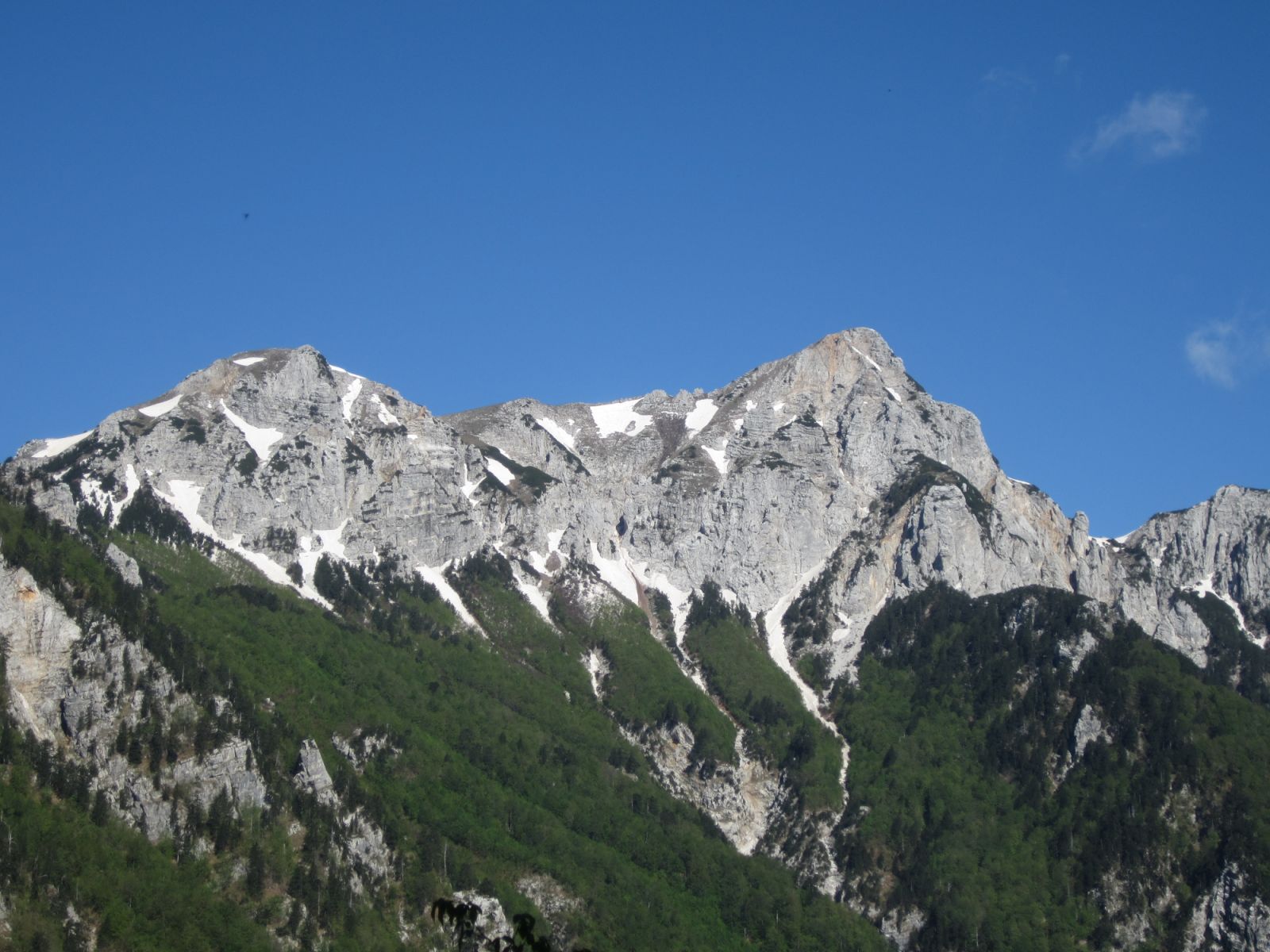
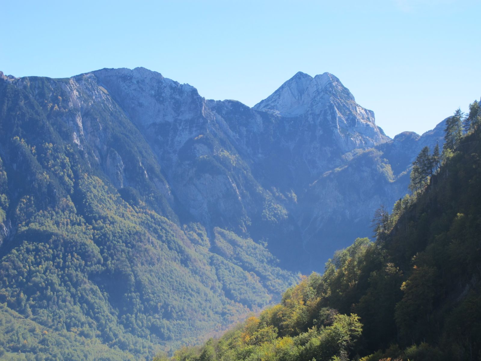
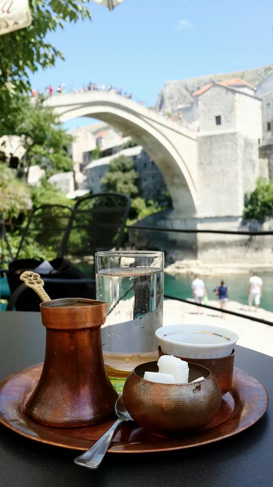

![[Green Trail] Looking back on September](https://viadinarica.com/images/IMG_20170928_112301352-01.jpg)
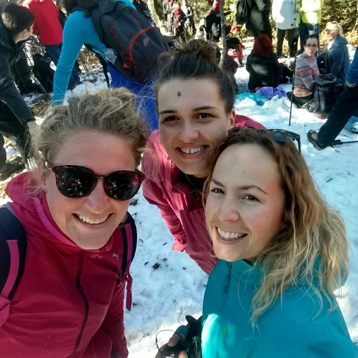
![[Green Trail] Looking back on October (2017)](https://viadinarica.com/images/IMG_20171023_220352_017.jpg)